|
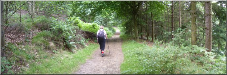
The path from Caley Gate into the Chevin Forest Park
|
|
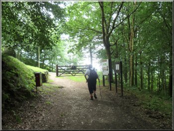
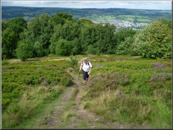
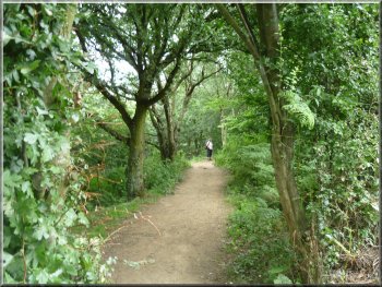
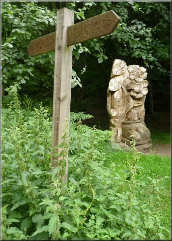
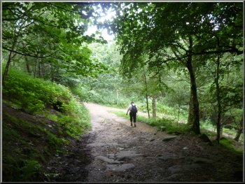
Entering the park at Caley Gate
This is at the Caley Gate entrance to the forest, just below Caley
Crags. At each entrance to the forest there is an information board
with a map of the paths which helps to find your intended route on the
OS Explorer map. We set off through Caley Gate, following a track gradually
climbing into the woodland.
|
This morning my wife and I visited a relative in Cookridge, Leeds.
After some lunch we called at Otley Chevin Forest Park for a walk. The
weather forecast for today was poor and from time to time the sky was
quite threatening but we were lucky and had no rain at all. If fact
it was quite warm with a few sunny spells. We parked in a narrow lay-by
at the side of the A660 about 2km from Otley at map ref. SE228446.
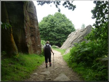
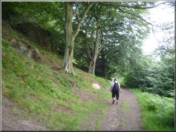
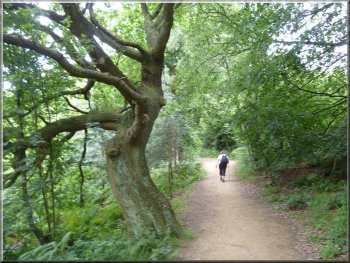
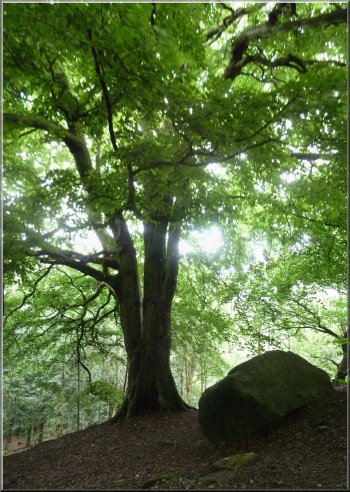
Crags & boulders as we climbed up through the Chevin woods
|
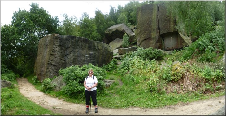
Crags & boulders as we climbed up through the Chevin woods |
|
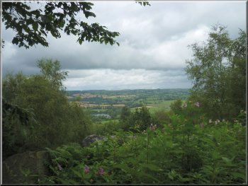
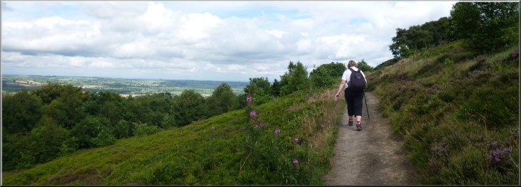
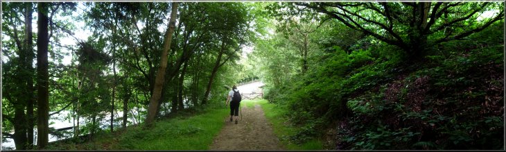
Looking across Wharfedale from the path though the woods
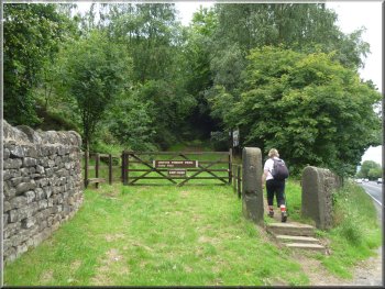
We followed this track through the woods for about 1.5km to a road
at map ref. SE211445. This is the Danefield Gate to the forest park.
|
After about 300m we came to a junction with a track and continued straight
ahead.
Approaching the road at Danefield Gate
|
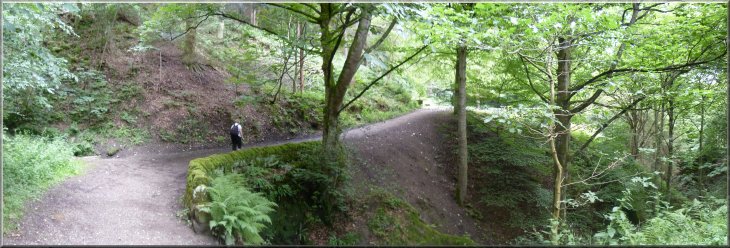
Path through the Chevin forest to Danefield Gate |
|
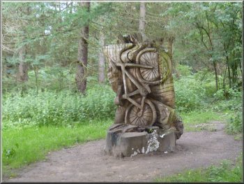
In the car park at the gate back into the forest park a sculptor was
at work on a large block of stone. His design was sketched out on a
piece of paper and it seemed that the work was only just beginning.
The sculptor was quite friendly and explained that the design for this
block at one of the main entrances to the park, would reflect many of
the designs that are already in place around the park. He gave me permission
to photograph him and his block of sandstone.
|
At the road we turned left and walk about 100m up the hill. Here we
turned right off the road into the East Chevin Quarry car park.
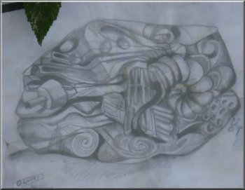
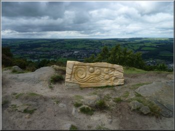
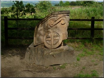
Design for a sculpture
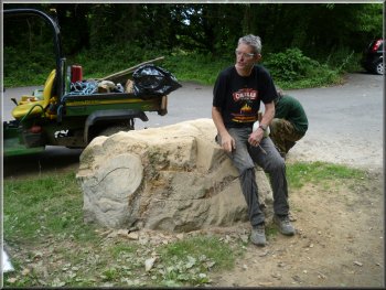
The sculptor had just started work on this block
|
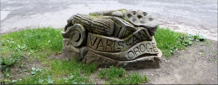
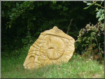
This is the completed sculpture seen on a visit to the Chevin in July 2015. It marks the start of the Chevin Geology Trail and the inscription reads, "VARISCAN OROGENY". This is a Geological term for the huge collision between two of the tectonic plates of the earth's crust that forced up the mountains across the West Country, South Wales and Ireland and injected the igneous intrusions called the Whin Sill across Northern England
|
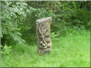
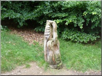
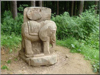
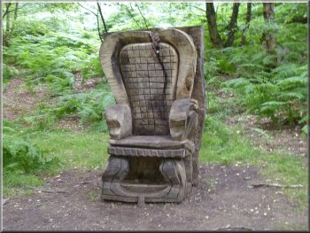
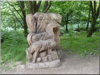
One of many sculptures in the forest |
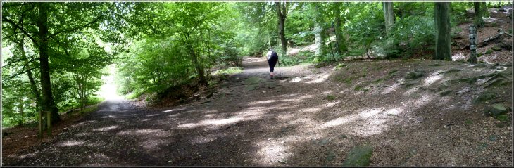
Path from East Chevin quarry car park |
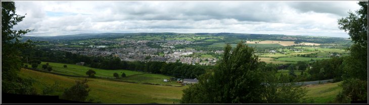
Looking over Otley from our path through the Chevin forest
|
|
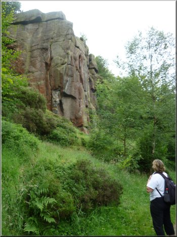
Another crag above the path
After about 400m we came to a junction in the track, and at the junction
we turned left to climb up the hillside for about 70m to map ref. SE206443
|
From the car park, map ref. SE211444, we followed a broad track through
the woodland.
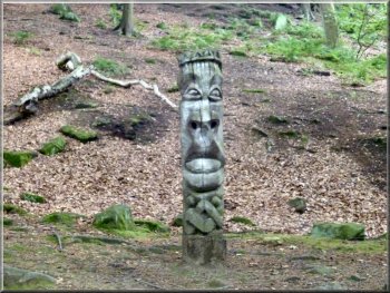
One of many sculptures in the forest
One of many sculptures in the forest
|
Junction in the track where we turned left to climb higher up the hill
side |
|
One of many sculptures in the forest
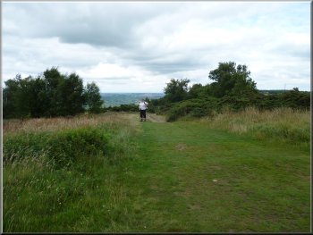
Here we had come out of the wood on to a hillside covered in heather
and bilberries. Our path met a path coming straight up the hill from
Otley and we turned left to climb the short distance remaining to the
path along the ridge of the Chevin.
|
Here we turned right to follow a path parallel to our path from the
car park, but higher up the hillside. We continued along this path for
about 1.2km to map ref. SE194443.
Climbing up to the Chevin ridge
|
Path along the Chevin ridge |
|
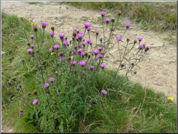
Knapweed by the path
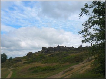
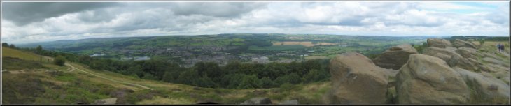
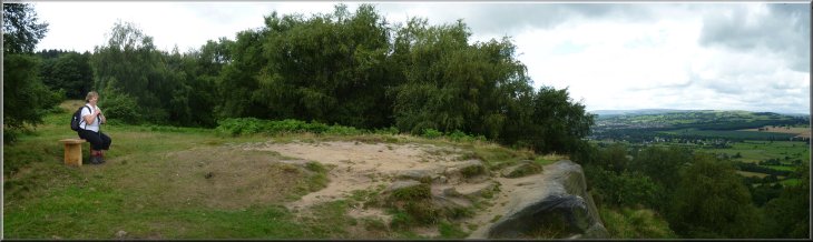
The rocks on the ridge at the Surprise View
From the rocks here we could see Wharfedale laid out in front of us
and behind, that's to the South, we could see tall buildings in Leeds
and far into the south of Yorkshire including the TV mast at Emly Moor.
|
At the ridge path we turned left to walk east along the ridge for about
400m to a view point at map ref. SE198442. There was a great view up
and down Wharfedale From here we continued along the ridge path for
another 600m to the "Surprise View".
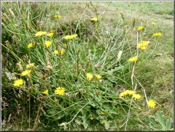
Smooth Cat's Ear - a variety of dandelion
One of many sculptures in the Chevin forest park
|
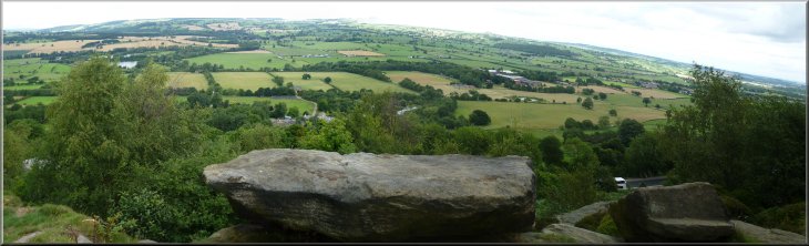
Looking over Otley from the Surprise View |
|
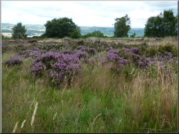
Heather in bloom on the Chevin ridge
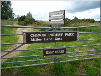

Walking along Miller Lane
It was about the size of a buzzard and it took me a while to realise
that it was a red kite. We were only a few kilometers from the captive
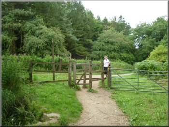
breeding centre at Harewood House. From the Miller Lane gate we walked
along Miller Lane between the fields to a road at map ref. SE214443.
|
From the view point we walked along the ridge path for another 500m
to the Miller Lane gate from the forest park. Looking back from here
my wife spotted a large bird of prey hovering some distance away. Its
hover seemed effortless with no apparent wing movement, just a slight
twitch of its tail in the strong breeze.
Track to Miller Lane
The start of Miller Lane
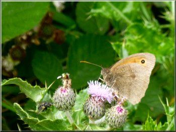
A meadow brown butterfly
|
|
Looking through the gap in the hedge opposite the end of Miller Lane
From the car park we followed a path called the "Chippendale Ride".
|
At the road we crossed to a path through an archway in the hedge opposite
and followed a path through the woods up to the car park at map ref.SE217442.
Path to the car park at the start of the Chippendale Ride
|
|
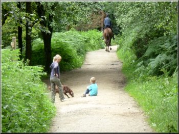
This large forest park absorbs many people without feeling at all crowded
|
We followed this pleasant path through the woods for about 1.5km past
many sculptures to map ref. SE230443.
|
 |
 |
 |
 |
|
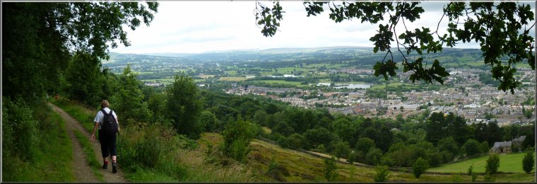
Admiring the view from Caley Crags
Looking over Wharfedale from Caley Crags
|
|
Heading West from Caley Crags
Approaching the junction at map ref. SE225445
From there we retraced our steps back to our car at the Caley gate
entrance to the forest park. Our walk had been 9km and it had taken
us almost 3 hours to walk.
|
At map ref. SE230443 we turned left off the track to follow a path
over some open heath down to the top of Caley Crags. Again there was
a lovely view over Wharfedale with Almscliffe Crag on the horizon across
the valley. From Caley Crags we followed the path west for about 600m
to a junction in the track at map ref. SE225445, that we had passed
on our way out from the Caley Gate. We turned right at the junction
where there is a lovely old oak tree.
Oak tree near the junction in the track at map ref. SE225445
|
Returning down the woodland track to the Caley Gate entrance to the forest
park on the A660
|
Background Notes:
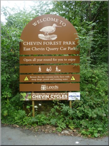
It's about an hour's drive from York to Otley Chevin but well worth the trip. There's a little informal lay-by on the A660 at an entrance to the Chevin Forest Park called Caley Gate and there's an information board with a map of the Chevin. The park is a nature reserve that was formally designated in 1989. The habitats found here in addition to the woodland include grassland and heathland with ponds and watercourses with outcrops of rocky millstone grit, so it supports a great variety of plants and animals.
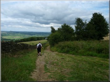
Our walk is a circular route of 9km, almost 6 miles, and from Caley Gate a broad path leads up the hillside, through the woodland with huge boulders of millstone grit that have fallen down from the crags above. With this mixture of boulders and woodland the path passes through some very pretty glades on the way up the hillside. As the path climbs there are some very good views out across Wharfedale and over Otley town.
Soon the path stops climbing and follows the contour around the valley side to Danefield Gate at East Chevin Road. Here we cross the road to the East Chevin Quarry car park. When I was here a couple of years ago there was a sculptor at work in the car park carving a sandstone block to become one of the many sculptures scattered along the paths through the Chevin park.
From the car park the path follows the contour along the side of the valley with lovely views out through the trees across Wharfedale. One feature to look out for on the far side of the valley is Farnley Hall. In the 1800's the hall was owned by Walter Fawkes, a close friend of Turner, the renowned artist. He was a regular visitor to Farnley Hall for about 15 years in the early 1800's and sketched and painted views of this part of Wharfedale. A famous example painted in 1812 is the snappily titled ' View of Farnley Hall in the Valley of the Wharfe in Yorkshire' and it's kept in the Rijksmuseum in Amsterdam.
The walk is along some of the many informal paths through this hillside parkland and you may notice a wall by the path made of flat slabs of rock set vertically in the ground. This is the 'Vacca' wall who's origins may go back to Roman times. It's original use is unknown. Near the western end of the Chevin we turn up the hillside to the path along the ridge.
We follow this path eastwards back along the ridge past two well known view points high on the gritstone edge with no obstuction to the Wharfedale panoramas. The path along the ridge is part of the route of the Dales Way Link heading for Ilkley and the start of the Dales way proper.
The ridge path takes us through Miller Lane gate and along Miller Lane to cross the East Chevin Road and join the Chippendale Ride, named after Thomas Chippendale, the cabinet maker, who was born in Otley. This is a broad path and bridleway through the woodland again with a series of interesting sculpture. We follow the woodland path down to the rocky top of Caley Crags where there is another lovely view of Wharfedale, this time from a lower level around half way up the valley side. Our path goes along the top of this crag and then drops back down to Caley Gate and the lay-by at the end of our walk.
top of page
|