| 2001 walks | 2002
walks | 2003 walks | 2004
walks |
| 2005 walks | 2006
walks | 2007 walks | 2008
walks |
| 2009 walks | 2010
walks | 2011 walks | 2012 walks |
| 2013 walks | 2014 walks | 2015 walks | 2016 walks |
| 2017 walks | 2018 walks | 2019 walks |2020 walks |
| 2021 walks | 1993-2000 library | Find a Route Index |
| A few Routes to print out | Request a Route... |
Route No. 372 - Saturday 2 October 2010
Blakeney, Peddars Way,
Cley Windmill circuit - 6km
North Norfolk Coast (AONB) . . .
Route map from Ordnance
Survey Open Space service.
Map: OS Explorer 251 Norfolk Coast Central at 1:25000

|
|
|
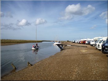
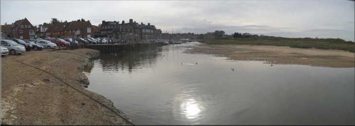
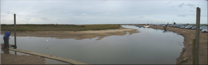
The car park by Agar Creek at Blakeney
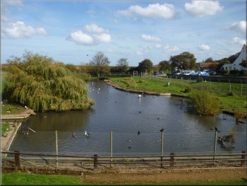
Wild fowl seen from the Peddars Way at Blakeney
We watched the tide coming in one evening and it was alarming just
how fast the water in the channels rose. The area where our car was
parked today was soon under water! It would be all too easy to be cut
off if you ventured onto the saltmarshes at the wrong state of the tide.
From the car park we set off Northwards following the Peddars Way along
the top of a floodbank.
|
My wife and I are spending this week in a holiday cottage on the North
Norfolk Coast. We drove down here this morning and this afternoon we
have come to Blakeney . We parked in a car park with an ominous warning
about unpredictable tidal flooding at map ref. TG028441. The village
is on the coast, but it's not like any sea front that I've seen before.
There are many boats but they are moored in a muddy channel, part of
a network of channels through the saltmarshes. The saltmarshes are between
1 and 2km wide running for many kilometers along the shore. There are
large sand dunes on the seaward side of the marshes and then beaches
next to the open sea.
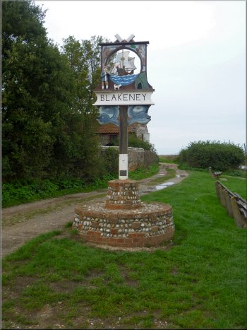
Villages along the coast all have signs in this style
|
|
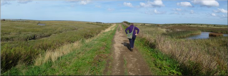
The Peddars Way along the floodbank through the saltmarshes near Blakeney
|
|
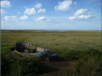
A hull left to rot into the marshes
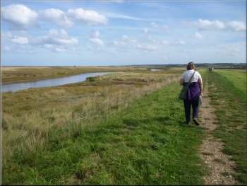
Following the Peddars Way towards Crey
I think the gas is piped to a huge underground storage facility in
Lincolnshire. We continued to follow the Peddars way in a clockwise
loop for over 3km until we reached Crey Windmill (map ref. TG045440)
on the edge of the saltmarshes at Crey-next-the-Sea.
|
There were birds feeding in the saltmarshes and we noticed particularly
white egrets and redshanks, but they were too wary to get a decent photograph
with my "point and click" camera. Out to sea we could see the superstructure
of a gas production rigg.
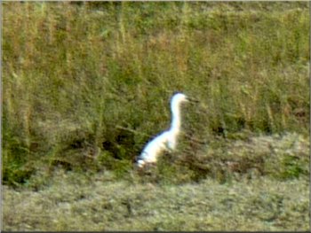
A white egret feeding in the marshes
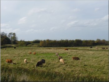
Cattle grazing on the edge of the marshes at Crey
|
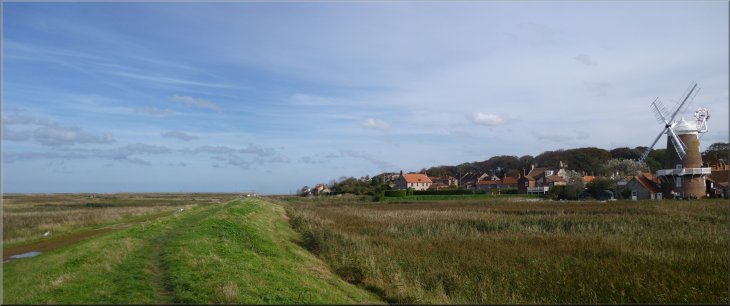
Crey Windmill seen from the floodbank |
|
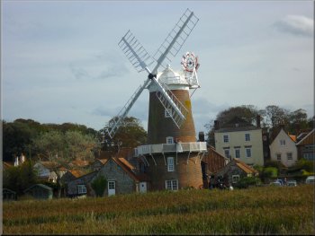
Crey windmill with bride & groom on the walkway
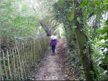
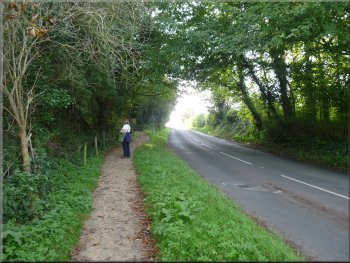
Footpath by the A149 to Blakeney
At the road we turned right to walk along the road. The road is quite
busy but fortunately there is a footpath. For part of the way the footpath
is separated from the road by a few trees and bushes. The road climbed
up a small rise and took us past the church at Blakeney.
|
The windmill must provide a wedding venue because there were wedding
guests milling around the base of the mill in the sunshine. The bride
and groom were sipping champagne on the walkway around the mill about
a third of the way up the structure. From there we continued on the
Peddars Way to the main coast road (A149) at map ref. TG043438.
Footpath by the A149 to Blakeney
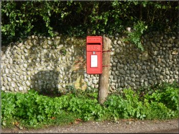
The letter box provides a splash of colour
|
|
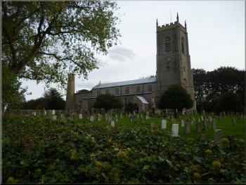
The church at Blakeney
Even today on at a weekend in school term time the area is popular
with many other people doing the same walk. It must be very crowded
in the summer holidays. It's a fascinating landscape and it's easy to
see why it's so popular.
|
About 150m beyond the church we turned right off the main road to walk
through the village back to the waterfront at Blakeney on Agar Creek
where we had started. The whole walk had been 6km and it had taken us
about two and a half hours to walk.
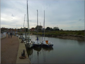
The waterfront at Blakeney
|
The car park at Blakeney beside Agar Creek |