| 2001 walks | 2002
walks | 2003 walks | 2004
walks |
| 2005 walks | 2006
walks | 2007 walks | 2008
walks |
| 2009 walks | 2010
walks | 2011 walks | 2012 walks |
| 2013 walks | 2014 walks | 2015 walks | 2016 walks |
| 2017 walks | 2018 walks | 2019 walks |2020 walks |
| 2021 walks | 1993-2000 library | Find a Route Index |
| A few Routes to print out | Request a Route... |
Route No. 400 - Tuesday 29 March 2011
Low Mill, Blakey Ridge, Rosedale railway,
Farndale daffodil walk circuit - 9km
Farndale, North York Moors . . .
Route map from Ordnance Survey
Open Space service.
Map: OS Explorer OL26 North York Moors Western area at 1:25000
A route by Ray Brown - thanks again for another very interesting
contribution
|
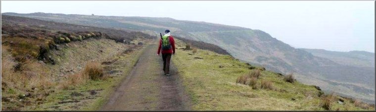
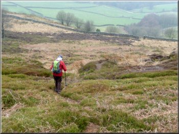
Start of the walk with Cragg House in the distance
We set off East, across a cattle grid on to a track which climbed towards
Cragg Cottage.
|
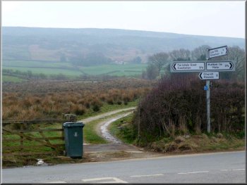
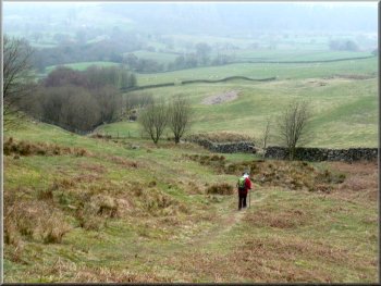
We parked on the grass verge by the T-junction on Daleside Road, East
of Low Mill (SE 677951).
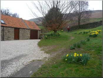
Daffodils at Cragg Cottage
|
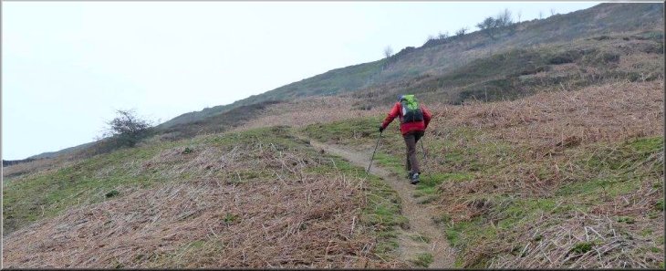
A narrow path leads uphill . . . |
|
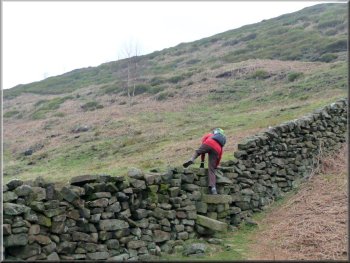
. . . to a stone stile
Following a small gully
Instead we followed a barely discernable path which initially followed
the contour North and passed beneath some small crags (SE684956) on
the right. The route then followed a small gully or ditch and climbed
as it curved at SE684958 towards the East before climbing steeply towards
a marker post on the skyline.
|
The right of way passed through the garden of Cragg Cottage with its
fine display of daffodils and then led uphill as a narrow path towards
a stone stile and then a gate at SE684955. Thereafter we missed the
right of way which is shown to continue uphill.
Gate at map ref. SE684955
Standing next to a marker post on the skyline
|
The post marked the end of a line of shooting butts |
|
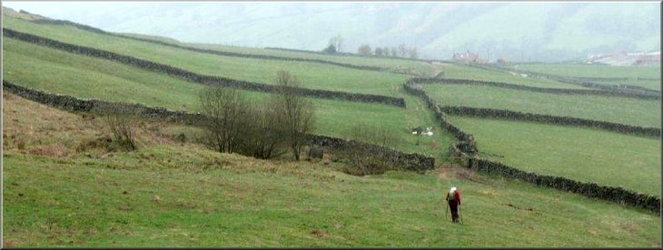
Heading towards a distant pile of stones
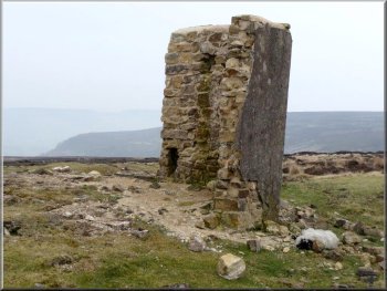
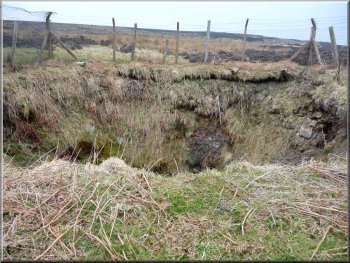
At SE 697962 we reached the disused iron ore mine known as Sheriff's
Pit. The shaft is fenced off for safety but running water below ground
could be heard. Also, adjacent to the track bed of the old railway built
to transport the ore, is a ruined building. The only artifact to have
survived was what appeared to be a boot cleaning iron.
|
The post denoted the end of a line of shooting butts which we followed
to the road running along Blakey Ridge. The path and the shooting butts
continued beyond the road, heading towards a large pile of stones. At
SE692962, shown on the map as Pike Howe, it was important to head due
East, ignoring what appears to be a more major track running south along
the parish boundary.
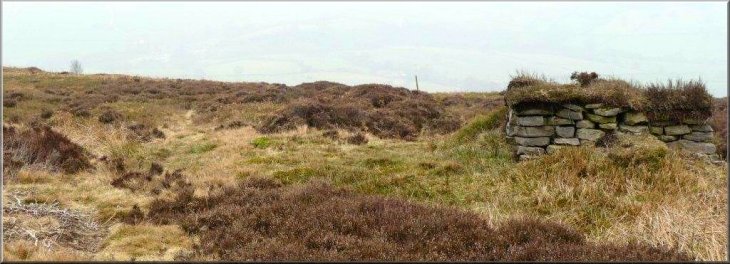
Ruin alongside the Rosedale railway bed
|
A remaining boot scraper? |
Mine shaft at Sheriff's Pit |
|
Track bed of the Rosedale Railway
Here a path on the left led us past further ruined buildings and then
onwards to cross the road again at SE685975.
|
We turned North to walk along the railway bed for a mile to map ref.
SE690976
Leaving the disused railway at SE690976
|
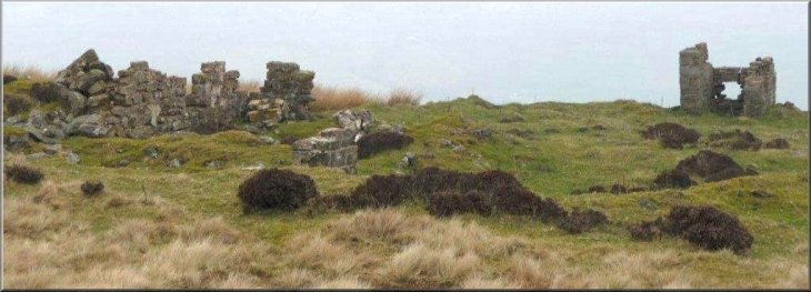
Further ruined buildings near the disused railway |
|
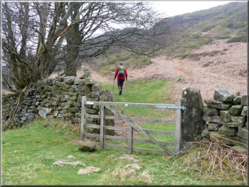
Descending steeply to a gate
The slope became gentler as we entered pastures to make for Daleside
Road, meanwhile keeping a stone wall on our right.
|
The path soon descended quite steeply towards a farm gate in a stone
wall and continued still steeply, swinging to the left before a copse.
Continuing steeply downhill and veering left before a copse
|
Heading for pastures with a wall on the right |
|
Passing High Bragg House
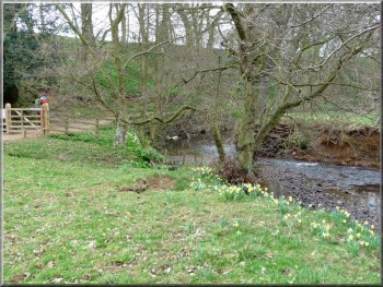
Reaching the River Dove below Bragg Farm
For more than a mile we enjoyed the display of daffodils alongside
the river as we walked to Low Mill where West Gill Beck flows into the
Dove. Here we joined the road South and in 100 metres took the left
fork to pass over Waste Bridge en route to the car - Ray
Brown
|
After crossing Daleside Road we passed to the left of High Bragg House
and then toured around the right of Bragg Farm as we followed the waymarked
route downhill towards the River Dove.
Leaving Bragg Farm
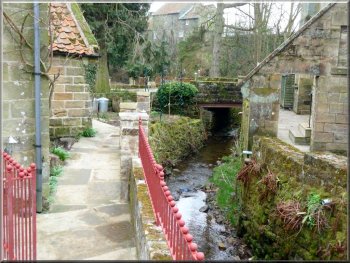
West Gill Beck in Low Mill
|
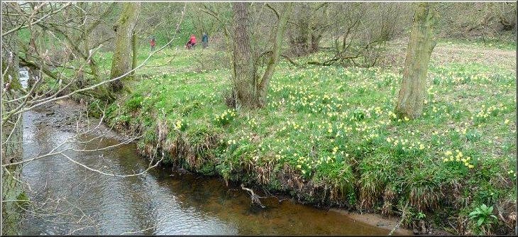
The daffodil walk beside the River Dove
|
Background Notes:
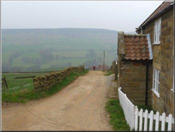
This 9km circular walk starts in the hamlet of Low Mill. There's a permanent small car park in the village but the daffodils are so popular now that there's some traffic management at daffodil time for traffic to negotiate the lanes around the valley and a large field is opened up as an overflow car park. There's a National Park Rangers' information caravan in the car park with details of a gentle 6km circuit of the daffodil walk.
Facing onto the permanent car park is a corrugated iron building, The Band Room. This building was put up in the 1920's for the Farndale silver band and now it's become an important venue for folk and country music with some of the big names in the business and it only seats around 100 people!
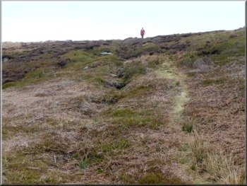
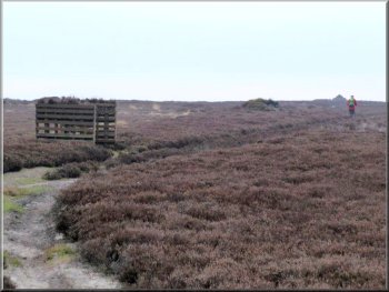
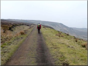
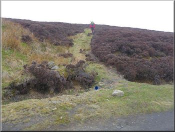
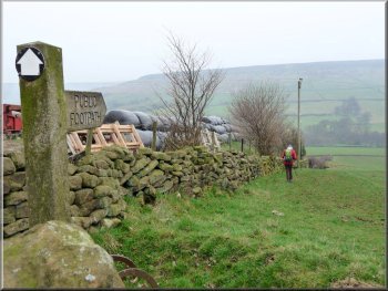
Our walk starts from the car park we begin the long steep climb straight up the eastern side of the valley past Cragg Cottage to Oak Cragg. This is a gritstone outcrop running along the valley side for almost 2km at an elevation of about 270m, that's 900 feet above sea level. The path goes up through the crag and continues up to the road along Blakey Ridge. This part of the route is rough going through the heather. There is a path going diagonally up the hillside all the way to the road along Blakey Ridge, but it's very easy to miss it. The navigation here is not easy! The road along Blakey Ridge climbs up from Hutton-le-Hole to the Lion Inn at around 400m, 1200 feet above sea level. On a clear day there's an amazing view south along the ridge and the plumes of steam from the three power stations of Drax, Ferrybridge and Eggborough can be seen about 75km, or 45 miles away.
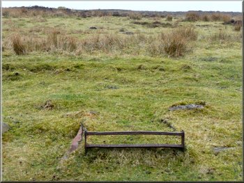
Our route crosses the road and continues to Pike Howe. This is one of several thousand such prehistoric burial mounds scattered across the North York Moors. A few have been excavated and recorded by archeologists, many have been searched by treasure hunters in the past, particularly in Victorian times and some have never been investigated.
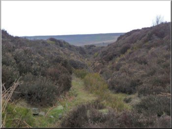
We continue across the moor to the old ironstone railway around Rosedale. Again the navigation here is not easy and if you get off the path you may need a compass bearing to keep on the right line. Just before reaching the railway the route passes a fenced off mine shaft. This is the old Sheriff's Pit, it's about 90m, 270ft deep and from the bottom there was a tunnel running out through the valley side into Rosedale. This tunnel or 'drift' was used to bring ore excavated on the valley side to the pit bottom to be lifted up to the railway along with the ore excavated in Sheriff's Pit itself. This mine operated in the latter half of the 1800's and finally closed in the early 1900's. The whole of Rosedale and Farndale was a thriving industrial area with iron stone excavation going on through out the 1800's. The ironstone railway was built to convey the iron ore to the blast furnaces of Middlesbrough on the River Tees.
We walk along the old railway bed for about one and a half kilometers and then turn off along a path across the moor for about 400m back to the road along Blakey Ridge. We cross the road and follow a path down the hillside back into Farndale past a large farmstead called Bragg Farm and down to the River Dove in the valley bottom.
We have now joined the daffodil walk and it's likely to be busy. The old name for the wild daffodil is the lent or lenten lily because they bloomed in lent, the period running up to Easter, which just goes to show what a hard season it's been this year with the first daffodil flowers appearing about a week after Easter. They are genuinely wild flowers and have been here for many hundreds of years although it's said that they were originally planted by the monks of Rievaulx Abbey. However there are other places in England where great drifts of wild daffodils exist, notably in Gloucestershire at Dymock Woods. Our path follows the River Dove for about one and a half kilometers back to Low Mill and the end of the walk. All the way the river banks are covered with swathes of daffodils it's a lovely sight, it's no wonder it's so popular, and it makes a striking climax to our walk for this week.
top of page
|