| 2001 walks | 2002
walks | 2003 walks | 2004
walks |
| 2005 walks | 2006
walks | 2007 walks | 2008
walks |
| 2009 walks | 2010
walks | 2011 walks | 2012 walks |
| 2013 walks | 2014 walks | 2015 walks | 2016 walks |
| 2017 walks | 2018 walks | 2019 walks |2020 walks |
| 2021 walks | 1993-2000 library | Find a Route Index |
| A few Routes to print out | Request a Route... |
Route No. 411 - Tuesday 10 May 2011
Reeth Low Moor, Arkle Town,
Arkle Beck circuit - 11km
Swaledale, Yorkshire Dales . . .
Route map from Ordnance Survey
Open Space service.
Map: OS Explorer OL30 Yorkshire Dales Northern & Central areas
Another interesting contribution from Ray Brown - Thanks
Ray!
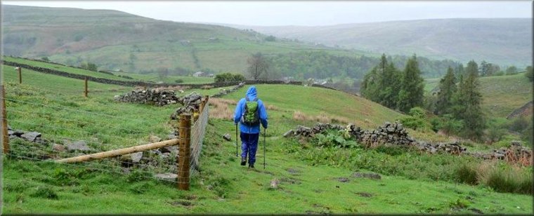
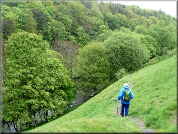
Descending from the moor to Thirns |
|
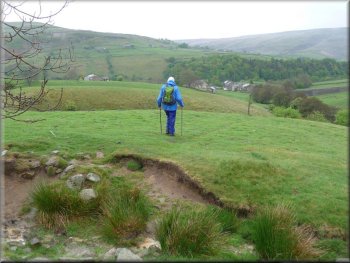
Passing path at SE 016996 on our way to Thirns
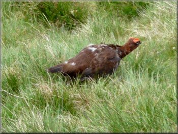
Daddy Grouse protecting his brood
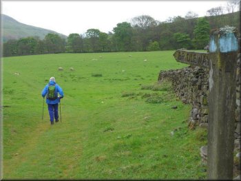
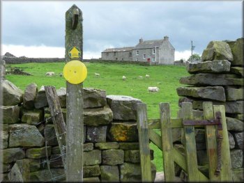
At SE 016996 a signposted path leading to the top of Reeth Low Moor
and a track both on the right were rejected as we stayed with the well-gravelled
track to reach Thirns farm and later Nova Scotia farm, both on the left.
At the second farm the gravel track gave way to a grass. A grouse family
with very small chicks ran across the path, both parents making themselves
obvious whilst the chicks scurried off to hide in the heather. From
here we had a view west up Mill Gill. At SE 0045 9997 the grass track
crossed over a gravel track before reaching a wall on the right.
|
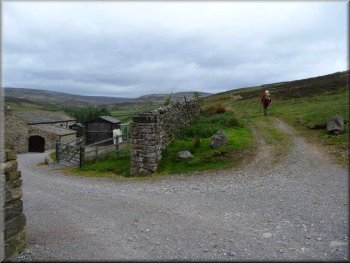
We left the car at NZ 028005 on the NE side of the Reeth-Langthwaite
road just under a mile from leaving the B6270 in Reeth. We walked back
down the road 200 metres to NZ 030003 where a farm track on the right
initially heads west and then curves towards the south as it climbs
up Black Hill. After a while the track descends and curves back to the
west. At SE 022996 a well-gravelled track from the south was joined
and we continued west with the Swale valley on our left.
Passing Nova Scotia farm
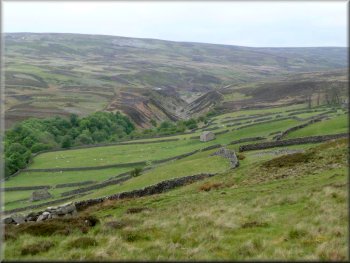
Mill Gill from Low Cringley
|
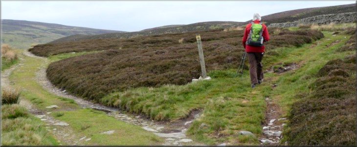
Waymark at SE 0045 9997 |
|
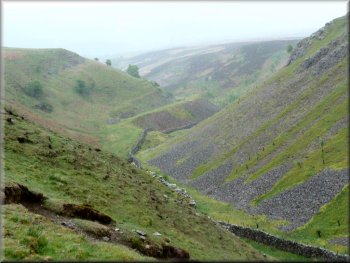
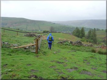
Fore Gill
In sight of Arkle Town
We descended down a steep grassy slope to a gated squeeze stile before
climbing up the other side of the ravine. Walking northeast along the
top of Fore Gill on a fairly obvious path we saw evidence of earlier
lead mining. As we passed a small plantation on our left the rain became
torrential, causing us to seek refuge in a small neglected farm building
at NZ 002016, so displacing a ewe which had been sheltering there. When
the rain abated we continued towards Arkle Town, passing a few stationary
caravans in a hollow by Cumbers Hill. On reaching the main road in Arkle
Town we turned right and in a few metres swung left on a metalled road
serving a few houses.
|
Waymarks indicated the route uphill which became a narrow path, sometimes
grassy, sometimes stony. At this time rain began to fall and the camera
was packed away. The bridleway continued almost to the metalled road
at Fore Gill Gate but at NY 9935 0093 we turned abruptly right on to
a bridleway track running east. About 280 metres further a few flat
stones on the left of the track indicated the start of a right-of-way
footpath heading towards Fore Gill, some 200 metres away. The path was
ill-defined but the route led past two circular filled disused mine
shafts towards a simple stile, but instead of using the stile we kept
to its left.
Descending above Fore Gill towards Arkle Town
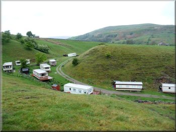
Caravan Park at Cumbers Hill
|
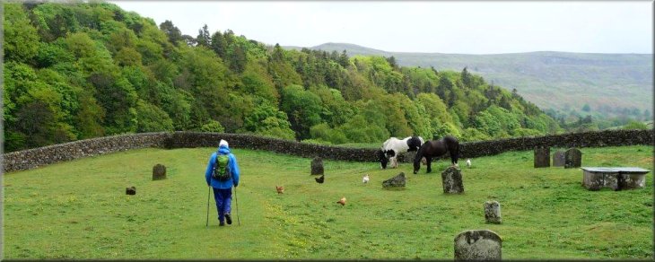
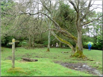
Leaving Arkle town through the old cemetery |
|
Dropping down to Arkle Beck
Over the beck we turned right on a bridleway running through an avenue
of trees and then pasture with Fremington Edge towering ahead.
|
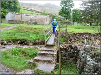
At a left bend in the road we carried straight ahead on a signposted
footpath through an old cemetery and down a steep slope to a footbridge
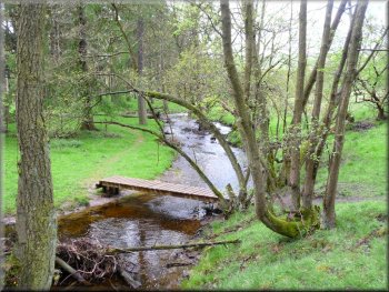
over Arkle Beck.
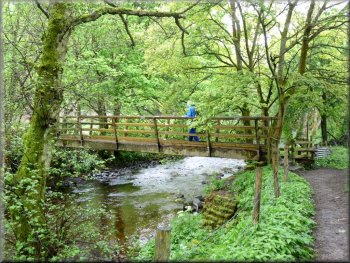
Footbridge over Arkle Beck
|
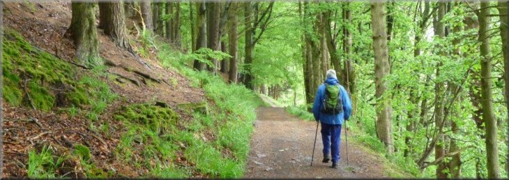
Bridleway running through an avenue of trees above Arkle Beck |
|
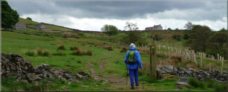
View of Fremington Edge
Bridleway beyond Storthwaite Hall
We followed the signpost for Reeth at NZ 0225 0193 but some 400 metres
later we veered left away from the beck to make a beeline across Thorn
Dale towards Castle Farm House.
|
At Storthwaite Hall farm we crossed the footbridge over Slei Gill.
The bridleway continued through a farm gate on the right and passed
through pasture to rejoin the north bank of the Arkle Beck.
Approaching Storthwaite Hall
Following the Reeth Signpost at NZ 0225 0193
|
Making towards Castle Farm House |
|
A series of footbridges and duckboards in Thorn Dale
Turning hard right before Castle Farm House we reached a track at NZ029009
which doubled back and wound its way downhill to a wooden vehicle bridge
across Arkle Beck. The track continued uphill to the main road, reaching
it some 130 metres from where our car was parked -
Ray Brown
|
For those walkers who prefer to stay longer with the riverbank there
is a series of recently introduced footbridges and duckboards which
allow the various strands of the Beck to be negotiated.
Castle Farm House
|
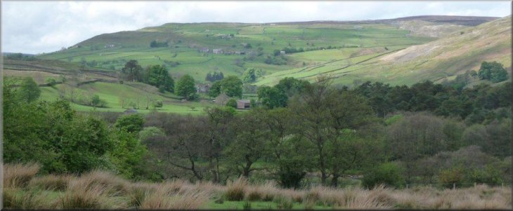
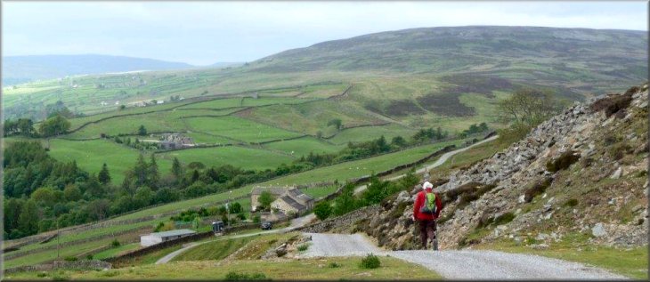
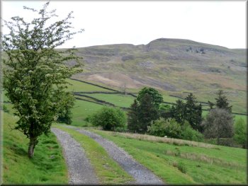
View up Arkengarthdale towards the end of the walk |