| 2001 walks | 2002
walks | 2003 walks | 2004
walks |
| 2005 walks | 2006
walks | 2007 walks | 2008
walks |
| 2009 walks | 2010
walks | 2011 walks | 2012 walks |
| 2013 walks | 2014 walks | 2015 walks | 2016 walks |
| 2017 walks | 2018 walks | 2019 walks |2020 walks |
| 2021 walks | 1993-2000 library | Find a Route Index |
| A few Routes to print out | Request a Route... |
Route No. 432 - 24/29 August 2011
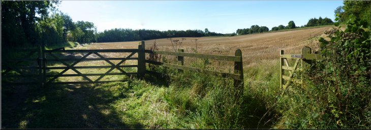
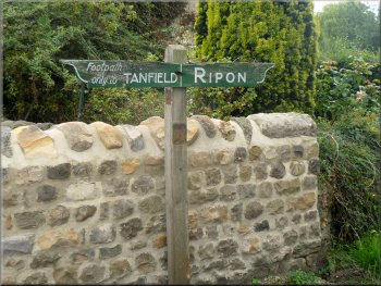
West Tanfield, River Ure,
North Stainley, Mickley circuit - 13km
Lower Wensleydale . . .
Route map from Ordnance Survey
Open Space service.
Map: OS Explorer 298 Nidderdale
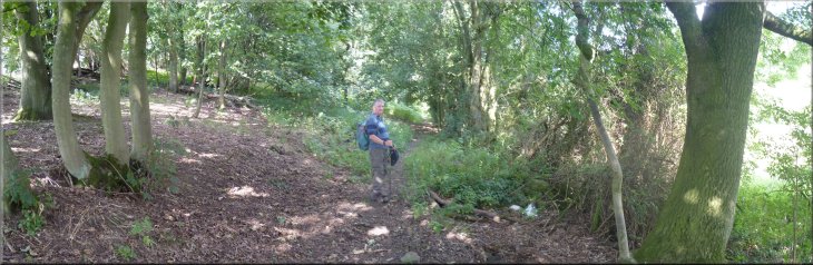
Note. My mate,Jim, & I did this walk on 24 August but we
did not enjoy the route we had taken out of North Stainley at all. On Monday
29 August I checked out another route from North Stainley which turned out
to be much better. The route described here is the walk Jim & I did on 24
August but with the alternative start to the route that I walked on 29 August.
| 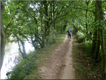
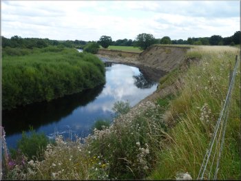
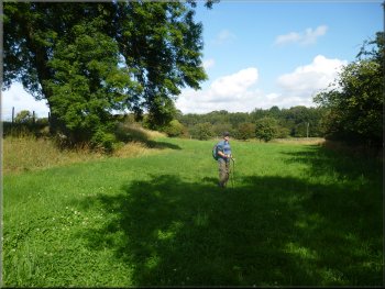
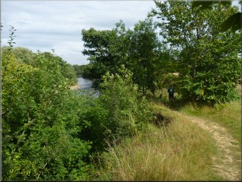
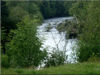
Ripon Rowel route beside the River Ure
We set off over the road bridge across the river to join the Ripon
Rowel route downstream along the bank of the River Ure. We followed
the path along the river side downstream through the Slenningford Mill
caravan site. |
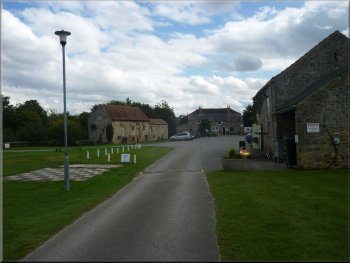
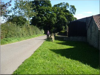
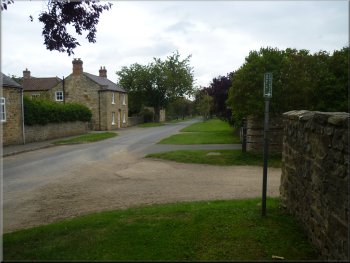
It was a bright sunny morning and we drove to West Tanfield, about
9km north from the centre of Ripon on the A6108. We parked in the public
car park at the village hall, map ref.SE268788.
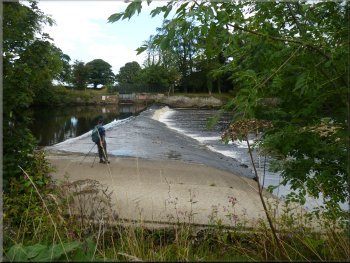
Weir on the River Ure upstream of Slenningford Mill
|
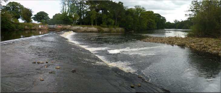
Weir on the River Ure upstream of Slenningford Mill |
| 
Slenningford Mill caravan site
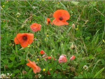
Poppies by the path
About halfway through the village on the main road we turned right
into Cock Pit Lane. |
We continued along the Ripon Rowel route to North Stainley and followed
the road into the village.
A last look at the Ure as we turned for North Stainley
The path around Slenningford Grange
|
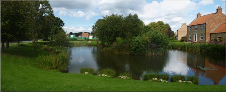
A pretty pond in North Stainley
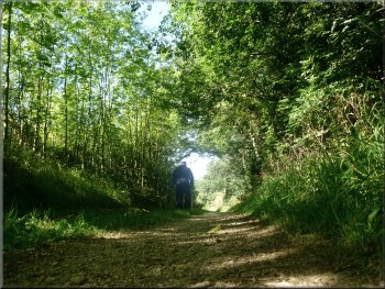
Start of the path at the end of Cock Pit Lane in North Stainley
|
| 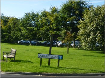
Cock Pit Lane turning off the main road
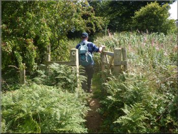
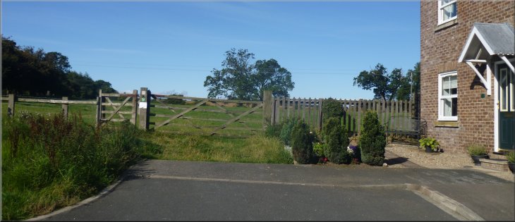
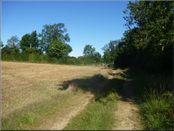
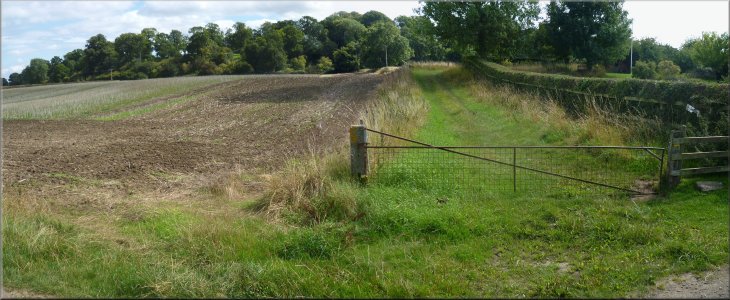
Where the road ended at map ref. SE285768, we followed the bridleway
across the fields heading in a southwesterly direction for about 300m.
|
We walked along a cul-de-sac called Cock Pit Lane to the west of
the main road. We took the right hand fork in the cul-de-sac.
Taking the right hand fork in Cock Pit Lane
|
Looking back to North Stainley from the path across the fields |
| 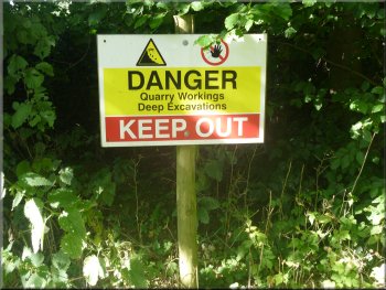
Warning signs were posted around the gravel workings
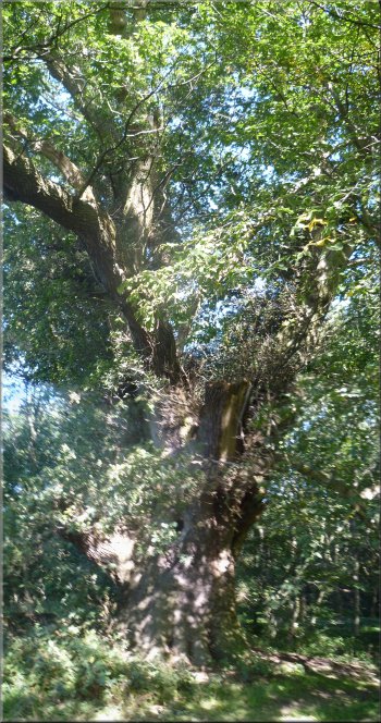
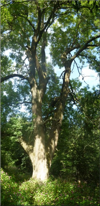
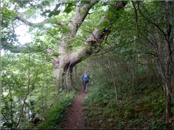
Ancient oak tree in Fiveponds Wood
The oak tree has a girth of over 7m. and must be at least 400 years
old. |
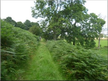
Here a gate from the field led onto a good farm access track. We
continued in the same direction along this track with pleasant views
across the farmland beside the track. After about 500m there were gravel
workings on the left of the track screened by an embankment. About 1.5km
from the start of our walk the track skirted the edge of a wood and
we came across a lovely old oak tree at map ref. SE276761.
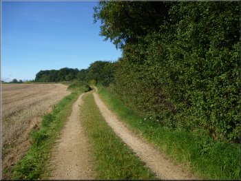
The track north from North Stainley between the fields
Track along the edge of Fiveponds Wood
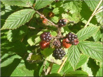
Ripening blackberries in the hedgerow
|
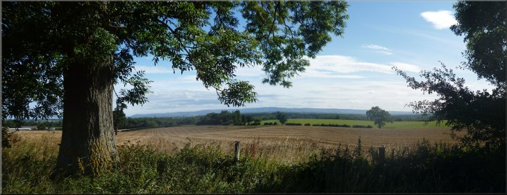
Looking east to the North York Moors from the track |
| 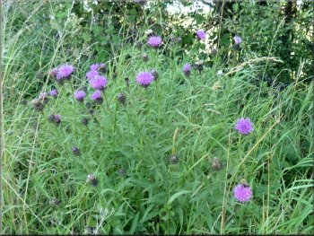
Knapweed in flower by the track
The track led us out to the road at map ref. SE272764. |
Just beyond the wood the track bent round to the right to head northwest
still following the embankment round the gravel workings on our left.
The track approaching the road near Musterfield
|
Gate from the track onto the road near Musterfield farm |
| 
The road towards Musterfield farm
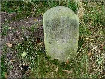
Musterfield marker stone at the road junction
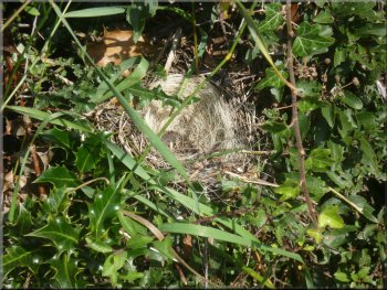
Birds nest lined with woven animal hair
We continued along the road for about 1km to a left hand bend at map
ref. SE261755. Here we turned off the road on the crown of the bend
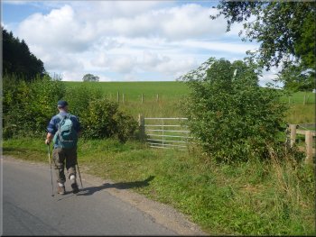
on to a footpath on the right-hand side of the road. |
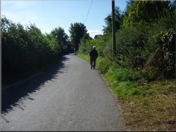
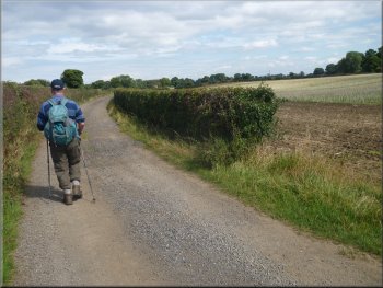
Here we turned left to walk along the road. After about 650m, and
a couple of right-angle bends we passed the Musterfield poultry farm
and came to a road junction at map ref. SE269759. There was a stone
marker at the junction with a rather worn inscription that just said
Musterfield.
Passing Musterfield poultry farm
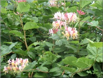
Honeysuckle in the hedgerow
Our turning off the road for the path to Mickley
|
| 
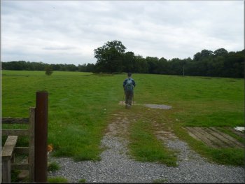
Our path across the fields to Mickley
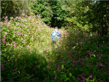
Making our way through great banks of balsam
The path close to our turning to cross a little valley
The entrance to the wood is overgrown with huge banks of that invasive
alien plant, Indian or Japanese Balsam. There were banks of the stuff
all along the way through the wood and round the southern edge of the
woods to map ref. SE251759 where we turned right to follow a path that
doubled back crossing a little valley. It climbed up to the corner of
the wood at map ref. SE253759. From here we took a path across the field
heading northeast towards Mickley. Care was needed here to check the
field boundaries with the map to be sure we followed the right fence
as there are no signs. |
We walked along the path across fields to a wood at map ref. SE257757.
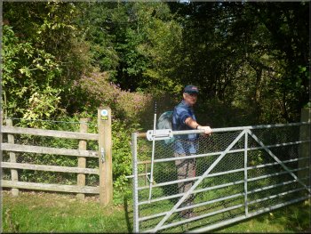
Gate into the woods full of balsam
A huge old ash tree in the woods
|
The path through the woods briefly free of balsam |
| 
The track heading for Mickley
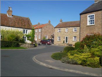
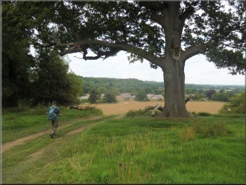
Looking back along the main street in Mickley from our lunch stop
At the end of the village street where the road bends to the right
there is a small grass area with a seat in the shade of a large tree
where we sat for our lunch break. The Ripon Rowel walking route goes
along the village street and after our lunch we followed this route
along a track to the left to map ref. SE258770. |
At the end of a long field we came to a farm track which we followed
down the hillside along the edge of the fields to the main street in
Mickley at map ref. SE255769. At the road we turned right to walk along
the village street. It's all well maintained with the air of a well
to do commuter village.
Turning onto the main street in Mickley
The Ripon Rowel route to West Tanfield
|
| 
The Ripon Rowel route across the fields from Mickley
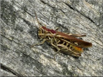
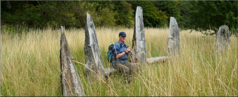
A grasshopper on the timber seat
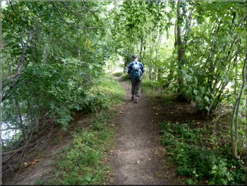
Ripon Rowel route beside the River Ure
Ripon Rowel route beside the River Ure
We walked along the riverside for almost 1km to the access track to
Quarry House Farm at map ref. SE254783. |
Here we continued along the Ripon Rowel route on a path across the
field and through a small wood to the bank of the River Ure.
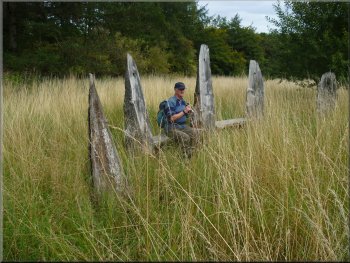
Timber sculpture seat by the Ripon Rowel route near Mickley
Ripon Rowel route beside the River Ure
Ripon Rowel route beside the River Ure
River Ure near West Tanfield
|
The track near Quarry House Farm approaching West Tanfield |
| 
Track approaching West Tanfield
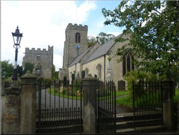
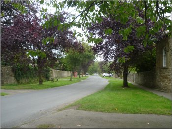
The Marmion Tower next to the church in West Tanfield
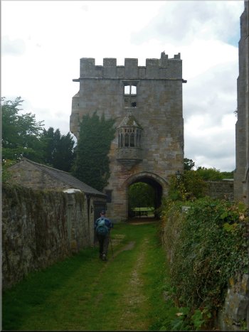
The Marmion Tower in West Tanfield
It's an impressive place and we climbed the spiral staircase to see
the view from the top. After our inspection of the Marmion Tower and
its information board we returned to the village hall car park just
across the road and the end of our walk. The whole circuit had been
just under 13km and it had taken us almost five hours to walk including
our stops and visit to the tower.
|
We followed this track out to the road bridge over the River Ure
at West Tanfield. We crossed the road bridge over the river into West
Tanfield and once over the bridge we turned left in front of the pub
to walk along the street to the Marmion Tower at map ref. SE267787.
This ancient tower was just the gate house to a great fortified mansion
that has disappeared over the centuries.
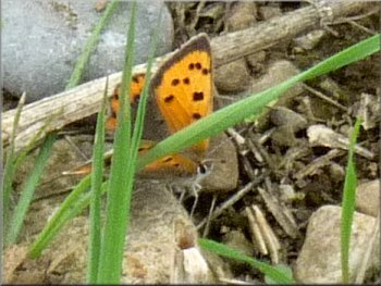
A small copper butterfly by the path
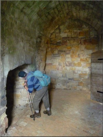
Inside the Marmion Tower at West Tanfield
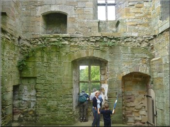
Inside the Marmion Tower at West Tanfield
|
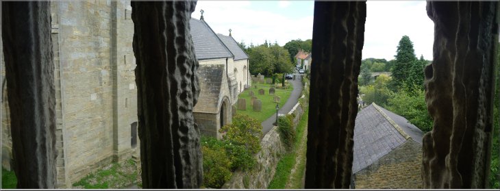
Looking back into West Tanfield from first floor oriel window of the Marmion
Tower
|
Background Notes:
This is a circular walk of 13km, a little over 8 miles, from West Tanfield on the River Ure, it's about halfway between Ripon & Masham. There's a public car park at the village hall where we start the walk and head out following the route of the Ripon Rowel Walk along the river bank past the weir on the river to Slenningford Mill. The grade 2 listed mill building dates from the end of the 1700's but now it's part of the admin centre of a large caravan site. We continue down-river to North Stainley and go through the village to leave via Cockpit Lane where I assume there must have been a cock fighting venue in the past. As we cross the fields, there is a series of active gravel pits on the left, but they are well screened by an embankment and I didn't find them too intrusive. The path leads passed the embankment through some woodland where there is a huge old oak tree by the path. It has a girth of around 7m, over 20ft, and must be at least 400 or 500 years old. Our route continues to the road through the hamlet of Musterfield where there is a large poultry farm and an old stone marker at the road junction. We head out first along the road, then across the fields and through some woodland to a wooded ridge above the village of Mickley with very pleasant views over the River Ure to West Tanfield and out to the east to the North York Moors. We follow the path down into Mickley and rejoin the Ripon Rowel route along the River Ure again. At one point there is a semi-circular timber sculpture forming a seat which I think is quite striking with it's tall shards of timber pointing skywards supporting the low seat in the long dry grass. It was quite nostalgic for me as we sat there for a drink on a warm summer day because there were so many grass hoppers around in the grass. It was just like it was when I played out in the fields as a boy in the 1950's. We continue along the river bank back to West Tanfield where the walk isn't complete without a visit to the Marmion Tower next to the church about 100m from the car park. This tower is quite impressive on it's own with an large oriel window at the first floor level, but in fact it's only part of the gate house to a long vanished huge manor house. It was just one of the stately homes of the Marmion family. They were a very powerful Norman family who came to England with William the Conquerer as his champions and retained great influence with the kings of England up to the 1400's. They had many great houses and lands in England and in Normandy and the large manor at West Tanfield seems to have been a fairly minor holding in their terms, but the Marmion Tower makes an interesting historical note to end our walk back in West Tanfield.
top of page
|