| 2001 walks | 2002
walks | 2003 walks | 2004
walks |
| 2005 walks | 2006
walks | 2007 walks | 2008
walks |
| 2009 walks | 2010
walks | 2011 walks | 2012 walks |
| 2013 walks | 2014 walks | 2015 walks | 2016 walks |
| 2017 walks | 2018 walks | 2019 walks |2020 walks |
| 2021 walks | 1993-2000 library | Find a Route Index |
| A few Routes to print out | Request a Route... |
Route No. 480 - Thursday 26 July 2012
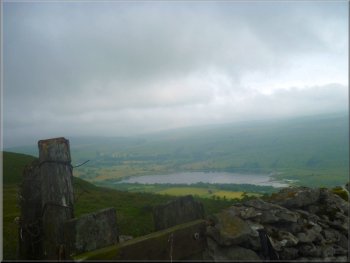
Marsett, Stalling Busk, Semer Water,
Countersett, (Cam High Road), circuit - 8km
Raydale, Wensleydale . . .
Route map from Ordnance Survey
Open Space service.
Map: OS Explorer OL30 Yorkshire Dales Northern & Central areas
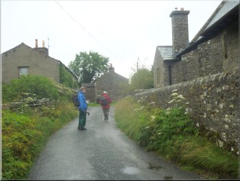
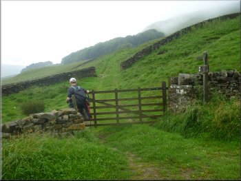
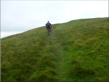
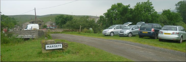
Starting out from Marsett
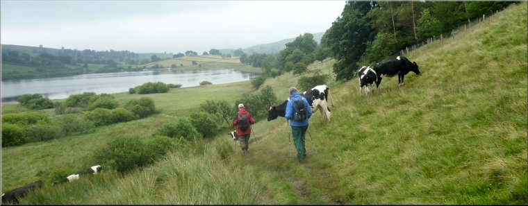
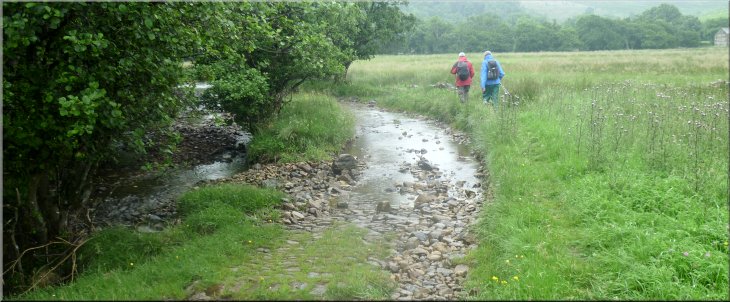
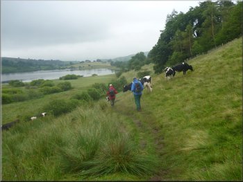
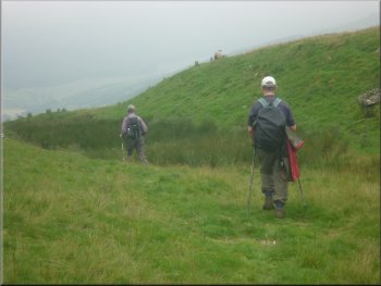
Overtaken by younger legs following the track along side Bardale Beck
|
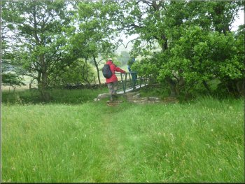
Footbridge over a small stream
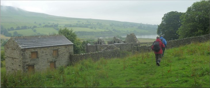
When we arrived it was already raining quite hard! We parked off the
road near Bardale Beck at map ref. SD902862, and set off heading eastwards
in the rain on a track beside Bardale Beck. Parts of the track were
flooded but there was a path on the grass beside the track and we continued
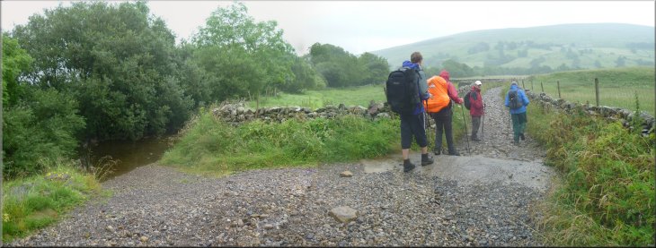
along the track to cross a concrete ford over Raydale Beck at map ref.
SD908859. |
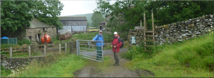
The weather forecast for today was for a cloudy overcast day over
the Yorkshire Dales but no rain so my mate, Jim, and I drove up Wensleydale
to Marsett in Raydale upstream of Semer Water to meet Ray, a friend
of ours, who has contributed numerous interesting routes to this web
site.
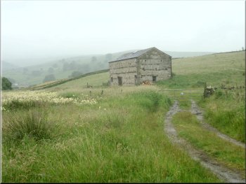
Stone barn beside the track
|
The beck on the left, flooded track on the right
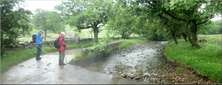
Concrete ford over Raydale Beck
|
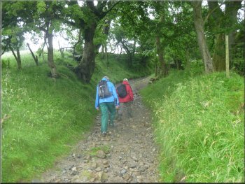
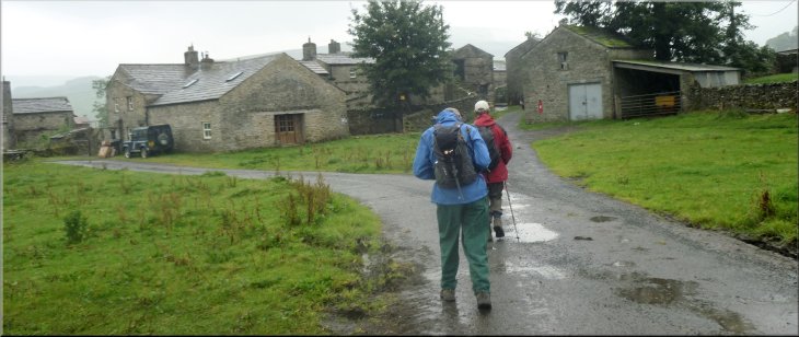
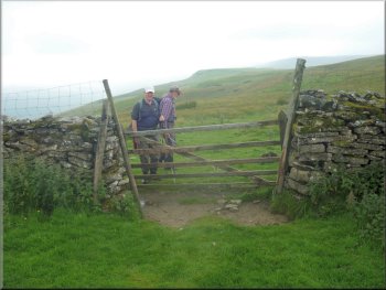
Climbing the track up to Stalling Busk
The road through Stalling Busk
We walked along the road past the church, a fairly modern building,
and after about 100m we turned left off the road onto a path back down
the steep hillside. |
About 200m after the ford the track was enclosed between two walls
and began to climb steeply for about 500m until we reached the tiny
village of Stalling Busk.
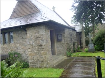
St Mathews, the present day parish church at Stalling Busk
Path down the hillside from Stalling Busk
|
Looking back to Stalling Busk as we started down the hillside |
Approaching the ruined church
|
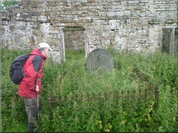
Graves by the ruined Stalling Busk church
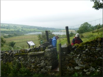
Start of the nature reserve adjoining Semer Water
A large area of marshland here adjoining the lake is a nature reserve
managed by the Yorkshire Wildlife Trust. We continued along the track
around the side of the lake to the road at map ref. SD923872 opposite
Low Blean farm. |
We followed the path down the hillside to the site of the old ruined
Stalling Busk church at map ref. SD916862. From the ruined church we
followed the path along the hillside above Crooks Beck, the main feeder
stream to Semer Water.
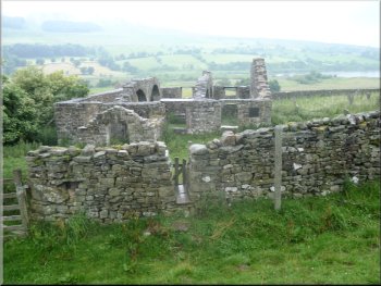
The ruined Stalling Busk church
Path above the nature reserve next to the lake
|
Reaching the road opposite Low Blean farm |
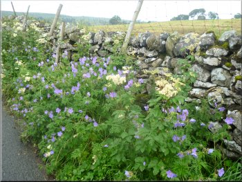
Cranesbill & meadow sweet by the road
Heading for the Carlow Stone on the lakeside
Seat where Turner sketched the lake in 1816
The gravel beach on the lakeside is a car park but the modest fee
of £2.50 per day is payable at Low Blean farm about 400m away. On the
roadside opposite the Carlow Stone is a little walled enclosure around
some steps up to a seat with a view over the lake. This has been completed
recently to commemorate the tour of North Yorkshire made by the artist
Turner in 1816 to sketch the natural wonders of the place including
Semer Water. The rain had stopped now and we sat on the seat for our
lunch and a couple of cheeky chaffinches came to clear up our crumbs. |
Here we turned left to walk along the road to a small gravel beach
area on the edge of the lake next to the road at map ref. SD921875.
Here next to the road is a large boulder called the Carlow Stone and
at the water's edge there are two boulders next to each other called
the Mermaid Stones. All three are glacial erratics dropped here as the
ice melted and the glaciers retreated at the end of the last ice age.
The lakeside car park
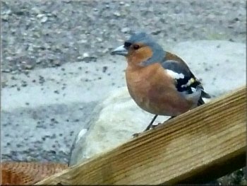
Chaffinch hoping to share our lunch
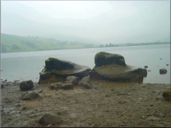
The Mermaid Stones on the edge of Semer Water
|
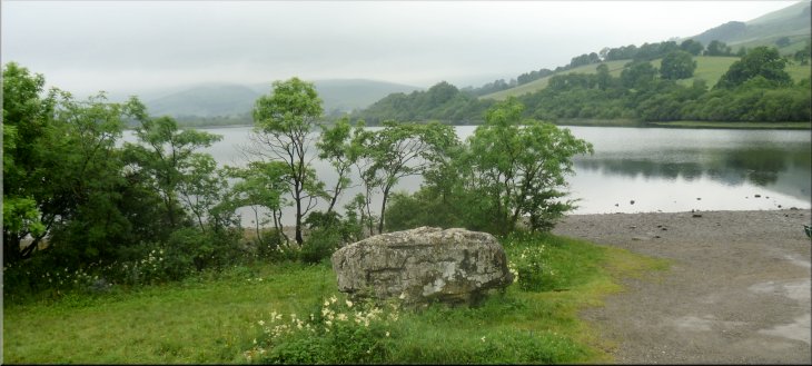
The Carlow Stone, a glacial erratic on the shore of Semer Water |
Bridge over the River Bain at the outlet to Semer Water
Looking back over Semer Water
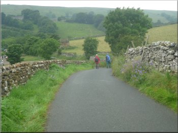
From the village we continued up the hillside along the road towards
Burtersett for about 600m to a sharp bend at map ref. SD912878. Here
we turned left off the road to follow a grassy track, a public bridleway,
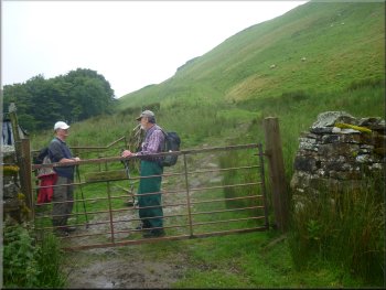
climbing up the hillside. |
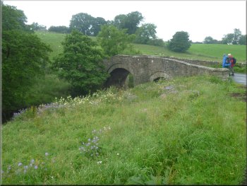
After our break we began the long climb up the hillside. First we
followed the road across the River Bain, the outlet to the lake and
continued up the hill to the edge of Countersett.
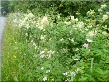
Meadow sweet & other flowers on the roadside
Leaving the road for a grassy track up the hillside
|
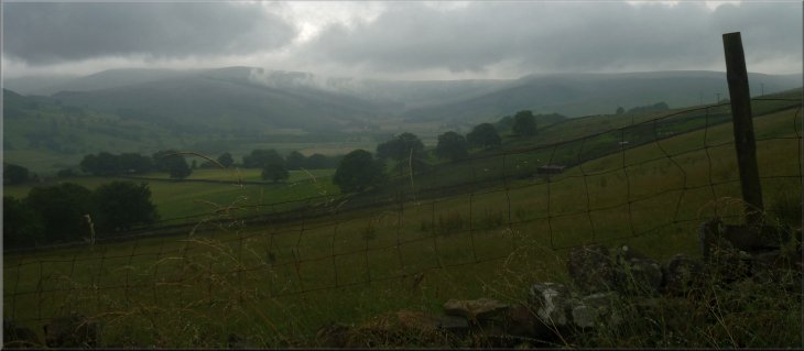
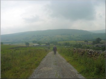
Looking up Raydale in the rain on this gloomy day
|
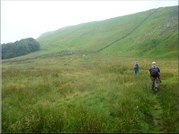
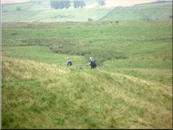
Crossing a marshy area
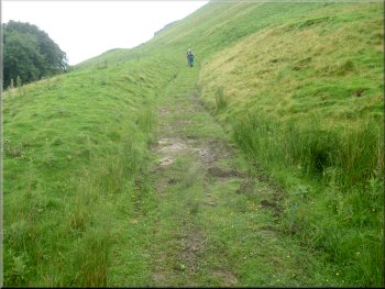
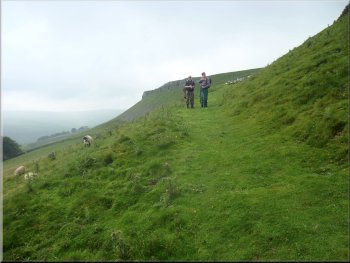
The track up to the moor top
The track along the moor top
The track along the moor top
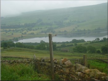
Along the moor top we were only a few hundred metres from the Cam
High Road to the northwest. It's a Roman road that went from the Roman
fort at Bainbridge to the Roman fort at Lancaster. We continued along
the moor top for another 700m to map ref. SD896873, where we met a path
that goes between Burtersett and Marsett. The word ending 'sett' is
an old Norse word for pasture, and in the case of these villages it's
preceded by the name of the Viking owner of the land. |
We crossed a marshy area and followed the track around the top of
a woodland plantation and below some crags and after about 700m from
the road we reach the moor top over looking Raydale. It's a climb of
about 250m (around 800ft) from the lake shore to the moor top.
The track up to the moor top
The track up to the moor top
View over Semer Water from the moor top
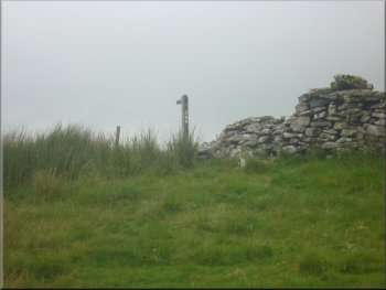
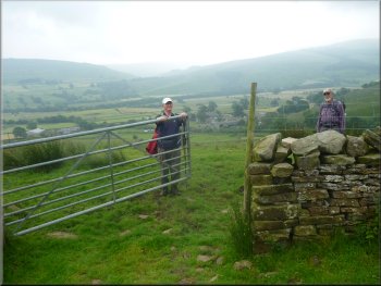
Finger post where we met the path from Burtersett
|
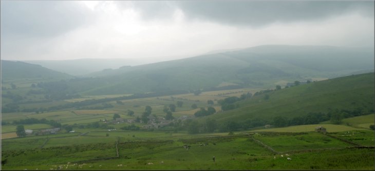
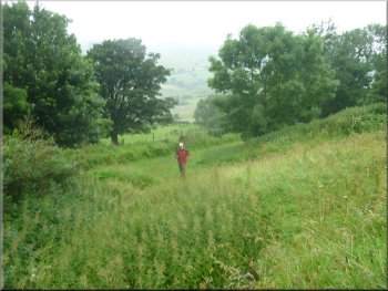
Looking across Raydale from the path down the hillside |
Beginning the descent to Marsett
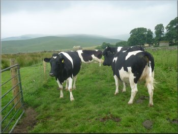
Young dairy cattle by the path
Farm track down to Marsett
At the road we turned right to our parking spot in Marsett and the
end of our walk. We drove back into Leyburn for a coffee and bacon roll
before driving home. Not a bad day despite the weather. |
We turned left here to follow the path from Burtersett down the steep
hillside towards Marsett for about 1km to a farm track at map ref. SD901863.
We followed this track for about 200m to the road.
Heading down the hillside to Marsett
Almost down to Marsett, it's a long descent
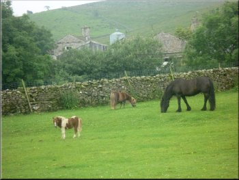
Mixed bag of horses at Marsett
|
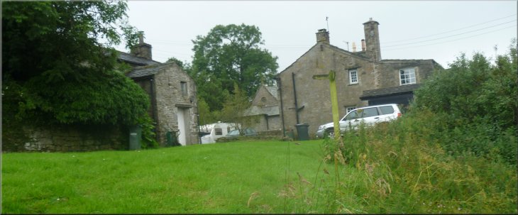
Back at our parking spot in Marsett next to Bardale Beck
|
Background Notes:
This walk is an 8km, that's 5 Mile circuit of Semer Water in Raydale, a branch off Wensleydale. We start from the village of Marsett. There's been a settlement here since Viking times and several villages in Wensleydale end in 'sett', an old Norse word meaning pasture, and the first part of the name is usually the Viking who owned the land.
From Marsett we make our way along a track following Bardale Beck and then climbing up the hillside to the village of Stalling Busk. The track comes into the village opposite the parish church of St Matthew built in 1909 to a modern style after the Arts and Crafts movement of the day. Quite an unusual church building and worth a visit.
About 100m past the church we turn back down the hillside and at the bottom we come to the ruins of the former Stalling Busk church. It was in use until the beginning of the 1900's when the new curch was built in the village. There had been a church on this site since the early 1600's.
We follow a path from the ruins to Semer Water and as we approach the lake there is a wetland nature reserve on the flat marshy land at the inlet to the lake. The site is managed by the Yorkshire Wild Life Trust, and you will need your binoculars to watch the wildfowl at the lake edge from the path as the site itself is not accessible.
We continue around the edge of the lake to the road and follow the road to a gravel beach area near the outlet to the lake. At this beach next to the road is a large boulder called the Carlow Stone and at the water's edge there are two more large boulders called the Mermaid Stones. All three are glacial erratics, that's boulders picked up by the advancing ice of a glacier and then dropped miles away from their starting point when the ice retreated at the end of the ice age. Semer Water itself is a glacial lake gouged out by the glacier. The whole valley was flooded by glacial melt water when Raydale was dammed off from Wensleydale by glacial debris. Over the years this dam was erroded away and the lake reduced to its present size.
Archeologists have found evidence of settlements around the lake from neolithic times, through the bronze age and into the iron age with the remains of iron age houses on stilts around the water's edge. There's a fanciful legend that there was once a town where the lake is and one stormy night a beggar was refuse help by the towns people. A humble couple took him into their cottage on the outskirts and the following morning as he left the beggar cursed the town condemning it to be drowned in a flood, and so it was! Personally I prefer the glacial explanation.
On the opposite side of the road to the beach is a seat on a bank with a view over the lake. The seat is one of a series that have been placed where it is believed that Turner made his sketches, including the lake, during his sketching tour of North Yorkshire in the early 1800's.
From the lake we make a big climb, about 250m, 800ft, from the lakeside up to the moor top almost to the Cam High Road. That's a Roman road that ran from the Roman fort at Bainbridge, via Ingleton, to the Roman fort at Lancaster. We follow the moor top to a footpath that crosses the moor from Burtersett to Marsett. This part of the route all the way from the lake edge has lovely views over Raydale and across to Aldbrough, a distinctively shaped hill across the valley. We take the path coming from Burtersett straight down the steep hillside back to Marsett and the end of our walk for this week.
top of page
|