| 2001 walks | 2002
walks | 2003 walks | 2004
walks |
| 2005 walks | 2006
walks | 2007 walks | 2008
walks |
| 2009 walks | 2010
walks | 2011 walks | 2012 walks |
| 2013 walks | 2014 walks | 2015 walks | 2016 walks |
| 2017 walks | 2018 walks | 2019 walks |2020 walks |
| 2021 walks | 1993-2000 library | Find a Route Index |
| A few Routes to print out | Request a Route... |
Route No. 529 - Thursday 16 January 2014
Carlton Bank, Raisdale, Beak Hills farm
Cringle Moor, Lord Stone's Cafe circuit - 11km
Cleveland Hills . . .
Route map from Ordnance Survey
Open Space service.
Map: OS Explorer OL26 North York Moors Western area
Lord Stone's Cafe at the top of Carlton Bank
|
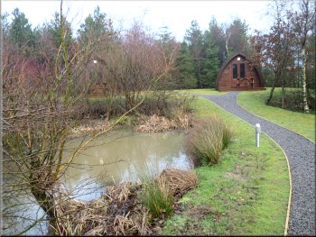
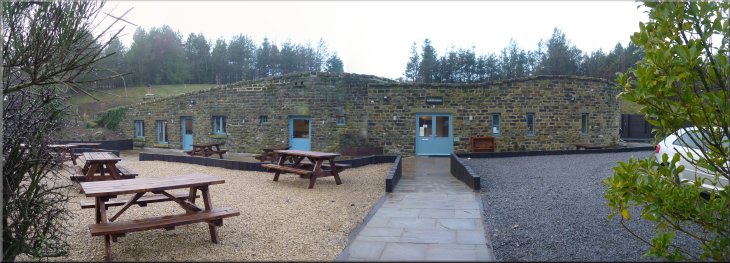
"Camping Pods" at Lord Stone's Cafe
Jim got chatting to the proprietor and
she showed us their latest project due to open at Easter. It's a series of "Camping Pods" in a very pretty enclosure with an attractive pond. The pods
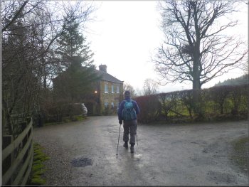
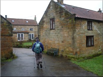
themselves consist each of a single well insulated room providing warm dry camping style accommodation. From the car park we walked out to the
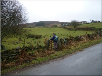
road where we turned left and walked about 100m along the road and then turned right off the road to follow a public footpath along a farm access
road. |
This morning my mate, Jim, and I drove through Helmsley and up Bilsdale to Chop Gate where we turned left to drive up Raisdale to Lord Stone's
Cafe at the top of Carlton Bank. We parked in the car park at map ref. NZ524030. Since our last visit the whole cafe and its grounds have been
completely revamped and all to a high standard too. We called in the cafe for a coffee before starting our walk.
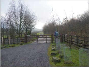
Our turning off the road onto the track to Thwaites House
|
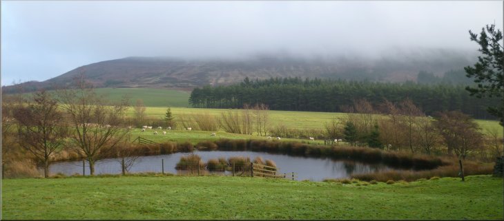
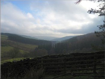
View across the pond near Thwaites House to Cringle Moor, still hidden in low cloud
|
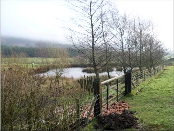
Pond near Thwaites House
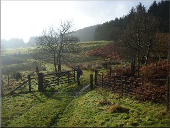
Track between Thwaites House & Staindale Farm
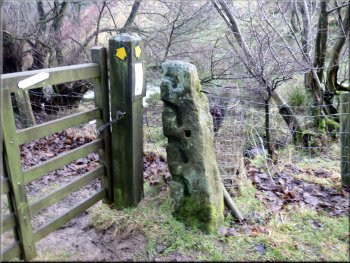
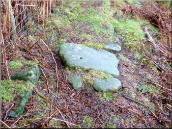
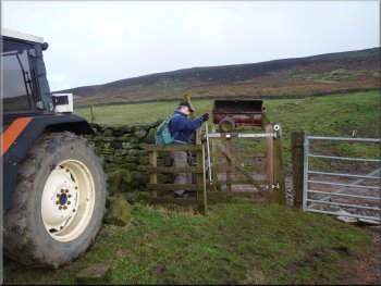
Old stone gatepost with slots for the crossbars
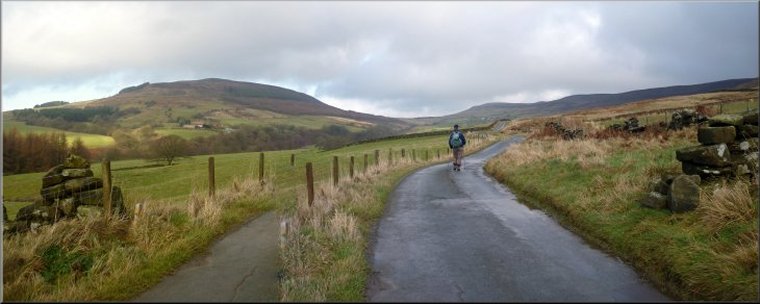
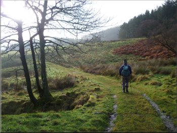
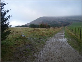
There was a nice view of Cringle
Moor away to our left with its top still hidden in the low cloud. We had occasional spells of bright sunshine as the sun broke through the cloud and
then disappeared again. After about 800m from Thwaites House we reached the access track to Staindale Farm. |
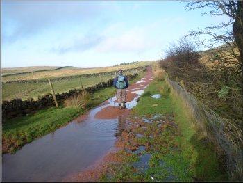
Along the farm access road we passed a pretty pond on the left and about 500m from the road we passed Thwaites House. From there we
continued along the path across the fields. It was a pleasant path, a bit muddy after the heavy overnight rain.
Approaching Thwaites House
Track between Thwaites House & Staindale Farm
Approaching Staindale Farm
|
|
|
|
|
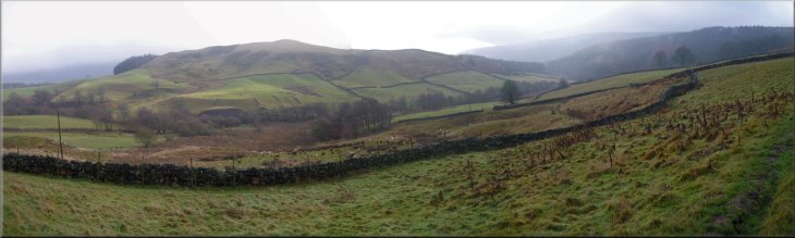
Looking across Raisdale to Wath hill
|
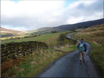
Track down Raisdale from Staindale Farm
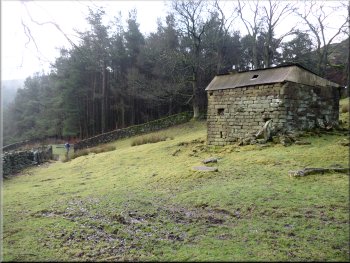
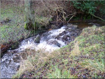
Small stone out building just above the path
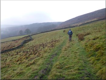
After about 500m from Staindale Farm we came to a small stone out building standing on its own just above
the path at map ref. NZ528011. |
We followed this track to our right
through Staindale Farm and continued following the path across the fields contouring around the hillside. Part of the path was quite hard to follow
through the dense reeds of cotton grass.
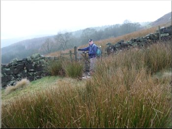
Beyond the gate the path gets a bit lost in the cotton grass reeds
Looking down Raisdale towards the misty hills of Bilsdale
|
|
|
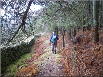
Path around the edge of woodland after the stone out building
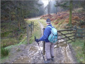
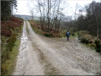
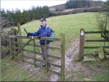
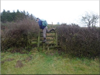
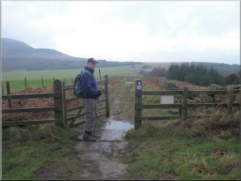
Gate leading towards the stone forest access road
We turned left to follow the forest track for about 500m to
map ref. NZ534007. Here we turned right off the stone track on to a muddy track following the stream on our right for about 300m to Raisdale Mill. |
From this out building we followed the path around the edge of some woodland for about 300m to a field gate on the
right at map ref. NZ530009. We went through the gate and after about 20m we joined a stone forest access track.
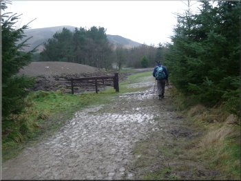
The path along Raisdale was once a paved pannier way
Turning off the forest road to a muddy path to Raisdale Mill
|
Raisdale Beck on the way to the mill
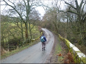
The road bridge over Raisdale Beck
The path up the grassy hillside
About 150m beyond the
beck the road bent round to the right and on the bend we turned off the road on to a footpath climbing steeply up the grassy hillside. After about 250m
the path led us to a road at map ref. NZ543006. |
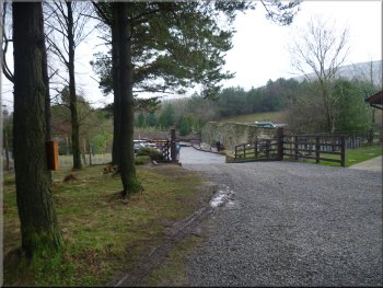
The old mill buildings are now a complex of holiday cottages. We followed the drive from the old mill up to the road and then turned right to walk along
the road. The road dropped down to cross Raisdale Beck and then began to climb up the hill on the other side of the beck.
Raisdale Mill holiday cottage complex
Turning off the road to climb up the grassy hillside
Stile onto the road from the path up the grassy hillside
|
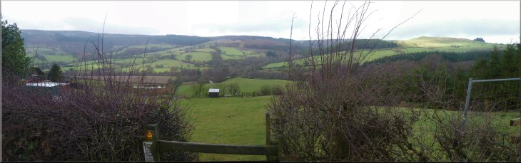
Looking back across Raisdale from the road at the top of the short climb
|
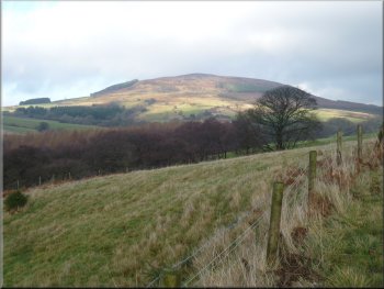
Cringle Moor briefly in the sun & free of mist
Joining the track from Beak Hills farm
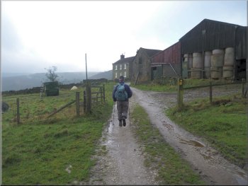
At the farm the metalled road ends but continues
past the farm as a track between the fields. It's an ancient route crossing from Bilsdale and down the northern escarpment of the Cleveland Hills and
on to Stokesley. |
At the road we turned left to walk along the road for about 1km to Cold Moor Cote. We followed the
road around the buildings and then continued for another 800m along the road to Beak Hills Farm.
Following the road to Cold Moor Cote
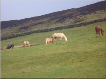
Horses at Beak Hills Farm
|
|
|
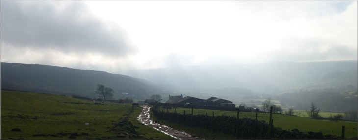
Looking back over Beak Hills Farm to the mist in Raisdale
|
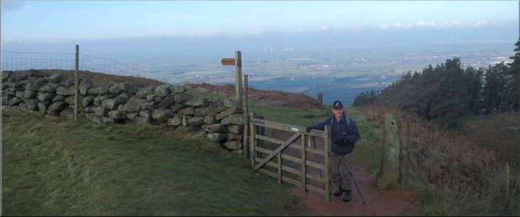
Track from Beak Hills Farm to join the Cleveland Way
Joining the Cleveland Way
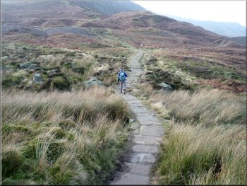
The route over Cringle Moor is paved with heavy stone slabs that I think came from the demolition of textile
mills. |
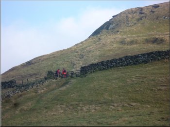
We followed the track from Beak Hills Farm for about 1km to join the Cleveland Way at map ref. NZ545034. Here we turned left to
follow the route of the Cleveland Way.
Walkers climbing up to Cold Moor along the Cleveland Way
Paved Cleveland Way path at the foot of Cringle Moor
|
Following the Cleveland Way to start the climb on to Cringle Moor
|
Cleveland Way climbing onto Cringle Moor
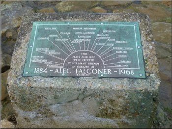
Alec Falconer memorial plaque
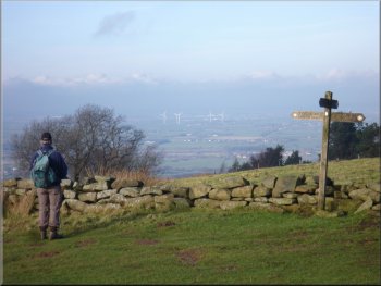
At the western
end of the ridge we came to the Alec Falconer memorial seat at the view point, and what a splendid view point it is looking out across the Tees valley. |
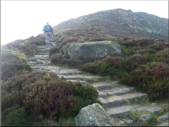
We climbed the stone steps and cobbles from the col between Cold Moor and Cringle Moor up to the ridge of Cringle Moor a climb of about
120m (400ft). We continued on the paved path along the ridge with a view through the misty low cloud out over Teesside to our right.
Cleveland Way on the ridge of Cringle Moor
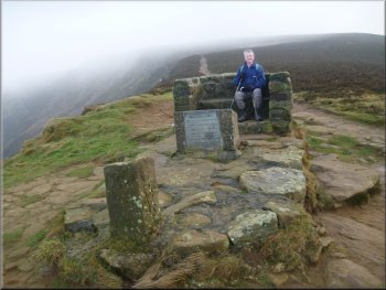
Alec Falconer memorial seat at the view point
|
Approaching the seat at the view point along the ridge of Cringle Moor
|
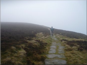
The Cleveland Way near Lord Stone's Cafe
Looking back to Cringle Moor hidden in low cloud again
The whole route had been around 10km and it had taken us three and a half hours to walk with no significant stops. The
weather had been very kind to us with no rain and some bright sunny intervals. The low cloud had sat on top of Cringle Moor all day but this had given
us some lovely effects with the bright sunny patches. We left our muddy gear in the car and went into the cafe for a coffee and a bacon roll before
heading for home. |
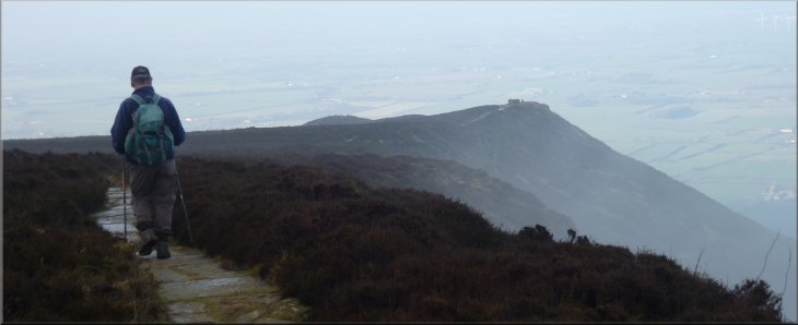
From the seat and view point we continued along the Cleveland Way route down from Cringle Moor for about 400m down the steeper part of the hill
and then another 600m back to the entrance to Lord Stone's Cafe. Here we turned off the Cleveland Way route and walked down into the car park
and the end of our walk.
Cleveland Way churned to mud by scores of boots
Turning off the Cleveland Way to Lord Stone's Cafe
|
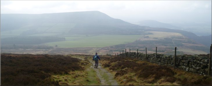
Cleveland Way coming down from Cringle Moor towards Lord Stone's Cafe with Carlton Moor ahead in the mist
|