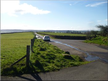
Parking spaces at the lay-by at map ref. SD601442
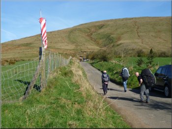
Men carrying their paragliders past the red & white windsock
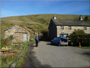
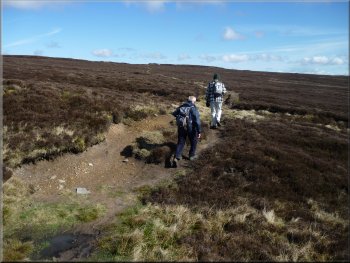
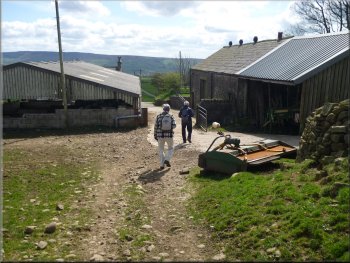
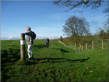
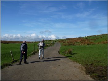
There are a couple of other lay-bys along the road to Fell Foot farm. From the lay-by at the junction we walked along the road to Fell Foot farm and passed a group of men taking huge back-packs from their cars and heading along the road to the fell. Then all became clear. There was a small red and white windsock attached to a fence post and the men were carrying their paragliders up the fellside to launch them. |
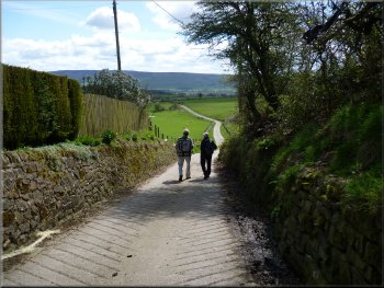
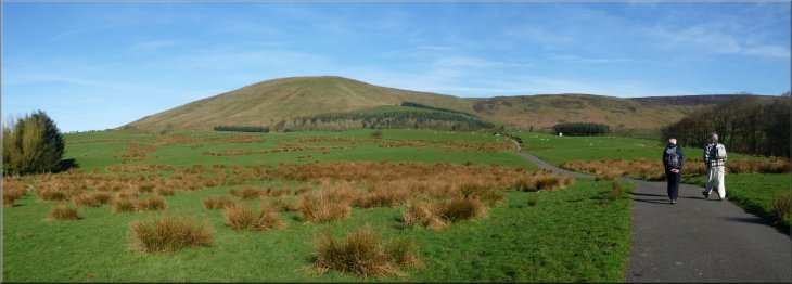
Each Spring for the last ten years we have had a short break with my wife's sisters and their husbands, somewhere with good walking for the brothers-in-law and some good sightseeing for the sisters. This year we are staying near Chipping in the Forest-of-Bowland in Lancashire. This morning we did a walk straight from our holiday cottage but I will start my description from a small lay-by at the road junction at map ref. SD601442.
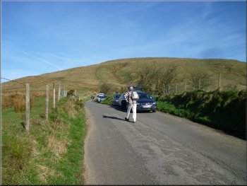
More parking space along the lane to Fell Foot farm
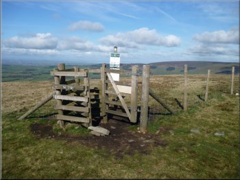
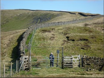
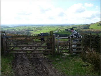
The gateway onto the fells at Fell Foot farm
|
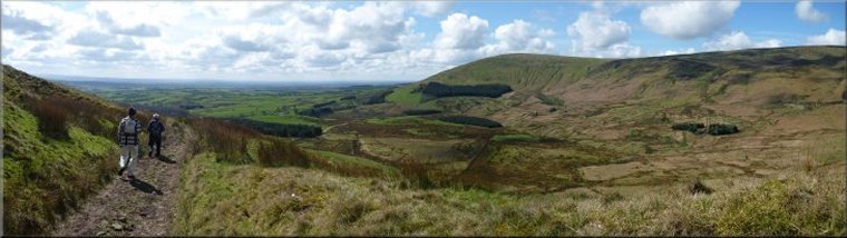
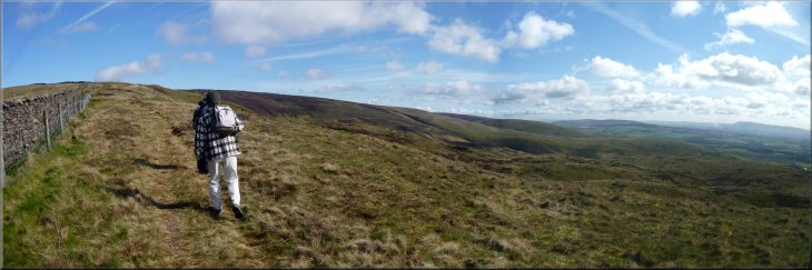
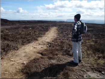
Starting the climb straight up Parlick Pike
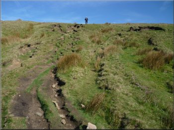
There are two skylines like this before reaching the real summit
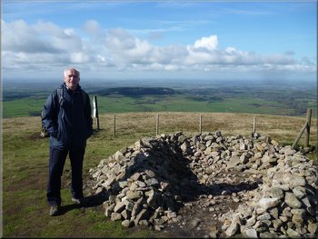
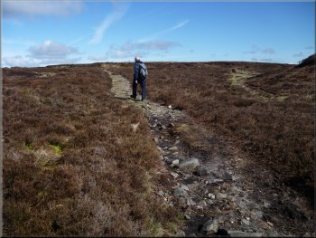
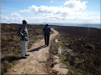
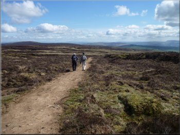
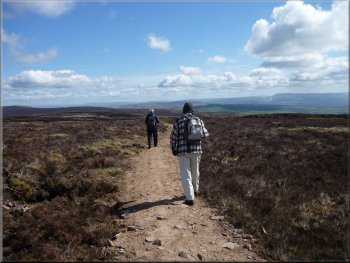
It took us about 45 minutes to reach the top with numerous short stops to admire the developing views, but really just to catch our breath. It was a clear bright day but still hazy in the far distance. We could see the high rise buildings in the centre of Preston, and the hills of the Forest-of-Bowland all around us. |
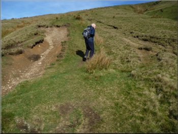
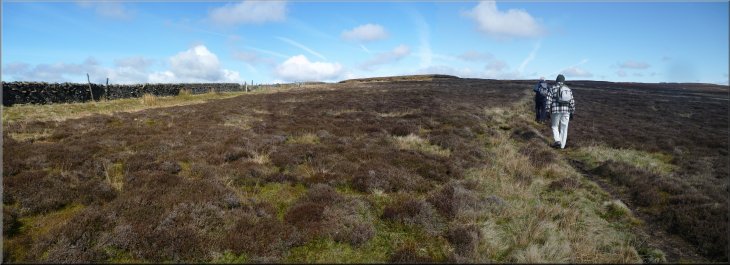
We went through the stile at Fell Foot and began the climb following a path straight up the steep fellside. From the lay-by at the road junction to the cairn on top of Parlick Pike is a climb of 216m (720 feet).
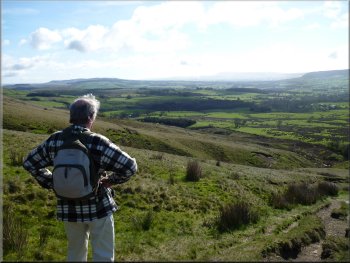
The view looking towards Clitheroe part way up Parlick Pike
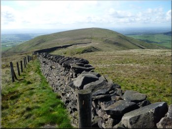
Gate in the ridge fence on Parlick Pike (but not our route)
|
|
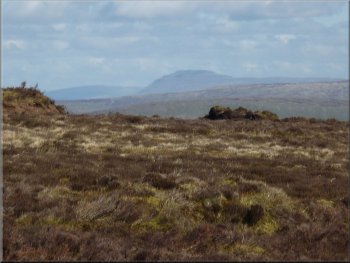
Looking over Wolf Fell to Far Snape Fell from Parlick Pike
|
Windbreak shelter on Parlick Pile
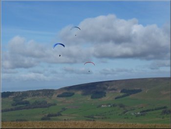
Paragliders in action over the ridge
Start of the climb up out of the saddle in the ridge
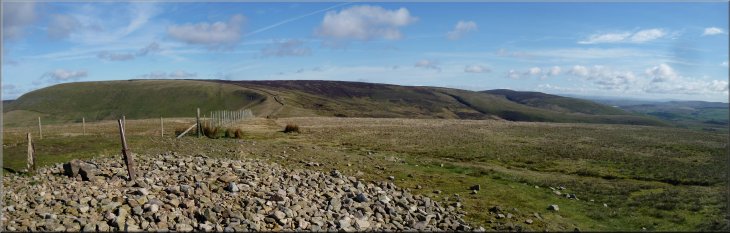
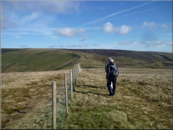
As we walked along the ridge the paragliders we being launched from the western slopes of Parlick Pike and quickly gained height in the strong westerly breeze. From the saddle we climbed up for a little over 1km to a fork in the path at map ref. SD595467. |
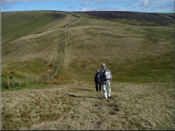
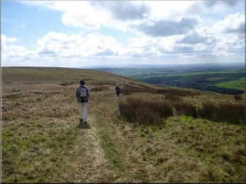
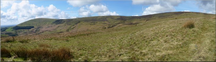
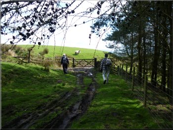
From the cairn we headed northwards along the ridge first dropping down to a saddle and then climbing up over Wolf Fell. There is a warning sign advising that Wolf Fell was used as a military training area in World War 2 and don't touch any shells you may come across - well that's the gist of it.
Setting off along the ridge to Wolf Fell
Dropping down from Parlick Pike to the saddle in the ridge
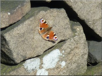
Peacock butterfly basking in the spring sunshine
|
Climbing up along the ridge from Wolf Fell
|
Looking back down the ridge to Parlick Pike
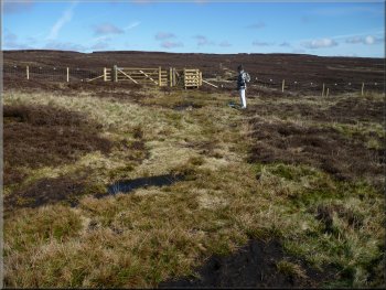
The path along the right hand fork to a gate in the wire fence
We passed through the gate and continued along the path around the hillside for about 500m to join another path at map ref. SD598471.
|
At the fork in the path we took the right hand fork heading for a new timber gate at a wire fence across the fell that we could see about 200m away.
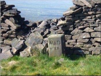
WW2 military training area boundary marker
Path from the gate across the hillside
|
Climbing up along the ridge from Wolf Fell
|
Path from the gate across the hillside
Following the path surfaced with shale & clay
All three of us looked in the direction he pointed and sure enough it was the distinctive shape of Inglebrough about 25km away. Then as we looked we could see Pen-y-Ghent a little to the right of Inglebrough with the end of Fountains Fell a little further to the right still. Then we picked out the ridge of Whenside in the haze a little to the left of Inglebrough. What a great view! To the east south east there was the smoke from the cement works chimney at Clitheroe, but at this distance it didn't spoil the view - it was just interesting to note. |
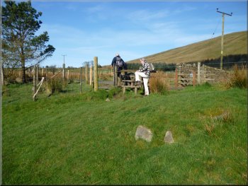
As we reached this 'T'-junction in the paths there was another gate in a wire fence about 100m to our left, but we turned right to follow the path across the heather clad hillside. The path had been surfaced with shale and stony clay material and so was easy to follow. After about 500m along this path we found a comfortable spot in the heather to stop for our lunch. It was very pleasant in the spring sunshine. George was staring intently at the skyline looking roughly north north east and suddenly remarked, "That's a big hill over there!"
Meeting the path surfaced with shale & clay
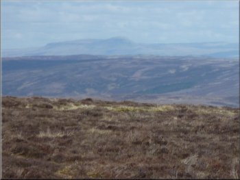
The hazy shape of Inglebrough seen from our lunch stop
|
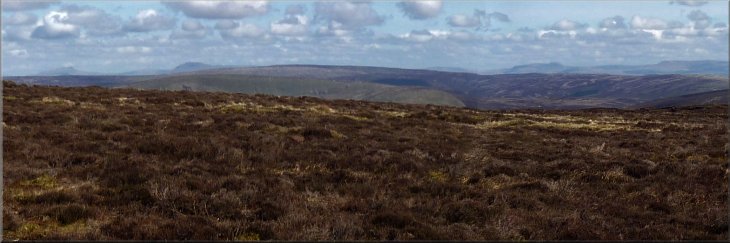
Skyline: Whernside . . . . . Inglebrough . . . . . . . . . . . . . . . . . . . . . . . . . . . . . . . . . . . . . . . . . . . Pen-y-Ghent . . . . . . . . . . Fountains Fell
|
A last look at Pen-y-Ghent in the haze
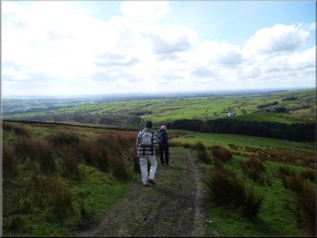
Continuing along the path after our lunch break
We went through the gate and followed the path as it turned right to head down a long spur of land from Saddle Fell. As we descended there was a fine view of Wolf Fell and Parlick Pike away to our right. |
After our break we continued along the shaly path for another 500m to another gate through a wire fence at map ref. SD608470 on Saddle Fell. The shale surfacing to the path stopped abruptly a few metres before the gate.
Continuing along the path after our lunch break
Following the path down the tongue of land from Saddle Fell
|
Coming down from Saddle Fell with a view of Wolf Fell & Parlick Pike on our right
|
Track down to Saddle End farm from Saddle fell
Track down to Saddle End farm from Saddle fell
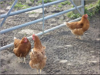
Free range poultry at Saddle End farm
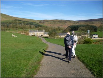
The track led us through the farm and along the farm access road to the public road at map ref. SD616448. |
It was a long descent, about 2km along a well defined track leading to Saddle End farm.
Track down to Saddle End farm from Saddle fell
The track through Saddle End farm
Farm access road from Saddle End farm
|
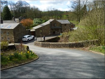
The public road towards Wolfen Mill
The turning to Wolfen Mill
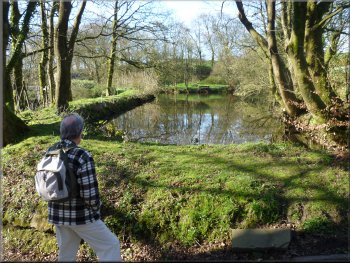
The mill pond at Wolfen Mill
Just across the bridge on our right at Wolfen Mill was the access road to Wolfen Hall. We turned right here and followed the access road up to the entrance to the hall. |
At the road we turned right and walked along the road for about 600m to a 'T'-junction at map ref. SD612442. Here we turned right down a steep slope with a hair-pin bend that brought us to a bridge over Chipping Brook.
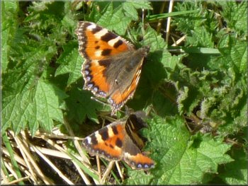
Two large tortoise shell butterflies
Bridge over Chipping Brook and the turning at Wolfen Mill
The access road to Wolfen Hall from Wolfen Mill
|
Parlick Pike and Wolf Fell seen from the access road to Wolfen Hall
|
The field path around Wolfen Hall
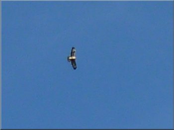
Buzzard circling overhead
As I mentioned at the beginning we did this walk straight from our holiday cottage at Wolfen Mill and this morning as we approached the parking area a buzzard took off from a tree top near the road and began circling to gain height. The bird passed over us on each circle and the patterns under its wings were clearly visible. I struggled with my little 'point and click' camera but I did manage a rather blurred picture at the limit of my camera's range. The buzzard was a lovely sight. |
Just before the entrance the path turns left to by-pass the hall. We followed the path along the edge of a field, then over a stile into the next field where the path turned right over another stile to join an access road coming from Wolfen Hall. We followed this access road for about 550m to the lay-by at the road junction where the route had started. The whole walk had been 10km including a good deal of climbing and it had taken us four and a half hours to walk including our lunch break and numerous photograph stops.
The field path rejoins the access road from Wolfen Hall
The access road from Wolfen Hall
approaching the lay-by at the end of the walk
|