| 2001 walks | 2002
walks | 2003 walks | 2004
walks |
| 2005 walks | 2006
walks | 2007 walks | 2008
walks |
| 2009 walks | 2010
walks | 2011 walks | 2012 walks |
| 2013 walks | 2014 walks | 2015 walks | 2016 walks |
| 2017 walks | 2018 walks | 2019 walks |2020 walks |
| 2021 walks | 1993-2000 library | Find a Route Index |
| A few Routes to print out | Request a Route... |
Route No. 631 - Thursday 21 July 2016
Malham Moor Lane, Mastiles Lane,
Lee Gate Farm, Bordley circuit - 8km
Yorkshire Dales . . .
Route map from Ordnance Survey
Open Space service.
Map: OS Explorer OL2 Yorkshire Dales Southern & Western areas
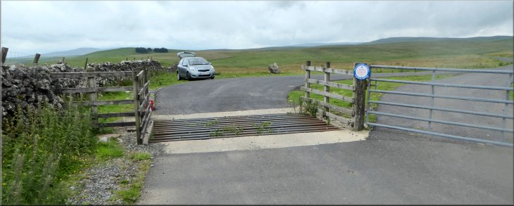
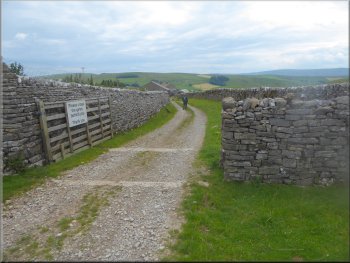
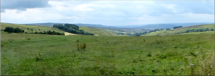
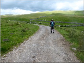
Our parking spot by the cattle grid on Malham Moor Lane at map ref. SD 951 653
|
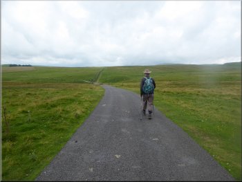
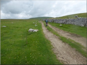
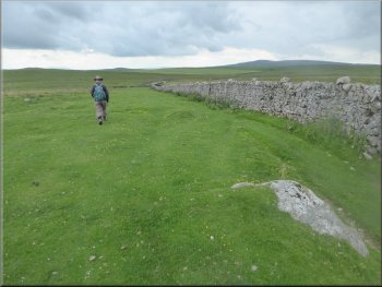
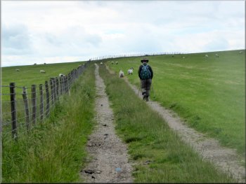
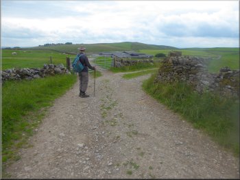
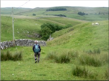
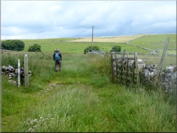
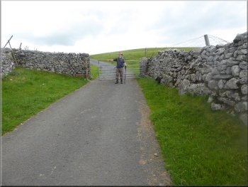
Setting off along Malham Moor Lane
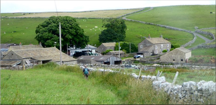
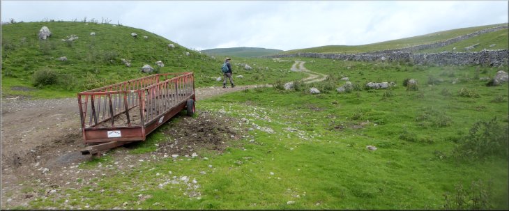
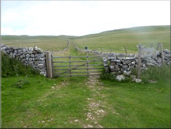
Around 4km from Threshfield we crossed a cattle grid where the road became unfenced. We parked here just off the tarmac next to the dry stone wall at map ref. SD 951 652. From our parking spot we walked along the road for about 350m dropping down to the bottom of the field where the public road ends. |
This morning my friend, Jim, and I drove out to Threshfield on the western bank of the River Wharfe opposite Grassington. From Threshfield we drove west past Skirethorns and north west along a narrow lane called Wood Lane. We continued driving along the lane climbing up to Malham Moor where the lane is called Malham Moor Lane.
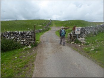
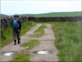
The public road ends at this gateway
|
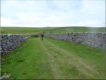
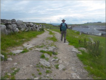
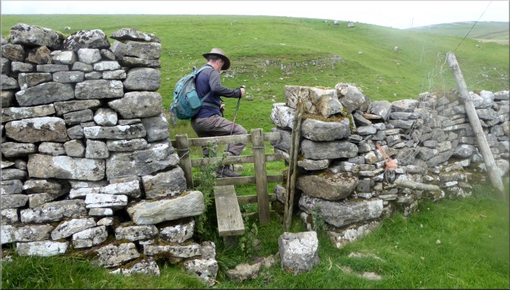
Turning right to follow the track up to Mastiles Gate
|
Following the track up to Mastiles Gate
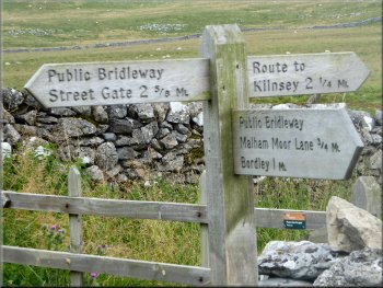
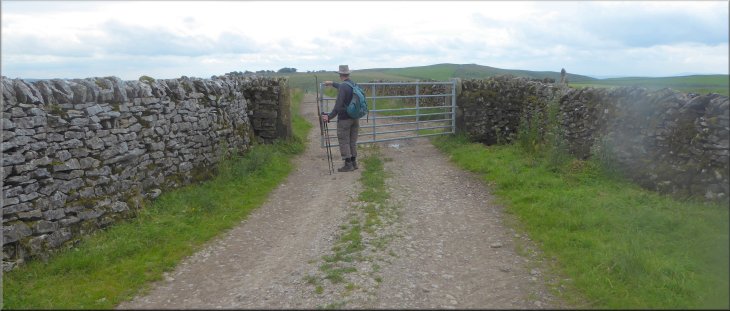
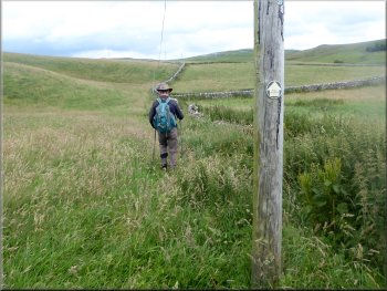
The sign post at Mastiles Gate
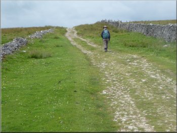
After about 700m we came to Mastiles Gate on Mastiles Lane at map ref. SD 944 661. To our right we could see the walled track of Mastiles Lane coming up from Kilnsey in Wharfedale.
|
From the end of the public road we continued through the gateway and after about 30m we turned right and followed a bridleway along a track next to the wall on our right.
Continuing along the track up to Mastiles Gate
Looking north east along Mastiles Lane towards Kilnsey
|
Looking south east from Mastiles Lane to Elbolton Hill (a reef knoll) in Wharfedale
|
Following Mastiles Lane south west
Gate on Mastiles Lane
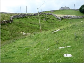
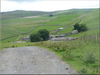
About 700m from Mastiles Gate we came to a few small fields on both side of Mastiles Lane and some small farm out buildings. |
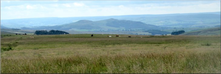
At Mastiles Gate we turned left and walked south west along Mastiles Lane. There was a lovely view to our left looking down into Wharfedale with the conical shape of Elbolton Hill (a reef knoll) coming into view.
Heading south west along Mastiles Lane
A walled section of Mastiles Lane
|
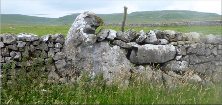
Large boulder built into the wall (the shape looks to me like a seal sitting up & laughing)
|
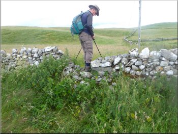
Turning left off Mastiles lane onto a track leading to Malham
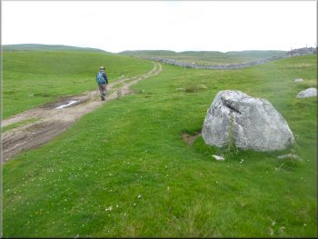
Track by the fence across a sheep pasture
We walked along this track for about 800m. The fence on our left had now become a dry stone wall and the field came to a point here at its southern extremity. |
After another 700m we came to a track crossing Mastiles Lane at map ref. SD 930 655. Here we turned left off Mastiles Lane and followed a bridleway along a track next to the fence across a large sheep pasture.
Track by the fence across a sheep pasture
Nearing the southern corner of the sheep pasture
|
Gate from the sheep pasture to a walled track
|
Following the walled track to the turning to Lee Gate
We followed the track to our left for about 100m to join a bridleway where it emerged from the field on our left. Here the field wall was constructed from large boulders, much bigger than anything I had seen used for wall construction before.
|
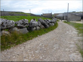
We passed through the gate at the end of the field and continued along a walled track for about 250m to a point just above the farms at Middle Laithe and Lee Gate. Here the wall on our left ended and there was an open track to our left.
The track leading to Lee gate
|
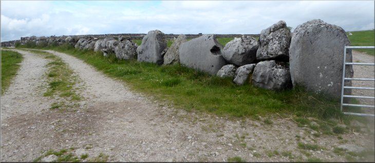
Wall constructed from large boulders on our way to Lee Gate
|
Track down to Lee Gate farm
Farm access road into New House Farm (National Trust)
Following the path below New House farm
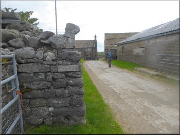
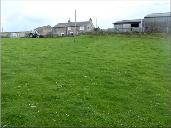
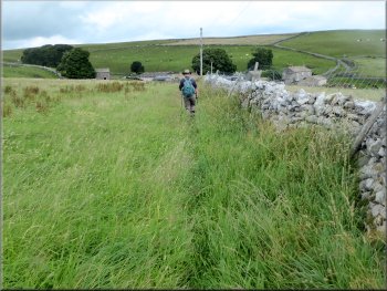
New House Farm is open to school parties for educational purposes. At the farm house the path bears right to pass in front of the farm buildings and drop down to the bottom of the field. Here we continued through a small gate and walked down the slope next to a wall on our left into the little valley of Heber Beck. |
We followed a footpath through Lee Gates farm and out along the track across the fields. After about 400m we came to New House Farm. This farm is owned by the National Trust and is farmed using traditional methods from the early twentieth century.
Path along the farm access road through Lee Gate
Looking back to New House Farm
Following the path down to Heber Beck
|
Crossing the stile to drop down to Heber Beck
|
Looking back towards New House Farm across Heber Beck
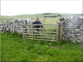
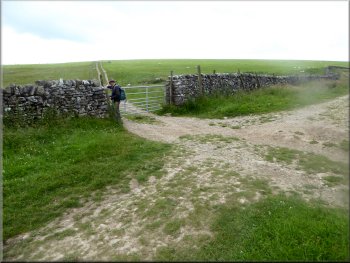
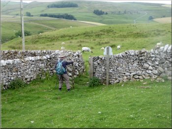
At map ref. SD 937 644 we turned right through a field gate
After about 25m from the gate we turned left over a stile
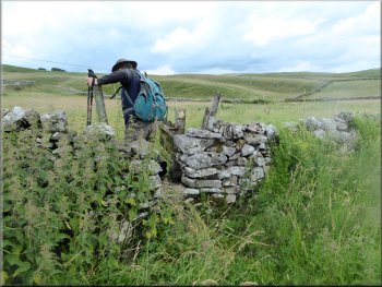
From the gate we followed the path next to the wall on our left for about 25m then we turned left to cross a stile in the wall. From the stile we crossed a small field to a wall corner opposite. At the wall corner, hidden in a clump of tall nettles was a broken down step stile in the wall. We carefully crossed this awkward stile and continued along the footpath following the wall on our right. |
Soon there was a stile in the wall which we crossed and made our way down a steep awkward bank to cross the rocky bed of the beck. From the beck we followed the path along a grassy track climbing away from the beck and then following a wall on our right. At map ref. SD 937 644 we turned right through a field gate.
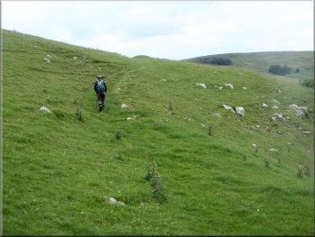
Grassy track climbing up from Heber Beck
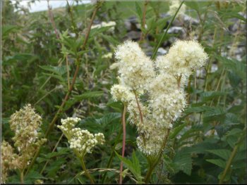
Meadow sweet with its heavy sweet scent by the path
Broken stone step stile in a clump of nettles
|
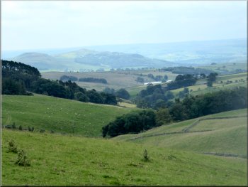
Looking south east from the path, down into Wharfedale
|
Path to Bordley from the broken stone step stile
Nearing Bordley along the path by the field edge
Entering Bordley
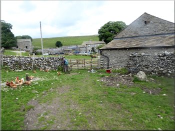
The path led us into Bordley through a field with numerous free range hens and cockerels. There was a flock of sheep gathered in a holding pen by the track through the farms. |
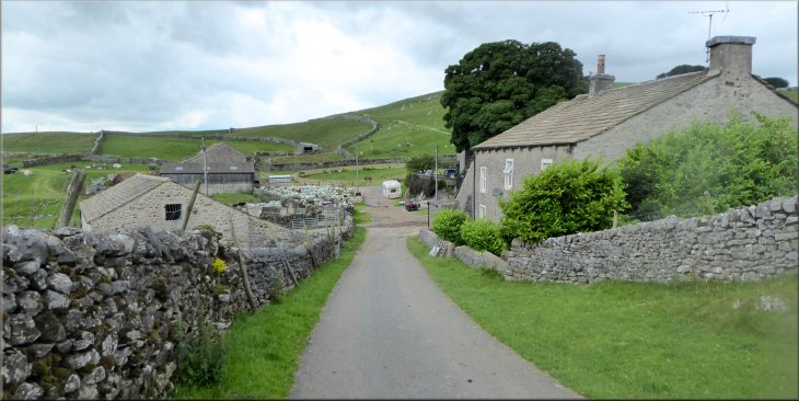
We continued along the path following the edge of the fields for about 500m to the Bordley. This little settlement seems to consist of just two farms, Bordley Green Farm and Bordley House Farm.
Path to Bordley along the field edge
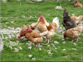
Free range poultry as we entered Bordley
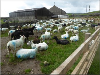
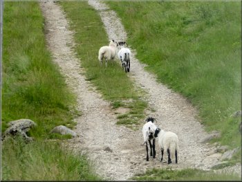
Flock of sheep in a holding pen by the track in Bordley
|
Looking back as we climbed up the road leaving Bordley
|
Farm access road leaving Bordley
A last glimpse of Bordley as we topped the rise
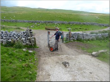
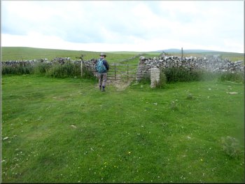
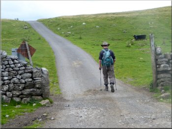
The gate leading back onto Malham Moor Lane
We walked along the public road up the hillside for about 400m back to our parking spot by the cattle grid at the top of the field, and the end of our walk. The whole route had been about 8km and it had taken me a little over three hours to walk it. |
We followed the road out of Bordley up quite a steep climb from its sheltered position in a little cleft in the hillside. We continued along this access road for about 600m to intercept our outward route at map ref. SD 946 654. Here we turned right to walk through the gateway and rejoin the public road.
The view into Wharfedale as we left Bordley
Following the track back towards Malham Moor Lane
Following Malham Moor Lane back up the hill to our parking spot
|
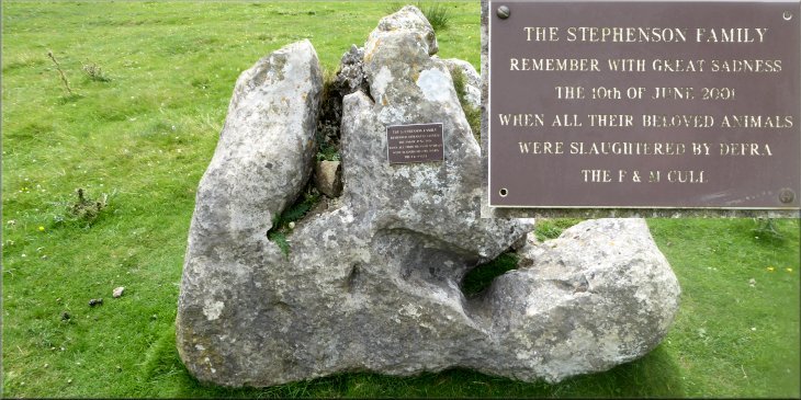
Plaque on a boulder by the cattle grid on Malham Moor Lane
|