|
2001 walks |
2002
walks |
2003 walks |
2004
walks |
|
2005 walks |
2006
walks |
2007 walks |
2008
walks |
|
2009 walks |
2010
walks |
2011 walks |
2012 walks |
|
2013 walks |
2014 walks |
2015 walks |
2016 walks |
|
2017 walks |
2018 walks |
2019 walks |
2020 walks |
|
2021 walks |
1993-2000 library |
Find a Route Index |
|
A few Routes to print out |
Request a Route... |
Route No. 666 - Thursday 6 April 2017
Gearstones, Dales Way, Pennine Way,
Nether Lodge, Ribble Way,
Thorns Gill Bridge circuit - 9km
Ribblehead . . .
Route map from Ordnance Survey
Open Space service.
Map: OS Explorer OL26 North York Moors Western area
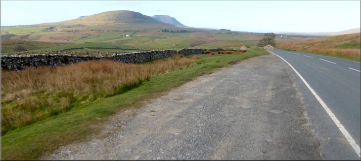
Looking to the south from our parking spot to Ingleborough over the shoulder of Park Fell
|
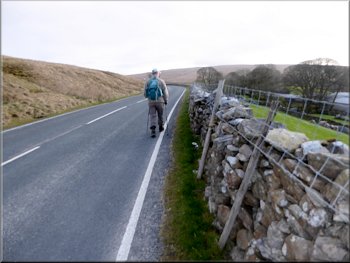
Setting off along the B6255 from our parking spot
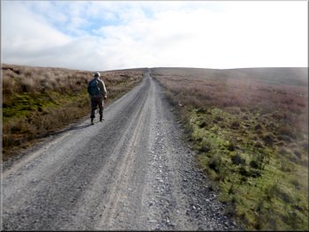
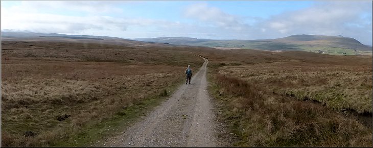
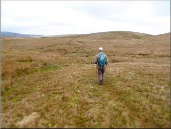
Dales Way track heading out across the moors
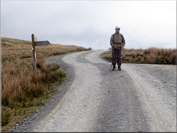
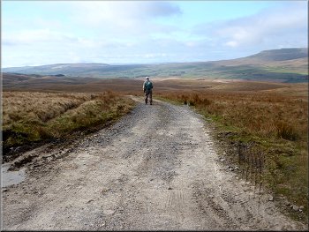
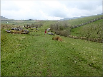
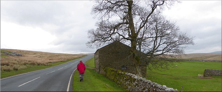
From our parking spot we set off north eastwards along the road, past Gearstones to a left hand bend in the road at map ref. SD 785 802, where we turned right off the road to follow the route of the Dales Way along a gravel moorland track heading generally eastwards. |
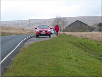
My neighbour, Jim, and I are staying at a pub in Kirkby Lonsdale for a few days. (We both have a 3-day pass from our respective wives) Today we drove from the pub in Kirkby Lonsdale to a gravel lay-by on the B6255 at Gearstones about 1.5kn north east of Ribblehead at map ref. SD 778 799.
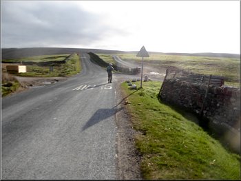
Turning off the B6255 to follow the Dales Way
Signs at an alternative joining point for the Dales Way
|
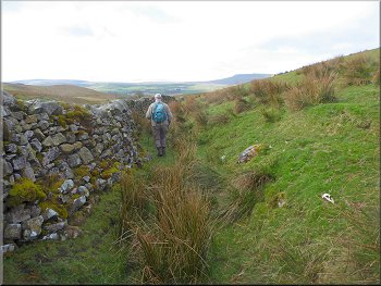
Route of the Dales Way along the track across the valley of Gayle Beck
|
Continuing along the Dales Way track
Junction in the tracks where we met the Pennine Way
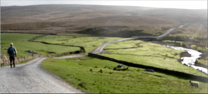
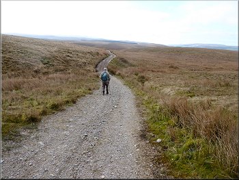
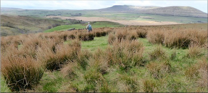
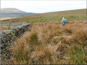
It does seems to be a long way when you can see the track stretching straight ahead with an unbroken climb all the way to the junction at the Pennine Way. At the 'T'-junction in the gravel tracks we turned left to follow the track heading generally southwards, now following the route of the Pennine Way. |
The track climbed steadily from the bridge over Gayle Beck for about 1.6km to map ref. SD 801 804, a climb of about 110m. For the final kilometer to the Pennine Way junction the track is following the route of a Roman Road.
Climbing up along the Dales Way on the route of a Roman Road
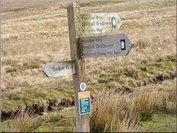
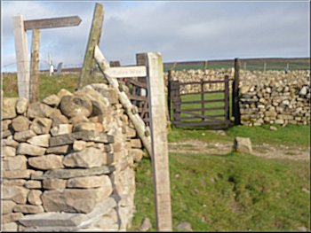
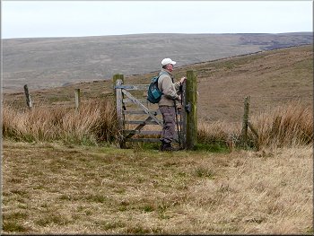
Signs where the Dales Way & Pennine Way meet
|
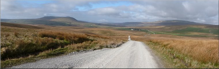
Looking back along the Dales Way with Ingleborough on the left and Whernside on the right
|
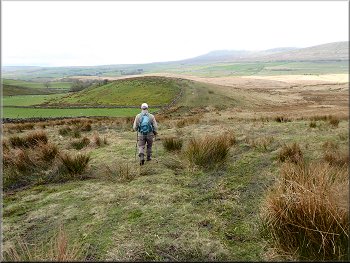
Following the Pennine Way down from the Dales Way junction
Nearing our turning off the Pennine Way
The path should be heading generally southwestwards towards Nether Lodge about 1.7km away, but we could not find the start of the it. |
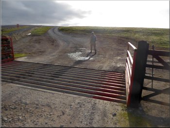
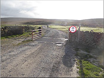
We continued along the route of the Pennine Way for about 1km to a left hand bend in the track at map ref. SD 801 794. From this point my OS Explorer map shows a public footpath going right off the Pennine Way track
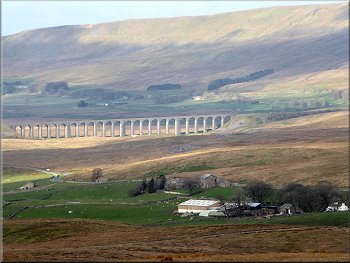
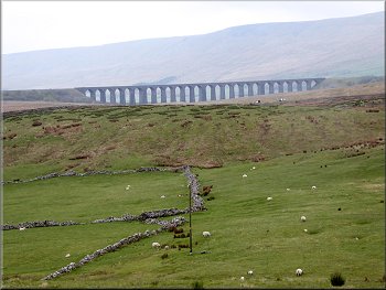
The Ribblehead viaduct seen from the Pennine Way
Failing to find our turning off the Pennine Way
|
Following the Pennine Way down from the Dales Way junction
|
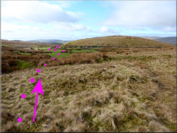
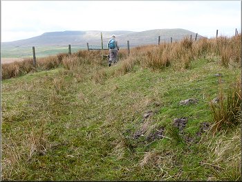
Our route around News Head Hill from the Pennine Way . . .
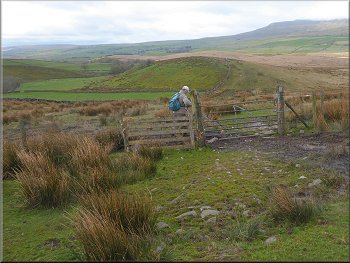
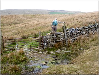
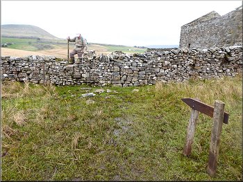
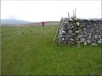
Stile & sign post at the wall by the sheep pens
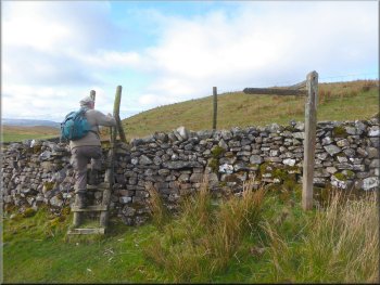
We approached the wall to the west of the sheep pens (ie with the sheep pens on our right). When we reached the wall we were pleased to find a stile and a finger post marking the path there. |
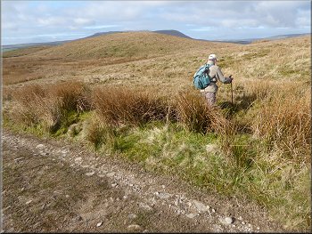
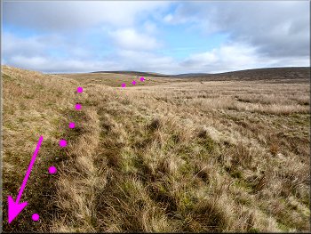
The land south of the Pennine Way track was quite wet and boggy, so when we set off from the Pennine Way track we kept to the higher ground working our way around the base of News Head Hill for a few hundred metres until we reached the sheep pens by the wall at map ref. SD 799 790.
. . . & our route from New Head Hill to the wall at the sheep pens
Path by the wall from the sheep pens towards Nether Lodge
|
Heading across the moorland towards Nether Lodge
|
Nearing a stile on the path towards Nether Lodge
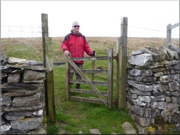
A gate this time, easier than a stile
Shortly before we reached Nether Lodge there was a short steep climb over Swinesett Hill before we dropped down to a finger post marking the Ribble Way in front of Nether Lodge at map ref. SD 792 778. |
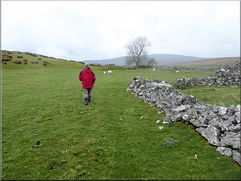
From the stile the path followed the wall on our left mostly close to the wall but sometimes up to 50m away but with the wall/fence still on our left. We continued towards Nether Lodge now about 1.2km away.
Another stile on the path towards Nether Lodge
The hill ahead is Swinesett Hill, just before Nether Lodge
|
Dropping down from Swinesett Hill to Nether Lodge
|
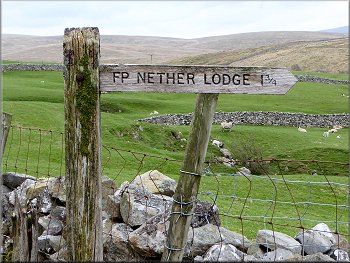
The finger post at Nether Lodge showing the Ribble Way
Gate on the Ribble Way at map ref. SD 789 783
Stone step stile at map ref. SD 787 788
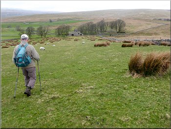
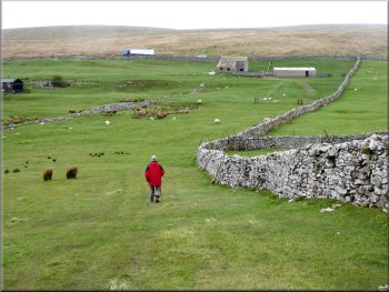
Walking down the field from Back Hools Hill
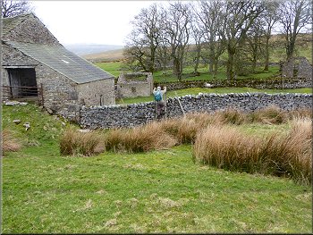
From here we could see our car on the B6255 about 1km away as the crow flies, across the valley of Gayle Beck. From the hill top we dropped down along the edge of the field to some stone farm buildings where a pedestrian gate led us out to a walled track. At the walled track we turned left by the farm buildings.
|
From the finger post at Nether Lodge we headed roughly north west following the Ribble Way, a wet path through the coarse grass of the moorland. The Ribble Way path climbed steadily over the hills and across the small valleys for about 1.4km from Nether Lodge to the top of Back Hools Hill at map ref. SD 783 791.
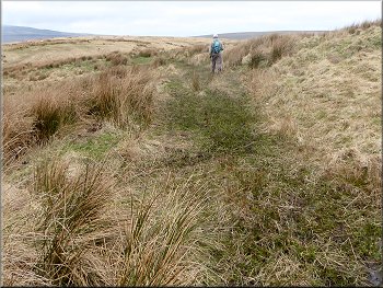
Following the boggy Ribble Way through the coarse grass
The Ribble Way climbing up across the rough moorland
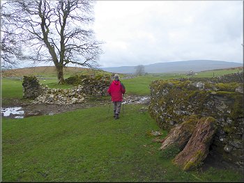
Stile by a ruined farm building at map ref. SD 784 790
Farm buildings at map ref. SD 782 793 on the Ribble Way
|
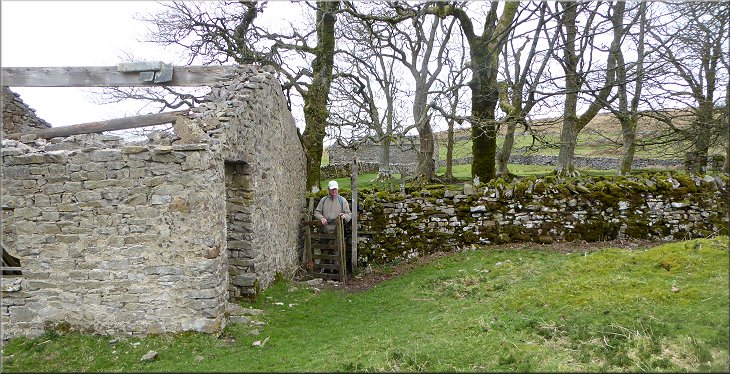
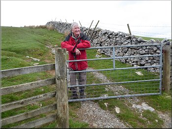
Gate on to a walled track at map ref. SD 781 794 on the Ribble Way. The Ribble Way turns right here and we turned left
|
Keeping straight ahead where the walled track turns left
Following the grassy farm track towards Thorns Gill Bridge
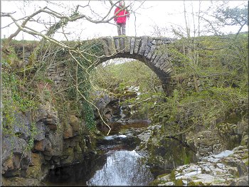
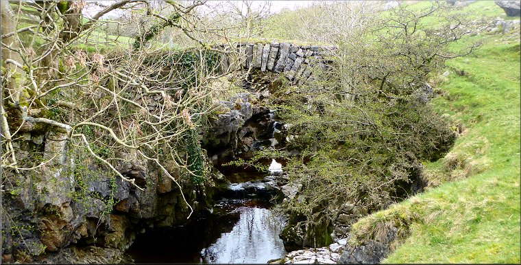
Looking upstream to Thorns Gill Bridge
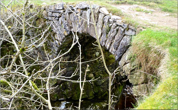
Here there is a lovely single arch stone pack horse bridge across a little limestone gorge called Thorns Gill, with Gale Beck flowing in the bottom of the gorge. About 4km downstream of the bridge and about 2km south of Nether Lodge, after a few other small watercourses have joined the beck, it becomes the River Ribble. |
After just a few metres the track turned left but we kept straight on through the ruins of a former farmstead. The path followed an unfenced grassy farm track across the fields for almost 400m in a westerly direction to Gale Beck at map ref. SD 777 794. (I think the photos are better with Jim's red coat)
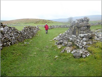
Following the grassy track past the ruined farmstead
Nearing Thorns Gill Bridge along the grassy farm track
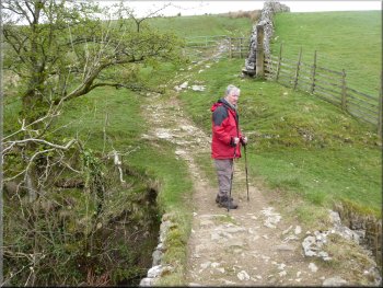
Crossing Thorns Gill Bridge
|
Looking downstream to Thorns Gill Bridge
|
The path leaving Thorns Gill Bridge
Another view of the Ribblehead Viaduct, but no train
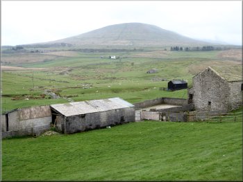
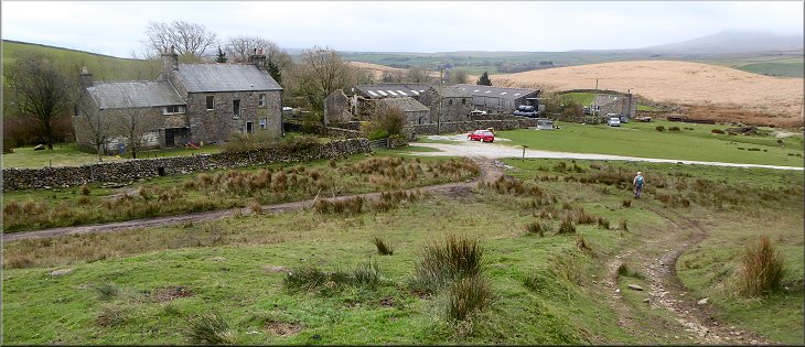
Looking back over the buildings at Ribble Head Ho to Park Fell
At the road we turned right and walked along the road for about 300m back to our car in the gravel lay-by at the end of our walk. The whole walk had been 9km and it had taken me a little over three hours to walk including pauses for far too many photos (as usual) and a good look at Thorns Gill pack horse bridge. |
We paused at the bridge to take a few photos and just to enjoy this lovely location for a few minutes, then we crossed the bridge an followed the footpath up alongside the stone wall for about 350m to the B6255 at map ref. SD 776 797. There was a finger post here that told us we had come less that 3km from Nether Lodge. Mmm . . . it seemed longer than that !
Heading across the fields to the road
Path following the wall up to the B6255
Gate from the field path onto the B6255
|
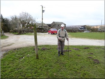
Less than 3km from Nether Lodge !
|
The end of our walk at the little gravel lay-by
|
The last 300m along the B6255 back to our car
|