|
2001 walks |
2002
walks |
2003 walks |
2004
walks |
|
2005 walks |
2006
walks |
2007 walks |
2008
walks |
|
2009 walks |
2010
walks |
2011 walks |
2012 walks |
|
2013 walks |
2014 walks |
2015 walks |
2016 walks |
|
2017 walks |
2018 walks |
2019 walks |
2020 walks |
|
2021 walks |
1993-2000 library |
Find a Route Index |
|
A few Routes to print out |
Request a Route... |
Route No. 671 - Tuesday 23 May 2017
Saul's Drive car park, New Barns, Coastal path,
Far Arnside, Arnside Tower, Arnside Knott Wood,
Arnside Knott view point circuit - 8km
Arnside, Cumbria . . .
Route map from Ordnance Survey
Open Space service.
Map: OS Explorer OL7 The English Lakes South-Eastern Area
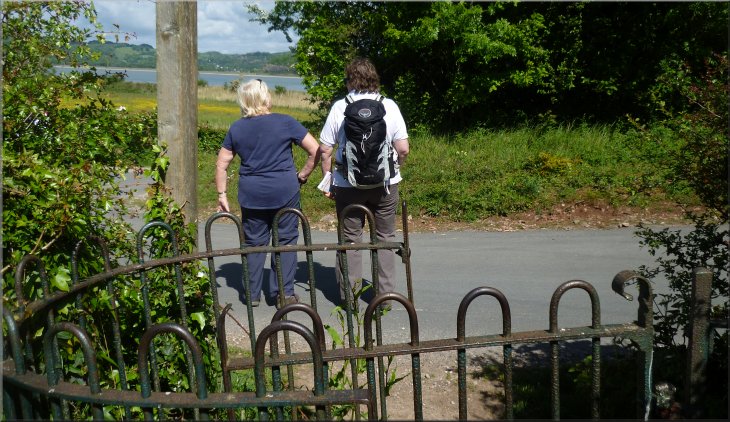
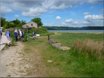
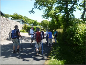
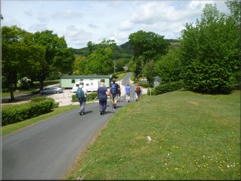
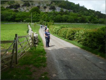
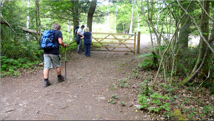
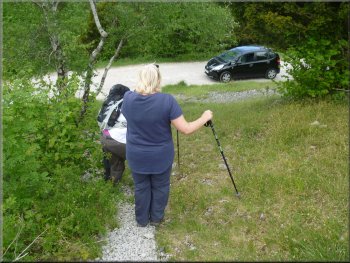
This week we are staying with some friends in a holiday cottage in Grange-over-Sands on the edge of Morecambe Bay south of the Lake District. So far the weather has been perfect, fine, dry, brilliant blue skies and warm sunshine with a gentle breeze. This morning we all drove from Grange around an arm of Morecambe Bay via Milnthorpe to Arnside. From The Promenade in Arnside we drove along Silverdale Road, Red Hills Road, Knott Lane and Saul's Drive to the bumpy earthen car park at map ref. SD 449 773 below Arnside Knott.
Setting off from the car park at the end of Saul's Drive below Arnside Knott
|
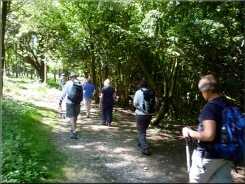
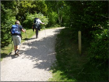
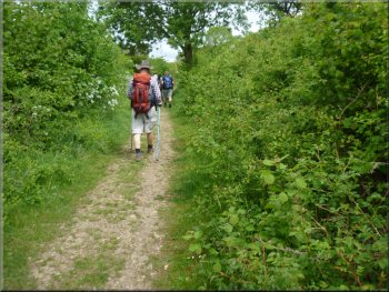
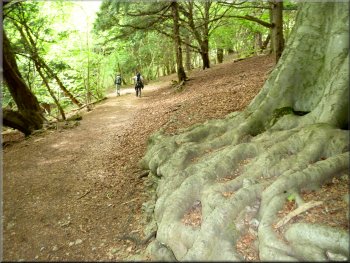
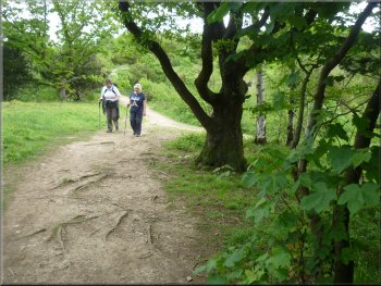
Following the woodland path from the car park
View from a clearing as we descended through the woods
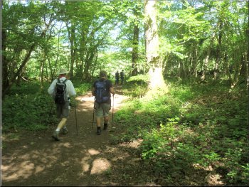
Path through the woods towards the shore
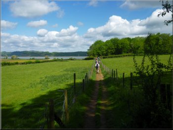
We were heading generally north westwards and after about 800m down the slope we emerged from the woodland into a grass field. We continued across the field to a stile that led us onto an access road at map ref. SD 444 777. |
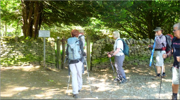
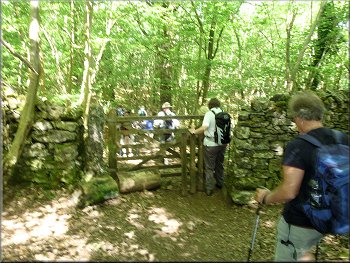
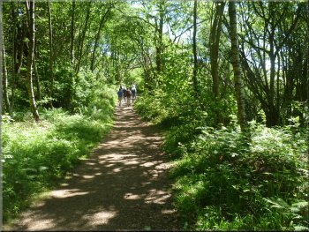
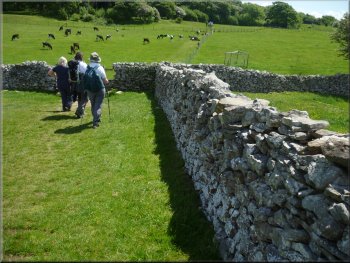
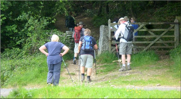
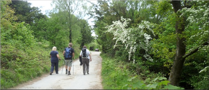
We parked near the southern end of the car park where there is a wooden footpath gate through the dry stone wall. We set off through this gate and followed the path through the woods for about 120m then turned right following a footpath down the wooded hillside.
Our right turn after about 120m from the car park
Path through the woods towards the shore
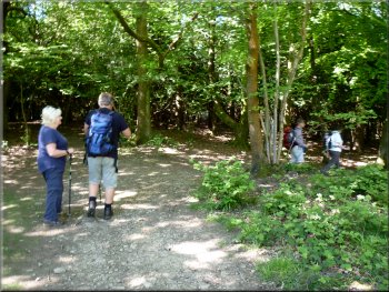
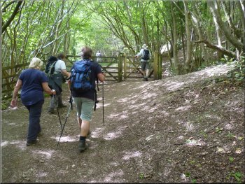
Crossing a field to the road from the edge of the wood
|
Kissing gate on to the road where we turned left towards New Barns
|
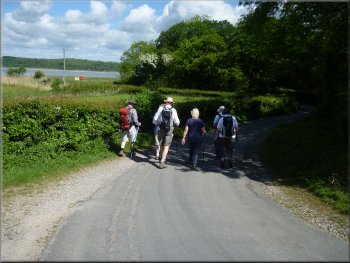
Following the road towards New Barns
Path along the shore around New Barns
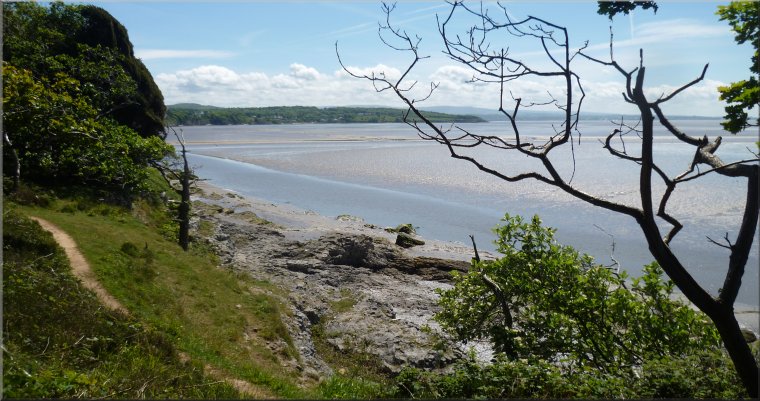
Looking across an arm of Morecambe Bay towards Grange
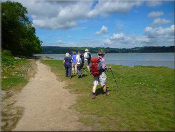
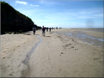
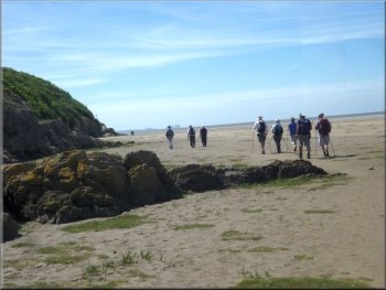
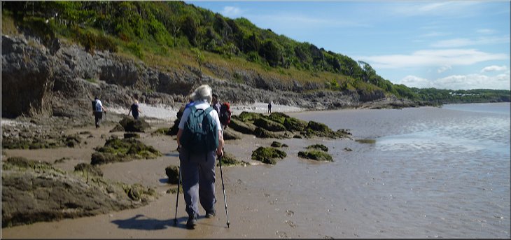
We continued along the shore past Blackstone Point and into the little bay that forms Leighton Moss Nature Reserve. We followed a path between the salt marsh and the rocky shore. |
At the road we turned left and walked along the road to cottages at New Barns. Here the path passed to the right hand side of the buildings, following the shoreline. We passed a sea angler with all his gear set up in the shingle.
Turning on to the path along the shore at New Barns
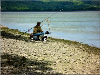
Sea angler on the shore at New Barns
Walking along the shore towards Blackstone Point
|
Start of the path between the salt marsh and the rocky shore at Leighton Moss Nature Reserve
|
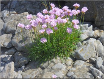
Armeria maritima - Thrift, or Sea Pink
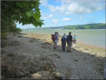
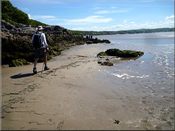
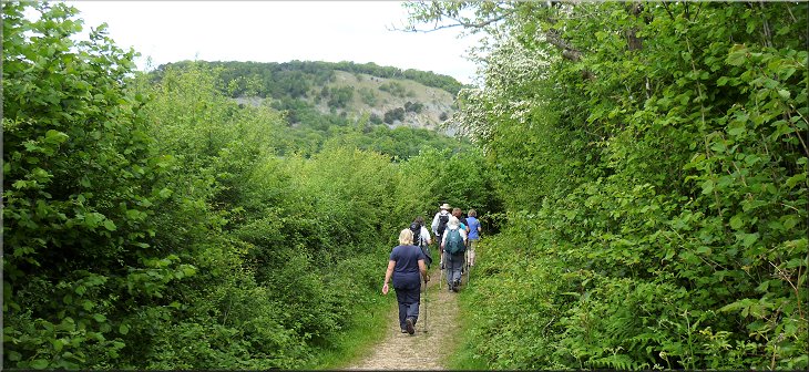
Continuing along the shore round Arnside Point
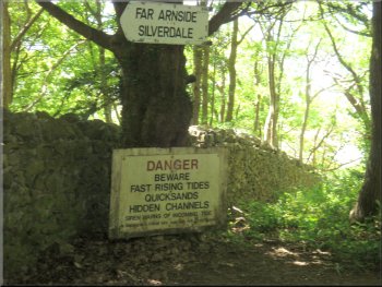
Anyone walking along the shore must be certain of the tide times. The tide comes in very quickly here, faster that a person can run if you are caught out on the sands. It's a very dangerous place with quicksands and deep channels as well as the tides to consider. The scenery was amazing with the bright sunshine glinting on the wet sands and the water in the channels flowing out in the bay all fringed with the rocky shore and woods. We could see across the arm of Morecambe Bay back to Grange-over-Sands where we are staying.
|
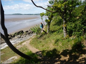
At the southern end of the bay there was a seat on a bank next to the path and here the path left the shore and climbed up the bank to the edge of the wood above the rocks. This was the path that I had planned to follow and this is the safe route around the coast to Far Arnside. However it was about half an hour after high water so around five hours before the incoming tide would be back at this position. The weather was gorgeous so we decided to continue along the shore.
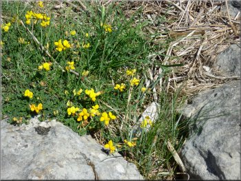
Bird's-foot-trefoil, common names 'Butter and Eggs', 'Eggs and Bacon', and 'Hen and Chickens' (latin name Lotus Corniculatus)
Making our way around Park Point
|
Passing between a deep water channel & the rocky shore east of Park Point
|

The rocky ramp up from the shore near Far Arnside
We walked up this ramp and sat on a wide ledge near the top for our lunch break. It was a lovely place with a fine view out over the bay. We could see Haysham Nuclear Power Station in the far distance and those with binoculars claimed to be able to see Blackpool Tower beyond the power station. As we sat there a pair of shellducks landed on the shore below us and began feeding. |
We had walked from the nature reserve past Arnside Point and past Park Point. Here a deep channel flowed close to the muddy shore and we had to pick our way carefully between the rocks. As we approached Far Arnside there was a rocky ramp up from the shore to re-join the path at the edge of the woods.
Path from the shore to the woodland near far Arnside
|
Woodland path to Far Arnside
|
Warning to people going to the shore
Following the road through Far Arnside
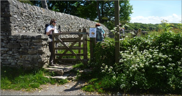
The swallows were very busy but they were so fast I didn't manage to get a photo of them, just the opening. About 300m from Far Arnside we came to a road junction where we kept straight on leaving the road via a wooden kissing gate for a path across the fields.
|
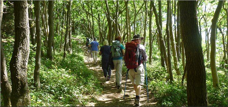
After our break we continued up the rocky slope to join the path around the edge of the woods. The path turned inland and came out onto the road at Far Arnside. We followed the road through the hamlet and passed a door into a barn that had an opening cut to allow swallows to pass in & out to their nests inside.
Woodland path to Far Arnside
Swallows' door to their nesting site in the barn
|
Kissing gate from the road near Far Arnside to the field path towards a caravan site
|
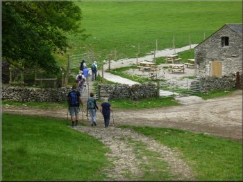
Field path towards a caravan site
One of the finger posts showing the path through the site
Turning off the access road to the path by the boundary hedge
There were finger posts indicating the route of the public footpath through the site and we followed them along the tarmac access roads through the site. Our path left the caravan site roads at map ref. SD 455 764 and followed a path between hedges along the site boundary. |
We passed though a field full of young calves where the ground rose up a gentle slope towards some woodland. We passed through a metal gate from the calves' field and entered the woodland. The path here was a gravel track that led us into a large caravan site.
Path from the fields in to the caravan site
Path along an access road through the caravan site
Path between hedges along the caravan site boundary
|
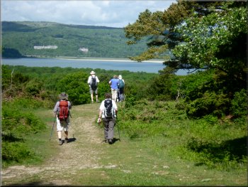
Path heading towards Arnside Tower with the ridge of Arnside Knott ahead
|
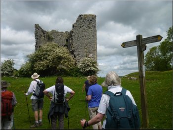
Our first view of Arnside Tower
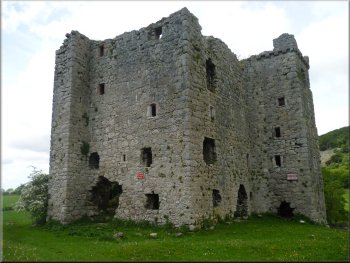
Arnside Tower, a defensive Pele Tower built to a Scottish design
Path around Arnside Tower Farm
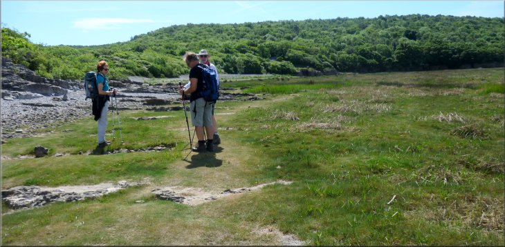
From the tower we followed the path heading north west along the field edge to Arnside Tower Farm. We followed the path around the farm and then out along the farm access road to the road junction at map ref. SD 457 771. At the road junction we crossed the road to a gate into the woods opposite. |
After about 450m along this path we came to a gate into a field with a large ruined tower ahead of us. This is Arnside Tower, a medieval Pele Tower that was built in the late 1400's and occupied until around 1700.
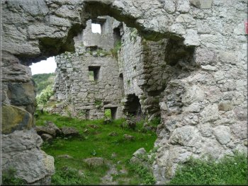
Arnside Tower falling into decay
Heading towards Arnside Tower Farm
Following the farm access road to the road junction
|
Start of the path into Arnside Knott Wood at the road junction
|
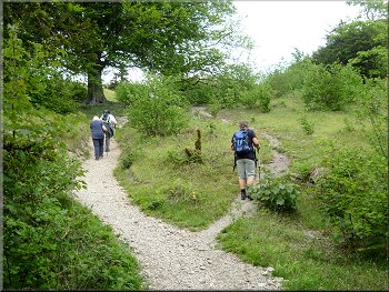
Woodland path climbing up around the side of Arnside Knott
The path led us in a westerly & south westerly direction around the hill called Arnside Knott. After about 150m we passed two ladies forlornly calling for their two dogs! After about 500m there was a track off to our right with a wooden field gate across it. |
Just as we reached the gate a deer flashed by in the woods hotly pursued by two dogs. In the blink of an eye the three of them had disappeared from view. We set off along the path slowly climbing up through the woods.
Woodland path climbing up around the side of Arnside Knott
|
We turned right off the main woodland path to take this path through the gate and climb up to the view point
|
It was a steep path up to the ridge of Arnside Knott
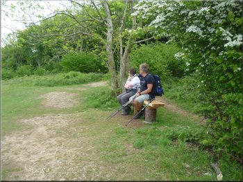
There was a bench at the top of the climb for a breather
Here there was a bench for a breather at the top of the climb. At this ridge track we turned left and walked along the ridge for about 50m before turning right to follow a path climbing gently to the edge of the wood. |
Here we turned right through the gate and followed this path climbing quite steeply up through Arnside Knott Wood. After about 300m we came to the track along the ridge of Arnside Knott.
It was a steep path up to the ridge of Arnside Knott
Last gentle climb from the ridge path to the view point
|
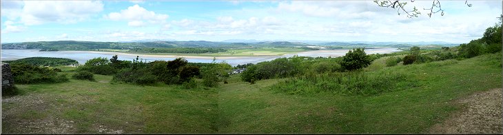
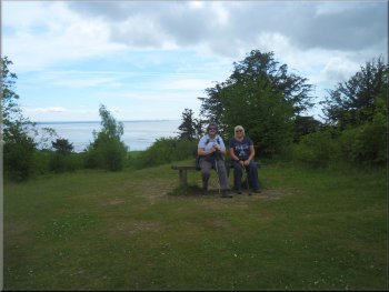
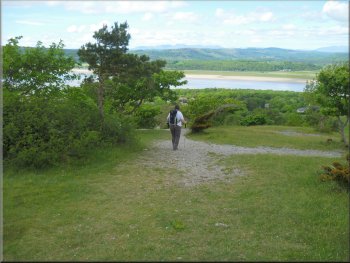
The view across an arm of Morecambe Bay from Arnside Knott ridge to Grange-over-Sands
|
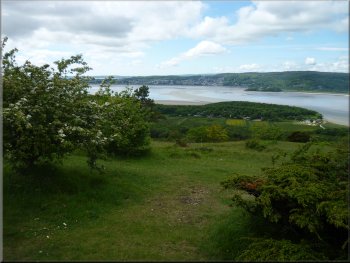
Another look at the view
Near the seat was a stone enclosure with an indicator board naming all the distant peaks visible on a clear day. We stayed there for some time just soaking up the atmosphere of this lovely place. |
As we emerged from the wood there was a magnificent view across an arm of Morecambe Bay with Grange-over-Sands on the far shore. A few metres further along there was a bench seat to admire the view.
There's even a bench to look at the view
|
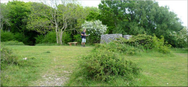
The view point on Arnside Knott ridge with a bench and a stone enclosure with an information board
|
Starting the steep descent to the car park
Making the steep descent to the car park
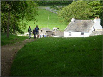
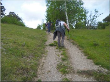
After about 100m we came to the southerly end of the car park where we had parked. The whole walk had been 8km and it had taken us almost four hours to walk including our lunch stop and much admiring of the wonderful scenery on this lovely sunny day. |
At last we had to leave the view behind and follow the steep gravel path westwards from the view point down the steep slope for about 150m to the car park access track. When we reached the access track we turned left and followed the car park access track.
Making the steep descent to the car park
Nearing the car park access road
|
Following the car park access road back to our cars at the end of our walk
|