|
2001 walks |
2002
walks |
2003 walks |
2004
walks |
|
2005 walks |
2006
walks |
2007 walks |
2008
walks |
|
2009 walks |
2010
walks |
2011 walks |
2012 walks |
|
2013 walks |
2014 walks |
2015 walks |
2016 walks |
|
2017 walks |
2018 walks |
2019 walks |
2020 walks |
|
2021 walks |
1993-2000 library |
Find a Route Index |
|
A few Routes to print out |
Request a Route... |
Route No. 722 - Thursday 24 May 2018
Winterburn, Hills Lane, Cross Lane, Moor Lane,
Winterburn Reservoir circuit - 9km
Airedale, Gargrave . . .
Route map from Ordnance Survey
Open Space service.
Map: OS Explorer OL2 Yorkshire Dales, Southern & Western Areas
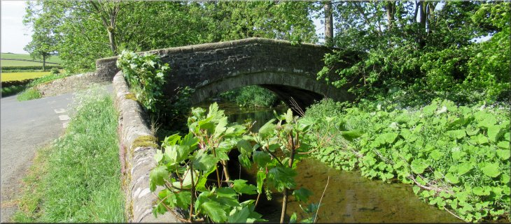
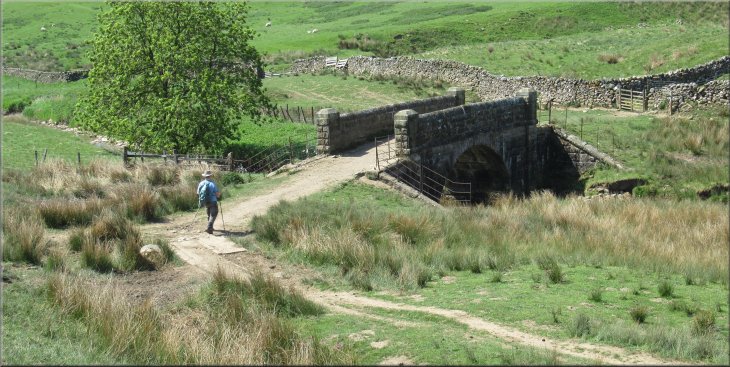
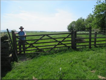
Bridge over Winterburn Beck at map ref. SD 933 585, where we started our walk
|
Our parking spot next to Winterburn Beck
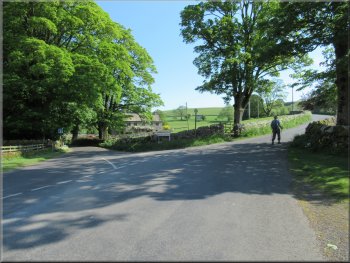
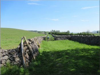
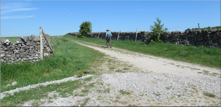
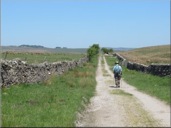
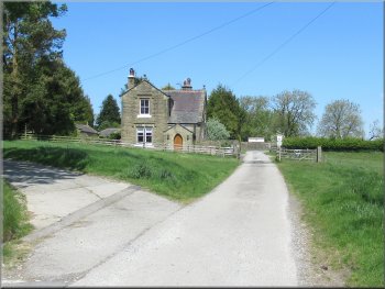
Hills Lane passing the junction with the road from Winterburn
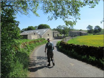
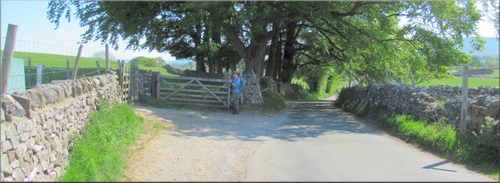
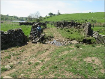
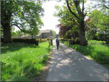
From our parking spot we set off along the road past Winterburn Hall and past the junction with the road from Winterburn Reservoir. We continued away from Winterburn village along the road called Hills Lane, climbing up the hillside. |
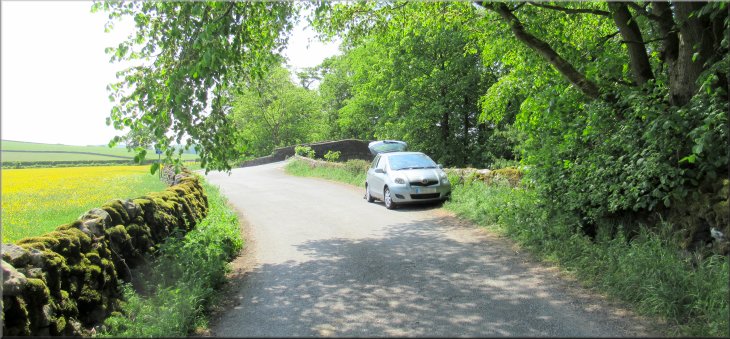
The lovely warm, dry settled spell of summer weather continues and this morning my friend, Jim, and I drove out to the tiny village of Winterburn about 5km north of Gargrave. We parked on the roadside next to the road bridge across Winterburn Beck at map ref. SD 933 585.
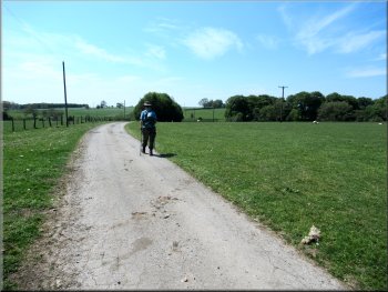
Setting off along the road towards Winterburn village
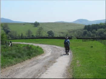
Heading away from Winterburn along Hills Lane
|
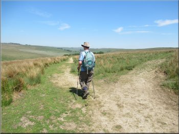
Climbing up the hill side along Hills Lane
|
A curlew in a field next to Hills Lane
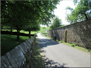
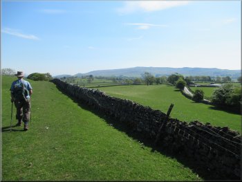
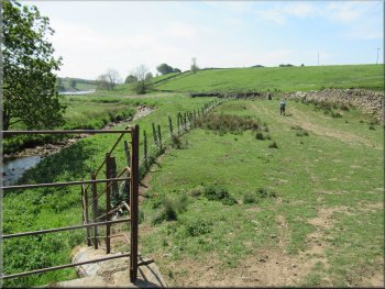
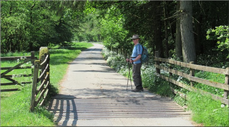
We followed Hills Lane for about 1.3km from our parking spot. Here the road bent towards our right and there was a bridleway along a farm access track forking off the road to our left. |
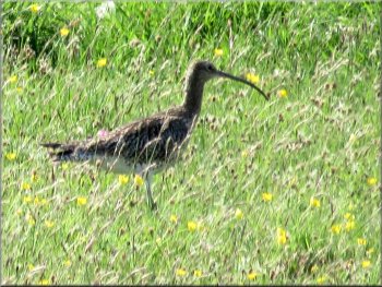
In a field next to the road I noticed a curlew that did not fly off but instead it ran across the field away from the road, catching my attention. I assume it had a chick in the long grass near the road.
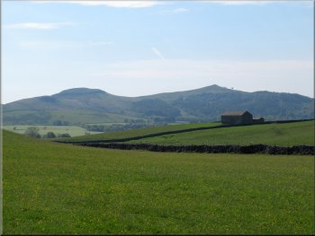
Flasby Fell with the twin peaks of Sharp Haw & Rough Haw
|
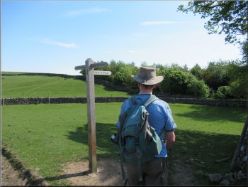
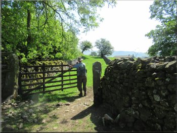
Our left turn off Hills Lane to follow the bridleway past Owslin Laithe
|
Bridleway heading for Owslin Laithe
Our right turn about 50m beyond Owslin Laithe
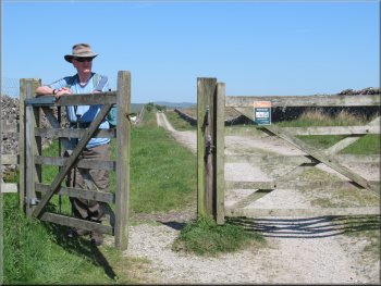
Gateway on to a wide grassy walled track
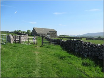
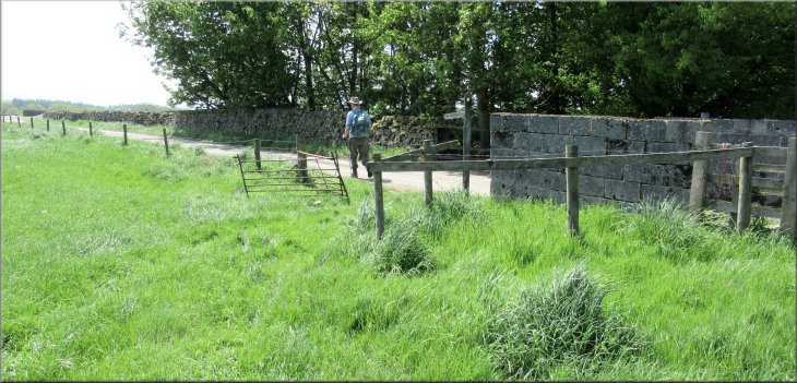
After about 50m along the field edge we passed through a wooden field gate on to a wide grassy track between dry stone walls. We followed this walled track for about 200m to a junction in the tracks at an old farmstead called Owslin. |
We followed the bridleway along the farm track to some farm buildings called Owslin Laithe. ('laithe' is an old dialect word of Norse origin and it simply means a barn) About 100m beyond these farm buildings we turned right at a wooden finger post.
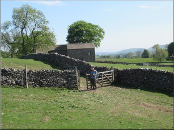
Gateway next to Owslin Laithe

We walked about 50m by the field edge to a gateway
Approaching Owslin farm along the walled track
|
About to turn left on to Cross Lane at the junction in the track by Owslin farm
|
Looking along Cross Lane from the junction
Cross Lane passing the New Laithe (recently re-roofed)
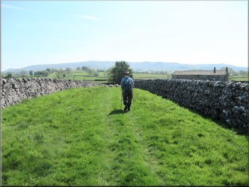
We followed this undulating lane for about 1km to a 'T'-junction with another track. At the junction we turned left to follow the track called Moor Lane. |
At the junction at Owslin we turned left and continued along a similar wide grassy track between dry stone walls. This track is called Cross Lane.
Cross Lane climbing gently up the hillside
The junction of Cross Lane and Moor Lane ahead
|
Setting out along Moor Lane from its junction with Cross Lane
|
Gate along Moor Lane
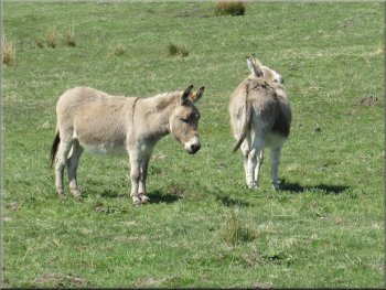
The donkeys were keeping clear of the horses
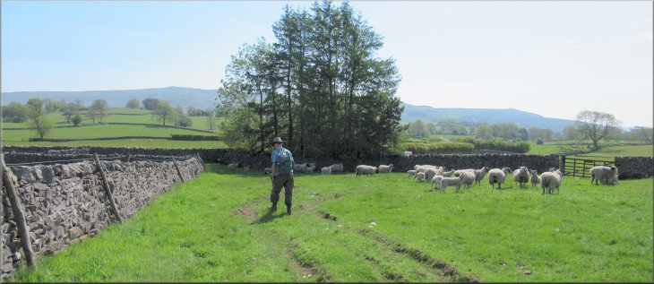
In one of the fields by Moor Lane there was an unusual collection of horses, ponies and donkeys and we wondered if they belonged to a sanctuary for equines but I have not found any reference to one. A little further on there was a seat by the track where we stopped for a drink and to look at the view. The route had been up hill to this point all the way from the start so a drink and a rest was quite welcome.
|
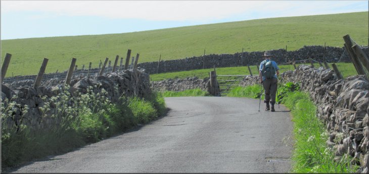
There had been public bridleways along all the tracks since we left the road near the start of our walk and we continued along a bridleway following Moor Lane. The route of the Dales High Way also follows Moor Lane. To the south we could see Flasby Fell with its two peaks of Rough Haw & Sharp Haw and to the east we could see the long ridge of Cracoe Fell and Rylstone Fell with the obelisk on Cracoe Fell.
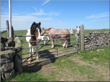
Mixture of horses, ponies & donkeys by Moor Lane
Continuing our walk along Moor Lane
|
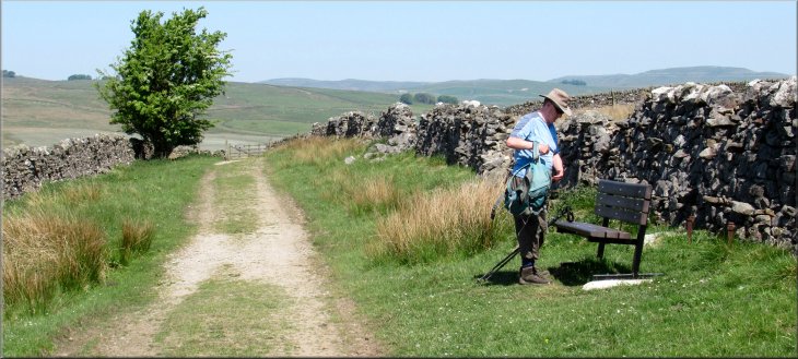
Pausing for a drink, a rest and to admire the view at this seat on Moor Lane - we sat there for about 20 minutes
|
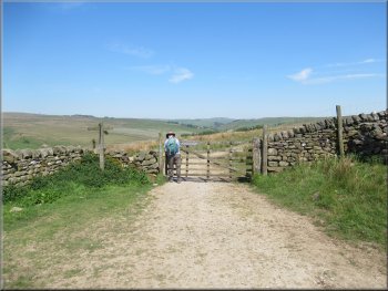
Through the gate Moor Lane turns right but we kept straight on
Continuing along the Dales High Way route
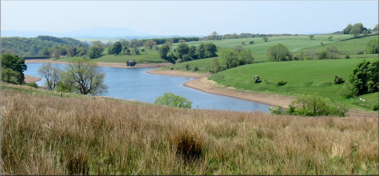
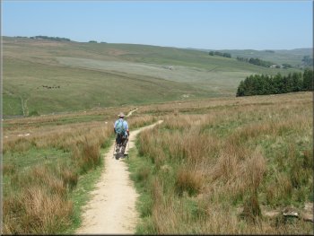
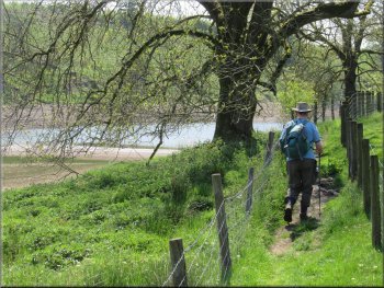
We followed the track on the left fork down to the head of the reservoir. The water level in the reservoir was very low, but this is not a water supply reservoir. The purpose of Winterburn Reservoir is to provide a source of water to top-up the water level in the near-by Leeds & Liverpool Canal near Gargrave. |
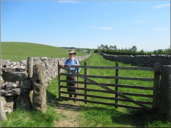
After our break we continued to a gate across the track by a wooden finger post. We passed through the gate and here Moor Lane turned right. We continued straight ahead along the route of the Dales High Way following a track down towards the head of Winterburn Reservoir. Between these two tracks there was a line of yellow topped posts marking the route of a public footpath across the moor.
We kept straight on along the route of the Dales High Way
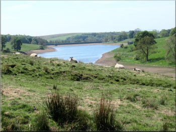
Winterburn Reservoir to the left of our path
|
Stone arch bridge over Hetton Common Beck near the head of Winterburn Reservoir
|
Path to the reservoir from the bridge over the beck
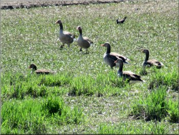
Greylag geese feeding on the dry bed of the reservoir
The small bird behind them is a lapwing apparently on its nest
The path became enclosed between two post & wire fences and was a bit awkward underfoot. The fenced path led us to a gate where a small stream called Park Gill, entered the reservoir. |
At the head of the reservoir we crossed the stone arch bridge over Hetton Common Beck and followed the path alongside the wall next to the reservoir. There were numerous greylag geese around the reservoir and a small group of cormorants on the far shore.
Footbridge over Whetstone Gill
The path was hemmed in between two post & wire fences
|
Gate as we came to the stream called Park Gill
|
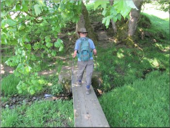
Plank footbridge over Park Gill
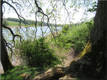
The reservoir from the path up the side of the gully
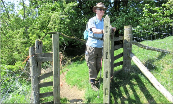
Here the path turned right and climbed up the top edge of the gully at the edge of a field to a stone step stile in the wall at the top of the field. |
Through the gate we crossed a plank footbridge over the Park Gill and continued along the edge of the reservoir to a second stream flowing down a deep gully at map ref. SD 944 606.
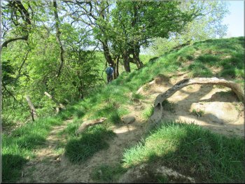
Path climbing up the edge of the gully, lower path is a dead end
Path along the edge of the field next to the gully
|
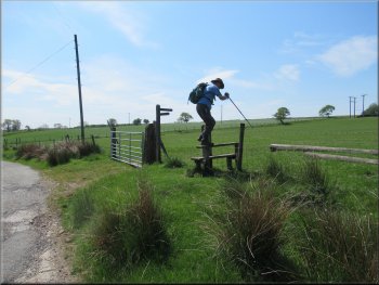
Stone step stile over the wall on to a farm access road at the top of the field
|
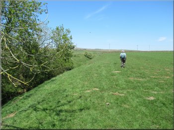
Farm access road heading towards Way Gill
Turning off the access road to cross the field to Way Gill farm
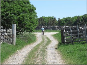
Just before we reached the farm buildings we turned left to go through a field gate. On my map the public footpath is shown going through the farm but now the path by-passes the farm, a much better arrangement. Through the gate we kept to the edge of the field for about 100m to join the farm access road heading south from Way Gill farm. |
We crossed the stile on to a farm access road and turned left following the access road in a southwesterly direction. The access road dropped down to cross Way Gill, a feeder stream to the reservoir. Just beyond Way Gill the road bent to our left and at the top of a short slope we turned right off the access road to follow a footpath across the field up towards Way Gill farm.
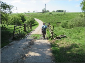
Farm access road crossing Way Gill
Turning left through the gate at the top of the field near the farm
|
Leaving the field to follow a farm access road heading south away from Way Gill farm
|
Access road from Way Gill heading down to the dam
Junction of the access road from Way Gill with the road from Winterburn up to the reservoir
At the junction to our left there was the old reservoir keeper's house at the end of the hedge that had been planted along the crest of the dam. |
We followed the access road away from the farm, down the hillside for about 600m to a junction with the access road leading up from Winterburn to the reservoir.
Access road from Way Gill heading down to the dam
The old reservoir keeper's house to the left of the junction
|
The access road down the valley to Winterburn
|
The access road down the valley to Winterburn
Following the road through Winterburn village
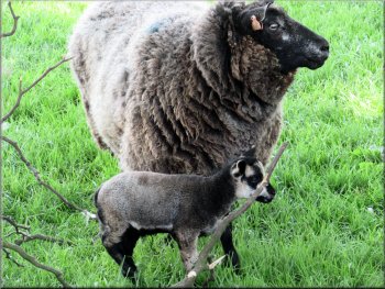
Very cute lamb but I've no idea what the breed is
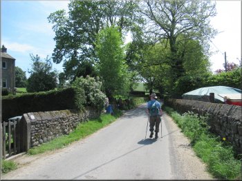
At the junction we turned right and walked along the road for about 100m back to our parking spot next to Winterburn Beck and the end of our walk. The whole route had been 9km and it had taken us almost four hours to walk in the hot sunshine and including a stop of about 20mins for a drink & to enjoy the views. |
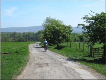
At the junction we turned right to follow the access road for almost 2km down the valley, crossing the road bridge over Winterburn Beck and continuing through Winterburn village to the junction with Hills Lane at map ref. SD 935 585.
Bridge over Winterburn Beck
just downstream of Winterburn Wood Farm
Following the road through Winterburn village
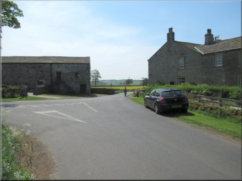
Turning right at the junction heading back to the car
|
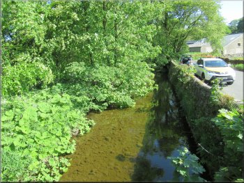
Back at our parking spot next to Winterburn Beck at the end of our walk
|