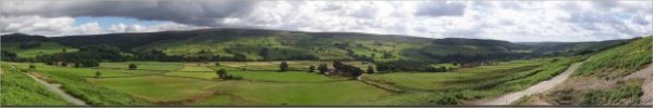
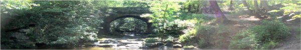
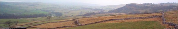
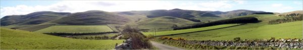
North York Moors . . . |
Bilsdale . . .

|
| Walk No. |
Length |
Route |
| 44 |
11km |
Fangdale Beck, Tripsdale,
Cock Howe, Bilsdale Mast |
| 93 |
11km |
Clay Bank to Lord Stone's
Cafe |
| 117 |
9km |
Helmsley, Ash Dale |
| 123 |
10km |
Newgate Bank, River
Rye, Hawnby |
| 226 |
9 km |
Cow House Bank, Roppa
Wood, East Moor Wood |
| 209 |
10km |
Laskill, Easterside
Hill, Fangdale Beck, River Seph |
| 277 |
12km |
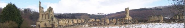
Newgate Bank, River
Rye, Rievaulx Abbey, Helmsley |
| 332 |
13km |
Newgate Bank, Roppa
Wood, River Seph, Easterside Hill |
| 358 |
9km |
Chop Gate, Seave Green,
Medd Crag, Urra, Cold Moor circuit |
| 530 |
8km |
Newgate Bank, River Seph, Hawnby, River Rye, Shaken Br |
| 552 |
6km |
Lord Stones Cafe, Cleveland Way, Cringle Moor circuit |
| 571 |
9km |
Clay Bank, West Wood Fm, Old Sheepfold Fm, Greenhow Plantation |
| |
|
(top of page) |
Cleveland Hills . . .
|
| Walk No. |
Length |
Route |
| 114 |
12km |
Oak Dale, Osmotherley,
Scarth Nick |
| 171 |
12km |
Ellers Wood, Cow Ridge,
Arnsgill Ridge, Wheat Beck |
| 172 |
9.5km |
Sutton Bank, Gormire
Lake, Boltby Scar |
| 195 |
12km |
Clay Bank, Botton Head,
Ingleby Incline, Greenhow Plantation |
| 210 |
10km |
Scarth Nick, Arncliffe
wood, Osmotherley, Cod Beck Reservoir |
| 211 |
10km |
Boltby, Boltby Forest,
Cleveland Way, Low Paradise Farm |
| 287 |
12km |
Cod Beck, Oak Dale,
Osmotherley, Cleveland Way, Scarth Nick |
| 312 |
11km |
Boltby, Felixkirk, Kirkby
Knowle circuit |
| 316 |
11km |
Ellers Wood picnic area,
Cow Ridge, Head Ho, Arnsgill Ridge |
| 324 |
8km |
Cod Beck Reservoir,
Cleveland Way, Osmotherley circuit |
| 385 |
10km |
Osmotherley, Cleveland
Way, Oak Dale, Thimbleby circuit |
| 412 |
6km |
Cod Beck Cleveland Way
Osmotherley Cod Beck Reservoir |
| 465 |
8km |
Swainby, Whorlton, Whorl
Hill, Cleveland Way, Scugdale |
| 620 |
6km |
Aireyholme Lane, Roseberry
Topping, Newton Wood |
| 630 |
10km |
Square Corner, Black Hambleton, Cleveland Way, Arden Great Moor, Dale Head farm |
| 658 |
5km |
Guisborough, Butt Lane, Guisborough Woods, Cleveland Way, Cleveland Street, Guisborough Priory |
| 745 |
7km |
Flatts Lane Park, Eston Moor, Eston Nab circuit |
| 793 |
4.5km |
Guisborough Branch Walkway Nature Reserve |
| 844 |
2.3km |
Circuit of Cod Beck Reservoir, Osmotherley |
|
|
(top of page) |
Hambleton Hills . . .
|
| Walk No |
Length |
Route |
| 103 |
7km |
Husthwaite to Coxwold
via Beacon Banks |
| 129 |
8km |
Byland Abbey, Wass,
Mt Snever Observatory, Oldstead |
| 188 |
7km |
Kilburn White Horse,
Hambleton Hotel, Sutton Bank |
| 264 |
9km |
White Horse Bank, Sutton
Bank, Hambleton Inn, Oldstead Road |
| 312 |
7km |
Boltby, Felixkirk, Kirkby Knowle circuit |
| 352 |
7km |
Oldstead, High Kilburn,
Oldstead Grange circuit |
| 389 |
11km |
Boltby, High Barn, Cleveland
Way, Steeple Cross, Boltby Forest |
| 393 |
2km |
Wass Bank Woods circuit |
| 450 |
8km |
Boltby, Low Paradise
farm, Hambleton Drove Road, High Barn |
| 493 |
8km |
White Horse Bank, John
Bunting's Chapel, Roulston Scar circuit |
| 496 |
6km |
Kepwick, Nab Farm, Cleveland
Way, Sheepwash Bank |
| 514 |
11km |
Kepwick, Cowesby, Cleveland Way, circuit |
| 679 |
7km |
Felixkirk, Cinque Cliff Ho, Thirlby, Tang Hall, Cinque Cliff Wd |
| 703 |
4km |
Hood Hill circuit, Kilburn |
| 723 |
8km |
By-way towards Arden Hall, Bridleway around Dale Town Common, Hambleton Drove Road |
| 791 |
7km |
Brickshed Cottage, Cowesby, Home Farm, Gallow Hill, Windygill Ridge circuit |
| 833 |
4km |
Kilburn, Church, High Kilburn, Brow Bank, River Road, Oldstead Road, Carr Lane circuit |
| 852 |
4km |
Sneck Yate car park, Boltby Bank, Cleveland Way, High Paradise Farm, Cross Hambleton Drove Road, Silver Hill Farm circuit |
| |
|
(top of page) |
Newtondale/Hole of Horcum/Dalby
Forest/Pickering/ . . .
|
| Walk No. |
Length |
Route |
| 01 |
10km |
Levisham to Newtondale |
| 12 |
11km |
Hole of Horcum, Dundale
Griff, Skelton Tower |
| 91 |
12km |
Hole-of-Horcum, Levisham,
Skelton Tower |
| 115 |
10km |
Levisham, Dundale Pond,
Saltergate, Skelton Tower |
| 166 |
10km |
Hole of Horcum: Pigtrough,
Hawdale & Honess Griffs |
| 187 |
8.5km |
Hole-of-Horcum, Dundale
Pond |
| 267 |
10km |
Fox & Rabbit pub, Newton
Dale, Levisham, Lockton |
| 276 |
9km |
Pickering, Howl Dale
circuit |
| 281 |
10.5km |
Thornton-le-Dale, Ellerburn,
Howl Dale, Pickering circuit |
| 371 |
11km |
Hole-of-Horcum, Skelton
Tower, Dundale Pond circuit |
| 419 |
7km |
Staindale Lake, Dargate
Dikes, Bridestones circuit |
| 471 |
11km |
Levisham, Dundale Griff,
Levisham Station, Farwath |
| 581 |
5km |
Lockton, Levisham Beck, The Valley Church, Sleights Road |
| 603 |
6km |
Lockton, Westfield La, Cross Dale, Valley Church, Mill Bank Rd |
| 618 |
6km |
Hole-of-Horcum, Newtondale Halt circuit |
| 685 |
8km |
Newton-on-Rawcliffe, Tabular Hills route, East Brow Rd, Ruddings Rd, Keldgate Rd, West Dyke Rd |
| 708 |
8km |
Lockton, Staindale, Low Dalby, Fox & Rabbit, Westfield Lane |
| 721 |
8km |
Pickering, A169, Love Lane, Pickering Beck, NYMR Station |
| 732 |
5km |
Thornton-le-Dale, South Lane, Outgang Lane,
Thornton Beck, Ellerburn, Thornton Mill |
| 783 |
5km |
Levisham, Levisham Brow, Dundale Griff, Dundale Pond, Limpsey Gate Lane circuit |
| |
|
(top of page) |
Goathland . . .
|
| Walk No. |
Length |
Route |
| 286 |
12km |
Goathland waterfalls
circuit |
| 291 |
7km |
Beck Hole, Rail Trail,
Grosmont, Crag Cliff Wood |
| 405 |
10km |
Grosmont, Rail Trail,
Goathland, Crag Cliff Wood |
| 563 |
11km |
Wheeldale Br, Cropton Fst, Wardle Gn, Simon Howe, Hunt Ho, Roman Rd |
| 674 |
5km |
Beck Hole, Hollin Garth, Green End, Rail Trail, Murk Esk |
| 814 |
4km |
Beck Hole, Murk Esk Cottage, Struntry Carr, Randy Rigg, Thackside Farm, Combs Wood circuit |
|
|
(top of page) |
Hutton-le-Hole/Rosedale/Farndale
. . .
|
| Walk No. |
Length |
Route |
| 70 |
12km |
Kirkbymoorside, Gillamoor,
Fadmoor, Kirk Dale |
| 76 |
10km |
Farndale head, Rudland
Rigg, Old ironstone railway |
| 119 |
12km |
Rudland Rigg, Farndale,
Low Mill |
| 187 |
8.5km |
Hole-of-Horcum, Dundale
Pond |
| 229 |
12km |
Hutton-le-Hole, Rosedale
Chimney, Anna Cross, Lastingham |
| 279 |
12km |
Blakey Ridge, Rosedale,
Ironstone Railway circuit |
| 282 |
8km |
Farndale Head, Bloworth
Crossing, Ironstone Railway Path |
| 288 |
11km |
Lowna, R. Dove, Low
Mill, Harland Moor circuit |
| 328 |
12km |
Blakey Ridge, Rosedale,
Ironstone railway circuit |
| 400 |
9km |
Low Mill, Blakey Ridge,
Rosedale railway, Farndale |
| 404 |
8km |
River Dove daffodil
circuit from Lowna, Farndale |
| 438 |
10km |
Rosedale Abbey, Northdale
circuit |
| 437 |
10km |
Russells Wood, Hartoft
Dale, Cropton Forest, Northdale Rigg |
| 436 |
10km |
Sinnington, Appleton-le-Moors,
Cropton, River Seven circuit |
| 452 |
10km |
Church Houses, Bragg
Farm, Blakey Ridge, Rosedale Railway |
| 538 |
10km |
Rosedale Abbey, Anna Cross, Ironstone Railway, Thorgill, R. Seven |
| 585 |
8km |
Elm House, Ironstone Railway, Rudland Rigg, Farndale |
| 604 |
9km |
Low Mill, West Gill, Rudland Rigg, Monket Ho, Dale Side Rd |
| 638 |
10km |
Hutton-le-Hole, Oxclose Lane, Hutton Beck, Douthwaite Dale, River Dove, Back of Parks Road, Gillamoor circuit |
| 651 |
7km |
Thorgill, Clough House, Bell End, River Seven circuit |
| 770 |
5km |
Bransdale Road, Harland Beck,
Track round Harland Farm, Rudland Rigg circuit |
| 787 |
6km |
Low Moor, High Wold Ho, Bragg Fm, Daleside Rd,
Church Houses, High Mill, River Dove circuit |
| 846 |
3km |
Blakey Ridge, Ironstone Railway Rosedale, Lion Inn, Ironstone Railway Farndale |
|
|
(top of page) |
Bransdale . . .
|
| Walk No. |
Length |
Route |
| 83 |
12km |
Sleightholme Dale &
Rudland Rigg |
| 151 |
12.5km |
Bransdale, Stump Cross,
Bloworth Crossing, Rudland Rigg |
| 226 |
9 km |
Cow House Bank, Baxton's
Wd, Roppa Wd, East Moor Wd |
| 225 |
10.5km |
East Moor Wood, Pockley
Moor, Lund farm, Helmsley |
| 283 |
9km |
Kirkdale, Hodge Beck,
Robin Hood's Howl circuit |
| 361 |
9km |
Cockayne, Bransdale
Mill, Shaw Ridge, Rudland Rigg |
| 397 |
11km |
East Moor Wood, Cinder
Hill, Birk Nab Farm, Lund Farm |
| 442 |
10km |
Hodge Beck Sleightholmedale
Rollgate Bank, Stonely Woods |
|
|
(top of page) |
River Derwent/Harwood Dale .
. .
|
| Walk No. |
Length |
Route |
| 221 |
9km |
Forge Valley, Ayton
Castle, River Derwent |
| 338 |
11km |
Forge Valley, Wrench
Green, Sea Cut, Raincliffe Woods |
| 456 |
8km |
Forge Valley geological
trail, Raincliffe Wood |
| 731 |
8km |
Scalby, Keld Runnels Road, Mowthorpe Fm, Sea Cut, Hay La |
| 772 |
8km |
Brompton, Wood Gate Way, Sawdon, Ruston,
Hudgin Lane, Acres Lane, Hungate Brompton |
| |
|
(top of page) |
Cropton Forest . . .
|
| Walk No. |
Length |
Route |
| 240 |
10km |
Cropton Forest, Simon
Howe, Wheeldale Beck, Roman Road |
| 563 |
11km |
Wheeldale Br, Cropton Fst, Wardle Gn, Simon Howe, Hunt Ho, Roman Rd |
| 667 |
7km |
Rutmoor Beck, Roman Road, Skivick Crag, Wheeldale Beck stepping stones, Cropton Forest, Keys Beck Rd |
| 713 |
7km |
Cropton, New Inn, Low Lane, Appleton Mill Farm,
Lower Askew, Cropton Beck, Cropton Banks |
| |
|
(top of page) |
Sutton Bank/Hawnby . . .
|
| Walk No. |
Length |
Route |
| 65 |
12km |
Sutton Bank, Kilburn
White Horse Gormire Lake |
| 121 |
10km |
Sutton Bank, Gormire
Lake, Cleveland Way |
| 153 |
11km |
Moor Gate, Hawnby Moor,Harker
Gates, Hawnby |
| 231 |
11km |
Sutton Bank Visitor
Centre, Cold Kirkby, Cleveland Way |
| 302 |
8km |
Hawnby, Easterside Hill,
Hawnby Hill circuit |
| 320 |
10km |
White Horse Bank, Gormire
Lake, Sutton Bank Visitor Centre |
| 398 |
4km |
Sutton Bank, Cleveland
Way, Hambleton House |
| 512 |
9km |
Sutton Bank, Roulston Scar, Hood Grange, Gormire Lake |
| 583 |
8km |
Hawnby Ch, Coomb Hill, Arden Hall, Mt Pleasant Fm, R Rye, Hawnby |
| 784 |
6km |
Hawnby Church, Coomb Hill, Arden Hall, Mount Pleasant Farm, Church Bridge |
| 785 |
6km |
Moor Gate, Ladhill Beck, Moorland Track, Ladhill Beck, Hawnby Moor circuit |
| 790 |
6km |
Sutton Bank, Hambleton, Hambleton High House, Dialstone Farm, Cleveland Way circuit |
|
|
(top of page) |
Esk Valley . . .
|
| Walk No. |
Length (km) |
Route |
| 186 |
7km |
Littlebeck, The Hermitage,
Maybeck, Falling Foss |
| 362 |
10km |
Danby, Little Fryup
Dale, Danby Rigg, Ainthorpe |
| 366 |
9km |
Hob Hole, Great Hograh
Moor, Baysdale Beck |
| 451 |
11km |
Falling Foss, Littlebeck,
Maybeck, John Bond's Sheephouse |
| 473 |
10km |
Sleights Moor, Littlebeck,
Falling Foss |
| 526 |
7km |
Kildale, Mill Bank Wood, Ayton Banks Wood,
Captain Cook's Monument, Coate Moor Forest, Bankside Farm |
| 555 |
11km |
Danby Beacon, Nean Howe Rigg, Scaling Dam Reservoir, Brown Rigg |
| 564 |
11km |
Castleton, West Green Farm, Stormy Hall, Danby Dale,
East Cliff, North End Farm, Esk Valley Walk |
| 580 |
7km |
Sleights to Grosmont (Esk Valley Trail) |
| 637 |
6km |
Beggars Bridge, Limber Hill, Egton Lane,
Egton Mortuary Chapel, Westonby Farm, Church Dale Farm, River Esk |
| 687 |
7km |
Lealholm, Esk Valley Walk, Underpark Farm,
Lealholm Rigg, Lealholm Station |
| 694 |
9km |
Westerdale, Whyett Bridge, Carr House Farm, Esk Valley Walk, John Breckton Road, Osseker Crook Bridge |
753 |
6km |
Castleton, Westgate Farm, Commondale Beck circuit |
851 |
3km |
Esk Valley Walk, East Arnecliff Wood, road to Egton Bridge, River Esk Stepping stones linear walk |
|
|
(top of page) |
Yorkshire Coast . . .
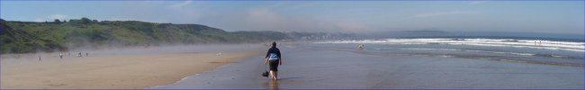
|
| Walk No. |
Length |
Route |
| 16 |
11km |
Ravenscar to Robin Hoods
Bay |
| 90 |
10km |
Reighton Sands to Filey |
| 183 |
4km |
Robin Hood's Bay, Rain
Dale |
| 224 |
8.5 km |
Sewerby to Flamborough
South Landing circuit |
| 214 |
10km |
Cloughton, Crook Ness,
Hayburn Wyke, Cleveland Way |
| 247 |
12km |
Ravenscar, Cleveland
Way, Robin Hood's Bay |
| 304 |
12km |
Whitby, Gnipe Howe(Hawsker),
Cleveland Way, Saltwick Bay |
| 364 |
9km |
Cayton Bay, Cleveland
Way, Scarborough, Low Water Shore |
| 379 |
10km |
Cayton Bay to Filey
via the Cleveland Way |
| 451 |
11km |
Falling Foss, Littlebeck,
Maybeck, John Bond's Sheephouse |
| 466 |
8km |
Robin Hood's Bay, disused
railway, Park Wall, Boggle Hole |
| 533 |
11km |
Robin Hood's Bay, Railway Path, Cleveland Way, Stoupe Beck |
| 615 |
9km |
Saltburn, Cleveland Way, Warsett Hill, New Brotton, Saltburn Gill Nature Reserve |
| 623 |
8km |
Bempton RSPB Reserve, Bempton village, Mill Farm, Buckton village, Headland Way cliff path |
| 681 |
6km |
Runswick Bay, Cleveland Way, permissive railway path |
| 697 |
7km |
Ravenscar, Coastal Railway, War Dike La, Cleveland Way |
| 736 |
8km |
Skinningrove Beck, Cleveland St Walk, Cleveland Way, Cattersty Sands |
| 771 |
6km |
Ravenscar, Peak Alum Works, Cleveland Way,
Stoupebrow Cott Farm, Railway Path circuit |
| 801 |
5km |
Whitby Abbey car park, Cleveland Way, Saltwick Bay,
Hawsker Lane, The Ropery, St Mary's Church circuit |
| 805 |
7km |
Peasholm Park, Dean Road Cemetery, Scarborough Castle, Marine Drive circuit |
| 807 |
5km |
West Ave, Centenary Way, Cliff top path, Primrose Valley, Filey Beach, Coble Landing, Filey Promenade, Glen Gardens |
| 836 |
9km |
Hawsker, Hawsker Bottoms, Cleveland Way, South Whitby Lighthouse, Beacon Hill, Widdy Field, Gnipe Howe circuit |
|
|
(top of page) |
Helmsley . . .
|
| Walk No. |
Length |
Route |
| 117 |
11km |
Collier Hag wood, Ash
Dale circuit |
| 225 |
10.5km |
East Moor Wood, Piethorn
Farm, Pockley Moor, Lund farm |
| 226 |
9km |
Cow House Bank, Baxton's
Wood, Roppa Wood, East Moor |
| 283 |
9km |
Kirkdale, Hodge Beck,
Robin Hood's Howl circuit |
| 300 |
8km |
Helmsley, Duncombe Park,
River Rye circuit |
| 305 |
5km |
Helmsley, River Rye
circuit |
| 392 |
9km |
Cowhouse Beck circuit
Helmsley |
| 457 |
11km |
Helmsley, Ash Dale (Tabular
Hills route) Riccal Dale |
| 547 |
10km |
Riccal Bridge, Rape La,
Gale La, Beadlam, Pockley, Riccal Dale |
| 562 |
10km |
Pockley, Riccal Dale, Hasty Bank Farm circuit |
| 584 |
8km |
Cowhouse Beck, Old Fold, Roppa Wood, Helmsley Moor, East Moor Wood |
| 670 |
6km |
Riccal Bridge, Riccal Dale, Low Tun Way, Rea Garth Farm (NOT Reagarth Farm) |
| 706 |
5km |
Sproxton, Ebor Way, River Rye, Helmsley |
| 816 |
6km |
A170 Kirkdale, Hold Caldron, St. Gregory's Minster, Kirkdale La |
| 842 |
3.5km |
Helmsley Market Square, Elmslac Close, Feversham Rd, Ash Dale, Tabular Hills Wk, Borough Beck, High St, All Saints Church |
|
|
(top of page) |
Easingwold & Thirsk . . .
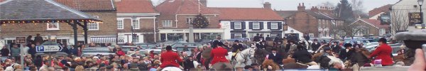
Boxing Day hunt from Easingwold Market Square
|
| Walk No. |
Length |
Route |
| 230 |
10km |
Birdforth, Thormanby, Husthwaite,
Carlton Husthwaite |
| 384 |
8km |
Birdforth, Thormanby, Husthwaite,
Carlton Husthwaite |
| 497 |
8km |
Market Sq, Knot La, Crankley La,
Alne Rd, Millfields, Uppleby |
| 517 |
11km |
E'wold, Foss Way, Acaster Hill, North Moor Rd, Toft Ings La |
| 518 |
8km |
Easingwold, Claypenny Hill, Wandal Rd, Stillington Rd, Nova |
| 560 |
7km |
Alne, Youlton, Tollerton, River Kyle circuit |
| 572 |
12km |
Knott La, Lund Sand La, Stoneycourse La, North Moor La, Toft Ings La |
| 605 |
8km |
Road walk from Husthwaite to Easingwold via Thornton Hill |
| 654 |
7km |
Thirsk, Cemetery Road, Thirsk Station, Sowerby, Cod Beck |
| 727 |
6km |
Millgate car park, Cod Beck, Whitelass Beck, Stockton Road, Upsall Lane, Hag Lane, Stoneybrough Lane circuit |
| 754 |
5km |
Thirkleby, Balk, Bagby circuit |
| 829 |
3km |
Market Sq, Church Hill, Copperclay Wk, Uppleby, Spring St |
| 830 |
4km |
Galtres Centre, Crab Mill La, Stillington Rd, Lay Carr La, Crayke Rd, circuit |
| 831 |
4km |
Main Street, Gracious Street, Hurn Road, Kirk Moor Fm, Skates La, Cemetery, Ox Close La, Stillington Road circuit |
| 834 |
4km |
Carlton Husthwaite, Wildon Hill, Wildon Hill Farm,
Twattleton Beck, Angram Grange circuit |
| 835 |
5km |
Sutton-on-the-Forest Main Street, public footpath south to Goose Lane, footpath via Sutton Park to Main Street |
| 838 |
5km |
Skipton-on-Swale, The Camp, Skipton Bridge,
River Swale path, Catton, St John's Church circuit |
|
|
(top of page) |
York . . .
|
| Walk No. |
Length |
Route |
| 181 |
5km |
Circuit of York City
Walls |
| 233 |
7.5km |
Bishop Wood (no hills)
Sherburn-in-Elmet/Selby |
| 280 |
8.5km |
River Ouse circuit,
City of York |
| 323 |
12km |
Skelton, Rawcliffe,
River Ouse circuit |
| 325 |
5km |
York City centre in
the alleys between the buildings |
| 327 |
8km |
Skelton, River Ouse,
Rawcliffe circuit |
| 355 |
8km |
Beningbrough, Newton-upon-Ouse,
Beningbrough Hall |
| 383 |
5km |
New Walk, Millennium
Bridge, Rowantree Park, R Ouse |
| 394 |
3km |
Skelton, River Ouse
circuit |
| 413 |
6km |
Strensall Common, Strensall,
Walbutts circuit |
| 511 |
10km |
Skipwith Common, Skipwith village circuit |
| 591 |
4km |
Wheldrake Ings wetland nature reserve |
Tansy
Beetle |
2km |
Tansy Beetles, River Ouse, York |
| 709 |
6km |
Skelton, Sustrans cycleway65, Overton, River Ouse |
| 751 |
5km |
Wheldrake Wood circuit |
| 755 |
7km |
Moor Monkton, Park Farm, River Ouse, River Nidd circuit |
| 818 |
5km |
Intake Lane, Hagg Farm, Hagg Wood, Hagg Lane, The Intakes circuit |
| 837 |
5km |
Westfield Lane pond, The Village, Church Lane, Footpath, Stoop Clo, Lund Clo, Westfield La track, Westfield Wood, Westfield Lane circuit |
| 839 |
5km |
Designer Outlet, Bishop‘s Palace, River Ouse, Fulford Ings, Love Lane, Millennium Bridge, Rowntree Park - linear walk |
| 845 |
3.3km |
Askham Bar Park & Ride, Askham Bog Nature reserve, Copmanthorpe |
| 850 |
5km |
Rawcliffe P&R, Manor Lane, Village Street, recreation ground, Rawcliffe Lake, Greystoke Road Eastholme Drive, Westholme Drive, Rawcliffe Ings |
| 855 |
3.4km |
Beningbrough Hall, River Ouse, Beningbrough Lane, Pike Pond circuit |
|
|
(top of page) |
Boroughbridge . . .
|
| Walk No. |
Length |
Route |
| 182 |
6km |
Boroughbridge, River
Ure, Aldborough |
| 215 |
10km |
Myton-on-Swale, River
Swale, River Ure, Milby |
| 381 |
12km |
Boroughbridge, R Ure,
Myton-on-Swale, Milby, Milby Cut |
| 470 |
7km |
Langthorpe, Milby Cut,
Milby, Kirby Hill, Moor Lane, River Ure
|
| 506 |
9km |
Aldwark, Myton Moor circuit |
| 542 |
6km |
Marton-le-Moor, Cana Barn, Moor Lanr circuit |
| 543 |
8km |
Roecliffe, River Tutt, Staveley Nature Reserve circuit |
| 573 |
11km |
Staveley, Sheaflands Lane, Roecliffe, Newfields Farm |
| 574 |
7km |
Helperby, Thornton Br, Ewe Hole La, Brecks La, Rag Hill La |
| 578 |
7km |
Langthorpe, Boroughbridge, River Ure, Aldborough |
| 601 |
8km |
Dog Kennel Lane, Skelton, Cottage Farm, Moor Lane |
| 614 |
6km |
Boroughbridge Walking Festival, 'Aldwark Ramble' |
| 646 |
12km |
Burton Leonard, South Stainley, Brearton, Green La, Rigg Moor La, Limekiln La |
| 668 |
8km |
Rabbit Hill, Mickledale farm, Legram Lane (Marton-cum-Grafton), Ives Farm, Moor Lane |
| 828 |
7km |
Burton Leonard, Mains Lane, Bishop Monkton, Ripon Rowel Route circuit |
| |
|
(top of page) |
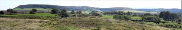
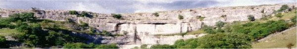
Yorkshire Dales . . . |
Wharfedale . . .
|
| Walk No. |
Length |
Route |
| 5 |
11.5km |
Kettlewell to Great Whernside |
| 53 |
10km |
Buckden Pike via Buckden
Beck, Starbotton Wharfedale |
| 61 |
11km |
Fewston & Swinsty reservoirs
Washburn valley Blubberhouses |
| 126 |
12km |
Thruscross Reservoir,
Washburn Valley |
| 167 |
7.5km |
Grassington Conistone
Malham Moor Treshfield |
| 192 |
6km |
Norwood Edge, Stainburn
Forest, Little Alms Cliff |
| 193 |
12km |
Blubberhouses, Roman
Road, Lipersley Ridge, Timble |
| 203 |
11km |
Burnsall, Hebdon, Grassington(via
High Lane), River Wharfe |
| 205 |
7km |
Barden Bridge to Cavendish
Pavillion, River Wharfe,the Strid |
| 223 |
8.6km |
Spofforth, Sicklinghall,
Stockeld Park circuit |
| 235 |
10km |
Blubberhouses, Fewston
Reservoir, Swinsty Reservoir |
| 256 |
11km |
Harewood village, Wike,
Harewood Estate |
| 258 |
10km |
Barden reservoirs, Broad
Park Moor |
| 292 |
11km |
Buckden, Cray, Yockenthwaite,
Hubberholme circuit |
| 299 |
9km |
Bolton Abbey, Beamsley,
Storiths circuit |
| 309 |
12km |
Golden Acre Park, Five
Lane Ends, Eccup Reservoir |
| 322 |
7km |
Heber Ghyll, Ilkley
Moor circuit, Ilkley |
| 353 |
9km |
Otley Chevin Forest
Park circuit, Otley |
| 356 |
12km |
Tadcaster, Catterton,
Healaugh circuit |
| 193a |
12km |
Blubberhouses, Roman
Road Lippersley Ridge, Fewston Res |
| 424 |
11km |
Grassington, Dales Way,
Conistone Dib, Conistone circuit |
| 458 |
11km |
Thruscross Dam, R. Washburn,
Kex Gill Moor, Spittle Ings Ho |
| 515 |
9km |
Golden Acre Pk, Eccup, Bramhope, Paul's Pond, Breary Marsh |
| 534 |
11km |
Grassington, Hebden(via High Lane), Hebden Beck, Yarnbury |
| 535 |
10km |
B6265 Stump Cross, Pock Stones Moor, R. Washburn(linear) |
| 554 |
11km |
Deepdale Br, Oughtershaw, Green Field Beck, Beckermonds, Dales Way |
| 556 |
11km |
Bolton Abbey along the River Wharfe to Ilkley via the Dales Way |
| 561 |
9km |
Beamsley Beacon, Little Gate, Foldshaw Ridge, Badgers Gate |
| 622 |
8km |
Grassington, Linton Falls, R. Wharfe, Grass Wood, Dales Way |
| 631 |
8km |
Malham Moor Lane, Mastiles Lane, Lee Gate Farm, Bordley |
| 655 |
8km |
Harewood Avenue, Farfield Farm, Ebor Way, River Wharfe, Fitts Lane, Harewood circuit |
| 675 |
8km |
Blubberhouses, Hall Lane, Kex Gill Road, Redshaw Hall, Washburn Valley |
| 682 |
8km |
Kirkby Overblow, Swindon Grange Farm, Kearby with Netherby, Marsh La, Barrowby La |
| 695 |
9km |
Addingham Bark Lane, Nesfield, Owler Park Road, Ilkley Bridge, Riverside park, Dales Way |
| 724 |
8km |
Dob Park Rd, Dob Park Ho Fm, Dob Park Wood, Dob Park Br, Middle Fm, Rose Tree Fm, Crag Fm |
| 750 |
7km |
Grassington, Linton Falls, Thorpe Lane, Linton, Threshfield, Sedber Lane circuit |
| 752 |
6km |
Burnsall, River Wharfe, Kail Hill, Appletreewick circuit |
| 757 |
5km |
Askwith, Brick House, Top Moorside Farm,
Whin Hill Farm, Scales House Farm, Hall Lane circuit |
| 760 |
6km |
North Lane car park, White Crag House, Beecroft Moor Plantation, Ridge Top Farm,
Timble, Nether Timble, Swinsty Hall |
| 764 |
8km |
Blubberhouses, Washburn Valley, Thruscross Dam, Kex Gill Road, Hall Lane circuit |
| 795 |
5km |
Arncliffe church, River Skirfare field path, Hawkswick footbridge, return via road |
| 802 |
7km |
Linton, Well Lane, Moor Lane, Linton Moor, Moor lane, B6265 circuit |
| 813 |
5km |
Hebden, Edge Top, Mossy Moor Reservoir, Hebden Beck, Hole Bottom circuit |
| 815 |
4km |
Kirkby Lane, Kearby Methodist Church, Kirkby Lane, public bridleway, Lund Head Lane, Kirkby Lane circuit |
| 843 |
4.3km |
Penny Pot Lane, Jonah‘s Lane, Bank End Farm, Harrogate Link, Haverah Park Top, Beaver Dyke Reservoir, circuit |
| |
|
(top of page) |
Nidderdale . . .

|
| Walk No. |
Length |
Route |
| 22 |
8km |
Studley Deer Park and
Fountains Abbey near Ripon |
| 157 |
11km |
Studley Deer Park, River
Laver, Fountains Abbey |
| 184 |
8km |
Spofforth, River Crimple,
Follifoot, Spofforth Castle |
| 227 |
10km |
Ripley via Nidderdale
Way, Bedlam - Lower Nidderdale |
| 232 |
7km |
Circuit of Grimwith
Reservoir nr Pateley Bridge |
| 223 |
8.6km |
Spofforth, Sicklinghall,
Stockeld Park |
| 206 |
11km |
Nidd Gorge circuit,
Knaresborough |
| 204 |
11km |
Studley Royal Deer Park,
Seven Bridges Valley, River Laver |
| 232 |
7km |
Circuit of Grimwith
Reservoir nr Pateley Bridge |
| 242 |
10km |
Ripley via Nidderdale
Way, Bedlam circuit, Lower Nidderdale |
| 250 |
11km |
Nidd Gorge Woods circuit
,Knaresborough |
| 274 |
12km |
Pateley Bridge, Wath,
Ashfold Side Beck, Nidderdale Way |
| 308 |
8km |
Our Ancient Tree Hunt,
Studley Deer Park, Fountains Abbey |
| 334 |
11km |
Pateley Bridge, Panorama
walk, Wath, Gouthwaite Res, R.Nidd
|
| 347 |
10km |
Scar House and Angram
reservoirs circuit |
| 380 |
9km |
Sawley, Lacon Cross,
Warsill Hall Farm, Eavestone Lake circuit |
| 440 |
10km |
Stock Beck, Dallow,
Carlesmoor, Kex Moor circuit |
| 501 |
11km |
Knaresbro, Harrgt Ringway,
Nidd Gorge, Nidderdale Greenway |
| 502 |
11km |
Dacre Walls Walk |
| 531 |
7km |
Ripley, Nidderdale Greenway, River Nidd, Nidd Gorge |
| 577 |
6km |
Geology Trail, Toft Gate Lime Kiln, Coldstone Cut, Lead Mines, Greenhow |
| 586 |
10km |
Studley Park, Whitcliffe Hall, Hell Wath, Studley Roger |
| 600 |
6km |
Galphay, Braithwaite Hall, Hubber La, Azerley, Lawnwith |
| 635 |
9km |
Dacre Banks, River Nidd, Hartwith, Summerbridge circuit |
| 636 |
8km |
Ripley, Newton Hall, High Cayton, Nidderdale Way circuit |
| 647 |
7km |
How Stean Gorge, Middlesmoor, Netherside Head Farm, Limley Farm, Nidderdale Way, Lofthouse |
| 650 |
7km |
Harlow Moor Road, Valley Gardens, Harrogate Ringway, Oak Beck, Harlow Carr |
| 657 |
7km |
R Nidd, Spruisty Hill Fm, Killinghall, Crag La, Crag Hill Fm |
| 705 |
8km |
Quarry Moor, Whitcliffe Wd, Studley Rd, River Skell, Hell Wath |
| 716 |
8km |
Brown Hill Woods, Plumpton Rocks, Braham Hall, Crimple Beck circuit |
| 717 |
8km |
Ripley, River Nidd, Crag Hill, Hampsthwaite, Clint, Hollybank Lane circuit |
| 726 |
8km |
Studfold Farm, Nidderdale Way Ramsgill, Bouthwaite, Nidderdale Way, Lofthouse circuit |
| 729 |
6km |
High Grantley, Lumley Farm, Lumley Moor Reservoir, Drift Lane, Low Green Farm circuit |
| 730 |
9km |
Sawley, Studley Obelisk, Aldfield, Hird House Farm circuit |
| 733 |
9km |
Pateley Bridge, Panorama Walk, Blazefield, Kiln Farm, River Nidd, Glasshouses circuit |
| 762 |
7km |
Pateley Bridge, Bewerley, Nidderdale Way, Mosscar Bottom, Foster Beck, River Nidd circuit |
| 780 |
7km |
Brimham Rocks, High North Pasture Farm, Fell Beck, Sugar Hill Farm, NT Brimham Rocks site |
| 799 |
10km |
Ripley, Hollybank Lane, Clint, Clint Grange Farm,
Whipley Hall, Sadler Carr, Ripley Castle Lake |
| 849 |
2.3km |
Pateley Bridge, High Street, Ripon Road B6265, Harefield Hall hotel, River Nidd circuit |
| |
|
(top of page) |
Swaledale . . .

|
| Walk No. |
Length |
Route |
| 17 |
12km |
Reeth and Fremington
Edge |
| 50 |
12km |
Muker, Thwaite, Angram,
Keld Side, Kidson Force |
| 403 |
11km |
Washfold, Kexwith, How
Gate, Helwith |
| 409 |
10km |
Arkle Beck & Upper Arkengarthdale
farmland circuit |
| 411 |
11km |
Reeth Low Moor, Arkle Town, Arkle
Beck circuit |
| 434 |
9km |
Grinton, River Swale, High Harker
Hill circuit |
| 509 |
8km |
Park Br, Oven Mouth, W Stonesdale, Haw Shaws, E Stonesdale |
| 576 |
10km |
Round Howe car park, Westfields, Market Sq, Easby Low Rd, railway path, River Swale |
| 610 |
6km |
Reeth, River Swale, Grinton Bridge, High Fremington |
| 735 |
6km |
Gilling West, Hartforth, Gillingwood Hall, Old Hall Lane, St. Agatha's Church |
| 792 |
3km |
Cogden Gill, Grinton Lead Smelting Mill, Glead Gill, Cogden Moor circuit |
| 804 |
2.5km |
Richmond Station, Richmond Castle, River Swale in flood |
| 854 |
4km |
Reeth, Back Lane, River Swale, Healaugh Stepping Stones & return |
| |
|
(top of page) |
Wensleydale . . .
|
| Walk No. |
Length |
Route |
| 71Thurs |
6km |
Thornton Rust, Addlebrough |
| 71Mon |
12km |
Aysgarth, Nappa Hall, Carperby |
| 98 |
11.5km |
Jervaux Abbey, Thornton Steward |
| 95 |
12km |
Ripon Canal and River Ure Ripon |
| 134 |
11km |
Aysgarth, Redmire, River Ure |
| 207 |
11km |
Fearby, Masham, Marfield Nature reserve |
| 246 |
10km |
Leyburn, Leyburn Shawl, Preston-under-Scar,
Wensley |
| 290 |
12km |
Nutwith Common, Grewelthorpe, Hackfall
Wood, River Ure |
| 319 |
7km |
Harmby, Cow Close farm, Harmby Moor
circuit |
| 326 |
8km |
Masham, Ripon Rowel route, R. Burn,
River Ure circuit |
| 363 |
10km |
West Witton, River Ure, Templars
Chapel circuit |
| 365 |
10km |
Marsett Cam High Rd Countersett Low
Force Fm Semer Wtr |
| 367 |
9km |
Thornton Rust Knipe La Stepping Stones
R. Ure Aysgarth Moor |
| 369a |
3km |
Snaizeholme Red Squirrel Reserve,
Widdale, Hawes |
| 369b |
4km |
Masham, River Ure, Marfield Nature
reserve |
| 387 |
6km |
Ripon Canal, Littlethorpe, Oxclose
Lock circuit |
| 399 |
10km |
Carlton-in-Coverdale, Penhill circuit
|
| 407 |
12km |
Jervaulx, Ellingstring, East Witton,
River Ure circuit |
| 418 |
10km |
West Burton, Burton Pasture, Walden
Beck circuit |
| 423 |
12km |
Thornton Rust Gayle Ing Skellicks
Beck Folly Lane Castle Dykes |
| 453 |
9km |
Muker, Kisdon Hill, Keld, Crackpot
Hall circuit |
| 507 |
11km |
Ripon Canal, Littlethorpe, Bishop Monkton, River Ure circuit |
| 588 |
11km |
Middleham, R. Ure, Spennithorne, Ulshaw, R. Cover, Six Dales Trail |
| 598 |
7km |
Snape, Ings Lane, Hollins Lane, Firby, Bogs Lane |
| 606 |
9km |
Leighton Res, Roundhill Res, 6 Dales Trail, Low Ash Head fm, East Summer Side, Pott Bank |
| 607 |
9km |
Wensley, Harmby, Middleham Bridge, River Ure circuit |
| 624 |
11km |
West Burton, Newbiggin, Thoralby, Eshington Bridge,
Aysgarth church, Hestholme Bridge circuit |
| 634 |
8km |
Bolton Castle, Carperby, Beldon Beck ford circuit |
| 648 |
6km |
Kirklington, Lime Lane, Whinwath Lane circuit |
| 656 |
7km |
Hell Wath Nature Reserve, B6265, Studley Roger,
Plumpton La, R. Skell, Whitcliffe La, Whitcliffe Wood |
| 676 |
6km |
Bishop Monkton, Ashbrook Farm, River Ure, Ripon Rowel Route |
| 683 |
8km |
West Burton, Cauldron Falls, Morpeth Scar, Templars Chapel, Morpeth Gate circuit |
| 684 |
8km |
Hawes, Appersett, Hardraw, Hardraw Force, Pennine Way |
| 728 |
4.5km |
Hackfall Wood circuit Hackfall Explorer |
| 729 |
6km |
High Grantley, Lumley Farm, Lumley Moor Reservoir, Drift Lane, Low Green Farm circuit |
| 774 |
8km |
Linear Walk on the Pennine Way via Kidhow Gate, Dodd Fell, West Cam Road, Gaudy Lane, Gayle, Gale Beck Ford |
| 779 |
7km |
Cover Bridge, Stepping Stones, East Witton, Hullo Bridge, River Cover circuit |
| 782 |
4km |
Ripon Canal, Ripon City Wetlands, River Ure, Ripon Racecourse circuit |
| 825 |
5km |
Coverham Lane, Agglethorpe, Common Lane, Tupgill Park |
| 827 |
5km |
Ripon Canal, Firs Avenue, River Skell, Borrage Lane, River Skell circuit |
| 841 |
4.3km |
B6265, Ripon Racecourse, River Ure, River Skell, Ripon Canal circuit |
| 853 |
2.7km |
Circuit of Marfield Wetlands Reserve, Masham, |
| |
|
(top of page) |
Ribblesdale
|
| Walk No. |
Length |
Route |
| 59 |
8km |
Settle to Craven Lime Works to Victoria
Cave to Settle |
| 317 |
10km |
Langcliffe, Stainforth, Catrigg Force,
Attermire Scar |
| 360 |
11km |
Dent Station, via Blea Moor to Ribblehead
Station |
| 370 |
8km |
Clapham, Austwick, Norber Erratics
circuit |
| 575 |
8km |
Ribblehead, Colt Park, Winterscales Beck, circuit |
| 665 |
7km |
Horton-in-Ribblesdale, Pennine Way, Hull Pot & return |
| 666 |
9km |
Gearstones, Dales Way, Pennine Way, Nether Lodge, Ribble Way, Thorns Gill Bridge circuit |
| 781 |
7km |
Langcliffe, Stainforth Scar, Stainforth, Stainforth Force, R Ribble |
| |
|
(top of page) |
Airedale & Malham
. . .
|
| Walk No. |
Length |
Route |
| 460 |
11km |
Stirton, Canal towpath, Flasby, Rough
Haw, Sharp Haw |
| 467 |
9km |
Malham, Malham Cove, Watlowes, Langscar
Gate, Pikedaw Hill |
| 589 |
11km |
Airton, Pennine Way, Hanlith, Windy Pike La,
Weets Gate, Carlton |
| 612 |
10km |
Skipton, Leeds & Liverpool Canal, Springs Canal, Eller Beck |
| 631 |
8km |
Malham Moor Lane, Mastiles Lane, Lee Gate Farm, Bordley |
| 639 |
9km |
Gargrave, Pennine Way(S), Leeds & Liverpool Canal |
| 659 |
9km |
Buck Stone La, Coppy La, Greystones La, Pole Rd, Lund's Tower, Wainman's Pinnacle |
| 722 |
9km |
Winterburn, Hills Lane, Cross Lane, Moor Lane, Winterburn Reservoir circuit |
| 744 |
8km |
Airton, Kirk Syke Lane, Bell Busk, Pennine Way, River Aire |
| 756 |
7km |
A65 Skipton, Thorlby, Stirton, Aireville Park,
Leeds & Liverpool canal circuit |
| 773 |
6km |
Malham, Cow Close Lane, Kirkby Malham, Scalegill Mill, Malham Beck circuit
|
| 798 |
6km |
Malham Tarn, Pennine Way, Middle House Farm, Great Close Scar circuit
|
| |
|
(top of page) |
Dentdale/Garsdale . . .
|
| Walk No. |
Length |
Route |
| 71 |
|
A few days at the Sportsmans Inn in
Dentdale |
| |
12km |
- (Aysgarth, Nappa Hall, Carperby
- Wensleydale) |
| |
7km |
- Ingleton Waterfalls walk
- Sedgwick geological trail |
| 360 |
11km |
Dent Station, via Blea Moor to Ribblehead
Station |
| 513 |
8km |
Garsdale Head,Clough Force,Moor Rigg,Round Ing,Flust,S Lunds |
| 689 |
3km |
Market Square, St Mary's Church, Ruskin's View, Devil's Bridge, Kirkby Lonsdale |
| |
|
(top of page) |
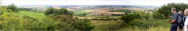
E. Yorkshire & Wolds . . .
|
| Walk No. |
Length |
Route |
| 74 |
10km |
Huggate, Cow Dale & Minster Way |
| 152 |
12km |
Bishop Wilton, Great Givendale, Millington
Grange |
| 169 |
12km |
Fridaythorpe, Wolds Way circuit |
| 212 |
11km |
Ellerton, River Derwent, Bubwith,
Aughton |
| 234 |
10km |
Londesborough, Market Weighton, Goodmanham |
| 296 |
7km |
Potter Brompton, Ganton, Wolds Way
circuit |
| 303 |
12km |
Lang Dale, North Dale, Fordon, Cans
Dale, Danebury Manor |
| 311 |
10km |
Cottam, Cottam Grange, Philip's Slack,
Cottam Well Dale |
| 313 |
7km |
Top Hill Low Nature Reserve, River
Hull |
| 416 |
12km |
Kilham W.Field Danes Graves Elmswell
Wold Cottam Warren |
| 435 |
10km |
Millington village, Wolds Way, Millington
wood circuit |
| 454 |
10km |
Wetwang, Thorn Dale, Green Lane,
Wetwang Grange circuit |
| 532 |
11km |
Welton, Brough, River Humber,
North Ferriby, Wolds Way |
| 553 |
12km |
Warter, Lavender Dale, Blanch Farm, B1246, Great Dug Dale |
| 619 |
9km |
Whitton, Alkborough, Julian's Bower, Devils Causeway |
| 653 |
6.5km |
Leavening Brow, Mount Ferrant Farm, Burythorpe, Pocklington Lane End |
| 704 |
8km |
Brayton, Brayton Barff, Burton Bridge, Selby Canal |
| 758 |
6km |
Walkington Road, Westwood Pasture,
Beverley Minster, Keldgate, Kitchen Lane,
Ripon Avenue, Blackmill circuit |
| 761 |
7km |
B1253 West Lawn Wood, Church Lane, Carnaby, Temple Lane, Carnaby Temple, Boynton circuit |
| 769 |
7km |
Hornsea Rail Trail, Ivy Farm, Skirlaugh Road, Old Ellerby, Crab Tree Lane, Green Lane |
| 786 |
9km |
Huggate, Wolds Way, Horse Dale, Rabbit Dale, Cow Dale circuit |
| 794 |
5km |
Allerthorpe Common, woodland circuit |
| 817 |
7km |
Skidby Mill, Skidby village, Little Weighton Road,
Beverley20 route, Dunflat Road, Oldgate, Skidby circuit |
| |
|
(top of page) |
Howardian Hills . . .

|
| Walk No. |
Length |
Route |
| 27 |
8km |
Family Boxing day stroll near Castle
Howard |
| 161 |
12km |
Byland Abbey, Newburgh Priory, Coxwold |
| 164 |
7km |
Caulkleys Bank, West Ness, Nunnington |
| 185 |
9km |
Kirkham Abbey,Crambe,River Derwent |
| 200 |
9km |
Circuit around the edge of the grounds
of Castle Howard |
| 230 |
10km |
Birdforth, Thormanby, Husthwaite,
Carlton Husthwaite |
| 273 |
11km |
Scawton, Cold kirby, Old Byland |
| 272 |
10km |
Ampleforth, Yearsley Woods |
| 314 |
7km |
Nunnington, River Rye, Caukleys Bank
circuit |
| 321 |
9km |
Ampleforth, Oxclose Wood, Studford
Ring circuit |
| 333 |
12km |
Kirkham Abbey, Crambe, Barton-le-Willows,
River Derwent |
| 350 |
8km |
Strensall, Centenary Way, River Foss,
Sheriff Hutton |
| 382 |
7km |
Terrington, Centenary Way, Cum Hag
Wood circuit |
| 417 |
5km |
Crayke Estate Walk circuit |
| 464 |
9km |
Yearsley village, Yearsley woods
& fish ponds |
| 498 |
7km |
Coxwold, Husthwaite, Beacon Banks
circuit |
| 590 |
11km |
Crayke, Foss Walk, Marton Abbey Fm,
Seaves, Launds Fm |
| 613 |
8km |
Flaxton, Oak Busk La, Thornton-le-Clay, Blue Coat Fm, Cuddy Ho |
| 629 |
8km |
Slingsby, Bank Lane, Centenary Way, Kirk Road,
Barton-le-Street, Green Dike Lane |
| 652 |
8.5km |
Hovingham, Fryton, Fryton Lane, Ebor Way circuit |
| 660 |
8km |
Brandsby, Peel Park, Yearsley, Well Lane, Beckfield House |
| 661 |
8km |
Byland Abbey to Ampleforth College (linear route) |
| 677 |
7km |
A64, Sandy Lane, Linton Mill, Sands Lane, Rillington, Scampston |
| 678 |
6km |
Terrington, Cotril Fm, Rose Cottage Fm, Howthorpe Fm, Centenary Way |
| 680 |
6km |
Carlisle Monument, Whitwell-on-the-Hill, Tout Hill, Whitwell Road, Welburn |
| 686 |
9km |
Slingsby, railway path, Fryton Grange, Socarrs Lane, Hovingham, railway path, Fryton |
| 696 |
7km |
Onhams Lane, Crambe, Rider Lane Farm, Riders Lane, Oak Cliff Wood |
| 700 |
6km |
Hovingham, Carr Lane, Cawton, Hovingham Spa circuit |
| 701 |
7km |
Oulston, Springview Farm, Thornton Lane, Thornton Lodge Farm drive, River Kyle |
| 714 |
8km |
Coneysthorpe, Centenary Way, Bridleway south to Road, Road to Coneysthorpe |
| 737 |
10km |
Nunnington, Harome, Hall Lane, River Rye circuit |
| 746 |
8km |
Pasture Lane, Middlecave Road, Maiden Grieve Balk, Broughton La, Castle Howard Rd, York Rd, Malton |
| 747 |
7km |
Terrington, Mowthorpe Lane, Mowthorpe Dale, Sleigh Lane, Ganthorpe, Broats Lane circuit |
| 748 |
6km |
Hovingham, Wath, Centenary Way, Ebor Way circuit |
| 763 |
7km |
Extended Crayke Estate Walk from the Dutch House cafe |
| 796 |
5km |
Butterwick, Boyton Lane, River Rye, Sleights Lane,
Slingsby Carr Cut, Green Lane circuit |
| 803 |
6km |
Circuit of Yearsley Woods from North Moor Lane car park |
| 806 |
9km |
Stonegrave, Cawton, Ebor Way, Oswaldkirk, Stonegrave Minster circuit |
| 808 |
6km |
St. Cuthbert's Church, Crayke Lane, Chesler Pit Lane, Mill Lane, Daffy Lane, Mosswood Lane, Foss Walk |
| 809 |
6km |
The B1363 at The Stripe, Skeugh Lane, Mill Bridge, Harryfield Lane, Stillington circuit |
| 810 |
7km |
City of Troy turf maze, Bonnygate Lane, Snargate Hill, Stearsby, Skewsby, Brow Wood circuit |
| 811 |
7km |
St. Peter's church Dalby, Dalby Bush Farm, Scackleton, Grange Lane, Green Lane, City of Troy turf maze, High Lane, Low Lane |
| 812 |
5km |
Thornton-le-Clay, Stittenham Hill, Skegmer Lane circuit |
| 819 |
5km |
Terrington, footpath to Sleigh Lane, Ganthorpe, Broats Lane circuit |
| 826 |
4km |
Circuit of Byland Abbey and Wass village |
| 832 |
4km |
Highthorne Lane, field path south, Woolpots Lane,
Amplecarr, Cemetery, field path circuit Husthwaite |
| 840 |
5km |
Coneysthorpe, Centenary Way, Appleton Lane circuit |
| |
|
(top of page) |
West Yorkshire . . .
|
| Walk No. |
Length |
Route |
| 335 |
7km |
Scammonden Water and Deanhead reservoir
circuit |
| 402 |
11km |
Bardsey, Pompocali, Thorner circuit,
Leeds |
| 429 |
8km |
East Keswick, River Wharfe, Sicklinghall
circuit |
| 515 |
9km |
Golden Acre Pk, Eccup, Bramhope, Paul's Pond, Breary Marsh |
| 593 |
10km |
Bramham village, Bramham Park, Bramham Rd, Thorner Rd |
| 669 |
4km |
The Obelisk Walk (red route) at Nostell Park, Nostell Priory |
| 688 |
6km |
Morkin Bridge, Keighley Moor Res, Millennium Way, Broad Head Lane, Whitehill Rd |
| 693 |
7km |
Home Farm, Colton Road, North Plantation, golf course, Bell Wood, 'M1',
Little Temple, Menagerie Pond, Temple Newsam |
| 698 |
8km |
Anglers Country Park, Haw Park Wood,
Barnsley Canal, Stubbs Wood, Anglers Park Lake, Wakefield |
| 715 |
8km |
Fairburn Ings Visitor Centre, Ledsham, Holy Rood La,
Fairburn, Fairburn Ings Nature Reserve |
| 725 |
6km |
St. Aidan's RSPB site by the River Aire at Allerton Bywater |
| 759 |
8km |
Rodley Nature Reserve, Leeds & Liverpool Canal, River Aire, Newlay, canal circuit |
| 768 |
8km |
Aberford, Nellie‘s Tree, Parlington Hollins, M1 underpasses, Long Lane, Parlington Lane circuit |
| 800 |
7km |
Pugneys Country Park, River Calder, Sandal Castle circuit |
| |
|
(top of page) |
South Yorkshire . . .
|
| Walk No |
Length |
Route |
| 621 |
10km |
R. Don, Levitthagg Wd, Conisbrough Station, Trans Pennine Trail |
| |
|
(top of page) |
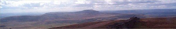
The Peak District. . .
|
| Walk No. |
Length |
Route |
| 04 |
11km |
Longnor to Pilsbury via Dove Dale return
via River Manifold |
| 351 |
5km |
Langsett Reservoir circuit &
Penistone |
| 544 |
11km |
Derbyshire Bridge, Cat & Fiddle Inn, Three Shires Head |
| 545 |
12km |
Cat&Fiddle Inn, Errwood Hall-Goyt Valley, Cats Tor, Shining Tor |
| 546 |
8km |
Monsal Head, Brushfield, Millers Dale, River Wye, Cressbrook |
| 548 |
6km |
Eyam, Stoney Middleton, The Riley Graves, Mompesson's Well |
| 550 |
8km |
Alport, Over Haddon, Lathkill Dale, Youlgreave, Bradford Dale |
| 641 |
7km |
R. Manifold, Hoo Brook, Wetton Road, Clayton House, Ecton Bridge, Manifold Trail, Dale farm, Wetton Mill |
| 642 |
8km |
Paddock Farm, The Roaches, Roach End, return via minor road |
| 643 |
7km |
Hollinsclough, Booth Farm, concession path to Chrome Hill |
| 788 |
5km |
Gradbach, River Dane, Lud‘s Church, Black Brook circuit |
| 789 |
7km |
Danebridge, Ship Inn, Whitelee farm, Shell Brook,
Barleigh Ford Bridge, River Dane, Wincle Brewery |
| |
|
(top of page) |
Howgill Fells & North Pennines
|
| Walk No. |
Length |
Route |
| 45 |
10km |
Cautley Spout & The Calf - Howgill
Fells |
| 82 |
10km |
Carlin Gill & Fell Head |
| 178 |
9km |
Cautley Crags,Great Dummacks,The
Calf,Cautley Spout |
| 180 |
10km |
Ravenstonedale, Knoutberry, Green
Bell, Stwarth |
| 249 |
10km |
Wild Boar Fell, Ais Gill circuit,
Upper Eden Valley |
| 425 |
10km |
Mallerstang Edge, Hell Gill & Hell
Gill Force |
| 510 |
10km |
Kirkby Stephen, River Eden, Greenriggs, Waitby, Nature Reserve |
| 633 |
10km |
Allenheads, Dirt Pot, River East Allen,
Spartylea Br, Elpha Green, Burnfoot |
| 856 |
2km |
Bowes Village Hall, Gilmonby Bridge, River Greta,
Bowes Castle, St Giles Church circuit |
| |
|
(top of page) |
Durham, Northumberland &
The Borders . . .
|
| Walk No. |
Length |
Route |
| 87 |
10km |
High Force, Teesdale |
| 47 |
10km |
Simonside Hills |
| 120 |
11km |
Teesdale Way, Whorlton, Abbey Bridge |
| 197 |
12km |
Greta Bridge, North Wood, Brignall
Mill, River Greta |
| 220 |
6km |
Durham City centre and River Wear
|
| 239 |
10km |
Craster, Dunstanburgh Castle, Beadnell |
| 255 |
11km |
Bowlees, High Force, Pennine Way,
Low Force |
| 329 |
10km |
Kirk Yetholm, St Cuthbert's Way,
Staerough Hill, Pennine Way |
| 330 |
7km |
Town Yetholm, Bowmont water, Yetholm,
Cheviot Hills |
| 388 |
8km |
Dene Mouth, Castle Eden Dene, Castle
Eden |
| 415 |
12km |
Embleton Dunstanburgh Castle Craster
Longhoughton |
| 462 |
11km |
Wolsingham, Tunstall Reservoir, Waskerley
Beck |
| 463 |
7km |
Hamsterley Forest, Bedburn Beck,
Potato Hill |
| 508 |
5km |
Northumberlandia Land Form Sculpture Cramlington, |
| 565 |
5km |
Circuit of parkland and woodland at National Trust Gibside |
| 566 |
10km |
Linear walk from Warkworth Castle to Alnmouth |
| 567 |
3km |
'Riverside Walk' - River Wansbeck at Wallington Hall |
| 568 |
9km |
River Allen valley, Plankey Mill, to Staward Peel & return |
| 582 |
9km |
Circuit of Chillingham Wild Cattle Park (permissive paths) |
| 592 |
8km |
Craster, Howick Hall,
Northumberland Coast Path circuit |
| 633 |
10km |
Allenheads, Dirt Pot, River East Allen,
Spartylea Br, Elpha Green, Burnfoot |
| 640 |
6km |
Blanchland, Baybridge, Allenshields, Bridge End,
River Derwent, B6306 |
| 662 |
8km |
Embleton Bay, Dunstan Steads, Dunstan Square,
The Heughs, Craster, Dunstanburgh Castle |
| 663 |
7km |
Dunstan Steads, Embleton Bay, Low Newton,
Embleton Links, Embleton |
| 690 |
10km |
Leaplish Kielder, Lakeside Way, circuit of Bull Crag Peninsular |
| 691 |
10km |
Belvedere, Lakeside Way, Soney Gap, Salmon Cubes, Robin's Hut |
| 692 |
5km |
Bakethin res, Lakeside Way, Bakethin Weir, Old Railway path |
| 707 |
5km |
Butts Lane, River Tees, Teesdale Way, Egglescliffe |
|
|
(top of page) |
Lake District . . .
|
| Walk No. |
Length |
Route |
| 130 |
|
Grasmere and Langdales |
| 218 |
|
A wet week in Grasmere |
| 285 |
7km |
Cat Bells, Derwent Water circuit |
| 293 |
3km |
Gummer's How circuit overlooking
Windermere |
| 341 |
6km |
Great wood, Castle Head, Derwent
Water circuit |
| 343 |
6km |
Knipe Fold, Holm Fell, Yew Tree Fm,
Tom Gill, Tarn Hows |
| 459 |
9km |
Bowness Ferry, Claife Heights,Belle
Grange, Windermere |
| 468 |
11km |
Claife Station, Claife Heights, Latterbarrow,
Hawkshead |
| 469 |
10km |
Elterwater, High Close, Loughrigg
Terrace, Skelwith Bridge |
| 521 |
6km |
Wray Castle, Blelham Tarn, High Tock How Farm, Windermere |
| 522 |
9km |
Near Sawrey, Moss Eccles Tarn, Claife Heights, High Blind How, Far Sawrey |
| 523 |
3km |
Finsthwaite, Low Dam, High Dam circuit |
| 626 |
6km |
Patterdale, Side Farm, Silver Crag circuit |
| 649 |
4km |
River Kent, Miller Bridge, Kendal Castle, Jenning's Yard Br |
| 671 |
8km |
Saul's Drive, New Barns, Arnside Tower, Arnside Knott |
| 672 |
6km |
Grange-over-Sands, Hampsfell Hospice circuit |
| 673 |
8km |
Cartmel Racecourse, How Barrow Trig point, Barns Bank Plantation |
| 699 |
6km |
Ulverston Canal Foot, Tow Path, Plumpton Hall, coast path |
| 718 |
8km |
Winster Parish Church, Crag Lane, Thornyfields,
By-way crossing Lindeth Lane & A5074, Winster House circuit |
| 719 |
8km |
Canal Foot, R. Leven estuary, Plumpton Hall, Next Ness, Hoad Hill, Parish Church, Ulverston Canal |
| 720 |
9km |
Staveley, Barley Bridge, Littlewood Farm, Potter Tarn, Gurnal Dubs, Hundhowe, River Kent circuit |
| 739 |
5km |
Humphrey Head circuit, Morecambe Bay |
|
|
(top of page) |
Lancashire, Forest of Bowland .
. .
|
| Walk No |
Length |
Route |
| 569 |
8km |
Barley, Ogden Reservoirs, Pendle Hill, Pendle Way |
| 570 |
10km |
Foulridge, Lake Balwain, Stansfield Tower, Lister Well Rd, Leeds & Liverpool Canal |
| 664 |
5km |
Great Stone of Fourstones, Ringstones, Usherwoods circuit |
| 749 |
6km |
Wycoller, Gt Thorn Edge Fm, Raven Rock Fm, Wycoller Hall, Parson Lee Fm, The Atom view point |
| |
|
(top of page) |
Midlands & Southwards .
. .
|
| Walk No. |
Length |
Route |
| 81 |
|
Holiday Walks at Crackington Haven,
North Cornwall |
| 222 |
3km |
Pole Bank, The Long Mynd, Shropshire Hills |
| 228 |
|
A week in the New Forest Hampshire |
| 237 |
5km |
Simmonds Yat, Biblins Bridge, Wye
Valley Walk |
| 236 |
11km |
Cannop Ponds, Gloucestershire Way,
Forest of Dean |
| 263 |
11.5km |
Swanage to Corfe Castle, Purbeck
Hills, Dorset |
| 372 |
6km |
Blakeney, Peddars Way, Cley Windmill
North Norfolk Coast |
| 373 |
10km |
Circuit of the grounds of Holkham
Hall |
| 421 |
7km |
Appledore to Westward Ho! via the
Southwest Coastal Path |
| 422 |
8km |
Lundy Island, Threequarter Wall circuit,
Bristol Channel |
| 439 |
5km |
Pulteney Br, Royal Victoria Park,
Royal Crescent, Bath |
| 608 |
8km |
Bradgate Deer Park, Newtown Linford, Leicester |
| 609 |
3km |
Foxton Locks (10 rise) & Boat Lift, Grand Union Canal |
| 710 |
7km |
Cambridge, River Cam, Grantchester circuit |
| 711 |
7km |
Picklescott, Cothercott Hill, Shropshire Way, Port Way circuit |
| |
|
(top of page) |
Scotland . . .

|
| Walk No. |
Length |
Route |
| 160 |
|
A week in Blair Atholl nr Pitlochry,
Perthshire |
| 190 |
4.5km |
Ochil Hills,Dollar Burn, Castle Campbell,
Burn of Sorrows circuit |
| 271 |
5km |
Armadale Clan MacDonald visitor centre,
Isle of Skye |
| 270 |
4km |
Portree, Bile pasture circuit, Isle
of Skye |
| 269 |
3km |
Tourist path up to the Old Man of
Storr and back, Isle of Skye |
| 268 |
4km |
Claigan along the coast to the coral
sands and back,Isle of Skye |
| 307 |
6km |
The Ice House, Shell walk - Tentsmuir
National Nature Reserve |
| 306 |
11km |
Elie, St. Monans, Pittenweem, Anstruther,
Cellardyke |
| 329 |
10km |
Kirk Yetholm, St Cuthbert's Way,
Staerough Hill, Pennine Way |
| 330 |
7km |
Town Yetholm, Bowmont water, Yetholm,
Cheviot Hills |
| 594 |
7km |
"The Kelpies", Forth & Clyde Canal, Falkirk Wheel |
| 595 |
7km |
Findochty, Moray Coast Trail, Portknockie, Cullen |
| 597 |
6km |
Winding Walks, Monument, Ranalds Grave, Peeps View |
| 644 |
11km |
Loch Katrine ferry pier car park way-marked 'green' route |
| 741 |
5km |
Mersehead RSPB Reserve circuit, Solway Firth |
| 743 |
5km |
River Annan circuit, Moffat |
| 765 |
6km |
Cademuir Hill & John Buchan Way circuit |
| 766 |
5km |
Cardrona Forest extended 'Yellow' way marked walk |
| 767 |
1.5km |
Pirn Hill there & back, Innerleithen |
| 775 |
12km |
Kelso Abbey, Kelso Bridge, disused railway, Roxburgh Viaduct, River Teviot, Borders Abbeys Way |
| 776 |
6km |
Sprouston, River Tweed, Banff Mill, B6350, disused railway path |
| 778 |
1.7km |
Coldstream, Hirsel Estate, circuit of the lake |
| 820 |
2km |
Walk & boat trip from Inverewe Gardens |
| 821 |
1.7km |
Beinn Eighe visitor centre, way marked Circular Walk |
| 822 |
3km |
Circular walk in Laide Wood, Aultbea |
| 823 |
2.3km |
Gaineamh Mhor, Gairloch Harbour, roadside footpath |
| 824 |
4km |
Gairloch Harbour, Flowerdale Waterfall walk and return |
|
|
(top of page) |
Majorca . . .
|
| Walk No. |
Length |
Route |
| 472 |
6 |
Cala Millor, Punta de N'Amer, Headland marker |