Menu:
National Parks
The approximate route is shown by a blue line.
Use your mouse to drag the map to the area of interest and
zoom in/out using the controls on the left hand side of the map.
Please use my map to find the route on your own large scale
walking map such as the OS Explorer series at 1:25000.
If you have time if you do this walk please let me know how you get on.
That would be very helpful to me to keep my information accurate and up to date.
Please note that I provide this free service to you as a fellow walker on the
understanding that you walk
the route entirely at your own risk and that the information is not used for
any commercial purpose.
Library Route No. 960424
Boltby, Sita Pike, Windygill Ridge,
Cleveland Way,Dale Town Common,
High Paradise farm, High Barn circuit
14km - North York Moors . . .
Map: OS Explorer OL26 North York Moors Western area
General Directions (see markers on the route map)
1.) The walk starts at a small lay-by on a bend in the road at the eastern end of Boltby village at map ref. SE494865. From the lay-by walk westwards along the road through the village for about 600m to map ref. SE488866. Turn right here off the road to follow a bridleway up past West Gurtof Farm. At the field boundary about 200m beyond the farm the bridleway turns left but our route keeps straight on along a public footpath. Follow the footpath across the fields for almost 1km to the edge of Gurtof Wood. The route of the public footpath through the forest is hard to find and it's easier to follow the forest access tracks through this open access forestry. From the forest track on the north side of West Moor Slack there is a good path from map ref. SE477882 up to Seta Pike at map ref. SE477888 along the boundary between the open moor and the forest. From Seta Pike follow the bridleway along Windygill Ridge to the gate on to the open moor at Gallow Hill. From Gallow Hill follow the bridleway climbing up over the moor for about 1km to join the Cleveland Way at the Hambleton Drove Road at map ref. SE489909. At the Hambleton Drove Road turn left and follow the wide track for about 1km to map ref. SE490919.
2.) At map ref. SE 489 915, turn right off the Hambleton Drove Road to follow a bridleway along a stony access track for about 2.2km. Here turn right to follow another farm access track heading generally southwards for about 350m. Turn right here off the track to follow a public bridleway heading south west across Dale Town Common. (If you’re lucky you may spot the small herd of fallow deer that roam this area) After about 1.2km the bridleway reaches the Hambleton Drove Road at map ref. SE 504 890.
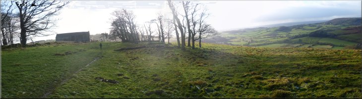
3.) Cross the Drove Road track and follow the farm access road opposite past High Paradise Farm. This is the route of the Cleveland Way. About 400m below High Paradise farm the farm access road bends sharply to the right and our route goes straight on, off the road, to continue along the Cleveland way across the fields and through the woodland to the road near the top of Sneck Yate Bank. Cross the road and continue along the Cleveland Way for almost 1km to High Barn at map ref. SE506867. Just past the barn turn right off the Cleveland Way to follow the zig-zag path down the steep hillside to cross Lunshaw Beck at the bottom and then climb up across the field to the road at the lay-by where the route started.
(top of page)