| 2001 walks | 2002
walks | 2003 walks | 2004
walks |
| 2005 walks | 2006
walks | 2007 walks | 2008
walks |
| 2009 walks | 2010
walks | 2011 walks | 2012 walks |
| 2013 walks | 2014 walks | 2015 walks | 2016 walks |
| 2017 walks | 2018 walks | 2019 walks |2020 walks |
| 2021 walks | 1993-2000 library | Find a Route Index |
| A few Routes to print out | Request a Route... |
Route No 23 - 4 December 2001
Hutton-le-Hole,
Rosedale, Spaunton circuit - 9 miles
North York Moors . . .
Route map from Ordnance Survey Open Space service.
Map: OS Explorer OL26 North York Moors Western area at 1:25000
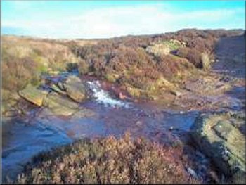
Ford across Loskey Beck
Amongst the close cropped grass beside the road I noticed a few small yellow flowers which seemed a bit unusual for early December. On closer inspection they turned out to be buttercups with their leaves hidden below the grass. About half a mile to my right was the silouette of Anna Cross against the blue sky. |
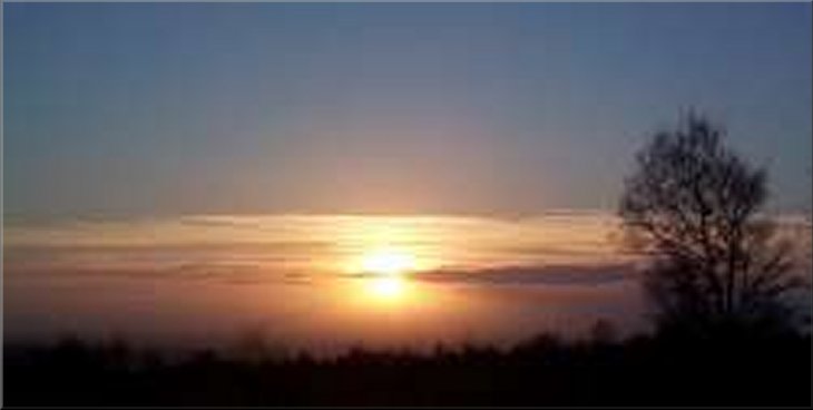
This morning I drove to Hutton-le-Hole in the bright winter sunshine and arrived in the car park at about 9.45am. From the car park I crossed the road and headed north on the footpath along Hutton Ridge. I followed the path across the fords over the two branches of Loskey beck until I reached the road near the top of Rosedale Chimney.
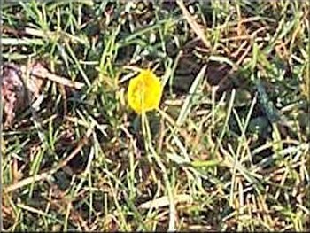
Buttercup in the roadside verge
|
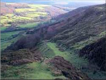
The old railway incline into Rosedale
There was a maroon helicopter slowly following the route of the overhead power lines up the valley causing the sheep the rush to the farthest end of their field as it passed slowly over just above the tree tops. The field below me was full of swaledale sheep and a couple of tups with their magnificent double curled horns. The resulting lambs will be born in 5 months at the beginning of April when the worst of the winter weather on the moors is over. |
Just as the road starts to descend the chimney bank there is a memorial seat to the right of the road at the top of an incline that was part of the ironstone railway. It's now a steep green track and I followed it down to the fence line around the sheep pastures in the valley bottom. I sat in the heather here for a few minutes for a drink and to look at the view up the valley.
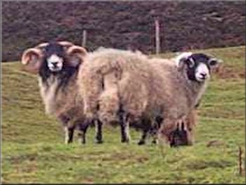
Swaledale tup and ewe
|
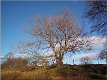
Ash tree beside the path near Lastingham
It was very pleasant here just to enjoy the sunshine and the sound of the stream. I continued to the new millennium stone at Lastingham and on around the walled sheep pastures to Spaunton. From here I followed the lane back for about a mile to the picnic area adjoining the car park where I had started. The whole route was about 9 miles and took me about four and a half hours including my stops in the heather. I noticed that during the foot and mouth restrictions some areas of the moor have had post and wire fences erected around them. I presume that this was to limit contact between flocks of sheep on the moors. |
I crossed the field to join the bridleway that runs down the valley just above the river on the right bank. I kept on this path for about 2 miles to the point where Hartoft Dale joins Rosedale. Near here I passed a plaque that marks the place where there was an Elizabethan glass works (now reconstructed in the Ryedale Museum in Hutton-le-Hole). Where the path from Hartoft Bridge crosses the bridleway I turned right onto the path heading for Lastingham. This path passes Tranmire Beck and I stopped in this pretty little valley to sit in the heather out of the wind for a drink and a sandwich.
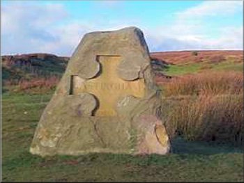
The millennium stone at Lastingham
|