| 2001 walks | 2002
walks | 2003 walks | 2004
walks |
| 2005 walks | 2006
walks | 2007 walks | 2008
walks |
| 2009 walks | 2010
walks | 2011 walks | 2012 walks |
| 2013 walks | 2014 walks | 2015 walks | 2016 walks |
| 2017 walks | 2018 walks | 2019 walks |2020 walks |
| 2021 walks | 1993-2000 library | Find a Route Index |
| A few Routes to print out | Request a Route... |
Route No 38 - 24 February
2002
Newgate Bank, Easterside Hill
Fangdale Beck, Helmsley Moor circuit - 10 miles
Bilsdale, North York Moors . . .
Route map from Ordnance Survey Open Space service.
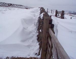
Map: OS Explorer OL26 North York Moors Western area. 1:25000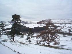 To-day was
a grey overcast winter's day with wet snow lying on the high ground
after the falls yeaterday. The weather forecast told us to expect
sleety rain in the afternoon, so we set off early and drove to
the car park at the top of Newgate Bank about 5 miles from Helmsley
on the road to Stokesley. We started walking just after 9.00am
and took the path that starts about 200 yards below the top of
Newgate Bank to Fair Hill Farm. In the field just above the farm
we turned right to follow the path across the valley and a minor
road to skirt the north side of Easterside Hill.
To-day was
a grey overcast winter's day with wet snow lying on the high ground
after the falls yeaterday. The weather forecast told us to expect
sleety rain in the afternoon, so we set off early and drove to
the car park at the top of Newgate Bank about 5 miles from Helmsley
on the road to Stokesley. We started walking just after 9.00am
and took the path that starts about 200 yards below the top of
Newgate Bank to Fair Hill Farm. In the field just above the farm
we turned right to follow the path across the valley and a minor
road to skirt the north side of Easterside Hill. 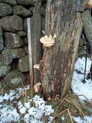 About
a mile from the minor road that we crossed the path goes through
a gate in a drystone wall and crosses a cart track. Here we turned
right onto the track which heads north east out across the moor.
We followed it for about a mile and a half to a path to our right
that led us down into the village of Fangdale Beck. We walked
through the village to cross the main road and take the path up
the othe side of Bilsdale to High Crossett Farm. Just above the
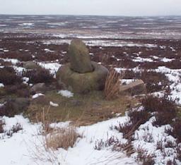
farm we turned onto a path leading south east onto the moor top.
The path goes passed the remains of two old stone crosses which
I think indicate that this is a very old route.
About
a mile from the minor road that we crossed the path goes through
a gate in a drystone wall and crosses a cart track. Here we turned
right onto the track which heads north east out across the moor.
We followed it for about a mile and a half to a path to our right
that led us down into the village of Fangdale Beck. We walked
through the village to cross the main road and take the path up
the othe side of Bilsdale to High Crossett Farm. Just above the
farm we turned onto a path leading south east onto the moor top.
The path goes passed the remains of two old stone crosses which
I think indicate that this is a very old route. 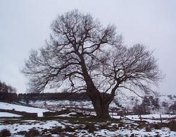 The
present path is alongside a wet gulley but I think that the gulley
is in fact all that is left of an old sunken pack horse trail.
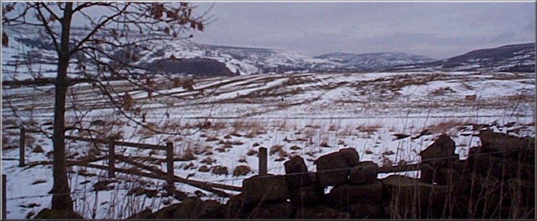
After almost two miles across the moor (called Helmsley Moor on
the map) the path reaches the edge of Roppa Wood. Here we followed
the path down the edge of the wood (a large chunk of it was felled
last year) to the bottom of Rievaulx Bank. We climbed up the track
to join the footpath that runs around the edge of the moor above
the forestry and followed this path all the way back to Newgate
Bank where we had started. The whole route was about 10 miles
and took us about 5 hours. A little sleety drizzle started when
we were about a mile from the car and shortly after we set off
for home in the car it started to rain quite heavily so the forecasters
had got it just right.
The
present path is alongside a wet gulley but I think that the gulley
is in fact all that is left of an old sunken pack horse trail.
After almost two miles across the moor (called Helmsley Moor on
the map) the path reaches the edge of Roppa Wood. Here we followed
the path down the edge of the wood (a large chunk of it was felled
last year) to the bottom of Rievaulx Bank. We climbed up the track
to join the footpath that runs around the edge of the moor above
the forestry and followed this path all the way back to Newgate
Bank where we had started. The whole route was about 10 miles
and took us about 5 hours. A little sleety drizzle started when
we were about a mile from the car and shortly after we set off
for home in the car it started to rain quite heavily so the forecasters
had got it just right.