| 2001 walks | 2002
walks | 2003 walks | 2004
walks |
| 2005 walks | 2006
walks | 2007 walks | 2008
walks |
| 2009 walks | 2010
walks | 2011 walks | 2012 walks |
| 2013 walks | 2014 walks | 2015 walks | 2016 walks |
| 2017 walks | 2018 walks | 2019 walks |2020 walks |
| 2021 walks | 1993-2000 library | Find a Route Index |
| A few Routes to print out | Request a Route... |
Route No. 255 - Wednesday 2 July 2008
Bowlees, Dirt Pit, High Force,
Pennine Way, Low Force circuit - 9km
Teesdale . . .
Map: OS Explorer OL31 Teesdale
Route Map on 'Landranger' base
map from OS Open Space service
Open this route in Google Earth

Footbridge from the car park to the visitor centre at
Bowlees
We
parked in the visitor centre car park, map ref. NY907282,
at about 9.30am. We crossed the footbridge over Flushlemere
Beck and followed the footpath through the woods for about
100m to the visitor centre in Bowlees village.
|
Today
I am on grandad duty to collect my little grand daughter
from her nursery between 3.00 and 3.30pm so we had to
make an early start. Just after 8.00am we set out to drive
to Bowlees in Teesdale.

The visitor centre at Bowlees
|

Track from Bowlees to Ash Hill |

All the buildings here are painted white |

Another white farmhouse
He was given short shrift by the tenant when it transpired
that he was on a neighbouring estate and not his own land.
When he eventually arrived back home he decreed that all
the buildings on his estate must be painted white to identify
the extent of his estate. Well all the buildings here
are white but only a few kilometers away they are all
natural stone.
|
We
walked in front of the visitor centre and set off along
a track through the fields heading North West to Ash Hill
and Dirt Pit. Neither name does justice to the very pleasant
scenery at both places. All the buildings here are white
and the story goes that the local land owner was caught
in a tremendous storm whilst out riding and called at
the farm he was passing to demand hospitality until the
storm abated.

A brand new grass rake
|

Track from Bowlees to Ash Hill |

A pretty stream at Dirt Pit called Smithy Sike
Here we crossed the road to follow a path across the fields
for about 500m to the tourist car park for High Force
(complete with toilets).
|
At
Dirt Pit the track became a narrow tarmaced lane which
we followed to the junction at Map ref. NY890289.

Birds Foot Trefoil
|

Most of this field was covered with a mixture of buttercups
and speedwells
Then
we crossed the road to have our tickets punched at the
entrance to the private path through the woods to the
foot of the falls.
|
Near
the entrance to the car park is a gift shop where the
tickets are on sale to view High Force from river level.
As three old codgers we bought three concessions at 1
each.

Path down to the High Force view point
|

High Force on the River Tees from the visitor view point
|

Steps down to the River Tees from the road (B6277)
After almost 15 minutes gazing at the sight we retraced
our steps to the kiosk at the entrance to the path at
the road. We walked about 100m along the road and turned
off to the right to follow a path down through some woods
to the river side.
|
It's
about 600m to the river at the foot of the falls and what
a spectacular sight it is when you get there! There was
quite a lot of water in the river after the recent rain
and we could hear the thunder of the falls long before
we could see them.

A wild orchid
by the path
|

Footbridge over the River Tees about 1km downstream from
High Force |

Caterpillar webs on a willow tree
We
crossed the river to join the Pennine Way route on the
far side.
|
We
walked about 250m by the river side to a footbridge over
the Tees at map ref. NY889283.

Mountain pansies by the Pennine Way
|

Woodland carpeted with Dogs Mercury - this suggests that
there has been woodland here for a very long time |

Juniper berries
At
the end of this path we had a view of High Force from
the cliff top just downstream of the falls. After that
we made our way to the rocks at the top of the falls
|
We
turned right to follow the Pennine Way upstream for about
1km. Here there is a little side path through the juniper
bushes.

A juniper bush
|

High Force seen from the Pennine Way |

Standing above High Force on the River Tees
After
our lunch break we set off to walk along the river bank
following the Pennine Way downstream for almost 3km.
|
There
we sat for our lunch with an amazing view of the river
and the roar of the falls in our ears.

Birds foot trefoil with ground ivy and wild thyme
|

An orchid on the river bank |

The River Tees from the Pennine Way near Bowlees |

Knapweed
|
|
 Low
Force on the River Tees
Low
Force on the River Tees |

Four
old tupps by the Pennine Way
Just
below Low Force is a pedestrian suspension bridge called
Wynch Bridge, over the Tees. We crossed the bridge and
walked through the woods on the river band to cross two
fields that brought us back to Bowlees Village.
|
This
brought us to a series of waterfalls called Low Force.
They are not as spectacular as High Force but are still
well worth a visit to see the impressive cascade of white
water tumbling through the rocks.

Low
Force on the River Tees
|

Wynch
Bridge over the River Tees below Low Force
We stopped on the way back for a coffee, but the service
was much too slow for a toasted teacake or a bacon roll.
We arrived back home just in time to collect my grand
daughter from her nursery and was presented with a pile
of her drawings and models to admire.
|
From
there we made our way back to the car park where we had started. The
whole route had been 9km and had taken us almost 4 hours to walk including
our lingering stops at High Force.

Heading
back to Bowlees across the fields
|
Background Notes:
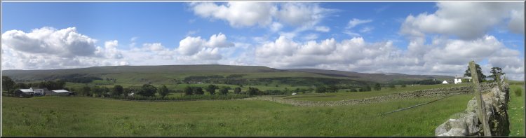
This walk would make a good day out in the summer holidays. It's just a little bit further afield. but it's such a spectacular place it's well worth the drive and may even keep the kids interested. It's a circular walk of about 9km, about 5.5 miles so not too strenuous either, from the visitor centre at Bowlees in Teesdale to High Force and Low Force on the River Tees.
There's a good car park at Bowlees where the visitor centre is in a converted Methodist Chapel. From the village we follow a pretty track with pleasant views of Teesdale to two hamlets called Ash Hill and Dirt Pit, neither name does justice to these places, but the names may be a hang over from the area's lead mining past.
From there our route takes us through the tourist car park at High Force. To see the falls of High Force from the North bank of the river you have to pay at a little kiosk and follow the path down to the foot of the falls and then return to the road next to the car park.
From there our route takes a public footpath down to the river and a footbridge across the river Tees to join the Pennine Way on the south bank of the river. We follow the Pennine Way path upstream and through the juniper bushes to the cliff edge where there is a spectacular view of these huge falls. The whole river Tees thunders over a cliff about 70feet (22m) high formed where the river crosses a volcanic rock layer called the Whin Sill and drops down into carboniferous limestone that is much more easily eroded. I think it's worth seeing this amazing natural sight from both banks.
And our friend J M W Turner visited the falls to sketch them on his epic tour of North Yorkshire in 1816. When you can tear yourself away our route returns back downstream following the Pennine Way. There are all manner of wild flowers along the path including wild orchids, mountain pansies, as well as juniper bushes and many other flowers.
After about 2.5km, (1.5miles) we come to Low Force. These falls are not as high or spectacular as High Force but in their own way are equally impressive. It's a series of steps each a few metres high forming a white water cascade down the river. On a couple of occasions when I've been here there's been a group of teenagers from the local outdoor centre being taught how to shoot these waterfalls in small canoes. It looks to be a very exciting activity and lots of fun.
There's a nice sculpture of two rams, or tupps, by the path here to look out for and just below Low Force is a wobbly pedestrian suspension bridge called Wynch Bridge, built in the early 1800's, and it takes us back over the River Tees. It's safer to cross it one at a time. From the bridge the path leads across the fields back to Bowlees and the end of our walk for this week.
top of page
|