|
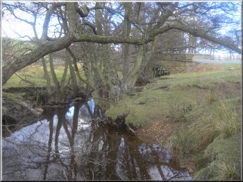
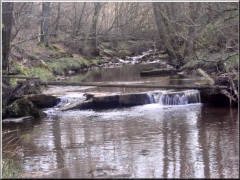
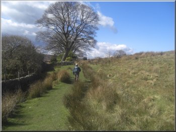
Eller Beck next to the lay-by at the start of our walk
We parked in a small lay-by on the road into Goathland off the A169,
at map ref. SE847992. It's next to Eller Beck just before the road goes
under the North York Moors Railway. As we were getting our boots on
Swaledale ewes began to gather round us, hoping to be fed.
|
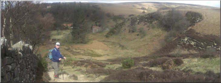
Recently I recieved a request for a route around several waterfalls
at Goathland. Access to the waterfalls for a decent view is difficult
so today Jim, my neighbour, and I drove to Goathland to walk out a route
and check on ways of seeing the falls.
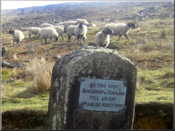
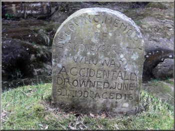
Memorial by the track at the start of our walk
|
|
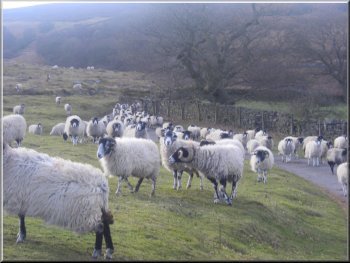
Our hungry sheep escort near Birchwood
The flock of sheep followed us in a long crocodile of around 100 sheep
until we reached Birchwood. By this time they decided that there was
no food to be had and just stood on the moor watching us disappear along
the path.
|
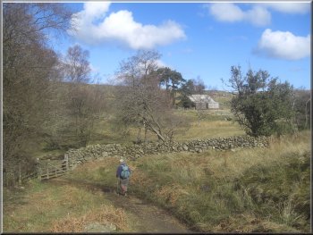
Their numbers increased until the road was blocked and there were cars
slowly creeping through the bleating flock. We set off along an access
road just opposite the lay-by, leading to a farm called Birchwood on
the map.
Our hungry sheep escort near Birchwood
|
Looking across Eller Beck from the path near Birchwood |
|
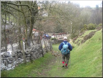
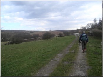
Path from Birchwood to Partridge Hill
Beyond the beck we joined another access road at Partridge Hill.
|
At Birchwood the path left the access road to skirt round Birchwood
to cross Brocka Beck.
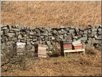
Beehives left on the moor all winter
|
|
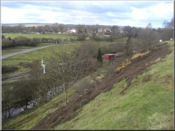
NYMR near Goathland Station
We crossed the road and followed the path around the hillside and down
to Goathland Station.
|
We continued along this access road from Partridge Hill for about a
kilometer, until we reached a road at map ref. NZ840012.
Path down to Goathland Station
|
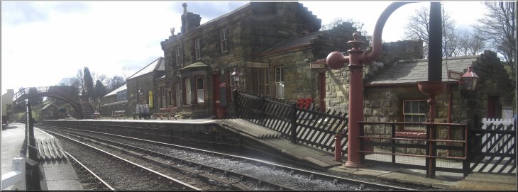
Goathland Station on the NYMR |
|
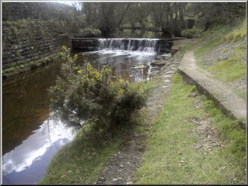
Pretty waterfall over the weir at Goathland Station
Then we recrossed the railway and followed the path over the hill to
the ford across Eller Beck at Darnholm.
|
We crossed the line at the station and walked alongside Eller Beck
next to the station to see the pretty, little waterfall over a weir.
NYMR near Darnholm
|
Coming over the hill from Goathland Station to Eller Beck at Darnholm
|
|
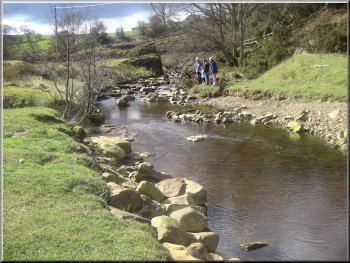
Eller Beck near the ford at Darnholm
Here we turned left to follow a path past a house at a great location
with a view across the valley.
|
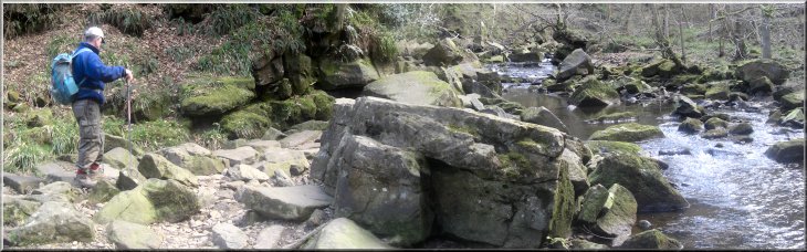
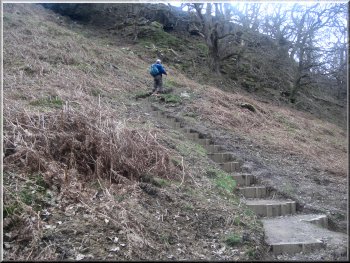
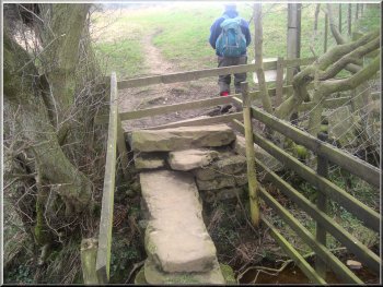
We did not cross the ford but instead we crossed the track to some
steps which we climbed up the hillside to map ref. NZ835024.
Steps up the hillside from the ford at Darnholm
|
Steps going up the hillside from the ford across Eller Beck at Darnholm
|
|
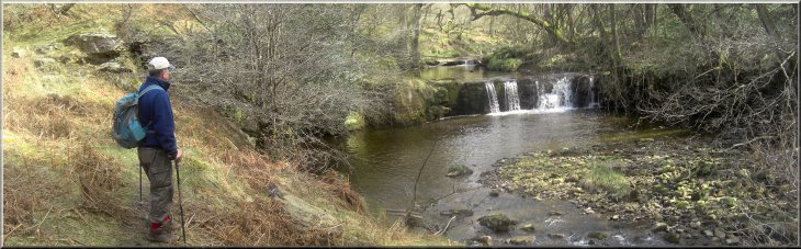
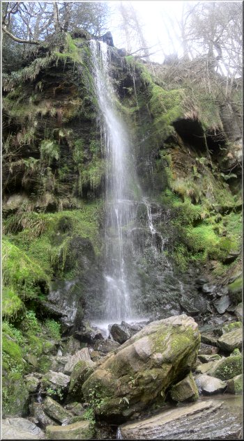
Eller Beck just above Walker Mill Foss
The waterfall is called Walker Mill Foss and at this very pleasant
spot we sat on the bank near the falls for our lunch break. There had
been dark shower clouds all around us all day so far but somehow we
had managed to stay in the sunny bits and had had no rain at all.
|
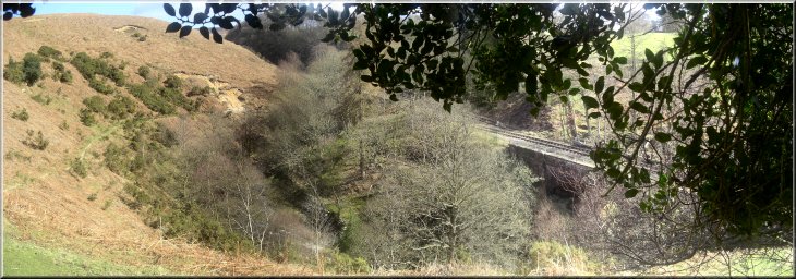
We continued along the path around the hillside with Eller Beck and
the railway below us for about 500m to map ref. NZ828024. Here we turned
left to follow the path down a very steep slope to a path by the side
of Eller Beck at the bottom of the slope. We followed this rather boggy
path upstream for about 400m to a pretty waterfall at map ref. NZ832022.

A last look at Walker Mill Foss, waterfall
|
 |
|
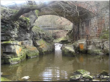
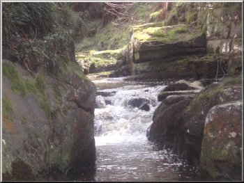
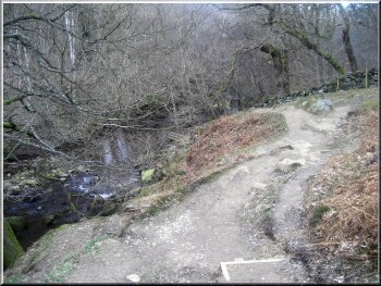
Memorial by the rapids under the railway bridge
Under the railway bridge there are some rapids where the beck flows between the rocks and we climbed down to the beck for a closer look. The beck bends round and re-crosses the railway where there is another waterfall called Water Arc and the river above the falls is called Water Arc Pool.
|
After our break we retraced our steps back along Eller Beck to the
point where we had joined the path earlier at map ref. NZ828022. Here
there is a footbridge over Eller Beck and a railway bridge at a much
higher level over the beck and the footbridge.
Narrow rocky channel for the beck below the railway bridge
|
|
Narrow rocky channel for the beck below the railway bridge
People do scramble down to a rock shelf at the top of the falls but
it is a perilous descent. There is a path in along the beck from the
road at Beck Hole (map ref. NZ821022) to the railway bridge. Along the way you come to Thomason Foss waterfall, well worth a visit. To reach Water Arc waterfall from the
railway bridge you need to paddle or wade along the river for a few
metres to see the falls properly. I did it once a long time ago but
I wouldn't do it now.
|
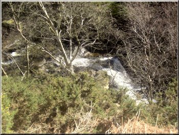
From here it's best to climb back onto the footpath and follow it around
the bend in the beck until you reach a seat under a holly tree at map
ref. NZ826022. From the seat you can see another waterfall at the next
railway bridge. This one is called Water Arc but you cannot see much
of it from the path.
A glimps of Water Arc waterfall from the bank just below the seat under
the holly tree
|
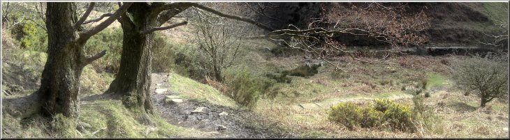
Eller Beck lost beneath the trees from the seat under the holly tree |
The West Beck approaching Mallyan Spout waterfall |
|
Path from Beck Hole towards Mallyan Spout
Path up from the West Beck to the road at Goathland
Path up from the West Beck to the road at Goathland
|
From the seat under the holly tree we followed the path out to the
road at map ref. NZ822023. Here we turned left to cross the bridge over
the railway and follow the road down into Beck Hole. In Beck Hole we
turned right off the road at map ref. NZ821022 to follow Eller Beck
again for about 150m to the point where it joins the West Beck and becomes
the Murk Esk. We followed the path along the West Beck for just over
a kilometer to Mallyan Spout waterfall. It is a rocky approach to the
falls, and the waterfall is on a small tributary as it joins the West
Beck, but it is very pretty.
Mallyan Spout waterfall
|
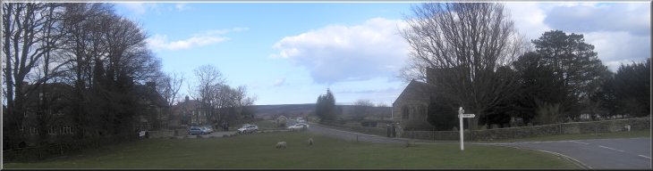
Church by the main street into Goathland |
|
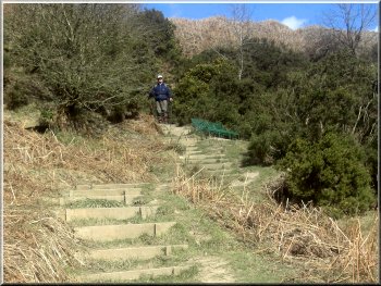
Path from Goathland to the disused railway line
I'm not sure the plan has succeeded. In places the steps are cut into
the hillside instead of following the original ground surface and the
resulting sides of the small cutting are already crumbling with the
rain. At the road we walked along to the church in Goathland.
|
We continued for about 400m beyond Mallyan Spout to map ref. NZ821008.
Here we turned left to climb a long flight of steep steps up the valley
side to the road at map ref. NZ823006. A great deal of hard work has
gone into making these steps up the hillside. I presume the idea is
to limit soil errosion.
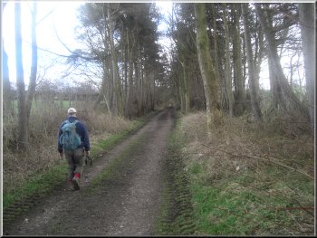
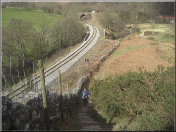
Path along the disused railway track just a few metres from the working
line
|
|
Path along the disused railway track just a few metres from the NYMR
working line
The whole route had been about 12km and had taken us almost 5 hours
including our breaks and our scrambles and diversions to find view points
to the waterfalls. On the way home we did manage to find one cafe in
Helmsley that was still open for a coffee and a toasted teacake.
|
Just beyond the church we turned right to follow a path from the village
across the fields to a path along a disused railway track at map ref.
NZ838005. At thr railway path we turned right and walked along the railway
path for about 1.3km to the road. Here we turned left and followed the
road for about 250m under the railway bridge and back to our car.
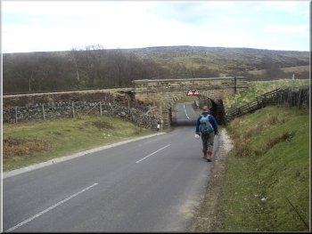
The final few hundred metres back to the car
|
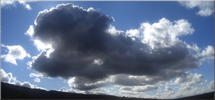
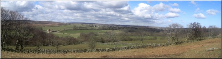
Dark shower clouds were around all day but somehow we managed to stay
in the sunshine and avoid the rain |
