| 2001 walks | 2002
walks | 2003 walks | 2004
walks |
| 2005 walks | 2006
walks | 2007 walks | 2008
walks |
| 2009 walks | 2010
walks | 2011 walks | 2012 walks |
| 2013 walks | 2014 walks | 2015 walks | 2016 walks |
| 2017 walks | 2018 walks | 2019 walks |2020 walks |
| 2021 walks | 1993-2000 library | Find a Route Index |
| A few Routes to print out | Request a Route... |
Route No. 320 - Wednesday 9 December 2009
White Horse Bank, Gormire Lake,
Sutton Bank Visitor Centre circuit - 10km
North York Moors . . .
Ordnance
Survey route map on the Landranger series map base.
Map: OS Explorer OL26 North York Moors Western area at 1:25000
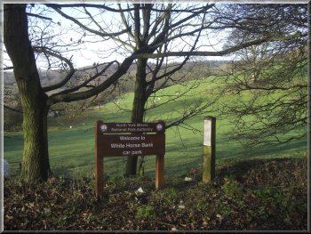
The car park at the foot of White Horse Bank
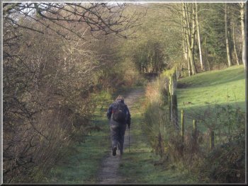
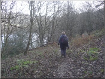
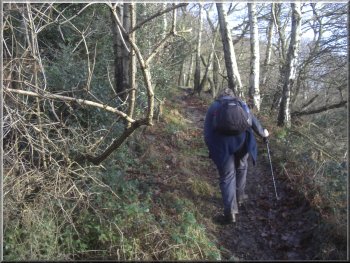
Path up in to the forest
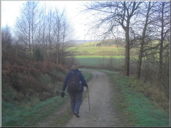
Approaching our turn off the forest access road
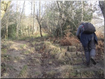
We continued straight ahead along the path which then entered the woodland and bore to the right a little leading us up through the woodland.
About 750m from the White Horse Bank road we joined a stony forest access road at map ref. SE508811. Here we turned left to follow the forest
road for about 800m, (keeping left at the fork) to map ref. SE505818. Here the forest road bends to the left and on the outside of the bend is a
footpath, marked by a finger post. We followed this path dropping down from the edge of the forest road for a few metres to the edge of the
woodland. |
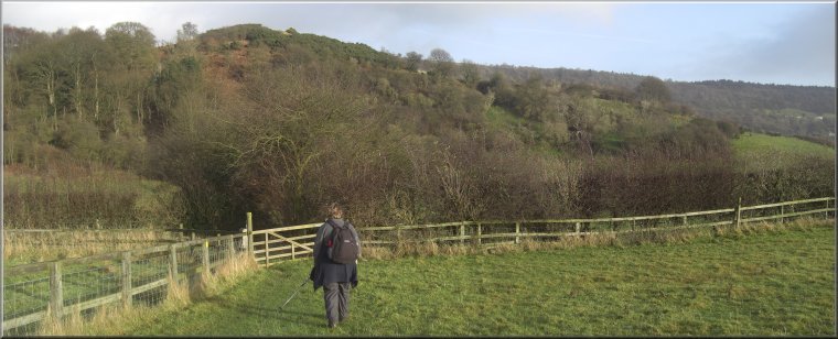
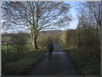
It was a clear bright winter's day today and my wife and I drove through Kilburn to the bottom of White Horse Bank. There's a little car park about
100m up the road on the left where we parked at map ref. SE514807. From the car park we turned back down the road for about 50m to a footpath
along a tarmac farm access road on our right. We turned to follow this path and after about 250m the tarmac access road turned left to Acre House
farm.
The farm access road off White Horse Bank
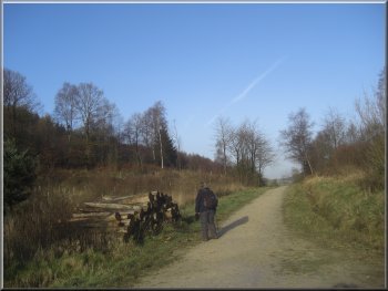
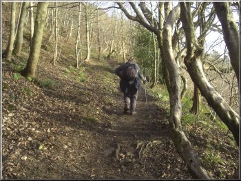
Stony forest access road leading towards Hood Grange
Path across the field to Hood Grange farm
|
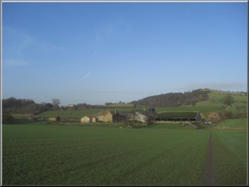
Hood Grange farm seen from the path
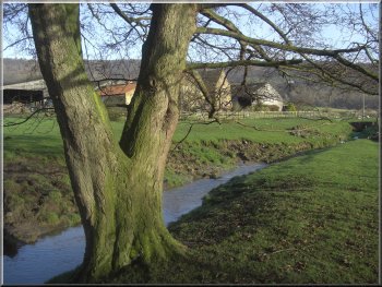
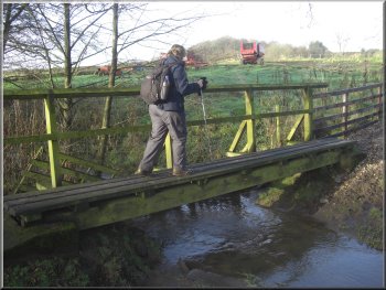
The path then turned right to cross the stream on a footbridge and continued for a few metres to join the farm access road via a pedestrian
gate. We turned left and followed the farm access road out to the main road (A170). |
The path then led us along the field edge to Hood Grange farm. Here the path turned left inside a fence along a stream at the back of the
farm.
Footbridge across the stream at Hood Grange farm
|
Heading for the A170 along the farm access road from Hood Grange farm
|
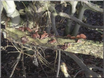
"Jew's Ear" fungus on an elderberry tree, so called because tradition has it that Judas Iscariot hanged himself on one
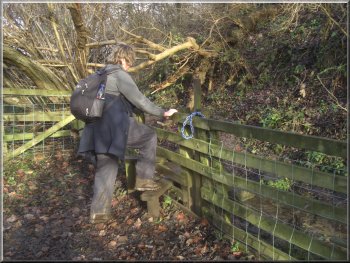
The stile at the bottom of the slope into the wood
Path dropping down to the edge of Gormire Lake
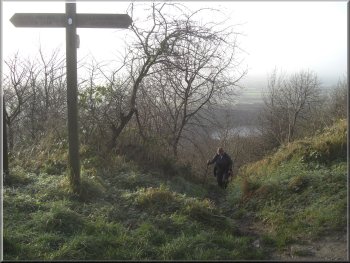
Here the bridleway continued straight ahead but we turned right to follow a public
footpath down the slope along the edge of the field to a stile at the bottom of the slope. We crossed the stile into some woodland and followed the
path to the left and then right to climb up the wooded hillside. After about 200m we reached the top of the slope where there was a wooden finger
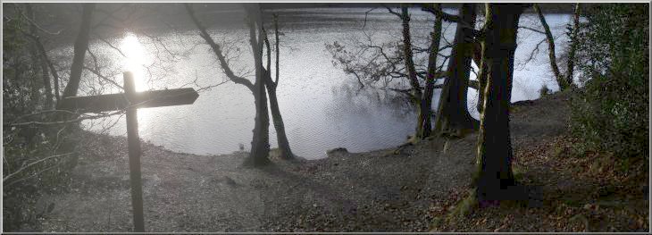
post indicating the way along the path to Gormire Lake. The lake is in a bowl in the hillside below Whitestone Cliff and we followed the path down into
the bowl until we came to the edge of the lake at map ref. SE502830. |
We crossed the main road and took a public bridleway up a
tarmaced farm access road a few metres to the left. We walked along this access road for about 200m and here the access road turned sharp left,
but we turned sharp right along a farm track for about 30m. Here the farm track turned sharp left but just before the turn in the track we turned left off
the farm track to follow the bridleway through a pedestrian gate and along the edge of a field for about 250m. to map ref. SE501827. Here the
bridleway went through a wooden field gate and turned left along a fenced grassy track. We followed this track for about 400m passing through two
sets of gates along the way until we reached map ref. SE499831.
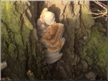
Large bracket fungus in the base of an oak tree
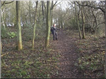
Path through the wood towards Gormire Lake
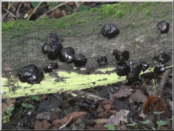
Fungus called "King Alfred's Cakes"
|
|
Start of the permissive path up the hillside away from Gormire Lake
|
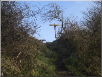
The finger post ahead is on the public footpath
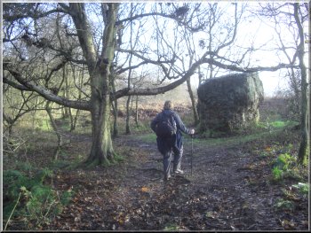
Large boulder by the path from the cliff above
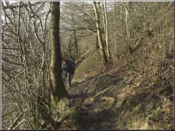
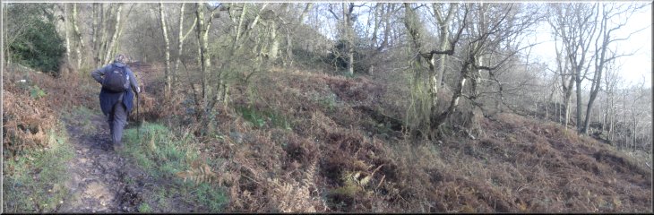
Path up the hillside from Gormire Lake to the Cleveland Way
Then after another 50m the
path becomes a public right of way. We continued our climb up the hillside past a large sandstone boulder that had fallen from the cliffs above
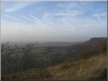
sometime in the past. We followed the path up the hillside for about 700m, a climb of about 150m, until we reached the Cleveland Way path around
the top of the escarpment. There was a lovely view from the Cleveland way but the hills of the Yorkshire Dales that are normally visible away to the
west were lost in the mist today. |
We continued along the public footpath going anticlockwise around the lake. It
is quite a boggy area at the eastern end of the lake. When we were roughly opposite the point where we had first reached the edge of the lake we
came to a wooden finger post indicating a permissive path straight up the hillside directly away from the lake head towards the Sutton Bank Visitor
Path up the hillside from Gormire Lake to the Cleveland Way
Path up the hillside from Gormire Lake to the Cleveland Way
Finger post on the Cleveland Way at the top of our climb
|
Path up the hillside from Gormire Lake to the Cleveland Way
|
About to join the Cleveland Way route
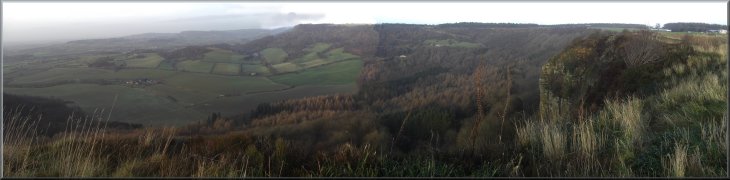
Looking west towards the Yorkshire Dales from Sutton Bank
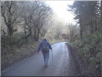
Heading down White Horse Bank to the car park
We followed the road down the bank for about 800m back to our car park at the bottom of the bank. The whole walk had been 10km and
it had taken us almost three and a half hours to walk including our stop at the visitor centre cafe. |
There was a lovely view from the Cleveland way but the hills of the Yorkshire Dales that are normally visible away to the
west were lost in the mist today. After about 200m along the Cleveland Way we came to the Sutton Bank Visitor Centre where we stopped in the cafe
there for a large coffee before continuing around the edge of the Yorkshire Gliding Club airfield above Roulston Scar. Just beyond Roulston Scar we
descended the step at the side of the white horse to the car park at the bottom. From the car park we made our way on to the road going down White
Horse Bank.
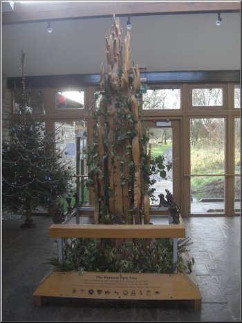
Sculpture at the Sutton Bank Visitor Centre
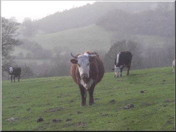
Cattle near the car park off White Horse Bank
|
Looking north west from the path around Roulston Scar
|
Background Notes:
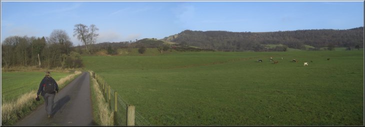
This is a circular walk of 10km, 6 miles from the Kilburn White Horse. We start from the car park at the foot of the White Horse which is a figure cut into the hillside to expose the underlying sandstone. It's a very large figure covering around 1.5 acres of the hillside facing roughly southeast. It was completed in 1857 and is visible from around 30 miles away. Unfortunately the sandstone here is a dull grey and it's a continuing maintenance nightmare to keep a bright white surface on the horse. Even so it's such a conspicuous landmark that during WWII it was covered up so that enemy pilots couldn't use it as a navigation aid. During its lifetime it has been badly damaged by storms twice and completly neglected for a period after the first world war, but it's now maintained by a charity called the Kilburn White Horse Association.
From the White Horse we make our way down the bank and out through Hood Hill plantation. This is a conifer plantation managed for timber but it's appearance is softened by a sprinkling of deciduous trees along the edges of the conifer blocks and the overall effect is quite attractive. The woodland track leads out to a path across the fields to Hood Grange. Originally Hood Grange was a hamlet but in the late 1800's it was abandoned for economic reasons leaving only the farm called Hood Grange. The farm is on the site of a hermitage dating from the early 1100's. The hermitage became a grange of the priory at Newborough near Coxwold until the dissolution of the monastaries in the 1500's.
From Hood Grange we cross the A170 and skirt around High Cleaves Farm to climb over a hill called Gormire Rigg to Gormire Lake. Yorkshire has few natural lakes. I suppose Semer water off Wensleydale is the most well known, and Gormire Lake is another of Yorkshire's natural lakes. It's roughly semi-circular with a radius of around 200m. Gormire Rigg was left by the errosion of glacial melt water at the end of the ice age forming a bowl between it and the main escarpment which is now filled with the water of Gormire Lake. There are no streams into the lake and it is fed by springs from the escarpment. This is an absolutly idylic spot with the expanse of calm clear water surrounded by woodland and with the backdrop of the Hambleton Hills escarpment. It's such a very pleasant place to sit and watch the wild fowl, coots, moorhens, mallard, grebes and swans.
Our route leaves the lake to make the long climb up the escarpment to the Cleveland Way at the top. The whole climb is about 150m, 500ft. The Cleveland Way runs around the edge of the escarpment at a height of 300m, 1000ft. The edge is very steep and for much of the way it's a sheer cliff with amazing views out across the Vale of York and the Vale of Mowbray to the hills of the Yorkshire Dales. On a clear day the entrance to Wensleydale is quite easy to pick out. We follow the Cleveland Way path to the A170 at the top of Sutton Bank and the North York Moors Visitor Centre there. Near the Sutton Bank Visitor Centre there is an indicator board showing the direction of many distant landmarks.
From the visitor Centre we continue along the edge of the escarpment on the top of Roulston Scar, part of the Hambleton Hills and the wonderful views continue. Around 400BC this flat hill top was occupied by a large Ironage hill fort, but now it's the airfield of the Yorkshire Gliding Club. The prevailing westerly winds make it an ideal site for gliding and people have been using this site since before WWII. The frequent take-offs and landings make for a very interesting walk around the edge of the airfield back to the Kilburn White Horse and the end of our walk.
top of page
|