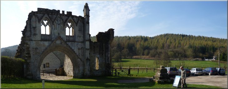
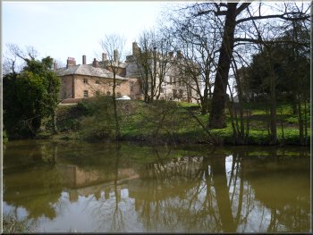
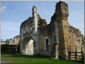
Kirkham Abbey at the start of our walk |
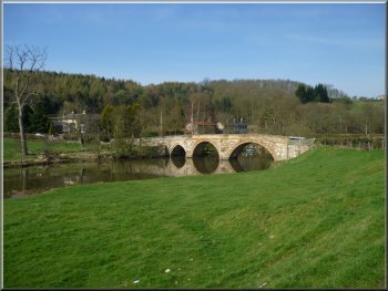
Road bridge over the River Derwent
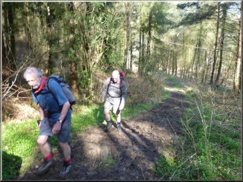
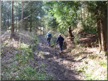
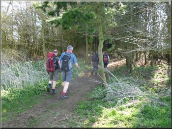
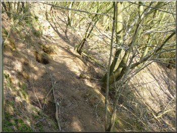
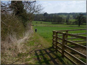
Steep climb up through the wood
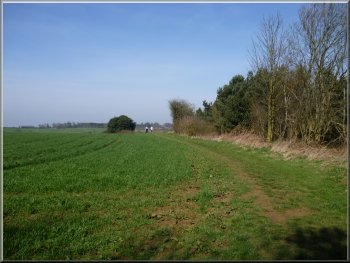
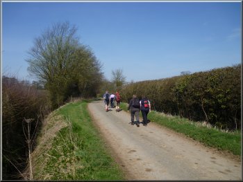
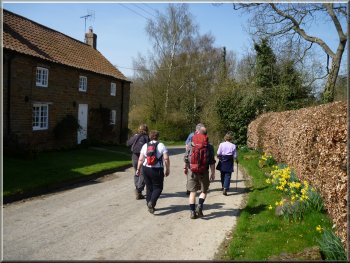
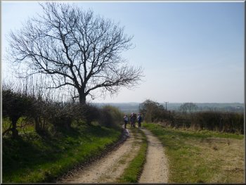
We continued along the road across the level crossing on the York to
Scarborough railway line and about 30m beyond the crossing we turned
right off the road to climb a steep path through the woods for about
250m to a road. |
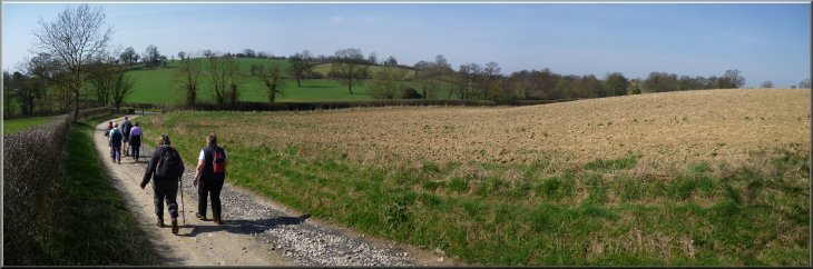
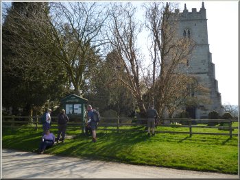
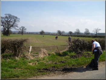
This morning my wife and I met a small group of friends at the little
parking area in front of Kirkham Abbey at map ref. SE735658. It's about
1km east of the A64 from the top of Whitwell Hill. We started walking
around 10.30am back along the road to cross the River Derwent on the road
bridge.
Steep climb up through the wood
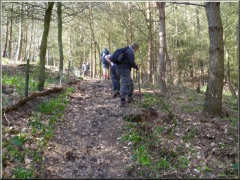
Heading for the road at the top of the climb
|
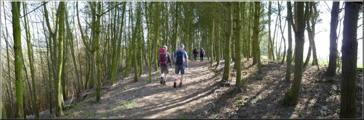
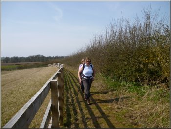
Path along the top edge of the wood |
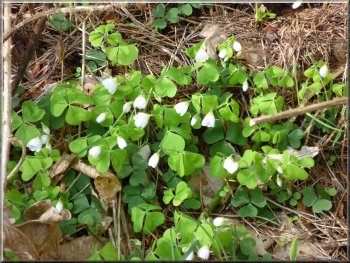
Wood Sorrel by the path
Looking back towards the road
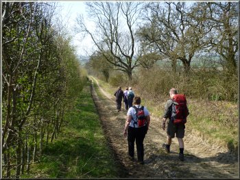
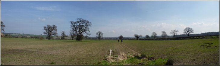
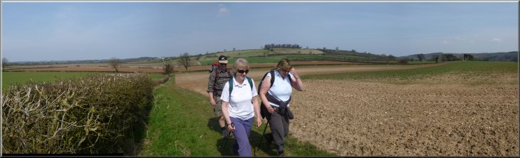
We walked around the top edge of the wood for about 700m. Below the
path at one point was a large badger sett. We emerged from the end of
the wood overlooking Oakcliffe Farm. |
At the road we turned left and walked along the road for about 30m
and there turned right off the road onto a footpath that led us back
into the wood.
Path along the top edge of the wood
A badger sett below the path
|
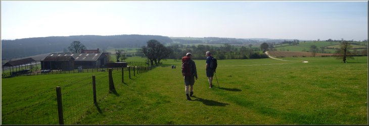
Dropping down the hillside past Oakcliffe Farm
Following the farm track out to the road
|
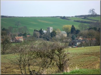
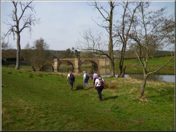
The road up towards Crambe
Path through the churchyard
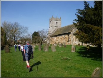
After about 450m we turned left off the road to follow a footpath
across the fields, through the churchyard and out to the road by the
church in Crambe. We sat on the grass bank in front of the church for
a drink |
We followed the path down the hillside and along the farm track out
to a road at map ref. SE738645. At the road we turned right to walk
up towards the village of Crambe.
Path across the field into Crambe
A short break by the church notice board
|
Road through the village of Crambe
Looking back to Crambe
The road quickly bent round to head south as we left the village and
followed a farm track along the edge of the fields passing Hillside
farm over to our left. |
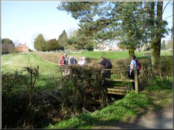
After this short break we continued along the road through the village
heading initially north west.
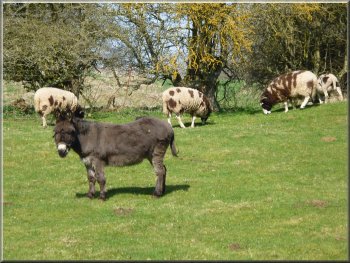
Jacob's Sheep & a donkey as we left Crambe
Track along the edge of the fields from Crambe
|
Following the track down to Barton-le-Willows
The level crossing at Barton-le-Willows
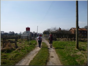
We followed the road around the edge of Barton-le-Willows. At the road
junction at map ref. SE716632 we turned left for about 25m and then
left again to walk along a footpath across the fields. |
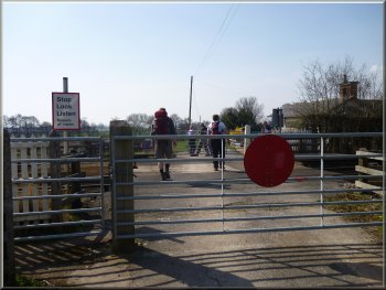
After about 1.2km from the edge of Crambe we came to a level crossing
over the railway and then a road bridge over Spital Beck.
Approaching the level crossing at Barton-le-Willows
Path across the fields towards Crambe Grange
|
Path across the fields towards Crambe Grange
Path across the fields towards Crambe Grange
|
A llamas at Crambe Grange
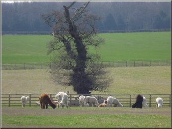
Llamas at Crambe Grange
Path to the road from Crambe Grange
Here there turned out to be a large Llama herd. We followed the path
across the road and out to the bank of the River Derwent at map ref. SE731631.
|
We crossed Spital Beck and crossed the fields to join another path
above Crambe Grange. We followed this path south and then east past
Crambe Grange.
Path around Crambe Grange
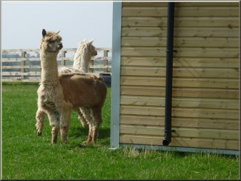
Llamas at Crambe Grange
Wood anemones by the path
|
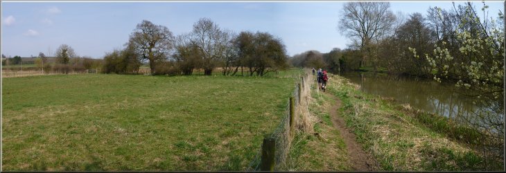
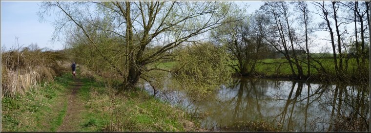
Heading upstream on the path by the River Derwent
|
Heading upstream on the path by the River Derwent
Heading upstream on the path by the River Derwent
Along this part of the river there were Howsham Woods on the opposite
bank. After a little over 3km we came to a weir on the river next to
Kirkham Abbey and about 200m further on we came to the road.
|
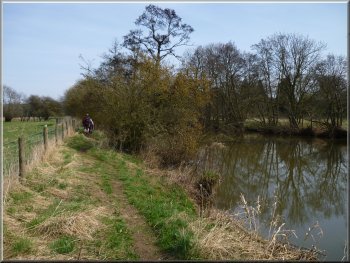
Here we turned left to walk along the river bank past the imposing
buildings of Howsham Hall on the opposite bank. We continued along the
river bank with the fields on our left and the occasional train passing
by.
Howsham Hall seen across the River Derwent

Heading upstream on the path by the River Derwent
|
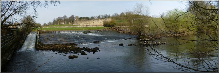
Weir across the River Derwent at Kirkham Abbey
|
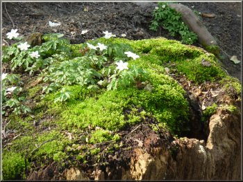
Wood anemones on a tree stump

Level crossing at Kirkham Abbey
The whole route had been 12km and it had taken us about four and a
half hours to walk in the Spring sunshine including our lunch stop. |
Here we turned right and crossed the River Derwent on the road bridge
to return to the little parking area in front of Kirkham Abbey and the
end of our walk.
Approaching the road at Kirkham Abbey
Back at Kirkham Abbey
|
Background Notes:
This is a walk of 12km, about 8 miles, from Kirkham Abbey in the Howardian Hills between York and Malton. Strictly speaking it's not an abbey, but a priory. Founded by the Lord of Helmsley, William l'Espec in the early 1100's for a group of Augustines, known as the black canons because of their hooded black cassocks and black cloaks. The canons were priests in their own right and so could work in the local community as a parish priest or running almshouses, a hospital or a school. The site of the priory continued to be developed over the following 400 years. From the priory our walk crosses the York to Scarborough railway line at the level crossing next to the old signal box, built in the mid 1800's and it's now a grade 2 listed building. Kirkam Station was next to the signal box but it was closed in 1930. We make our way up through the woods and across the fields to the village of Crambe on the top of the hill. Crambe is listed in the Doomsday Book and was one of William the Conqueror's personal estates. The Lord of Helmsley passed ownership to Kirkham Abbey when it was founded. The Norman church of St. Michael in Crambe has a memorial plaque to Karl Pearson recording that he, "was among the first to apply the mathematical theory of statistics to the study of biological problems". In fact he is credited with establishing Statistics as a distinct mathematical discipline. He died in 1936 just after his 79th birthday. From Crambe we follow a track between the fields down the hill across an unmanned level crossing on the York to Scarborough railway line. Keep a sharp lookout because, as they approach, the diesel carriages are alarmingly quiet and seem to appear from nowhere. From there we skirt the edge of Barton-le-Willows and follow the paths across the fields to the River Derwent. Our route follows the river bank back to Kirkham Abbey and along the way we pass Howsham Hall on the opposite side of the river. The hall was built in the early 1600's using stone and other materials from Kirkham Abbey following the dissolution of the monasteries. Many people at the time regarded this as sacrilege and it is said that the owners of the hall were cursed such that the male line of the family would die out and apparently this has happened to the various families that have owned the hall since that time. As our route approaches Kirkham Abbey on the opposite side of the river we reach a weir and a very pleasant view of the abbey ruins across the river. There's one final surprise about the abbey. It's in such a peaceful beauty-spot by the river Derwent in the Howardian Hills area of outstanding natural beauty now, but during the preparations for the D-day Normandy landings in WW2, the abbey grounds were used as a test area for landing craft. I think testing different types of waterproof seals. There was a top secret visit to see the vital preparations by the Prime Minister, Winston Churchill and King George VI himself. The site was used to train the drivers of landing craft to manoeuvre their cumbersomb vehicles. From the weir we follow the path out to the road by the level crossing and return to the car park at Kirkham Abbey and the end of our route.
top of page
|