| 2001 walks | 2002
walks | 2003 walks | 2004
walks |
| 2005 walks | 2006
walks | 2007 walks | 2008
walks |
| 2009 walks | 2010
walks | 2011 walks | 2012 walks |
| 2013 walks | 2014 walks | 2015 walks | 2016 walks |
| 2017 walks | 2018 walks | 2019 walks |2020 walks |
| 2021 walks | 1993-2000 library | Find a Route Index |
| A few Routes to print out | Request a Route... |
Route No. 521 - Saturday 14 September 2013
Wray Castle, Blelham Tarn, High Tock How Farm,
Watbarrow Point Lake Windermere circuit-6km
English Lake District . . .
Note details of this walk are also available from the National Trust , Wray Castle web site
Route map from Ordnance Survey
Open Space service.
Map: OS Explorer OL7 The English Lakes South Eastern area
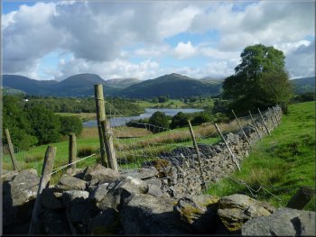
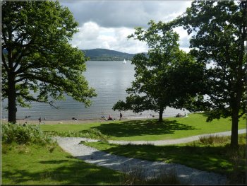
Looking north from Wray Castle across Windermere to the hills above Ambleside
|
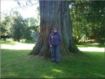
An impressive conifer in the grounds of Wray Castle
Ridges of the Fairfield Horseshoe route from Wray Castle
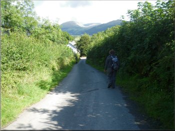
The road heading down towards Low Wray
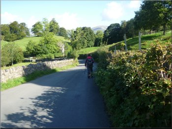
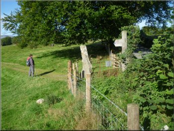
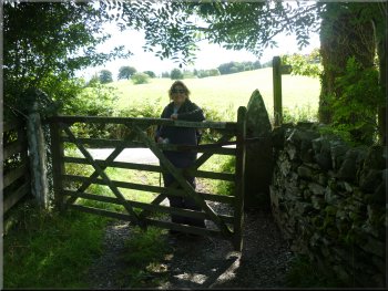
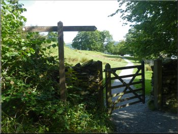
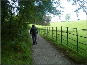
There's a church behind the
gate house almost completely hidden in the trees. At the road we turned right and walked along this narrow road passing the turning to Low Wray off
to the right hand side of the road. After about 300m from the Wray Castle gate house, there was a gate on the left hand side of the road leading to a
permissive path following the road safely over the wall inside the fields. After another 200m we came to a public footpath with a gate from the road
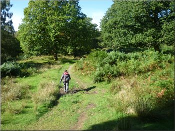
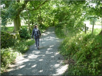
and we turned left to follow the footpath across the field. |
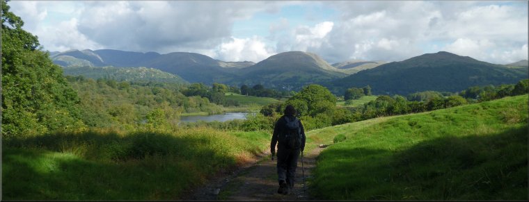
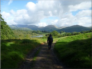
This week my wife and I are staying in a holiday cottage in the tiny village of Near Sawrey near Hawkshead. This morning the weather was warm,
bright and sunny showing off the Lakeland scenery in all its glory! We drove to Wray Castle on the edge of Windermere just a few kilometres away.
It's a National Trust property and we parked in their car park there at map ref. NY375010. We had a brief look around the grounds where there are
some impressive trees and then we set off along the drive from the castle, a Victorian folly, to the road at the gate house.
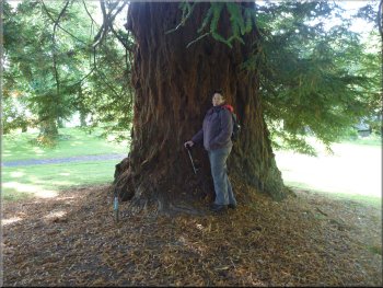
Another impressive conifer in the grounds of Wray Castle
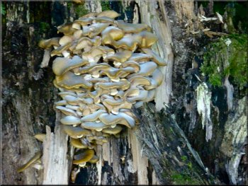
Cluster of bracket fungi on a tree at Wray Castle
Start of the permissive footpath following the road
|
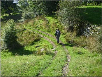
Turning away from the road on a path across the fields
Heading into open woodland en route for Blelham Tarn
Ford across a feeder stream to Blelham Tarn
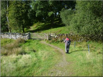
From the stream we continued along the track for another 400m to a fork where
there was a finger post indicating the village of Outgate straight ahead, reminding us that we had come from the direction of Low Wray and showing
that our route lay along the left hand turn to High Tock How. |
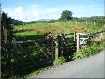
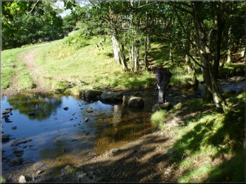
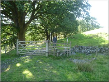
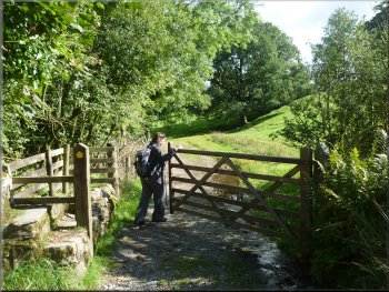
The path followed a farm access track across the sheep pasture for about 450m to a gate
into some open woodland. We continued on the farm track through the woodland for about 500m to a ford and some rough stepping stones across a
stream that flowed into Blelham Tarn a few hundred metres to our left.
Path across the fields heading for Blelham Tarn
Heading into open woodland en route for Blelham Tarn

Path heading south west above Blelham tarn
|
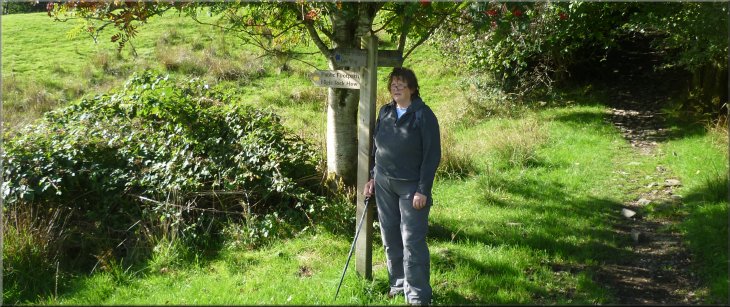
Finger post at a fork in the track - we turned left towards High Tock How farm
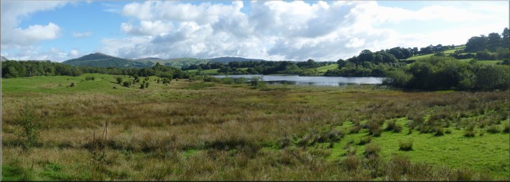
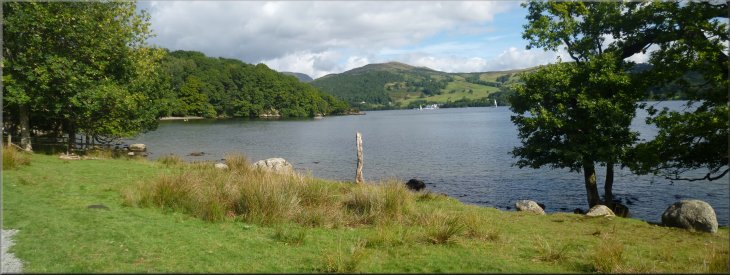
Looking north east across Blelham Tarn
Looking across Blelham Tarn to Wansfell Pike
|
Track climbing up to High Tock How farm
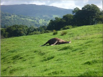
This horse was having a good roll in sunshine
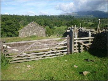
Gates at the stone barn on the way up to High Tock How farm
We continued up the
track to pass the entrance to High Tock How farm and reached the road at map ref. SD363998. At the road we turned left and followed the road for
about 150m to a junction at a bend in the road. |
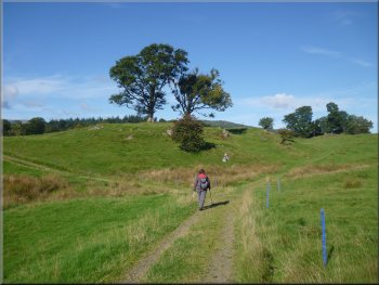
We followed this path around the end of Blelham Tarn and began climbing up the track
towards High Tock How farm. As we climbed the views, particularly away to our left got better and better. We cam to a field gate across the track at a
stone barn and from there we had a lovely view over the tarn to the hills above Ambleside on the far side of Lake Windermere.
Track climbing up to High Tock How farm
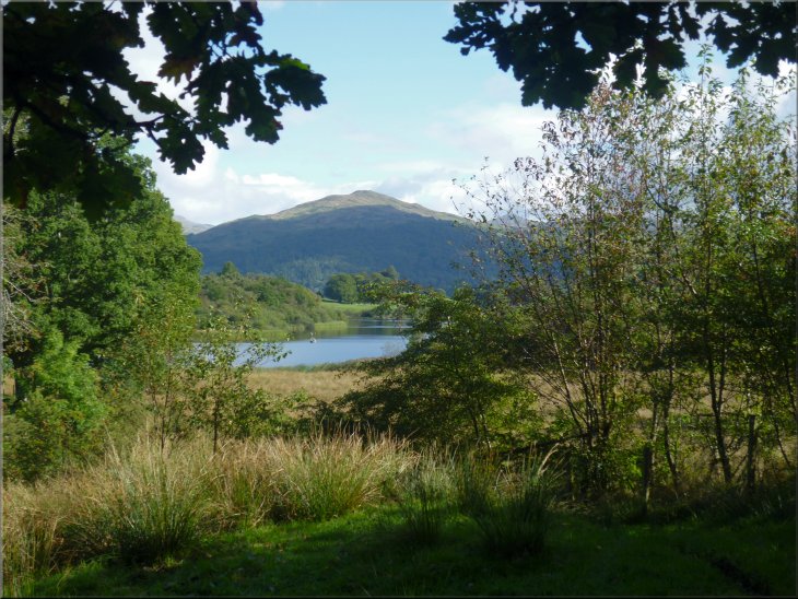
View of the hills above Ambleside from the track
The road down to Hole House farm
|
Leaving Hole House farm on the track across the fields
Stone slab stile on the path from Hole House farm
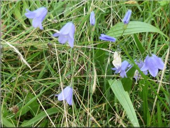
Harebells by the path - such a delicate blue
After about 650m we came to a road at map
ref. NY370004. There had been some wonderful views from this path looking north east across Windermere to the hills above Ambleside. |
Here we kept straight on, effectively turning left off the road on to a farm access track passing Hole
House farm. Once we were passed the farm the footpath followed a farm access track across the fields.
The hills above Ambleside from the track above Blelham Tarn

Gate on to the road at map ref. NY370004
|
|
About to turn off the road approaching Wray Castle gate house
Track down towards the side of Lake Windermere
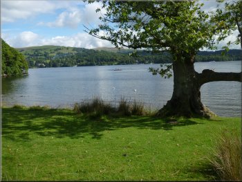
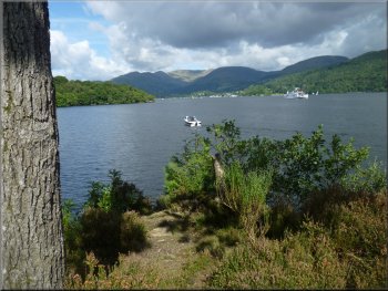
Windermere from the lakeside path
We followed the track to within about 50m of the lakeside and there we turned left through a pedestrian gate to join the lakeside path. There
were cattle grazing by the water's edge, boats on the lake and people sitting on the grass in the sunshine. It was a lovely scene. We walked along the
lake shore for about 400m and then the path began to climb up away from the lakeside to a gate into some woodland. |
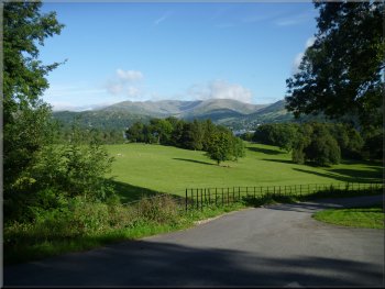
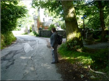
At the road
we turned left and walked along the road for about 300m almost back to the Wray Castle gate House. About 100m before the gate house we turned
right off the road on to a track heading down to the side of Lake Windermere. There was a good view of the Wray Castle Church on the left of the
track.
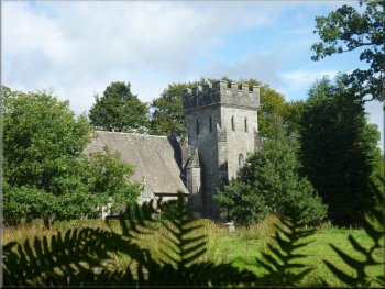
St Margaret’s Church behind the gate house to Wray Castle
Our turning on to the lakeside path
Windermere from the lakeside path
|
|
Windermere from the lakeside path
|
|
|
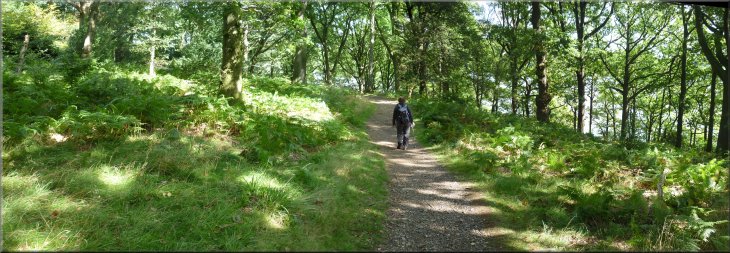
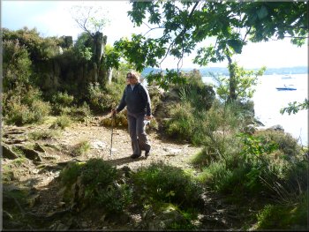
National trust permissive path through the woods to Watbarrow Point
|
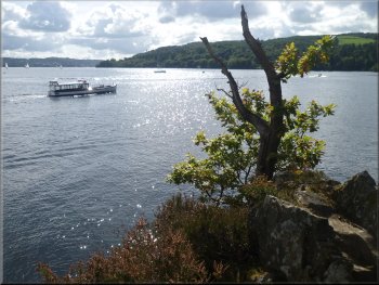
Windermere from Watbarrow Point
Leaving Watbarrow Point
Here we turned away
from the lake to follow a footpath alongside some iron railings climbing back up to the car park at Wray castle and the end of our walk. The whole
route had been 6km and it had taken us about two and a half hours to walk with numerous stops to admire the view and take far too many
photographs. |
This is a National Trust
permissive path leading down through the woods to Watbarrow Point. We stood on this rocky outcrop for a few minutes watching the pleasure boats
on the lake. At last we had to leave this lovely spot and continue along the path for another 400m to the corner of Low Wray Bay.
Windermere from Watbarrow Point
Path back up to Wray Castle car park
|
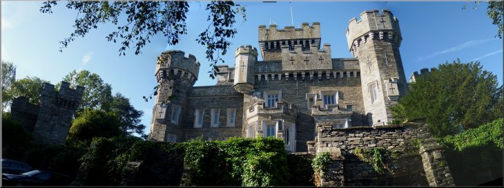
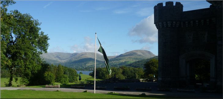
Wray Castle (a Victorian folly) seen from the car park
|