| 2001 walks | 2002
walks | 2003 walks | 2004
walks |
| 2005 walks | 2006
walks | 2007 walks | 2008
walks |
| 2009 walks | 2010
walks | 2011 walks | 2012 walks |
| 2013 walks | 2014 walks | 2015 walks | 2016 walks |
| 2017 walks | 2018 walks | 2019 walks |2020 walks |
| 2021 walks | 1993-2000 library | Find a Route Index |
| A few Routes to print out | Request a Route... |
Route No. 652 - Wednesday 14 December 2016
Hovingham, Fryton, Fryton Lane,
Ebor Way circuit - 8.5km
Howardian Hills, North Yorkshire . . .
Route map from Ordnance Survey
Open Space service.
Map: OS Explorer 300 Howardian Hills & Malton

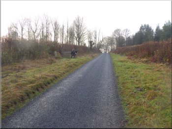
Setting off along the public footpath between the village hall car park on the right and the Malt Shovel pub on the left
|

Footpath past the Malt Shovel at Hovingham

Morning sun just breaking through the clouds

Track between the fields heading for Fryton Lane
We set off from the village hall car park along a footpath heading east between the car park and the Malt Shovel pub next door. We had managed an early start and as we followed the path along the edge of the fields the low winter sun was just breaking through the clouds. After about 2km along the field path, the second half is along the route of the long disused railway, we came to Fryton Lane at map ref. SE 688 756. |
This morning my wife and I drove to the village of Hovingham on the edge of the Howardian Hills. We parked at the village hall car park where there is an honesty box with a request of £1 for half a day and £2 for all day parking. If you are organising a group walk from there you can arrange to have the toilets opened at the village hall.

Footpath from Hovingham along the field edge

Over the footbridge the path turns left then right at the field corner

Track between the fields nearing Fryton Lane
|

Turning onto Fryton Lane heading for the village
|

Fryton Lane heading for the village

Leaving Fryton along Fryton Lane
From the mosaic we continued along Fryton Lane through the village and out to the B1257 Hovingham to Malton road. |
At Fryton Lane we turned right and walked along the lane into Fryton Village. There is a large mosaic depicting the village houses and a plaque giving details of the Fryton millennium walk.

Millennium mosaic in Fryton

Crossing the B1257 along Fryton Lane
|

The Millennium mosaic in Fryton
|

Looking back to Fryton along Fryton Lane
Seat on the route of Fryton millennium walk
Looking back along Fryton Lane the low lying land we had crossed from Hovingham was in bright sunshine but the North York Moors to the north we completely hidden in a dense bank of low cloud. |
We continued along Fryton Lane across the B1257 and up the hillside opposite to Fryton Wood at the top of the climb.

Following Fryton Lane up to Fryton Wood

Seat on the route of Fryton millennium walk
|

Sign post where the Centenary Way crossed the top of Fryton Lane
|

Farm access road down to High Baxtonhowe farm

Following the farm access road towards the farm
We were now following a bridleway along a farm track between the large fields with well established autumn sown cereal crops. After about 250m gently climbing along the farm track, we came to a field boundary at the top of the rise. |
The public road ends at the ridge in Fryton Wood and we continued along a farm access road down from the ridge towards High Baxtonhowe farm and about 100m before we reached the farm we turned right.

Farm access road between the fields to High Baxtonhowe farm

Turning right off the access road about 100m before the farm
|

From the top of the rise we followed the bridleway towards the two small ponds at map ref. SE 677 732
|

Following the bridleway along a farm track

Turning right onto the Ebor Way just beyond the ponds

Gate into the narrow field
Through the field gate at the far side of this field we came to a farm track between fences/hedges. (This farm track with a bridleway along it continues past Airyholme farm on the left for about 1km to Moor House Farm also on the left. At Moor House Farm there is a public footpath on the right following a farm track that climbs up through South Wood to rejoin the route of the Ebor Way at map ref. SE 666 742). |
From the top of the rise we followed the bridleway along the farm track down to two ponds and just beyond the ponds at map ref. SE 677 732 we turned right to follow the route of the Ebor Way along the field edge next to some woodland. After about 250m we passed through a field gate into a narrow field, less than 50m wide.

Farm track between the two ponds

Following the Ebor Way along the field edge

Leaving the narrow field on the Ebor Way
|
From this point the original route follows the Ebor Way back to Hovingham.
Click here for an alternative route that extends to walk by about 800m.
Below the route continues along the Ebor Way towards Hovingham:

Turning right off the farm track to continue along the Ebor Way
|

Muddy path with a small stream on the right

Nearing the edge of the wood

Gate out of the field to very wet grassland . . .
The path led us to a pedestrian gate out of the field into some very wet grassland on the fringe of the wood. We followed the footpath across a footbridge over a small stream and up a grassy slope to firmer ground with a splendid oak tree on our right. |
However as soon as we had left the narrow field we turned right off the farm track to continue along the Ebor Way. It was a muddy fenced path around the edge of the woodland with a small watercourse on the right. After about 350m the path emerged from the woodland to continue along the edge of a field.

Continuing along the muddy path through the wood

Path along the field edge next to the wood

. . . crossing the wet grassland to a footbridge
|

There was a splendid oak tree to the right of the path
|

Gate into the wood near the large oak tree

Following the Ebor Way along the forest tracks
We continued along the forest tracks still following the route of the Ebor Way which was well signed.
|
We followed the path through a gate to walk along a leaf covered track up through the wood. There was a squirrel's nest or 'drey' in the fork of a beech tree on our left.

Squirrel's nest (Drey) in a fork of a beech tree

Sign where the path from Moor House Farm joins the Ebor Way
|
If we had followed the alternative route this is where we would have re-joined the route of the Ebor Way back into Hovingham |

Following the forest tracks to the edge of the forestry
Then we followed a long straight track between the fields. About 700m from the edge of the forestry we came to a point in the track where we could see down the slope to Hovingham. |
We passed the junction where the path from Moor House Farm comes along a forest track to join the Ebor Way. We continued along the Ebor Way to the edge of the forestry.

Leaving the forestry along the Ebor Way
|

Following the Ebor Way along the track to the road above Hovingham
|

Joining the road above Hovingham

Joining the road through Hovingham
The whole route had been about 8.5km (a little over 9km if we had taken the route via Moor House Farm). Our route had taken me about two and a half hours to walk and after our walk we called at the bakery cafe by the ford in Hovingham for a very nice light lunch before returning home. |
We followed the track down to a minor road and walked about 100m down the road to a footpath on the left that led us down to the road through Hovingham. We walked along the path on the road side past a lovely oriel window in the primary school building. We crossed the road here back to the village hall car park and the end of our walk.

The footpath leading down the bank into Hovingham

Oriel window in the school at Hovingham
|

Walking back through Hovingham to the village Hall car park & the end of our walk
|
Alternative route that extends the walk by about 800m

Continuing along the grassy track past the point where the Ebor Way turns off to the right, map ref. SE 674 733
|

Passing Airyholme farm on our left

Farm access road between Airyholme & Moor House Farm

Moor House Farm
We followed the grassy access track past Airyholme farm on our left. Just beyond the farm the grassy track joins the farm access road and we continued along it for about 1.4km from Airyholme to Moor House Farm. |
A week after my wife & I walked this route from Hovingham, I did the walk again with my friend, Jim. This time, when we reached the point (map ref. SE 674 733) where the Ebor Way turns right off the farm access track just before Airyholme farm we kept straight on.

Joining the farm access road at Airyholme farm

Farm access road between Airyholme & Moor House Farm

Turning right off the farm access road at Moor House Farm
|

Public footpath across the field from Moor House Farm to the gate into South Wood
|

Gate from the field into South Wood

Climbing up through South Wood along an old sunken track
We followed a clear track up through the wood for about 400m and rejoined the Ebor Way at map ref. SE 666 741. From here we were back on the original route that I walked with my wife a week ago. |
Moor House Farm is on the left of the access road and we turned right opposite the farm to follow a public footpath heading across the field past an oak tree in the middle of the field to a gate into South Wood at map ref. SE 664 738.

Public footpath entering South Wood

Footpath along a forest track heading towards the Ebor Way
|

Re-joining the original route of the walk following the Ebor Way back into Hovingham
From this point re-join the original route and follow the Ebor Way into Hovingham |
