|
2001 walks |
2002
walks |
2003 walks |
2004
walks |
|
2005 walks |
2006
walks |
2007 walks |
2008
walks |
|
2009 walks |
2010
walks |
2011 walks |
2012 walks |
|
2013 walks |
2014 walks |
2015 walks |
2016 walks |
|
2017 walks |
2018 walks |
2019 walks |
2020 walks |
|
2021 walks |
1993-2000 library |
Find a Route Index |
|
A few Routes to print out |
Request a Route... |
Route No. 659 - Thursday 9 March 2017
Buck Stone La, Coppy La, Greystones La, Pole Rd,
Lund's Tower, Wainman's Pinnacle circuit - 9km
Cowling, South Pennines . . .
Route map from Ordnance Survey
Open Space service.
Map: OS Explorer OL21 South Pennines
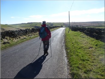
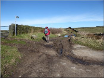
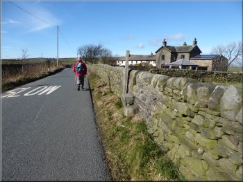
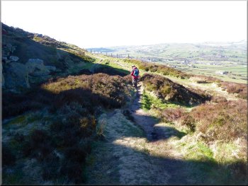
Setting off along the moorland path from Buck Stone Lane opposite the car park
|
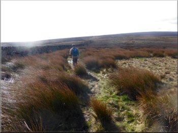
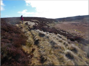
The path followed the wall across the moor
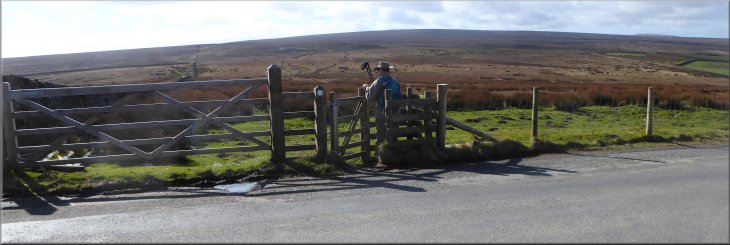
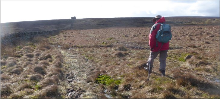
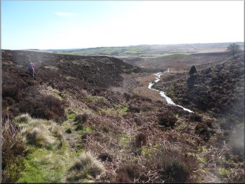
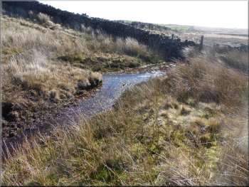
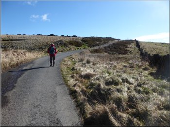
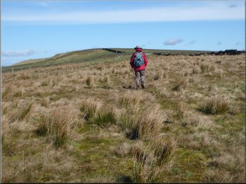
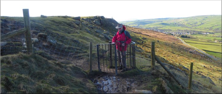
The gate took us on to a public footpath going across an area of open access land. The area is rough, very wet moorland. The path followed a wall a few metres on our left. There were several drainage channels at intervals crossing the path at right angles and after last week's rain and some overnight rain this week they were running full. We had a choice of wading across or a muddy detour in each case. After about 400m we came to another kissing gate in a stone wall. |
This week we have had a spell of settled fine weather with clear blue skies, bright sunshine and a cool breeze. So this morning my friend, Jim, and I drove to a little parking area off Buck Stone Lane at map ref. SD 985 425. The parking area is about 300m south of Wainman's Pinnacle on Earl Crag overlooking Cowling, about 9km south of Skipton. From the parking area we crossed Buck Stone Lane to a kissing gate opposite.
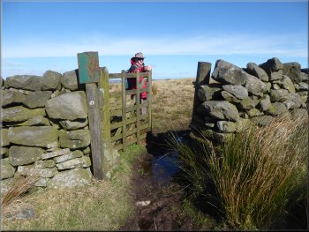
A boggy patch at the kissing gate
|
The path following the wall towards the Hitching Stone
|
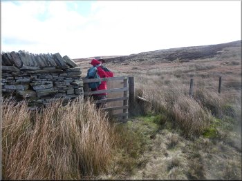
Turning left through the kissing gate in the wall
Path across the moor
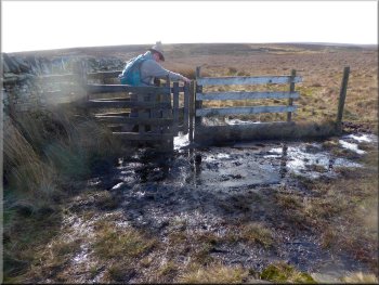
After about 600m we came to a stone step stile over a wall at map ref. SD 992 415. The first half of the path to this point is a bit hit and miss and a compass bearing is probably a good idea to stay on track. We had to keep north of a developing depressing in the moor which, by the time we reached the step stile, this depression had developed into a little valley with a small water course and much boggy land in the bottom. |
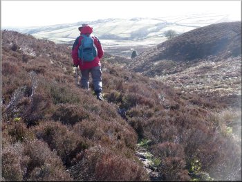
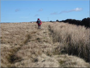
Through the gate we continued along the path next to a wall, passing a padlocked field gate on our left. After about 250m we came to another kissing gate in the wall on our left. Ahead of us at the top of the rise was a huge boulder called the Hitching Stone. We turned left through the kissing gate and followed the route of a public footpath across the rough wet boggy moorland through heather and coarse grass.
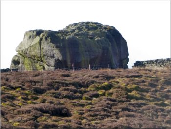
The Hitching Stone
Path above the boggy floor of the little valley on our right
|
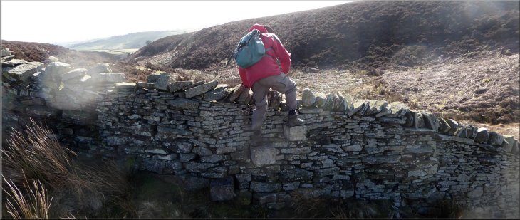
Stone step stile as we made our way along the little valley
|
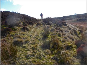
Following the narrow path along the little valley
Approaching the wall where we turned left

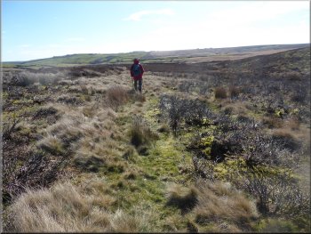
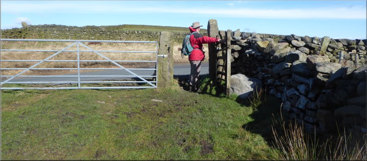
From our starting point at Buck Stone Lane to the road here, called Long Gate, we had walked about 1.8km across the open access moorland. I had found this hard going. Bog hopping is an energy sapping pastime with my old wonky knees and I was very glad to reach the road and some firm going for a while. |
Over the step stile the path followed the path running along the side of the little valley above the watercourse. After about 600m the path brought us to a stone wall at map ref. SD 997 411. Here we turned left and followed the wall for about 350m to a road at map ref. SE 000 411.
Following the narrow path along the little valley
Following the path by the wall across a boggy area
Heading for the road along the path by the wall
|
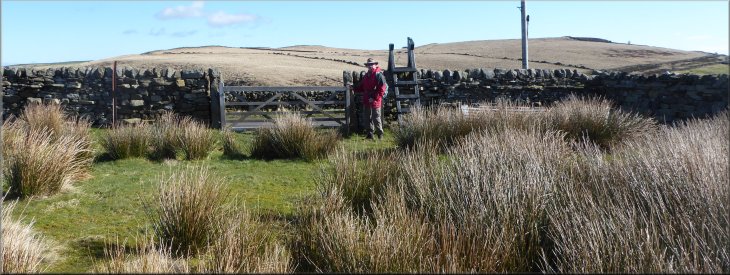
Gate & stile on to the road called Long Gate
|
Walking along Long Gate to the junction with Coppy Lane
Following Greystones Lane
Track over moorland to Pole Road
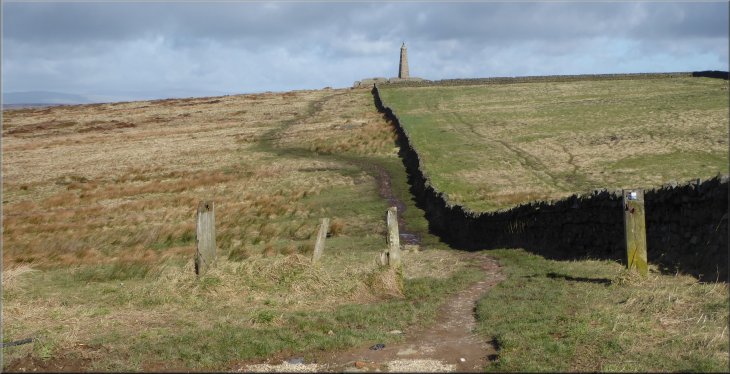
We continued along Greystones Lane round Grey Stones Hill to a sharp right hand bend where the lane again changes its name this time to Todley Hall Road. At this bend we kept straight on following a walled track around the edge of a small area of open access land to Pole Road at map ref. SE 014 416. |
At the road we turned right and walked along Long Gate for about 150m, then turned left to follow Coppy Lane down to a right hand bend in a small dip where the lane changed its name to Greystons Lane.
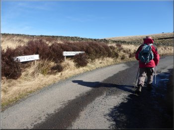
The bend where Coppy Lane becomes Greystones Lane
Turning off Greystones Lane along a track to Pole Road
Track over moorland to Pole Road
|
Turning left on to Pole Road from the track across some open access moorland
|
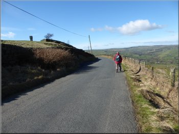
Following Pole Road towards Lund's Tower
Passing Hill Top Farm along Pole Road
After about 2km we came to the crossroads with Buck Stone Lane. Here we kept straight on along the road towards Lund's Tower. We continued along the road around a left hand bend with Lund's Tower above us on our left. |
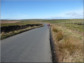
At Pole Road we turned left and walked along the road in the bright sunshine. There was not much traffic at all, although the occasional car did pass a bit too quickly for my liking.
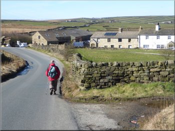
Passing High Pole Farm along Pole Road
Nearing Lund's Tower along the road
|
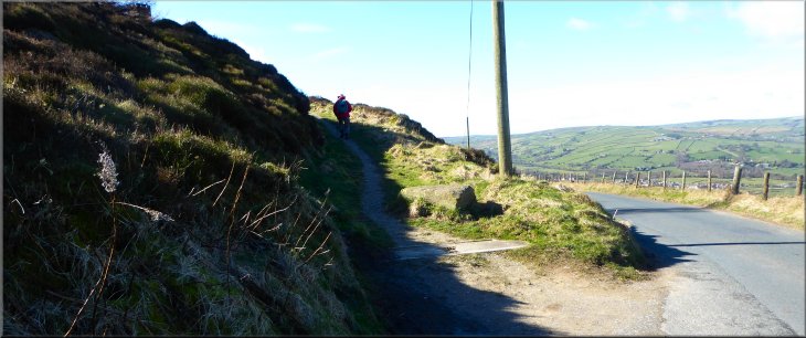
Turning left off the road to climb up to Lund's Tower
|
The path from the road up to Lund's Tower
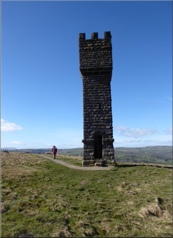
Doorway to the spiral staircase up Lund's Tower
|
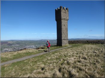
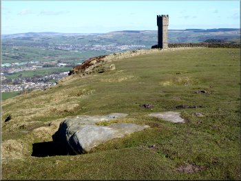
Just around the bend we turned left off the road and followed a public foot path up the hillside. We passed a few picnic tables with a lovely view but the picnic area was spoilt by an accumulation of litter. We climbed some steep steps to a path along the top of the escarpment that led us to the foot of Lund's Tower. There is a doorway into the tower where a narrow dark spiral staircase climbs to a viewing platform at the top of the tower. At the top of the spiral staircase there is a low stone slab and we had to duck under it to emerge on the viewing platform. There is Pendle Hill on the horizon to the west, the Yorkshire Three Peaks on the horizon to the north and Airedale to the north east at Cross Hills. We made our return to ground level down the rather precarious spiral staircase.
Approaching Lund's Tower
Looking out from the top of Lund's Tower
|
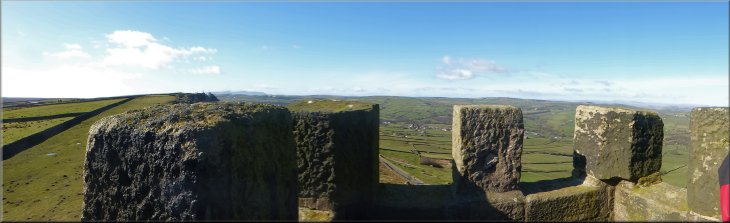
View north west from the top of Lund's Tower
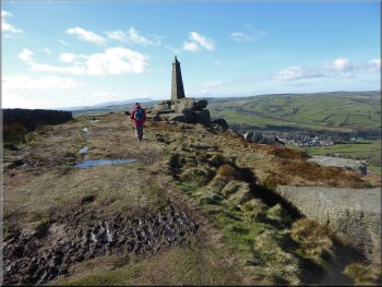
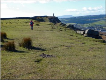
The path from Lund's Tower along the top of Earl Crag to Wainman's Pinnacle (the salt & pepper pots)
|
Looking back to Lund's Tower
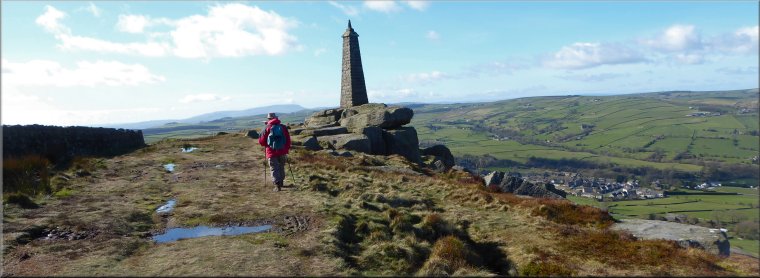
Nearing Wainman's Pinnacle
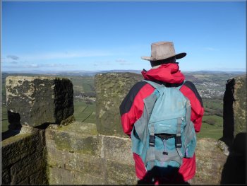
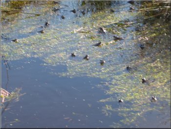
The origins of both monuments is unknown, but not free from speculation. We enjoyed the view from Wainman's Pinnacle and nearby we found a small pool full of frogs.
|
From the tower we followed the path along the top of Earl Crag for about 800m to Wainman's Pinnacle. Together Lund's Tower & Wainman's Pinnacle are known locally as the "salt & pepper pots".
Walking along the top of Earl Crag to Wainman's Pinnacle
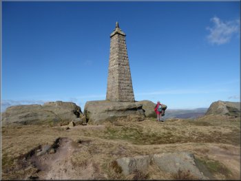
Wainman's Pinnacle on top of Earl Crag
|
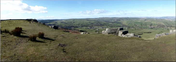
View from Earl Crag as we walked from Lund's Tower towards Wainman's Pinnacle
|
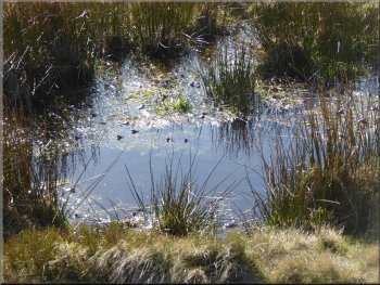
Frogs gathering to mate
The whole route had been just under 9km and it had taken me around three and a half hours to walk. Jim is very patient and keep waiting for me to catch up. |
I counted around 40 frogs intent on their spring mating ritual in the sunshine. From Wainman's Pinnacle we followed the path back to the parking area at Buck Stone Lane and the end of our walk.
Frogs gathering to mate
|
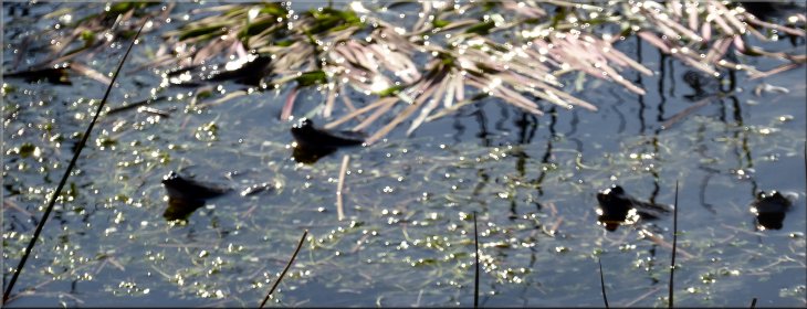
A few of the frogs we saw in a small moorland pool near Wainman's Pinnacle
Looking back to Wainman's Pinnacle from the car park at the end of our walk
|