|
2001 walks |
2002
walks |
2003 walks |
2004
walks |
|
2005 walks |
2006
walks |
2007 walks |
2008
walks |
|
2009 walks |
2010
walks |
2011 walks |
2012 walks |
|
2013 walks |
2014 walks |
2015 walks |
2016 walks |
|
2017 walks |
2018 walks |
2019 walks |
2020 walks |
|
2021 walks |
1993-2000 library |
Find a Route Index |
|
A few Routes to print out |
Request a Route... |
Route No. 669 - Thursday 27 April 2017
The Obelisk Walk (mostly the red route)
at Nostell Park, Nostell Priory - 4km
Wakefield, West Riding . . .
Route map from Ordnance Survey
Open Space service.
Map: OS Explorer 278 Sheffield & Barnsley
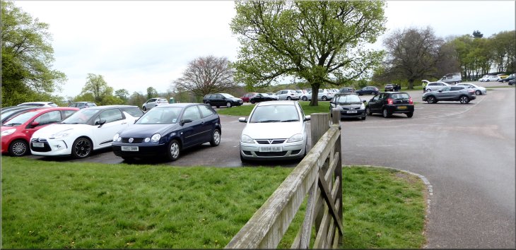
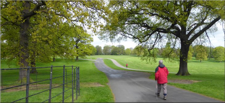
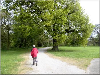
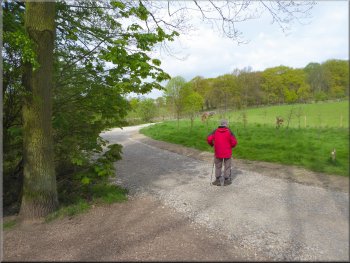
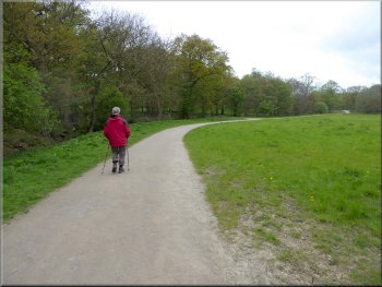
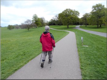
Our starting point at the Nostell Priory car park
|
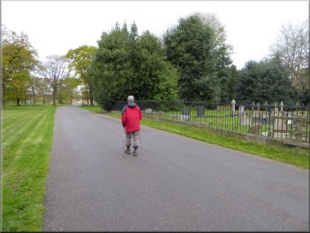
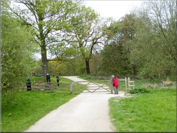
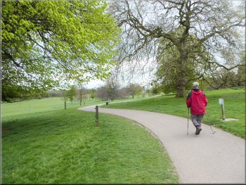
Passing the cemetery of Wragby Parish Church
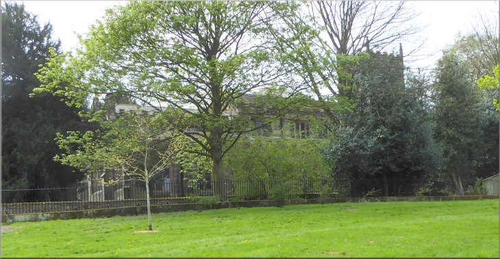
Parking costs £4 for the day but we had our National Trust membership badge so parking was free. From the car park we crossed the entrance drive and followed a road heading westwards past the Wragby Parish Church of St Michael & Our Lady, surrounded by trees on our right about 200m from the car park. There is a cemetery surrounding the church and just inside the entrance is a large patch of bluebells in full flower today. |
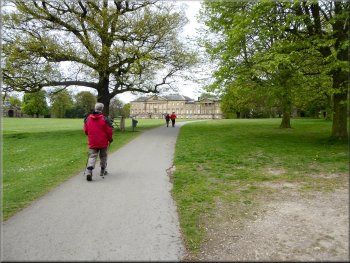
This morning my friend, Jim, and I drove to Nostell Priory, a National Trust property about 8km east of the centre of Wakefield. The entrance is off the A638 at map ref. SE 408 171. There is a large car park with a fine view across Nostell Park. On the OS map the parkland is marked as a Deer Park but the only deer here now are a few very elusive wild Roe Deer.
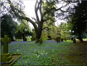
Bluebells in the churchyard at Wragby Parish Church
|
Following the parkland road towards the stable block
|
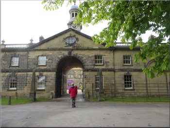
The entrance to the stable block
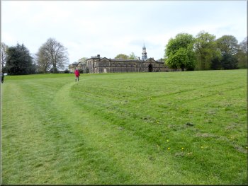
The Palladian Mansion at Nostell Priory
Path by the woodland edge leading to Boathouse Bridge
Just beyond the mansion we kept left off the road to follow a track along the edge of the woodland with a steep slope on our left down to the middle lake which we could just glimpse through the trees. There was a notice beside the track warning of bees flying across the track to gather nectar from the trees. The weather was bright, quite pleasant for a walk but it was cool and there was little or no bee activity when we passed their apiary. |
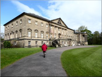
From the church entrance we continued along the road around the edge of the parkland for about 300m to the old stable block. The stable block is now the site of the ticket office, cafe, toilets, an exhibition and the entrance to the Priory gardens. From the stable block we continued along the road around the edge of the parkland and past the Palladian Mansion.

The courtyard cafe at the stable block
Keeping left off the parkland road to follow the woodland edge
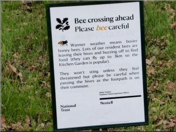
Beware low flying bees !
|
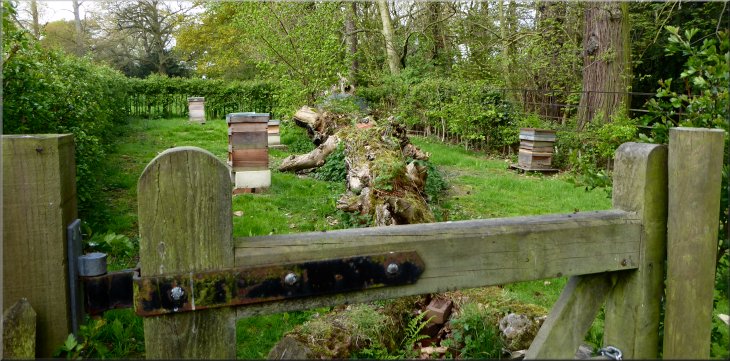
This apiary by the path is the source of the low flying bees
|
Heading down to Boathouse Bridge at the Lower Lake
Gravel road around the end of the Lower Lake
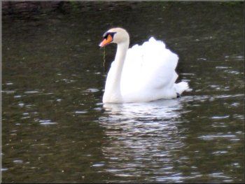
Male swan, cob, on guard duty, his mate, pen, is on their nest
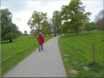
After about 150m we turned left off the gravel road to follow a wide path around the edge of the lake. It was a very pretty route with swathes of bluebells in the woods and wildfowl nesting by the lake. After about 350m the lakeside path rejoined a gravel parkland road. |
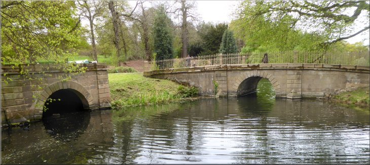
We followed the track down the slope to a parkland road at Boathouse Bridge at the end of the Lower Lake at map ref. SE 407 178. We crossed the bridge and continued along the gravel road around the Lower Lake.
Boathouse Bridge at the end of the Lower Lake
Start of the path along the edge of the Lower Lake
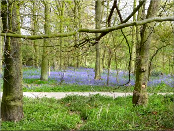
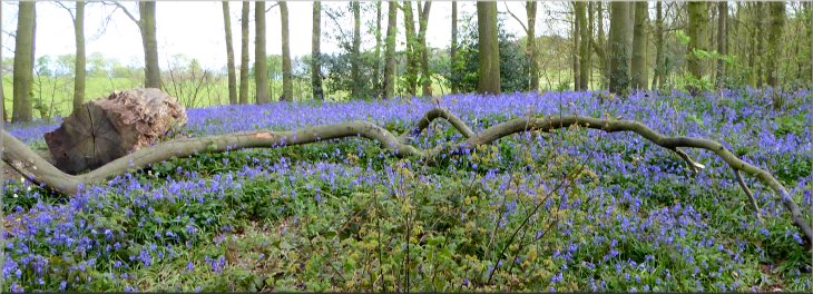
Bluebells in the woods by the Lower Lake
|
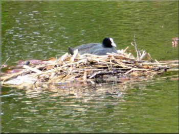
Coot nesting on the lake
|
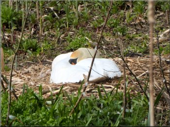
Swan's nest at the edge of the lake
|
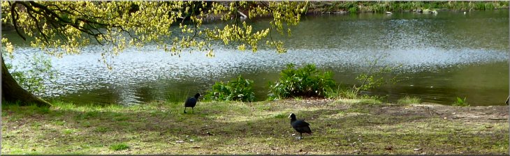
A pair of coots on the bank of the lake
|
Re-joining the gravel track from the lakeside path
Grassy path up the slope towards the Obelisk
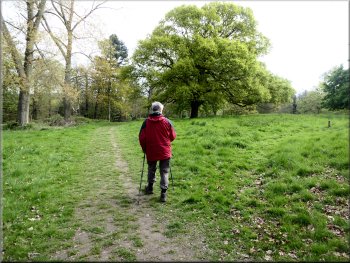
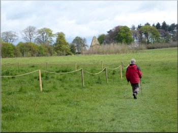
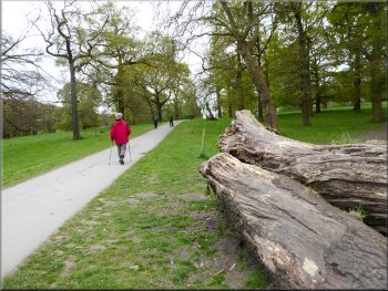
We followed this path for about 600m to a tall hedge at the top of the slope. At the hedge we turned right and continued along the grassy path towards the Obelisk. After about 250m we reached the Obelisk, a large triangular structure incorporating an arched gateway to the park. |
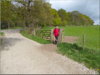
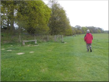
We turned left and walked along the gravel road for about 30m to a gate on our right. Here we turned off the gravel road to follow a path climbing up the slope along the edge of the grassland next to the woods.
Turning off the gravel track on to the path to the Obelisk
Path to the Obelisk by the hedge at the top of the slope
|
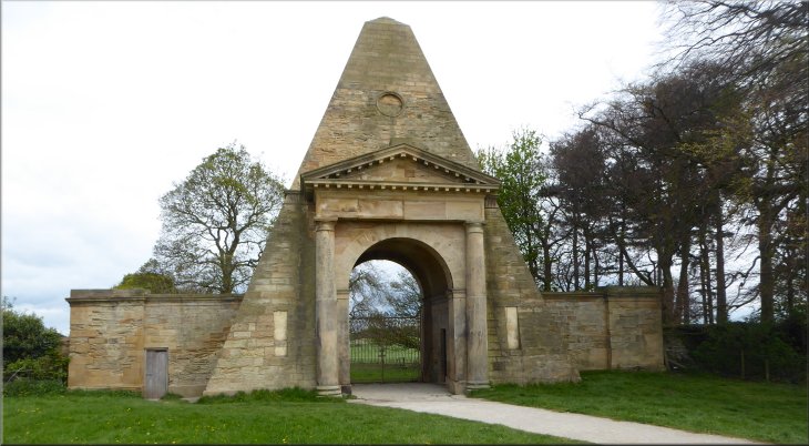
The Obelisk incorporating a gateway at the edge of the parkland
|
Path down the slope away from the Obelisk
There were some bench seats by the path and after about 1km we came down to another gravel parkland track next to Hardwick Beck at map ref. SE 411 178. |
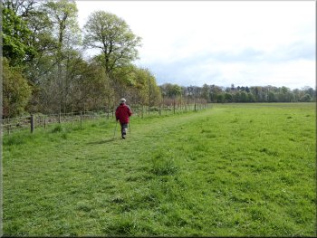
Just beyond the Obelisk the path turned right and followed the edge of the parkland next to a strip of woodland down the gentle slope with patches of bluebells amongst the trees.
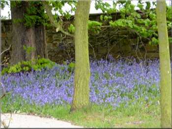
One of the patches of bluebells in the woods by the path
|
Turning on to the gravel track next to Hardwick Beck - the trees are along the bank of the beck
|
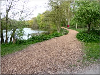
The path heading towards the Lower Lake
(Engine Lane runs around the edge of Nostell priory parkland from the village of Wragby) From these gates we walked along the track to some gates across the track at the eastern end of the Lower Lake. Ahead we could see the Boathouse Bridge. |
At this gravel track we turned right and followed it for about 250m by Hardwick Beck to a left hand bend. We continued along the track for another 100m to a right hand bend next to the wooden field gates where a track from Engine Lane joined our track.
Gate across the track just before we reached Boathouse Bridge
|
Boathouse Bridge at the eastern end of the Lower Lake - the boathouse entrance is the arch on the left
|
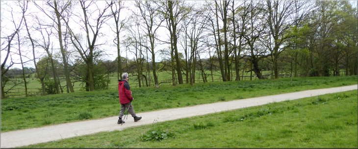
Road from Boathouse Bridge towards the mansion
We turned off the road to a mown path at the tree on the left
About 150m before we reached the mansion we turned left to follow a mown path across the grass back to the stable Block. We made our way into the stable block and had a coffee and a sandwich. |
Once we were through the gates we turned left and walked along a parkland road leading up towards the Palladian Mansion.
Parkland road to the mansion
Mown path across the park back to the Stable Block
|
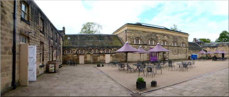
The courtyard cafe at the old stable block where we had a light lunch
|
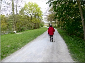
Parkland road to the car park from the old Stable Block
The whole walk had been about 4km and including our lunch break it had taken us about two and a half hours. (The Priory gardens are well worth a visit and they were open from 10.00am today) |
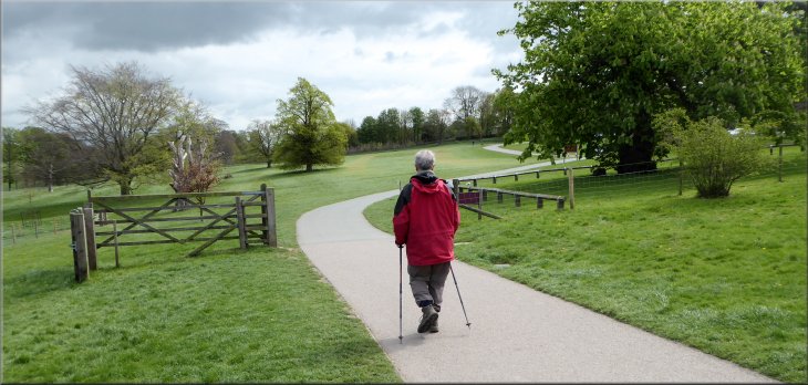
After our lunch break we returned to the car park following the parkland road to the north of Wragby Parish Church.
Parkland road to the car park from the old Stable Block
|
We passed the north side of Wragby Parish Church on the way back to the car park
|
Returning to the car park at the end of our walk
|