|
2001 walks |
2002
walks |
2003 walks |
2004
walks |
|
2005 walks |
2006
walks |
2007 walks |
2008
walks |
|
2009 walks |
2010
walks |
2011 walks |
2012 walks |
|
2013 walks |
2014 walks |
2015 walks |
2016 walks |
|
2017 walks |
2018 walks |
2019 walks |
2020 walks |
|
2021 walks |
1993-2000 library |
Find a Route Index |
|
A few Routes to print out |
Request a Route... |
Route No. 670 - Thursday 11 May 2017
Riccal Bridge, Riccal Dale, Low Tun Way,
Rea Garth Farm (NOT Reagarth Farm)
6km circuit - North York Moors . . .
Route map from Ordnance Survey
Open Space service.
Map: OS Explorer OL26 North York Moors Western area
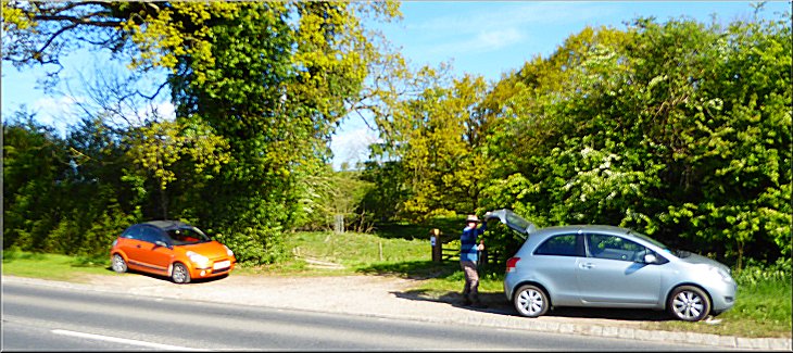
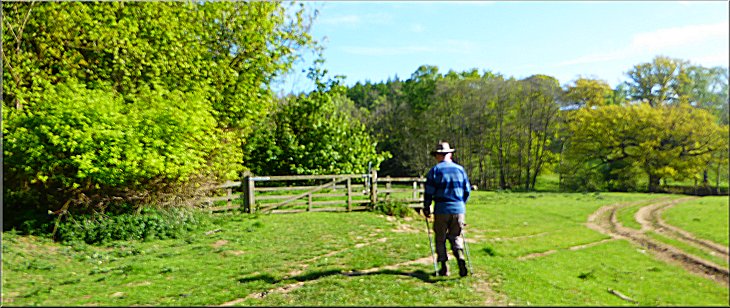
Our parking spot off the A170 at Riccal Bridge
|
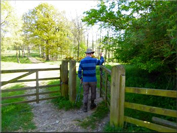
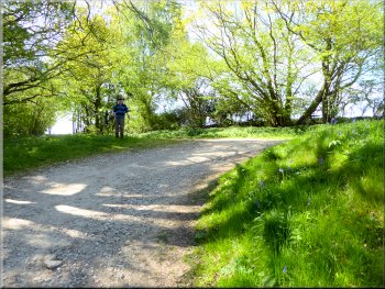
Setting off along the bridleway up Riccal Dale
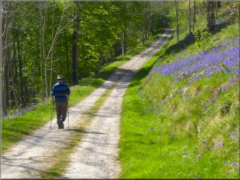
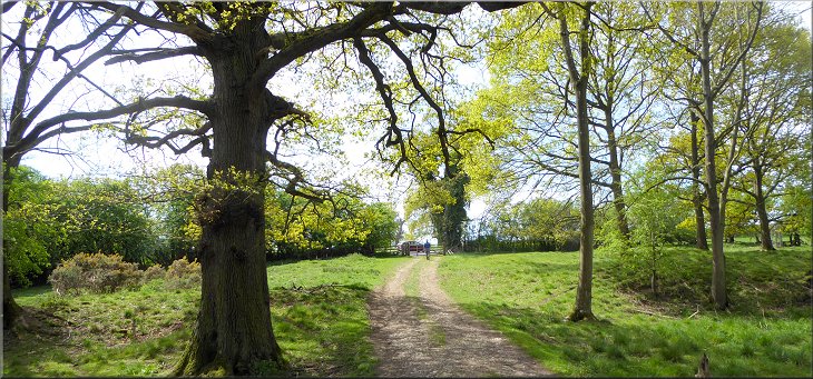
From our parking spot we walked through the gate on the north side of the road and followed the bridleway across the field heading northwards up Riccal Dale with the River Riccal away to our right. We passed felled tree on our left where a man was working with a chain saw reducing the fallen branches to firewood logs. |
This morning my neighbour, Jim, and I drove to Riccal Bridge on the A170 about 2km east of Helmsley market place. It's quite a busy road with fast moving traffic. We parked on the road side grass verge about 50m west of Riccal Bridge where a public bridleway from Riccal Dale joins the road at map ref. SE 631 841.
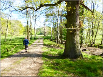
Following the path across the fields to the woodland
|
Gate from the field path in to the woodland
|
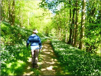
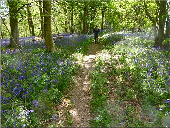
Track through the wild garlic up Riccal Dale
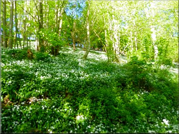
As we made our way along the track the valley side on our left was covered with the green foliage and white flowers of wild garlic (also known as ramsons). The air was full of their scent and the sheer profusion of them was truly amazing. There great swathes of wild garlic continued along the valley for about a mile. |
Just beyond this felled tree there was a gate into the wooded valley of Riccal Dale. The river bed was much closer to the forest track now but it was bone dry ! Sections of the River Riccal often run dry where the main flow of water is underground and the surface river only flows after heavy rain.
The air was full of the scent of wild garlic
|
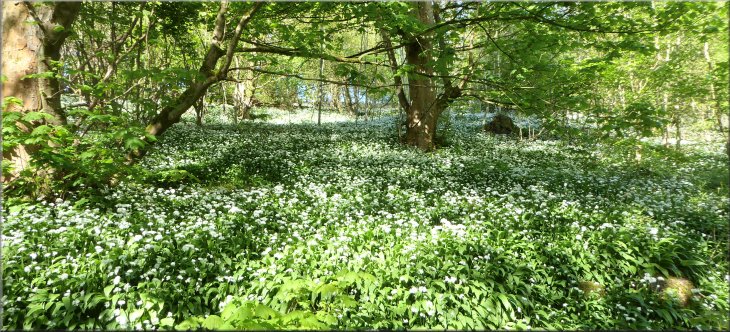
The whole valley side here was covered in wild garlic (ramsons)
|
|

Upstream the River Riccal with a good flow . . .
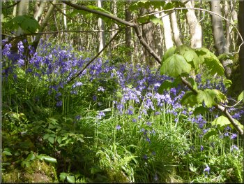
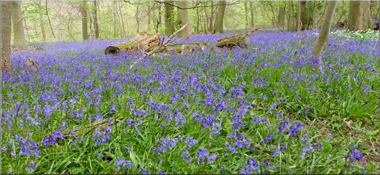
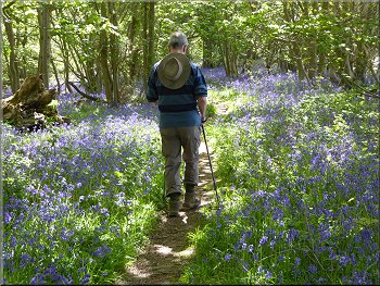
Bluebells on the valley side above the track
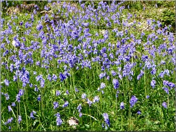
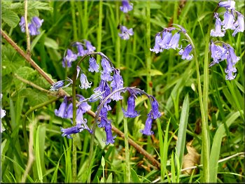
The bluebells were just as prolific and covered the valley side and valley bottom as we progressed northwards. There were large pheasant rearing pens along the valley bottom but no pheasants in them yet. |
Below us on our right we noticed the point where the flow in the River Riccal just disappeared into the gravel bed, but upstream there was a substantial flow. There were occasional bluebells amongst the wild garlic and, as the garlic petered out along the valley, the bluebells took over.
Bluebells on the valley side above the track

. . . downstream all the flow has disappeared underground
|
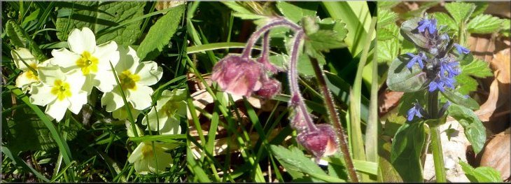
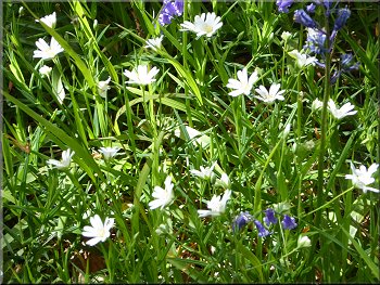
Primroses . . . . . . . . . . . . . . . . . . . . . . . . . . . . . . . Water Aven . . . . . . . . . . . . . . . . . . . . . . . . . . . . . . . . Ground Ivy
Wild flowers on the grassy margins of the forest track
|
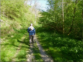
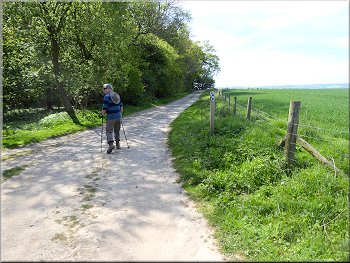
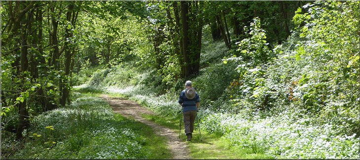
Following the track northwards along Riccal Dale
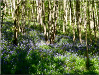
Bluebells in the dappled sunlight under the trees
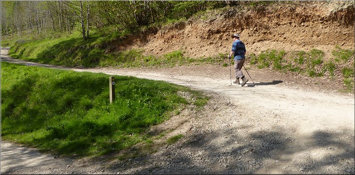
After about 3km from our parking spot we came to a turning doubling back on our left and climbing steeply up the hillside. On the OS Explorer map this track is called Low Tun Way and at map ref. SE 620 870 we turned sharp left and began to climb up towards the rim of the valley. |
There were small groups of many other spring woodland flowers in the grassy margins of the track that we were following along the valley. We continued along the track past a wooden hut which I believe is used by shooting parties in the winter pheasant shooting season.
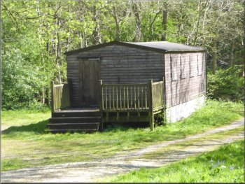
Shooters' hut in the valley bottom
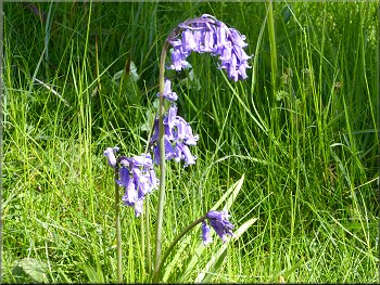
A lovely example of a native English Bluebell
|
Doubling back to start the climb up from the valley bottom
|
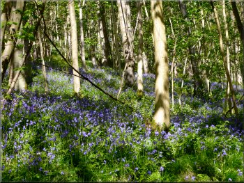
Bluebells everywhere as we climbed up the hillside
Bluebells everywhere as we climbed up the hillside
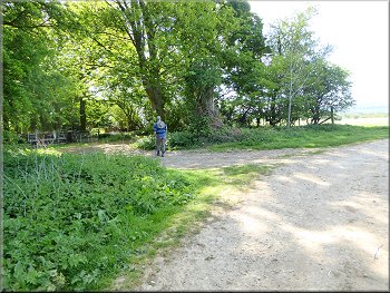
Following the track between the wood and the fields
The woodland in Riccal Dale contains large swathes of the ground cover plants that indicate that the land has been woodland for an unbroken period of many centuries. These indicator plants are the wild garlic (ramsons), bluebells, dogs mercury and smaller amounts of wood anemones and primroses. |
There were lovely areas of bluebells by the track as we climbed up the hillside. At the top of the climb we had reached the edge of the woodland where the land is relatively flat and used for agriculture. We followed the track, now heading southwards, along the boundary of the woodland and the agricultural fields.
Bluebells everywhere as we climbed up the hillside
The top of the climb up the valley side

Bluebells & dog's mercury together
|
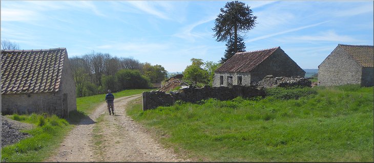
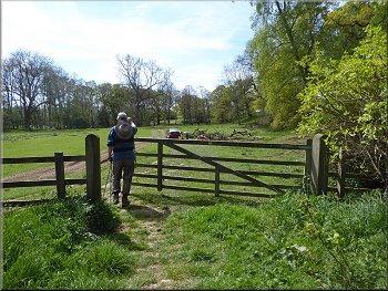
Passing through Rea Garth Farm
|
Following the track between the wood and the fields
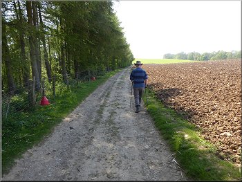
We continued along the track for about 600m from Rae Garth Farm to a bend in the track at map ref. SE 626 852. At this bend we turned left off the track to follow a public footpath through the woodland. |
We followed track southwards and passed a ruined farm house and numerous farm buildings named on the OS Explorer map as Rae Garth Farm (not to be confused with Raegarth Farm about 1km further south).
Leaving the track for a footpath along the top edge of the wood
|
Leaving the track for a footpath along the top edge of the wood
|
English bluebells by the path
Baling machine just releasing another bale of grass
Stitchwort with a few bluebells by the path
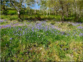
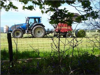
We were amazed at the continuing array of bluebells as far as we could see. Through the trees on our right we could see a round bailer working the field where a crop of grass had been cut and was now being bailed. |
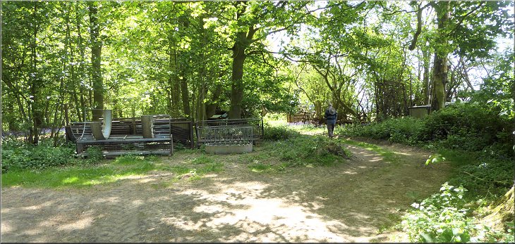
The woodland floor here is covered in bluebells but this lovely spectacle is spoilt somewhat by an array of farm surplus materials and equipment that is stored here. After about 100m we had left the farm storage area behind.
Path through the bluebells
Path through the bluebells

Wood anemones by the path
|
Woodland track retracing our outward route through the wild garlic back to the A170
|
Gate from the woodland track to the field path
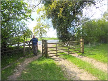
Gate on to the A170 at the end of our walk
We turned right at the track to retrace our outward route back to the A170 and our car at the end of our walk. The whole route had been 6km and it had taken us a little over two hours to walk including many pauses to enjoy the wonderful display of wild flowers. |
After about 600m along the woodland footpath, the footpath turned down the hillside and after another 150m we re-joined the track in the bottom of the valley at map ref. SE 631 846. This is the track that we had used on our outward route.
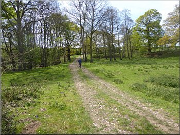
Bridleway across the fields back towards the A170
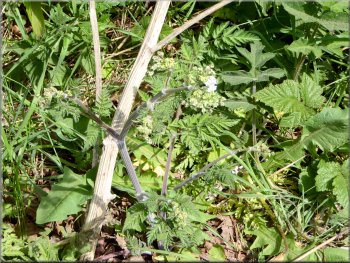
This year's new shoots on a hemlock plant with last year's dried stem laying behind - highly poisonous
|
Crossing the last field to the gate on to the A170 at Riccal Bridge and the end of our walk
|

A variety of speedwell by the path. Each flower is on its own delicate stem so it's probably "Slender Speedwell"
|

A variety of St John's-wort by the path.
I think this variety is called "Trailing St. John's-wort"
|