|
2001 walks |
2002
walks |
2003 walks |
2004
walks |
|
2005 walks |
2006
walks |
2007 walks |
2008
walks |
|
2009 walks |
2010
walks |
2011 walks |
2012 walks |
|
2013 walks |
2014 walks |
2015 walks |
2016 walks |
|
2017 walks |
2018 walks |
2019 walks |
2020 walks |
|
2021 walks |
1993-2000 library |
Find a Route Index |
|
A few Routes to print out |
Request a Route... |
Route No. 681 - Thursday 3 August 2017
Runswick Bay, Cleveland Way, permissive path
along disused coastal railway bed - 6km circuit
Yorkshire Coast . . .
Route map from Ordnance Survey
Open Space service.
Map: OS Explorer OL27 North York Moors Eastern area
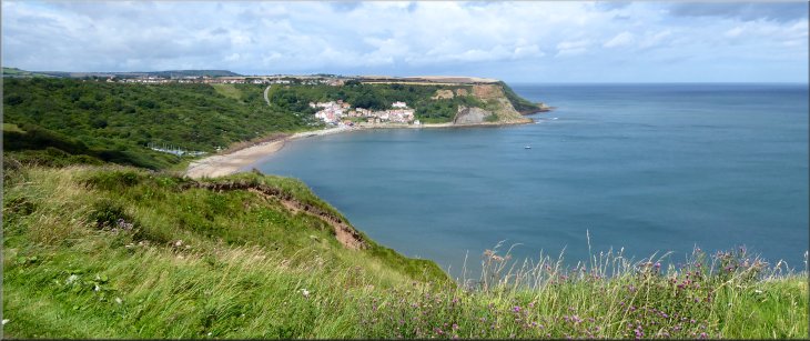
Looking across Runswick Bay from the view point at the end of Bank Top Lane
|
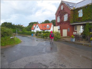
Bank Top Lane from the car park passing the Cliffemount Hotel
Steep descent to Runswick Bay & the beach
Then we turned around and walked along the Bank Top Lane past the car park and the Cliffemount Hotel for about 250m to a road junction where we took a sharp left turn to head down the very steep hill into Runswick Bay village and another car park near the bottom of the hill. We followed the road down to the beach where some very large rocks have been placed to limit erosion by the sea. |
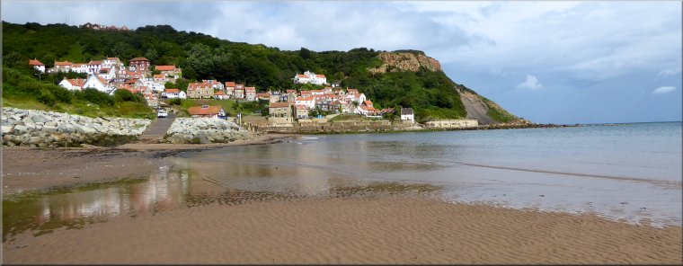
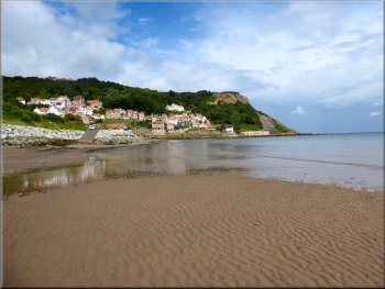
This morning my friend, Jim, and I drove out to Runswick Bay on the Yorkshire Coast. We parked on the cliff top at a large public 'Pay & Display' car park off Bank Top Lane opposite the Cliffemount Hotel at map ref. NZ 808 161. At the car park entrance/exit we turned right and walked about 20m to the seats at the viewpoint overlooking Runswick Bay.
Turn to the beach, junction of Bank Top Lane & Ellerby Lane
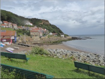
Runswick Bay
|
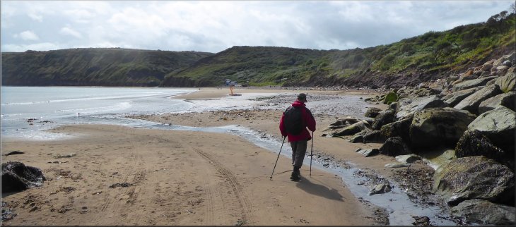
Crossing Nettle Dale Beck as we set off along the beach
|
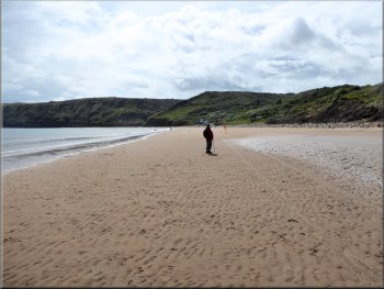
Crossing Runswick Sands
Nearing Claymore Beck to turn right on the Cleveland Way
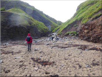
After about 1km along the beach from the village we came to another small watercourse called Claymore Beck flowing on to the beach at map ref. NZ 815 154 from another of the Barnby Dales. |
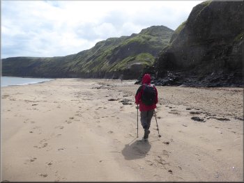
We turned right and walked along the beach. We crossed the small watercourse called Nettledale Beck flowing on to the beach from Nettle Dale and another called Limekiln Beck flowing from Dunsley Dale. Then we crossed Calais Beck flowing from one of the Barnby Dales.
Looking back to the village of Runswick Bay
About to follow the bed of Claymore Beck
|
Rocky steps & handrail as we followed the Cleveland Way along the bed of Claymore Beck
|
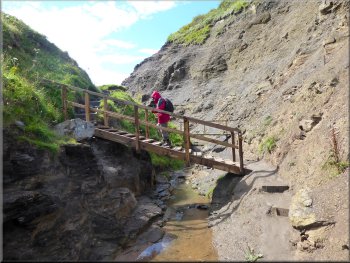
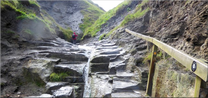
Footbridge across Claymore Beck
Short bit of the climb without steps
Even with his strimmer he was making faster progress than me up the hillside. At the top of the climb the workman was out of sight but the neatly trimmed path was evidence of his presence. There is a well placed seat at the top of the steps where we sat for a drink and to admire the view back across Runswick Bay. The weather forecast had promised us heavy thundery showers today and it was raining as we set off but this shower soon stopped and though there were some threatening clouds and just a few spots of rain we had no more showers all day.
|
This is where the Cleveland Way turns off the beach and follows the right hand side of the rocky bed of the watercourse for about 100m along the bottom of the steep sided little valley. There are some rough steps with a handrail to aid progress along the stream bed and then a wooden footbridge to cross the stream. Across the stream the steps begin. There are lots of steps climbing around 85m up the hillside in little more than about 200m. Yes it's steep! A council workman was busy with an industrial sized strimmer cutting the rampant summer growth back along the sides of the path.
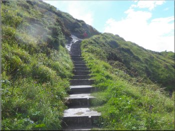
Cleveland Way steps up from Claymore Beck
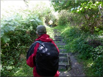
Workman ahead cutting back the folliage
|
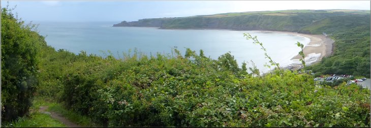
View from the top of the climb looking back across Runswick Bay
|
Turning right off the Cleveland Way to the railway path
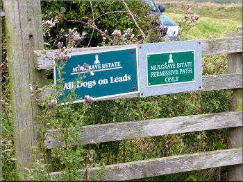
Markers for the permissive path
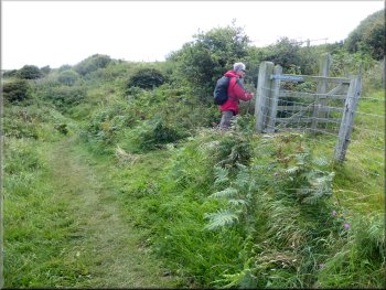
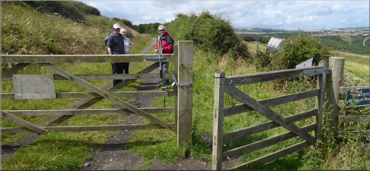
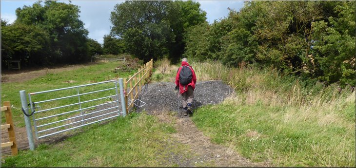
The path leads to the bed of the disused coastal railway about 25m away. We crossed the field to the railway where there are gates across it. There is a permissive path along the railway for about 3.3km to the road at map ref. NZ 803 156. We opened the gate and set off along the railway path. |
Refreshed by a drink, the view and a few minutes on the seat we set off again following the Cleveland Way path along the cliff tops. After about 400m we came to a pedestrian gate into the field on our right. There is a permissive path here across the corner of the field.
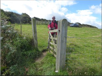
Permissive path across the field to the railway path
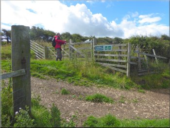
Gates on to the railway path
|
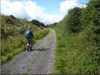
Remarking on the fine weather as we set off along the railway path
|
Plenty of wild flowers along the railway cuttings
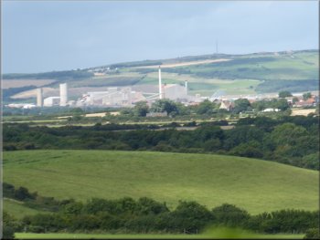
A distant view of Boulby Potash Mine
Continuing along the railway path to Ellerby Crossing Cottage
We continued to Ellerby Crossing Cottage at map ref. NZ 807 151. Here the wide track along the railway bed turned left to become Coverdale Lane. Our route was straight on continuing along a narrow somewhat overgrown footpath along the old railway bed. |
There were the usual array of lovely summer flowers along the railway with harebells, cranesbill, meadowsweet, willowherb and many others. We passed under several bridges carrying farm access tracks across the railway.
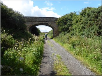
One of the bridges carrying a farm track over the railway
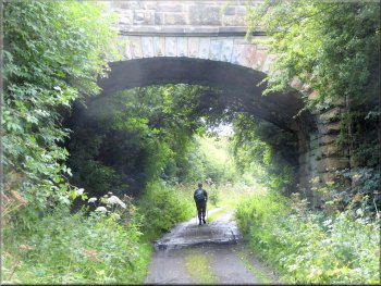
Another farm track crossing the railway
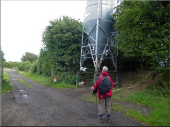
Animal feed silo by the railway path
|
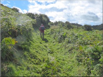
From Ellerby Crossing Cottage an overgrown path continued straight ahead along the old railway bed
|
Looking back past Ellerby Crossing Cottage at Coverdale Lane
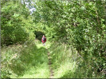
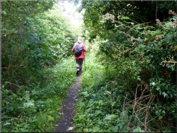
Footpath along the railway through the folliage
Nearing Ellerby Lane along the footpath along the railway
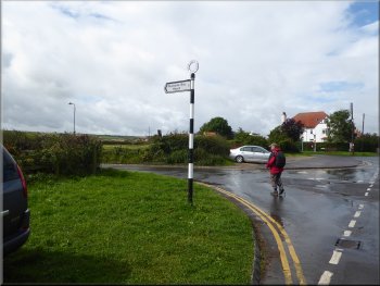
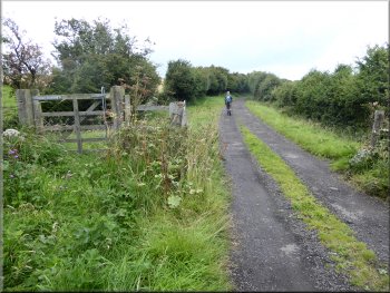
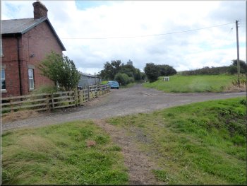
Ellerby Lane at Runswick Bank Top
Here we had turned down to the village & the beach at the start of our walk. From this junction we retraced our steps back along Bank Top Lane to the Cliffemount Hotel and the car park at the end of our walk. The whole route had been a little over 6km and it had taken us about two and a half hours to walk it.
|
We followed the footpath through the folliage along the old railway bed for about 500m to the road called Ellerby Lane. At the road we turned right and walked along Ellerby Lane back towards Runswick Bay. After about 400m along the road we came to a road junction.
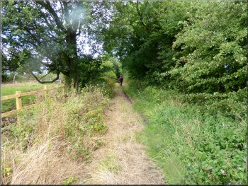
Footpath along the railway through the folliage
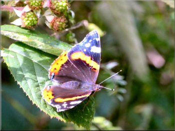
One of several red admiral butterflies by the path
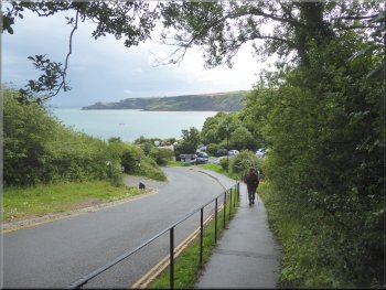
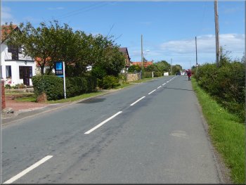
Following Ellerby Lane towards Runswick Bay
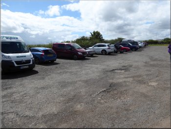
The car park off Bank Top Lane & the end of our walk
|
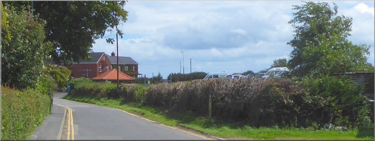
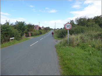
Bank Top Lane approaching the Cliffemount Hotel and the public car park at the end of our walk
|