|
2001 walks |
2002
walks |
2003 walks |
2004
walks |
|
2005 walks |
2006
walks |
2007 walks |
2008
walks |
|
2009 walks |
2010
walks |
2011 walks |
2012 walks |
|
2013 walks |
2014 walks |
2015 walks |
2016 walks |
|
2017 walks |
2018 walks |
2019 walks |
2020 walks |
|
2021 walks |
1993-2000 library |
Find a Route Index |
|
A few Routes to print out |
Request a Route... |
Route No. 739 - Thursday 6 September 2018
Humphrey Head circuit - 5km
Grange-over-Sands,
Morecambe Bay . . .
Route map from Ordnance Survey
Open Space service.
Map: OS Explorer OL7 The English Lakes South Eastern area
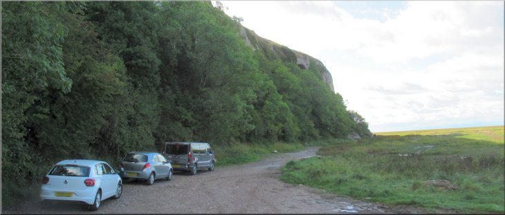
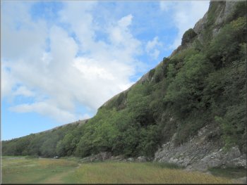
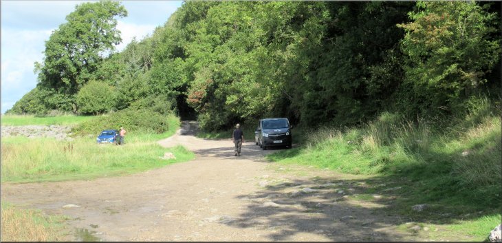
Our parking spot at the end of the road next to the limestone cliff of Humphrey Head
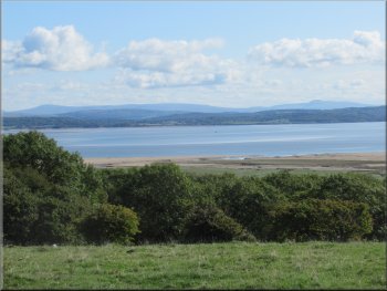
My friend, Jim, and I are having a few days walking in the Lake District staying at a pub in the centre of Coniston. Yesterday, Tuesday, we made our first visit to the National Nature Reserve at Sandscale Haws on the coast near Ulverston. An interesting National Trust site that I intend to visit again before too long. Yesterday, Wednesday, we explored the copper mining valley from Coniston, route 738, and today we are having a look at the limestone peninsular of Humphrey Head south of Grange-over-Sands before our drive home. |

|
|
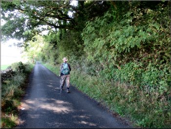
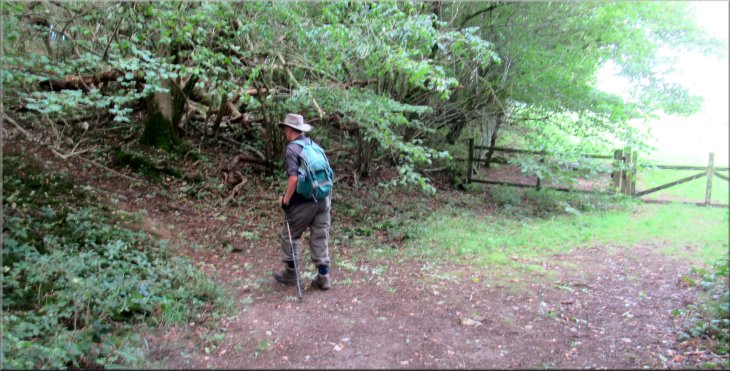
Setting off along the road from our parking spot
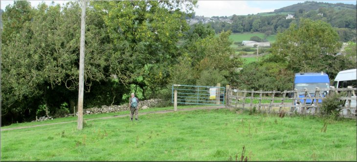
After about 700m we came to a turning on our right along the access road up to the Humphrey Head Outdoor Education Centre.
At the gate to the centre we turned right and walked across the field with the outdoor centre fence on our left. |
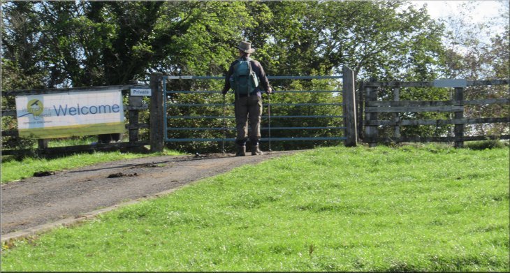
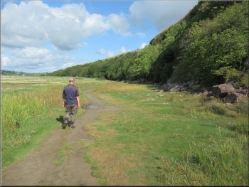
We parked at the west side of Humphrey Head at the end of the public road, map ref. SD 390 740, where there is plenty of room off the road. From here we set off walking back along the public road
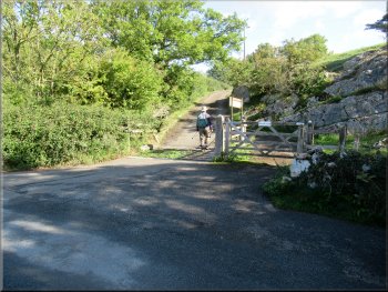
Turning right off the road towards the outdoor centre
|
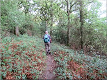
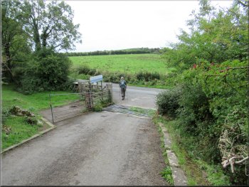
Just before this gate we turned right off the access road on a path across the fields
|
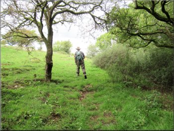
Path next to the boundary fence of the outdoor centre
Kissing gate into the next field
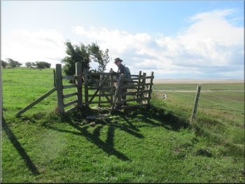
There was a small herd of dairy cattle laying by the trig point chewing the cud so to avoid disturbing them we diverted around the cattle. |
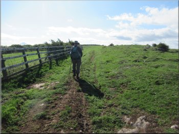
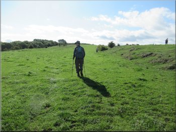
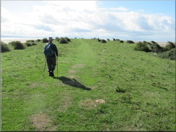
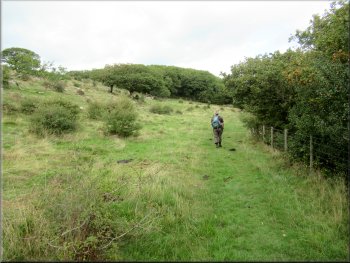
Where the fence turned left we kept straight on near the right hand side of the field. We continued across the fields heading generally southwards to the trig point at map ref. SD 391 738.
Crossing the fields near the right hand side of the peninsular
Following a grassy track along the headland
|
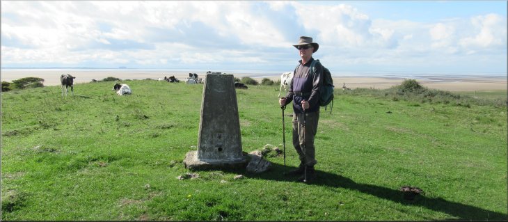
Trig point near the end of the headland
|
Dairy cattle chewing the cud by the trig point
Heading down towards Humphrey Head Point
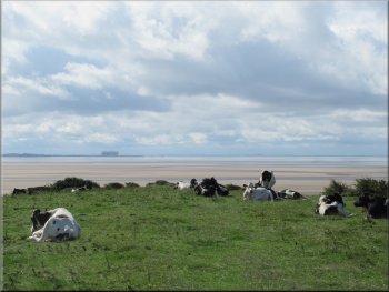
From the kissing gate, in the distance over Morecambe Bay, we could see the dark rectangular shape of Heysham Nuclear Power Station in the haze. |
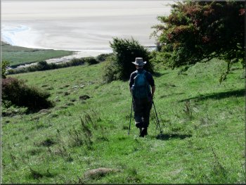
We walked around the cattle without disturbing them and then we followed a grassy track down to a kissing gate looking out over Humphrey Head Point.
View across Morecambe Bay to Silverdales
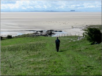
Heading down towards Humphrey Head Point
|
Looking out across the expanse of Morecambe Bay from Humphrey Head Point
|
Path from the kissing gate round the outside of the fence
Path across the field next to the fence on the right
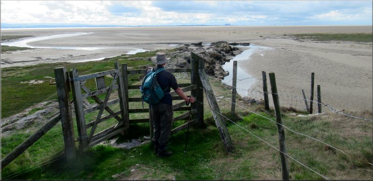
After about 250m there was a ladder stile on our left back into the field. We crossed the stile and continued along the edge of the field keeping the fence on our right. After another 250m we came to another kissing gate at the edge of some woodland. |
We went through the kissing gate and turned sharp left to walk around the outside of the fence with a great view over the vast expanse of Morecambe Bay at low water.
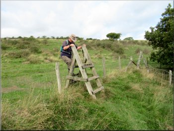
Ladder stile back into the field
Path across the field next to the fence on the right
|
Kissing gate from the field path into Humphrey Head Wood
|
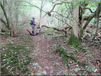
Clear path through Humphrey Head Wood
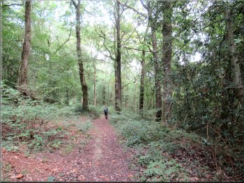
Clear path through Humphrey Head Wood
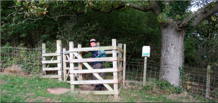
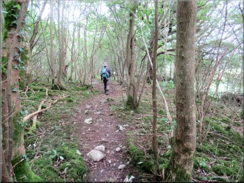
We followed the path through the woods for about 700m until we came to a gate ahead out into a field. A few metres before the gate we turned left along a path up the hillside. |
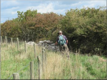
We passed through the kissing gate and followed a clear path along the bottom edge of the wood with a view across the bay to the wooded hillside of Arnside Knott and Silverdale. See route no. 671
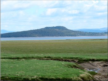
The wooded hill of Arnside Knott seen across the bay
Clear path through Humphrey Head Wood
|
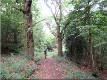
Just before the gate to the fields we turned left to climb straight up the wooded hillside
|
Path up the hillside to the top of the wood
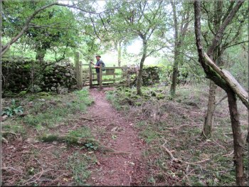
Kissing gate into the fields on top of the peninsular
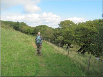
We headed across the field to re-join the route we had used on our way out to the trig point. We walked along side the fence of the outdoor centre back to the access road to the centre. |
The path became clearer as we climbed the slope for about 150m to a kissing gate through the wall at the top edge of the wood. We passed through the kissing gate into the field.
Path up the hillside to the top of the wood
Climbing across the field to the path by the outdoor centre
|
Turning left away from the outdoor centre at the access road
|
Turning left from the access road on to the public road
Looking back to our parking spot next to Humphrey Head
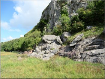
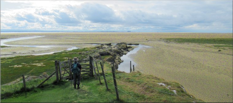
Are these the remains of the 'Natural Arch' noted on the map?
After about 300m we turned back and retraced our steps to the car. The whole walk had been a little under 5km and it had taken us around two hours to walk it with plenty of time for photos and admiring the views over Morecambe Bay. It had been our final treat before the long drive home. |
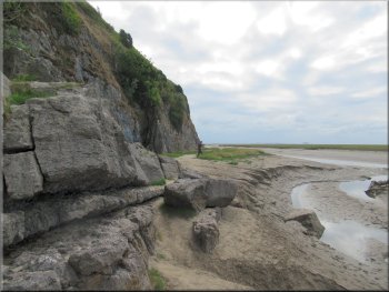
At the access road we turned left and walked down the access road to the public road at the bottom of the slope. At the road we turned left and walked along the road back to our parking spot. We left our rucksacks in the car and walked along the path at the foot of the limestone cliff of the headland.

Following the road back to our parking spot
We turned back here to return to the car
Heading back to the car next to the Humphrey Head cliff
|
Returning to the car at the end of the public road next to Humphrey Head
|