|
2001 walks |
2002
walks |
2003 walks |
2004
walks |
|
2005 walks |
2006
walks |
2007 walks |
2008
walks |
|
2009 walks |
2010
walks |
2011 walks |
2012 walks |
|
2013 walks |
2014 walks |
2015 walks |
2016 walks |
|
2017 walks |
2018 walks |
2019 walks |
2020 walks |
|
2021 walks |
1993-2000 library |
Find a Route Index |
|
A few Routes to print out |
Request a Route... |
Route No. 785 - Thursday 22 August 2019
Moor Gate, Ladhill Beck, Moorland Track,
Ladhill Beck, Hawnby Moor circuit - 6km
North York Moors . . .
Route map from Ordnance Survey
Open Space service.
Map: OS Explorer OL26 North York Moors Western area
Note: Most of this route is on open access land which may be closed for a few days each year for grouse shooting, land management and public safety reasons etc. See Natural England web site to check for any closures.

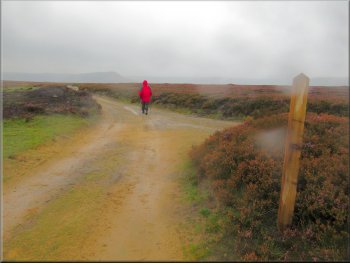
Our starting point at the little gravel car park at Moor Gate near Hawnby
|

|
|
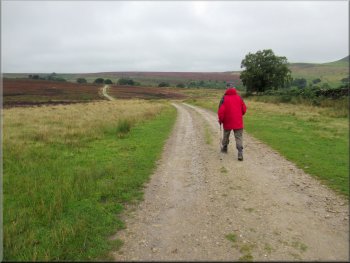
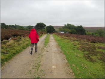
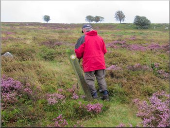
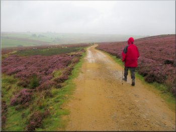
The stony track from the car park towards Sportsman‘s Hall
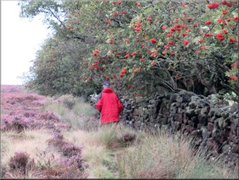
It was not the best of weather for a walk but it was still good to be out in the open moorland scenery even if we did get pretty wet in the process. From the car park we took the stony track heading towards Sportsman‘s Hall. After about 400m we came to a gate across the track at the boundary of the open access land. We turned left here off the stony access track to follow a public footpath along the boundary of the open access land. |
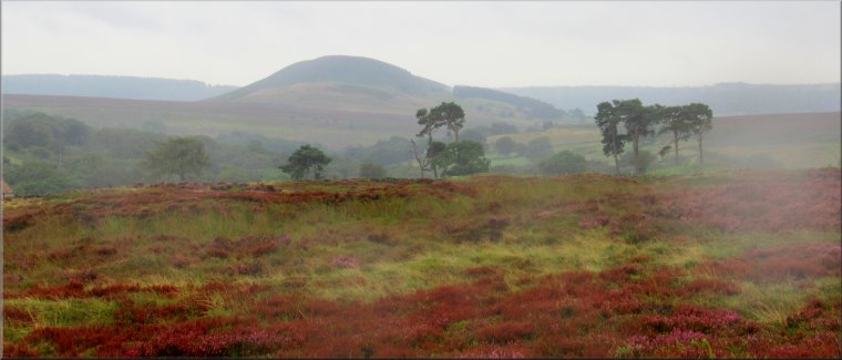
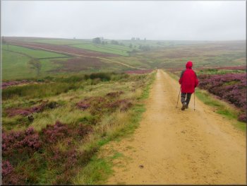
The weather forecast for today was poor everywhere locally. My friend Jim and I drove out through the village of Hawnby to Moor Gate where there is a cattle grid in the road as the road enters the open moorland at the foot of Hawnby Hill. Just over the cattle grid we turned right and parked in a little gravel parking area off the road at map ref. SE 540 917. At the car park we were just below the bottom of the heavy cloud cover and our route would take us up into the cloud and the wind blown drizzle.
The stony track from the car park towards Sportsman‘s Hall
|
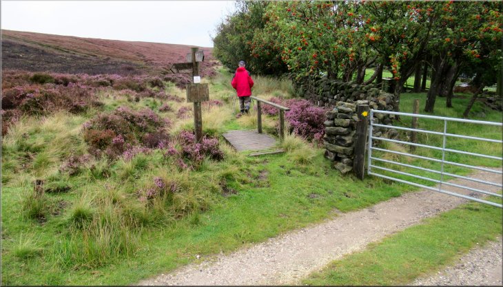
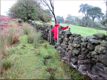
Turning left off the track on to the footpath along the boundary of the open access moorland
|
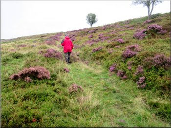
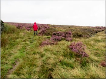
Following the path along the edge of the moor
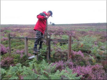
Gate into the second field
Right turn to drop down the edge of the third field
Gate hidden in the tall bracken at the bottom of the field
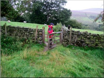
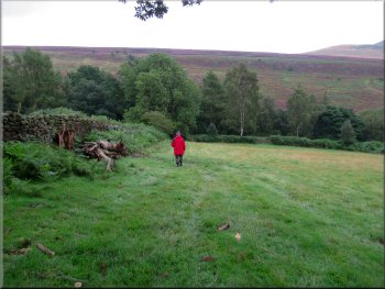
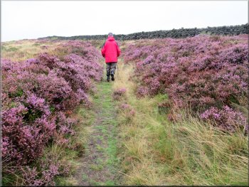
Through this gap in the wall we turned left and walked a few metres along the top edge of this field towards a gate. Just before the gate we turned right a walked down the edge of the field with the stone wall on our left. At the bottom of this field we came to a field gate almost hidden in the tall bracken. We passed though this gate and followed a clear path through the bracken dropping down the hillside to a footbridge over Ladhill Beck. |
After about 150m along the public footpath from the stony access track there was a pedestrian gate through the fence on our right. We turned right here through the gate and across a narrow field to a similar gate on the other side of the field. From the gate the path turned half left and dropped down across the next field to a gap in the wall into the next field.
Gate to the footpath down to Ladhill Beck
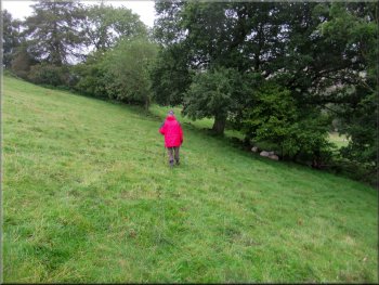
Path dropping down across the second field
Path down the field edge to the overgrown gate at the bottom
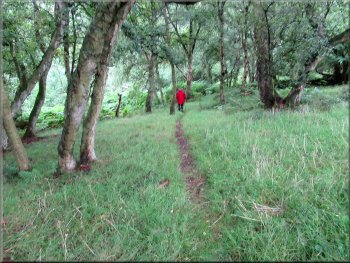
Woodland path down to the footbridge over Ladhill Beck
|
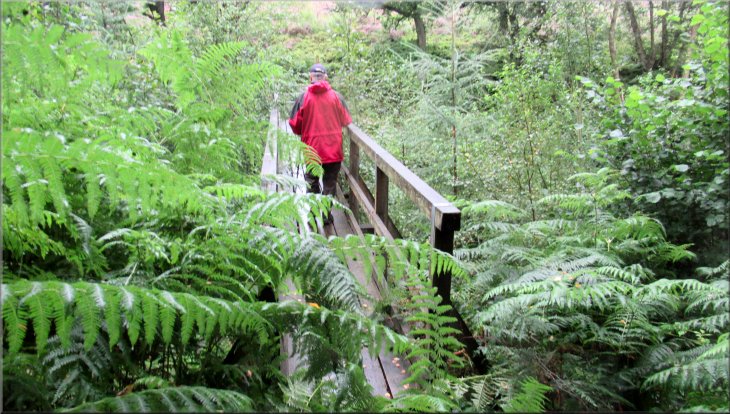
Footbridge on steel supporting structure across Ladhill Beck
|
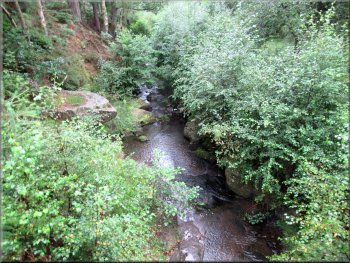
Ladhill Beck seen from the footbridge
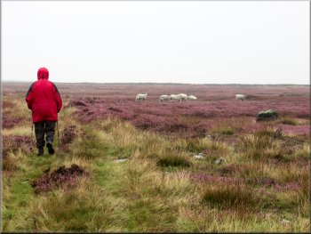
Path next to the post & wire fence in the bracken on the right
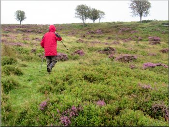
Crossing the moor aiming for the trees on the skyline
After about 70m the path turned right up to a stile over the fence. On the skyline there was a group of five trees that made a good landmark for us to aim for. From the stile there was a very narrow feint path that we did manage to follow and there was a waymark post with a yellow footpath arrow about half way between the stile and the trees. |
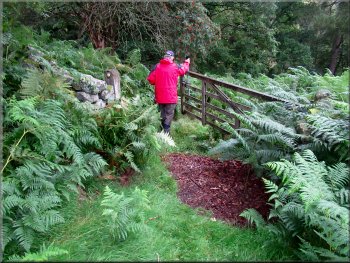
It was a long wooden footbridge sitting on top of a steel framework, high above the beck. On the far side of the beck the fenced path continued straight up the hillside for a few metres to a post and wire fence. We turned left below the fence and followed the path through the bracken with the fence above us on our right.

Fenced path from the footbridge
Stile over the wire fence
Waymark post a little over half way to the trees from the stile
|
Easterside Hill away to our right as we climbed up the moor from the stile towards the landmark trees on the skyline
|
Crossing the green track near the trees
The sunken track below the trees
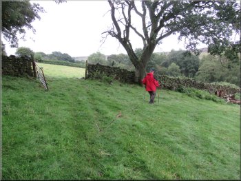
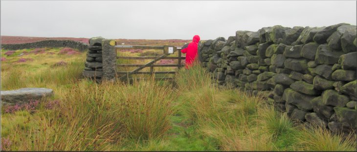
At the sunken track we turned left and followed the track up to a field gate at the top of the slope. We passed through the gate and out onto the open moor. |
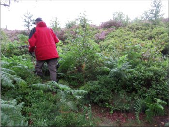
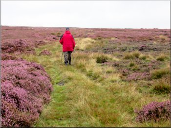
A little way beyond the waymark post we crossed a green track and continued through the bilberries and heather towards the trees. Just below the trees we came to a sunken track climbing diagonally up the hillside.
Crossing the bilberries & heather from the green track
Following the sunken track up to the wall at the top
|
Gate onto the open moor
|
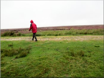
We ignored the track on the right and kept straight on
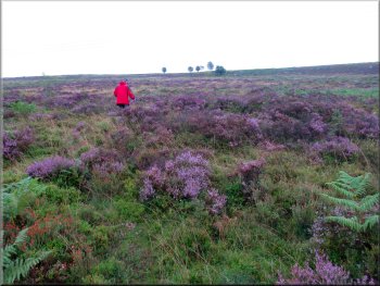
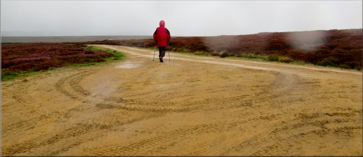
Following the clear track across the moor
(Note: the open access land may be closed for a few days each year for grouse shooting, land management and public safety reasons etc. See Natural England web site to check for any closures) |
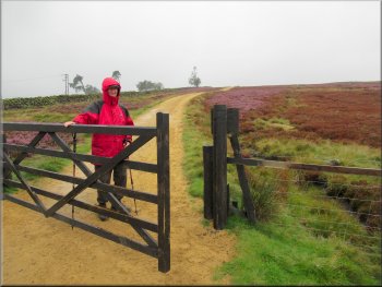
At this little enclosure we turned left along a gravel moorland access track. This track is not a specific right of way but it is across open access land so it is fine to walk along it.
Following the clear track across the moor
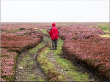
Following the clear track across the moor
|
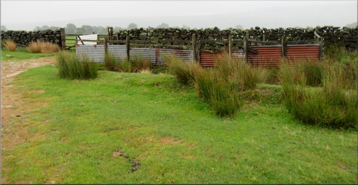
Sheep handling pen where we turned left
|
We turned left on to this track at the sheep pen
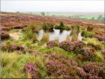
Moorland pond by the track
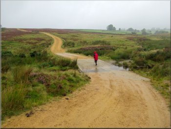
The ford across Ladhill Beck
From the beck we continued up along the track through a black wooden field gate, still on open access land. A public footpath joined the track from our right and a little further on a public bridleway joined the track. After another 100m another track joined us from our right. |
We walked along this track across the moor and down into the valley of Ladhill Beck for about 800m and crossed the ford over Ladhill Beck where Whetherhouse Beck joins it.
The track across the moor to the valley of Ladhill Beck
Dropping down to the ford across Ladhill Beck
We passed through the gate as we climbed up from Ladhill Beck
|
Wide junction where another track joined ours from the right
|
The track from Bilsdale TV mast joined ours from the right
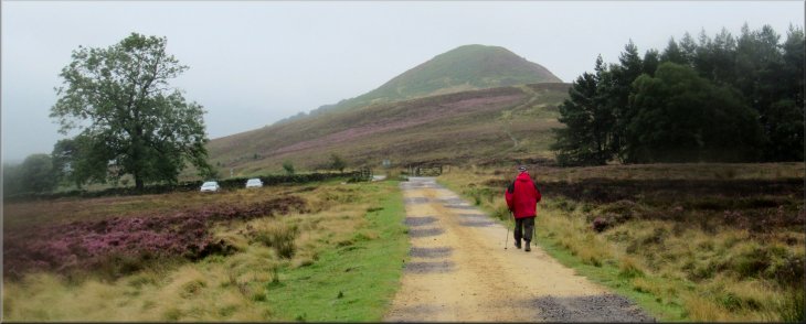
We continued down this track for another 1.3km with our view of Hawnby Hill improving all the time until we reached the end of our walk at our starting point. The whole route had been about 6km and it had taken me over two and a half hours to walk it. |
After another 800m we came to the junction of our track with the moorland access track coming down from the TV transmitter mast on Bilsdale Moor. Ahead of us we could see Hawnby Hill and away to our right there was Easterside Hill, all a bit hazy in the drizzly cloud.
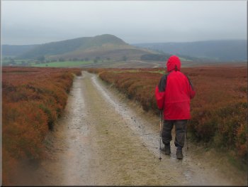
Hawnby Hill ahead as we dropped down from the moor
|
>
Returning to the car park at the foot of Hawnby Hill at the end of our walk
|