Menu:
National Parks
| Routes Library | North York Moors | Yorkshire Dales |
| Yorkshire Wolds | Howgill Fells | Teesdale |
| Lake District | Peak District |
| 2001 walks | 2002
walks | 2003 walks | 2004
walks |
| 2005 walks | 2006
walks | 2007 walks | 2008
walks |
| 2009 walks | 2010
walks | 2011 walks | 2012 walks |
| 2013 walks | 2014 walks | 2015 walks | 2016 walks |
| 2017 walks | 2018 walks | 2019 walks | 2020 walks |
| 2021 walks | 1993-2000 library | Find a Route Index |
| A few Routes to print out | Request a Route... |
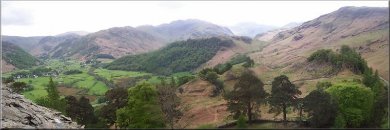
Library Route No. 940708
Seathwaite, Stockley bridge, Grains Gill, Esk Hause,
Broad Crag, Scafell Pike, Corridor Route, Sty Head,
Sty Head Tarn, Greenhow Knott circuit - 14km
English Lake District . . .
Map: The start of the route (northern half of the route)
is on OS Explorer OL4 The English Lakes North-Western area
and Scafell Pike (the southern half of the route)
is on OS Explorer OL6 The English Lakes South-Western area
Printer friendly version (opens
in a separate window)
The approximate route is shown by a blue line.
Use your mouse to drag the map to the area of interest and
zoom in/out using the controls on the left hand side of the map.
Please use my map to find the route on your own large scale
walking map such as the OS Explorer series at 1:25000.
If you have time if you do this walk please let me know how you get on.
That would be very helpful to me to keep my information accurate and up to date.
Please note that I provide this free service to you as a fellow walker on the
understanding that you walk
the route entirely at your own risk and that the information is not used for
any commercial purpose.
Library Route No. 940708
Seathwaite, Stockley bridge, Grains Gill, Esk Hause,
Broad Crag, Scafell Pike, Corridor Route, Sty Head,
Sty Head Tarn, Greenhow Knott circuit - 14km
English Lake District . . .
Map: The start of the route (northern half of the route)
is on OS Explorer OL4 The English Lakes North-Western area
and Scafell Pike (the southern half of the route)
is on OS Explorer OL6 The English Lakes South-Western area
General Directions (see markers on the route map)
1.) Make an early start to find a parking place on the road as near as you can to Seathwaite in Borrowdale. The tiny official car park at map ref. NY235124. Follow the road south, through Seathwaite and past the farm cafe (make a note for the end of the walk). Continue along the path by the beck for about 1km to Stockley Bridge. Cross the bridge and follow the path beside the stream called Grains Gill for almost 2.5km to the path at map ref. NY229087. (Sprinkling Tarn is below the path here to the north west). At this path turn left and follow the path for about 200m. Then bear right on a path climbing up to Esk Hause.
2.) From Esk Hause follow the path round to Broad Crag, by-passing Great End lying to the north. Follow the boulder strew path passing between Broad Crag and Ill Crag (that's "ill crag") and drop down to the col between Broad Crag and Scafell Pike. Make the final steep rocky climb up from the col to the summit of Scafell Pike (977m) at map ref. NY215072.
3.) From the summit of Scafell Pike head north west along the path towards Lingmell. About 200m above the Lingmell col turn right to follow the corridor route for about 2.5km to Sty Head. (Note it's easy to miss this turn and end up on the Lingmell col with a nasty little climb at this stage of the walk, back up to the turn)
4.) From Sty Head follow the path down to Styhead Tarn on the right and with Great Gable above and to the left. Continue along the path down the valley following the stream called Styhead Gill. Follow the path that crosses the gill to Green How Knott and drop down back to Stockley Bridge over Grains Gill.
5.) From Stockley Bridge retrace the outward route back to the farm cafe and the parking spot near Seathwaite at the end of the walk.
(top of page)