Narrow boat making for Ripon |
This
morning we decided to try something a bit different. We both took
our cars to the village of Roecliffe, map ref. SE 375659 about
1km west of Boroughbridge. We parked one car opposite the church
by the village green and then we drove to the British Waterways
car park at map ref. SE 323704 by the Ripon Canal near the Ripon
racecourse. Our plan was to walk back to Roecliffe along the canal
and beside the river Ure. It's quite a short route and uses a
path I walked yesterday but we both needed to be back home by
lunchtime and it is only 30 mins drive from home. It was
a bright sunny day as we set off along the towpath. There
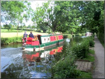
were several narrow boats making their way slowly up to the
canal basin in Ripon. and there were dozens of narrow boats
tied up in the marina next to the racecourse. There are a
couple of wooden garden-shed style huts next to the towpath.
They turned out to be hides giving a great view on to the
wetland wildfowl reserve on the racecourse and we sat there
for a few minutes looking through our binocculars at the nesting
coots and geese and the occasional oystercatcher. The canal
joined the river Ure at map ref. SE 332679 and from there
we followed the path along the river bank. |
There is one short
stretch that is not marked as a right of way on the map but
there is a well walked path and we did not encounter any obstuction.
There was a good view of Newby Hall across the river and shortly
afterwards there is an island in the river. One side is a rocky weir and rapids and the other side of
the island is the navigable route with a lock at the end
where we watched a boat making its way upstream. We stopped
for a drink in the summer heat and had a chat to a couple
who were spending their holiday walking the Yoredale
Way (I must admit that I had never heard of this long
distance route but it sounds quite good). From map ref.
SE 356662 the path goes through an overgrown wooded area
next to the river and we had to push our way through the
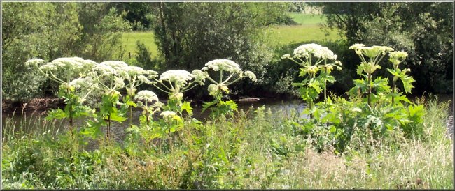
undergrowth including lots of giant hogweed, some of them
around 3m tall overhanging the path. The sap from them is
very irritating to the skin causing a sore burning rash.
The last 1.5 km were across fields to the edge of Roecliffe
village. When we got back to the car the children from the
village school were all playing on the green in the sunshine.
The whole route had been about 10km and had taken us just
over two and a half hours to walk.
|
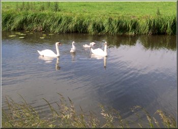
Family of swans on the canal |
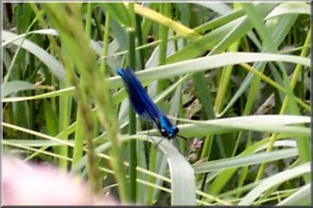
One of the many damsel flies beside the river Ure |
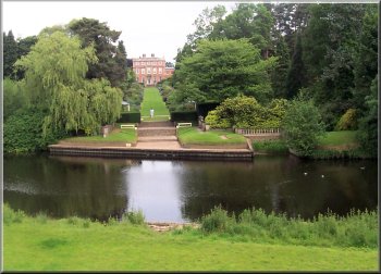
Newby hall from across the river Ure |
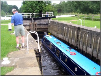
Narrow boat navigating the lock on the river Ure |
Narrow boat navigating the lock on the river Ure |
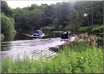
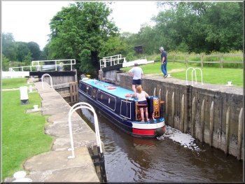
Narrow boats passing on the river Ure |
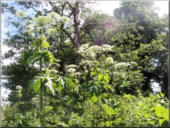
Giant Hogweed towering over us by the river Ure |