| 2001 walks | 2002
walks | 2003 walks | 2004
walks |
| 2005 walks | 2006
walks | 2007 walks | 2008
walks |
| 2009 walks | 2010
walks | 2011 walks | 2012 walks |
| 2013 walks | 2014 walks | 2015 walks | 2016 walks |
| 2017 walks | 2018 walks | 2019 walks |2020 walks |
| 2021 walks | 1993-2000 library | Find a Route Index |
| A few Routes to print out | Request a Route... |
Route No. 257 - Wednesday 9 July 2008
Hovingham, Slingsby, Barton-le-Street,
Centenary Way circuit - 15km
Howardian Hills,
North Yorkshire . . .
Map: OS Explorer 300 Howardian Hills & Malton at 1:25000
Route Map on 'Landranger' base map from OS Open Space service
Open this route in Google Earth
|

A vast field of broad beans |

Wide green path from Hovingham to Slingsby
We
set off from Hovingham along a path down the side of the
Malt Shovel pub heading east towards Slingsby. It turned
out to be a very pleasant broad green path between large
fields of very healthy looking crops.
|
Today
my neighbour. Jim, and I drove for about 20 minutes from
Easingwold to Hovingham. We made an early start and parked
in the little public car park next to the village hall
just before 9.00am.

A white convolvulus flower (a garden pest but lovely on
the hedgerow)
|
|

Wide green path from Hovingham to Slingsby |

A healthy field of potatoes
As
usual at this time of year there were wild flowers everywhere,
too many to photograph them all but I have a few samples.
|
There
were broad beans, potatoes, barley, wheat, oats and oil
seed rape with fat pods ripening ready to harvest.

Field Scabius
amongst the grass by the path
|

Purple vetch |

Ripening barley |

Silkie poultry on a smallholding near Slingsby
We
continued along this path to come into Slingsby by the
church.
|
At
map ref. SE695755 we turned right to follow a path past
some smallholdings.

Rose Bay Willow Herb
|

Heading along a farm road into Slingsby |
|
|

Tower of Slingsby
Church
We
left Slingsby along Green Dike Lane heading for Barton-le-Street.
The lane became a path between arable fields with wild
flowers amongst the grass and numerous butterflies.
|

Huge cones developing on a monkey puzzle tree |

Huge cones developing on a monkey puzzle tree |

The lane leading towards Barton-le-Street from Slingsby
The
path into Barton-le-Street led us through a very tidy
and prosperous set of farm buildings to the village green.
|
As
we left the village we passed a monkey puzzle tree with
huge cones developing. I don't remember seeing such cones
before.

A ruined barn with traditional pan-tile roof
|
|

The village green at Barton-le-Street |

Church at Barton-le-Street
We
crossed the road at map ref. SE720741 and took the path
opposite that led us up the edge of the fields to the
Centenary way at map ref. SE714729.
|
We
headed south through the village to cross the main road
(B1257 - quite busy).

Path from Barton-le-Street to the Centenary Way
|

A meadow brown butterfly |

A meadow brown butterfly |

Heading towards the Centenary Way from Barton-le-Street
This
ridge is at the edge of the Howardian Hills over looking
the Vale of Pickering to the North York Moors.
|
At
this point the Centenary Way has climbed up from Coneysthorpe
and turned left to go along a wooded ridge.

Finger post on the Centenary way
|
|

View from the Centenary Way across the Vale of Pickering
towards the North York Moors |
|
A wooded bank along the Centenary Way where we stopped for
our lunch |
|

View south from
the Centenary way towards the castle Howard estate |

A small skipper - the fore wings angled above the hind
wings is typical
We
continued following the Centenary Way along the wooded
ridge for over 3km to map ref. SE670738.
|
We
followed the path along the ridge to cross the road (map
ref. SE704732) forming the long straight avenue through
the Castle Howard estate.

The Centenary Way near Slingsby Bank
|

The Centenary Way near Hovingham |

The Centenary Way near Hovingham |

Bracket fungus on a dead beech tree
We
turned north west to follow the Ebor Way for the last
1.5km back to our starting point in Hovingham.
|
Here
the Centenary Way meets the Ebor Way and turns Southeast
(following the same route as the Ebor Way).

Path to Hovingham from the Centenary Way
|

Poppies by the path |

A large field of oats next to the path |

Heading down to Hovingham from the Centenary Way
The
mystery was solved they are both ringlet butterflies.
The underwing spots are decisive. The whole route had
been 15km and had taken us almost 5 hours to walk including
our lunch stop and lots of photos. Jim is very tolerant
of my continual stops for yet another picture. We called
at the bakers and tea shop near the ford in Hovingham
for a coffee and a toasted teacake before returning home
in good time to collect my grand daughter from her nursery.
|
As
we walked along the road into Hovingham I noticed a dead
butterfly in the dust at the roadside. We were able to
examine the eye spots both under the wing and on top.
This is often the only way to be sure what species it
is. (My sister gives me expert tips on butterflies). I
photographed a lovely chocolate brown butterfly with a
white edge to its wings when we were on the Yorkshire
Wolds two weeks ago and I could not identify it. The dead
butterfly I had found was the same kind but a lighter
shade of brown so that the eye spots were much clearer.

A dead ringlet butterfly I found by the roadside
|
|

Bakery and tea shop by the ford in Hovingham
|
Background Notes:
This walk is a circular route of 15km, about 9 miles from Hovingham in the Howardian Hills. In the centre of the village is Hovingham Hall the family seat of the Worsley's. The Hovingham Hall web site records that the Worsleys bought the estate at the end of the 1500's. The present hall was built in the Palladian style between 1750 and 1770 by Thomas Worsley who was passionate about riding and he made the entrance to the hall through the hall's own Riding School. The hall is the childhood home of Katherine Worsley, who married the Duke of Kent in 1961 in York Minster.
(On a personal note I remember the occasion well because in the early 1950's my uncle lived in Water End at Clifton in York. It was a street that was a dead end at the River Ouse so had very little traffic and my cousin and I used to cross the road to go play in the Homestead Park. Some years later, for the wedding the army built a pontoon bridge over the river to help the traffic circulation and Water End suddenly became a very busy road indeed! Afterwards the bridge was so useful it was replaced with a permanent one and Water End never did return to its former calm.)
In front of Hovingham Hall in the village centre is the old village school which has a lovely Gothic style Oriel window. Quite a striking feature to come across here. There used to be a railway station at Hovingham on the Thirsk to Driffield line but it was closed in 1964. The station was called Hovingham Spa in a failed attempt to draw people to visit the three springs, each with different properties, at Hovingham Spa about a mile west of the village. These springs were used for their healing properties in Roman times.
We leave the village on a path across the fields from the Malt Shovel pub. We head out to Slingsby through rich fertile arable farmland. At Slingsby there is a large ruin called Slingsby Castle that is just visible through the trees from the road. The original structure was a fortified hunting lodge built in the 1300's. There were various modifications over the years and in the 1600's the construction of a Jacobean manor house was started on the foundation provided by the earlier structures. However the owner, Sir Charles Cavendish, who was a Royalist, had to flee to the continent when the civil war was lost and the building was never completed or occupied and it's ruins remain to this day.
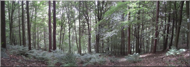
We continue out of Slingsby and follow a track between the fields to the next village called Barton-le-Street. There's a wide pleasant village green here and we walk through the village past the church to climb up to a wooded ridge south of the village. There's a path running west along the edge of the wood with views across the Vale of Pickering to the North York Moors. It's a pretty walk along the ridge with the woods on the left and the views on the right with the path meandering into the wood from time to time.
Just after we reach the path along the ridge, the Centenary Way comes up throught the wood to join our path. The Centenary Way was created to celebrate 100 years since the formation of a County Council for North Yorkshire and it was opened in 1989 by Chris Brasher, who founded the London marathon. The Centenary Way goes from Filey Brig to York Minster, a route of 134 Km, about 83 miles. We follow the Centenary way along the wooded ridge and then drop down the hillside back into Hovingham where there is a good choice of places for refreshments in the village to round off the walk.
top of page
|


