| 2001 walks | 2002
walks | 2003 walks | 2004
walks |
| 2005 walks | 2006
walks | 2007 walks | 2008
walks |
| 2009 walks | 2010
walks | 2011 walks | 2012 walks |
| 2013 walks | 2014 walks | 2015 walks | 2016 walks |
| 2017 walks | 2018 walks | 2019 walks |2020 walks |
| 2021 walks | 1993-2000 library | Find a Route Index |
| A few Routes to print out | Request a Route... |
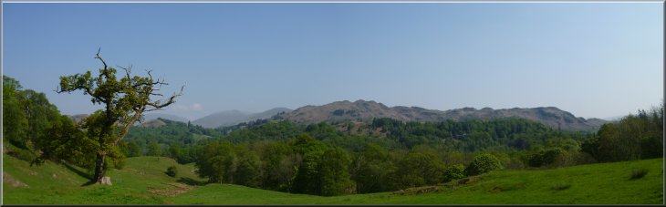
Route No. 342 - Saturday 22 May 2010
Skelwith Bridge, Little Langdale Tarn,
Oak Howe(Great Langdale), Elterwater circuit
13km - English Lake District . . .
Route map from Ordnance Survey
Open Space service.
Map: OS Explorer OL7 The English Lake District South-eastern area
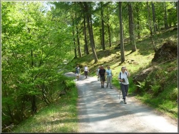
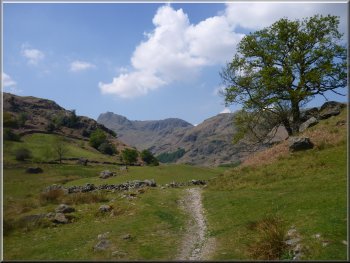
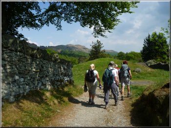
Path from the road (B5343) down to the River Brathay
|
Path from the road (B5343) down to the River Brathay
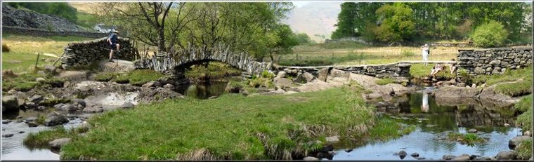
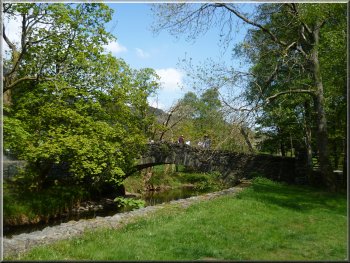
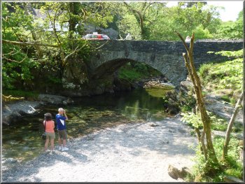
Footbridge over the River Brathay near Skelwith Force
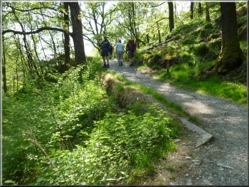
At the river we turned left and walked along the river bank towards Skelwith Bridge. This path is part of the
Cumbria Way National Trail, a 112km route from Ulveston to Carlisle. After about 300m the road (B5343) and the river almost came together and our
path was squeezed between them below the road. We crossed the river on a footbridge at map ref. NY340034 a little way upstream of the waterfall
known as Skelwith Force. |
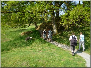
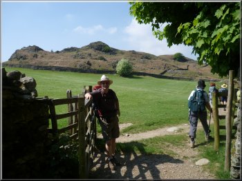
Every year we have short break with a group of friends to do some walks in an attractive part of the country. This year we are staying in a large well
appointed holiday cottage at Knipe Fold in the English Lake District. This morning was fine and sunny and we all drove to the National Trust car park at
map ref. NY340037 about 600m West of Skelwith Bridge off the B5343. From the car park we crossed the road and followed the footpath through
the trees down to the River Brathay.
Path from the road(B5343)down to the River Brathay
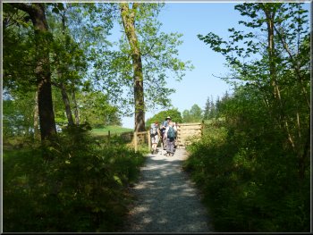
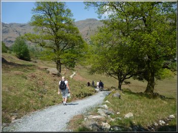
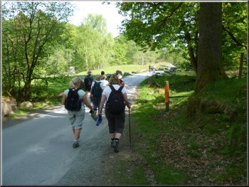
We continued along the Cumbria Way from the footbridge
|
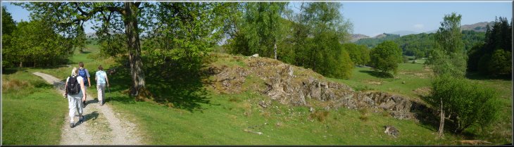
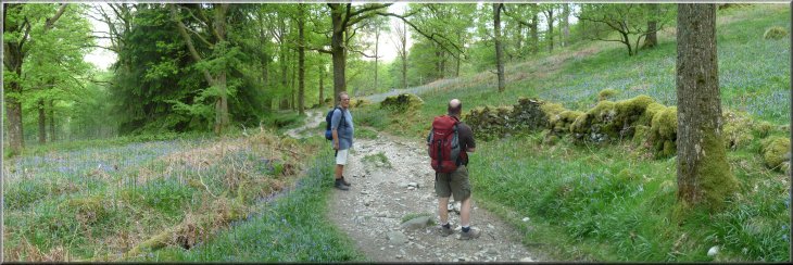
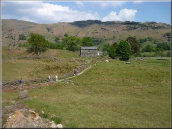
Leaving the wood to cross farmland at Park House
After about 1km we came to came to a minor road at map ref.
NY331029. At the road we turned right and walked along the road for about 150m, then we turned left off the road just before the road bridge over the
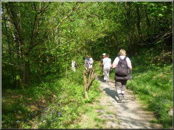
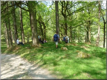
river into some very pretty woodland. |
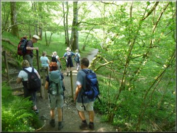
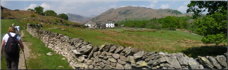
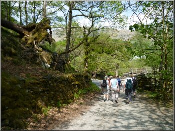
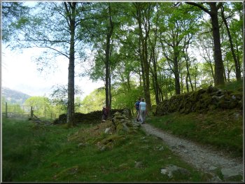
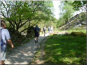
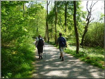
We continued along the Cumbria Way, following the path southeast through some attractive woodland and then West
heading out of the woodland across farm pasture land past Park House and Park Farm.

|
Following the track along the Cumbria Way towards Park Farm
View of Loughrigg Fell from the Cumbrian Way path
Descending the steps towards Colwith Force
|
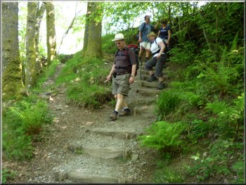
Descending the steps towards Colwith Force
The path down to Colwith Force
Then, after admiring the falls for a while, we climbed back up through the woodland for almost 500m to a farm access track at High Park
farm at map ref. NY323028. |
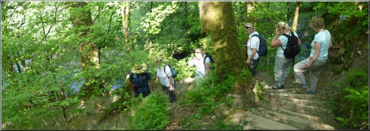
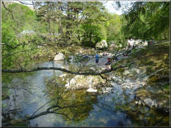
We followed an optional diversion from the Cumbria Way down a series of steps to Colwith Force on the River
Brathay.
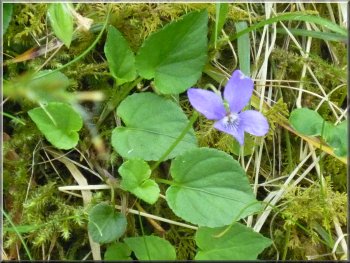
Violet by the path to the falls
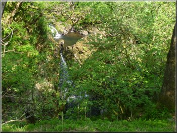
Looking down on to Colwith Force
|
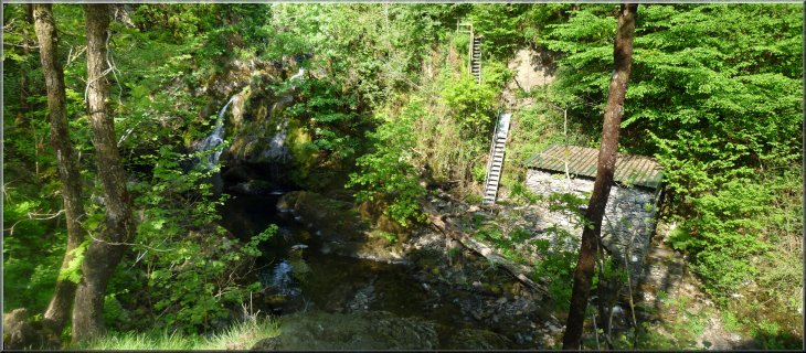
Looking down on to Colwith Force
Heading up Little Langdale towards Stang End
|
Heading up Little Langdale towards Stang End
The track down from Stang End to cross Pierce How Beck
We continued heading West up Little Langdale above the River Brathay, along the access road for
about 500m from the beck and then at map ref. NY311029 we turned right off the access road to follow a path down to the River Brathay. Here the
footpath crosses the river over Slater Bridge. This is a wonderful old stone arch footbridge constructed by a single arch of thin flat slabs of rock held
in place simply by the shape of the arch. |
Here the Cumbria Way turned right along the farm track but we kept straight on along the farm track through Stang End.
We dropped down along the farm access road to cross Pierce How Beck. It was hot and sunny and we took advantage of the shade of the trees by
the beck to stop for a drink and a short break.
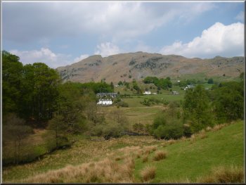
Looking across Little Langdale to Lingmoor Fell
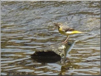
Grey Wagtail feeding on insects at the River Brathay
|
|
|
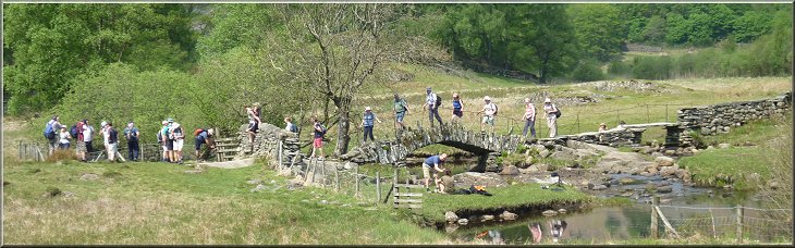
Streams of walkers crossing Slater Bridge in both directions
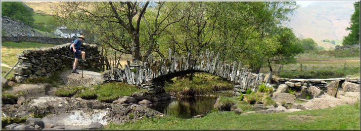
The amazing arch of Slater Bridge
Looking up Little Langdale from the path near Slater Bridge
|
Looking back to Slater Bridge
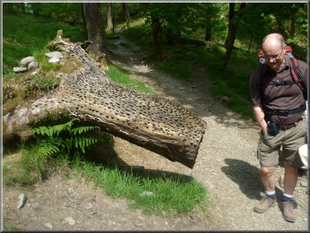
Tree stump studded with coins as a good luck charm
The track through the woods heading up Great Langdale
About 1km along
the lane as it was starting to drop down towards Elterwater at map ref. NY321041, we turned left off the lane to follow a path through the woodland
down to a track heading up Great Langdale above an extensive quarrying operation. |
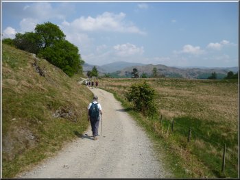
From the river we climbed up the hillside to a minor road at map ref. NY313034. We crossed the road and
continued along a lane heading for Elterwater village. The lane was taking us out of Little Langdale over the hill into Great Langdale.
Lane out of Little Langdale to Great Langdale
Our view up Great Langdale
The track through the woods heading up Great Langdale
|
The track through the woods heading up Great Langdale
|
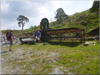
Large circular saw bench by the track
Path up Great Langdale heading for Oak Howe
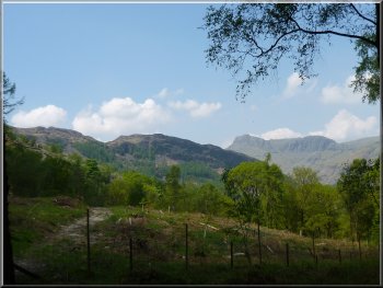
Looking along Great Langdale to the Langdale Pikes
It was much too comfortable laid out on the grass with a warm breeze wafting
over , but after our lunch we had to set off again. After another 500m along this track it turned sharp right to pass Oak Howe farm. From there we
followed the track to the side of Langdale Beck. |
It was a very pleasant walk up the valley in the shade of the woodland on this hot sunny day. After about 1.5km a little before we came to the end of
the woodland we stopped at a grassy spot for our lunch under the trees.
Path up Great Langdale heading for Oak Howe
A shady spot under the trees for our lunch break
The path past Oak Howe farm in Great Langdale
|
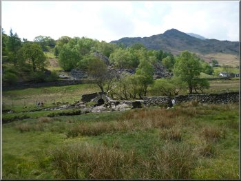
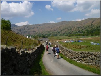
New Bridge over Langdale Beck at Chapel Stile
Langdale Beck as we made our way towards Elterwater
Following the track from Chapel Stile to Elterwater
We continued along the Cumbria Way route to recross the beck and pass Elterwater village on the other
side of the beck until we reached the road bridge over the beck at the Eastern end of Elterwater. |
Here we had re-joined the route of the Cumbria Way. Here we turned right to walk
along the Cumbria Way route following Langdale Beck downstream along Great Langdale. After about 600m the path crossed the beck on 'New
Bridge', a stone arch bridge at Chapel Stile.
Langdale Beck seen from New Bridge at Chapel Stile
Following the track from Chapel Stile to Elterwater
Following the track from Chapel Stile to Elterwater
|
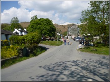
Elterwater village
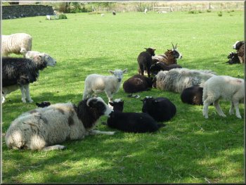
Jacobs Sheep by the path near Elterwater
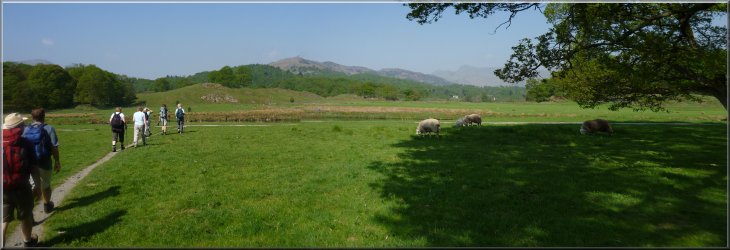
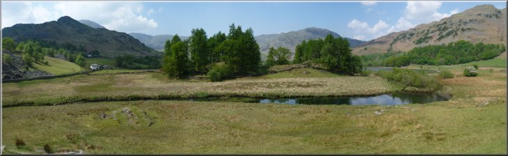
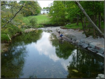
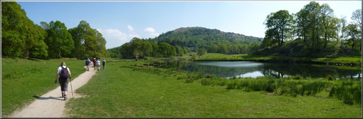
Langdale Beck flows into the lake from the Northwest and the River Brathay flows into the lake from the South and continues as the outlet from the
lake to the Southeast. We followed the path around the edge of the lake and then retraced our steps from the bank of the River Brathay below the
lake, back to the car park and the end of our walk. The whole route had been about 13km and it had taken us almost 5 hours to walk including our
breaks. |
Here we crossed the beck again and followed the
gravel path (a bridleway) alongside the beck. It's such a popular place to visit with the fabulous scenery of Langdale that the gravel path is necessary
to help control the erosion caused by so many feet. From Elterwater village we walked along the path by the beck for about 1km to Elterwater lake.
The road bridge over Langdale Beck at Elterwater
Path around Elterwater lake
|
Following the gravel bridleway track around Elterwater lake on the River Brathay at the end of our walk
|