| 2001 walks | 2002
walks | 2003 walks | 2004
walks |
| 2005 walks | 2006
walks | 2007 walks | 2008
walks |
| 2009 walks | 2010
walks | 2011 walks | 2012 walks |
| 2013 walks | 2014 walks | 2015 walks | 2016 walks |
| 2017 walks | 2018 walks | 2019 walks |2020 walks |
| 2021 walks | 1993-2000 library | Find a Route Index |
| A few Routes to print out | Request a Route... |
Route No. 378 - Wednesday 27 October 2010
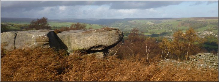
Pateley Bridge, Fishpond Wood, Ravens Gill,
Guise Cliff, Yorke's Folly, Bewerley circuit - 11km
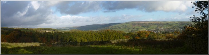
Nidderdale (AONB) . . .
Route map from Ordnance
Survey Open Space service.
Map: OS Explorer 298 Nidderdale at 1:25000
This walk is based on a route described by Paul Hannon in
his book, "Nidderdale" - ISBN 1 870141 23 7 published 1994
|
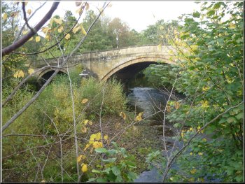
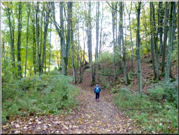
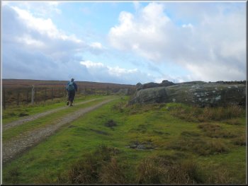
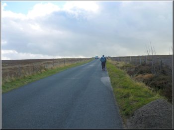
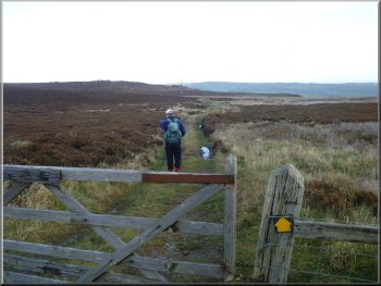
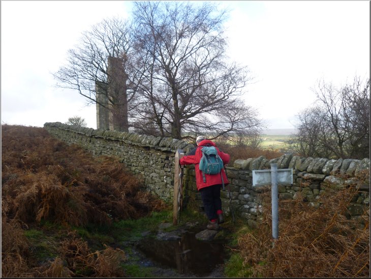
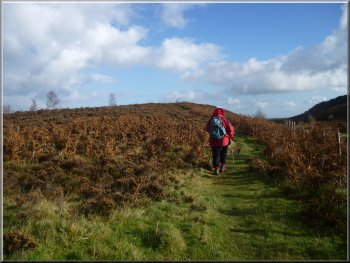
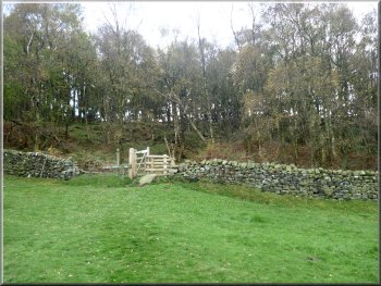
Road bridge (B6265) over the Nidd at Pateley Bridge
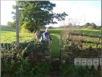
Turning off the road towards Fishpond Wood
The road climbed up to a junction at the edge of the village where
we turned right and con tinued to climb following the road for about
150m from the junction to map ref. SE154650. Here we turned left off
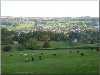
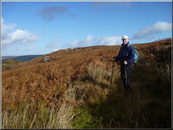
the road on to a footpath climbing up a steep grassy hillside with cattle
grazing. At the top of the climb there was a stile in a drystone wall
and looking back there was a lovely view over the valley with Pateley
Bridge in the bottom just over a kilometer away
|
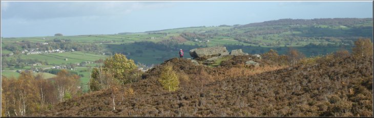
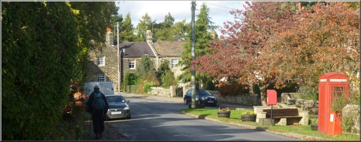
My neighbour, Jim, and I drove out to Pateley Bridge in Nidderdale
this morning. The weather was fine and bright , but with a few dark
shower clouds about and quite a breeze. We parked in the long stay car
park by the river in the town centre at map ref. SE158655. It's under
£2 for all day. From the car park we followed the main road (B6265)
across the River Nidd for about 300m to a cross roads at map ref. SE155653.
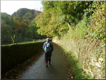
We turned left at the cross roads heading for the village of Bewerley.
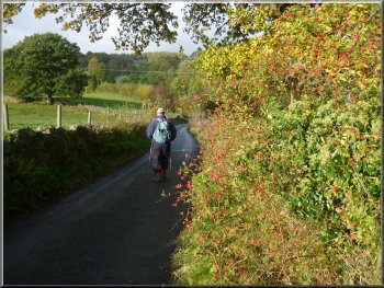
Lane uphill out of Bewerley
Looking back over Pateley Bridge
|
|
Steps down to the edge of Fishpond Wood
Path through Fishpond Wood
|
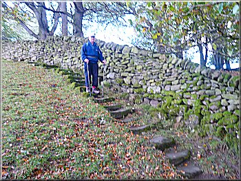
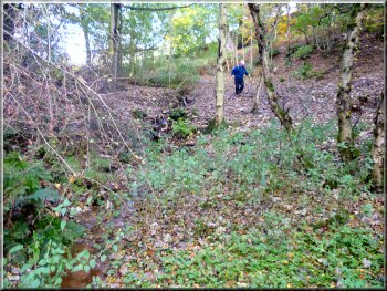
From the stile the path continued and dropped steeply down to the edge
of Fishpond Wood. In fact it was so steep that, long ago, a long flight
of stone steps had been constructed down the hillside next to the wall,
which made the descent much easier. We followed the path into the woods
and down to the fishpond. Apparently this was built by the monks of
Bewerley
Priory to provide fish to eat.
Autumn colours in Fishpond Wood
|
The pond in Fishpond Wood |
|
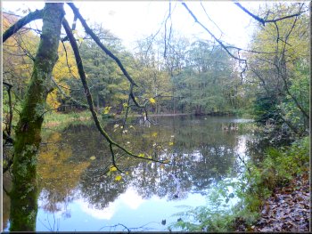
The pond in Fishpond Wood
Leaving Fishpond Wood
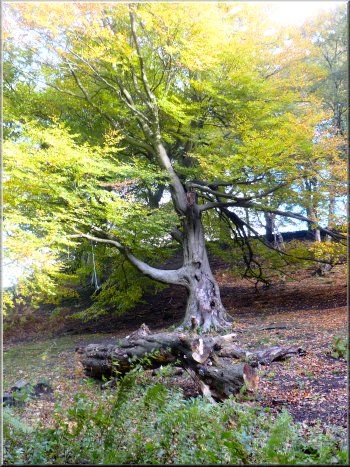
Autumn colours in the beech woods
On the right we passed some vintage style delivery vehicles parked
at the roadside. The road continued to climb steeply, first round a
left hand bend and then round a right hand bend. On the crown of this
right hand bend there is a footpath off to the left into the beech woods.
This is not our path.
|
From the fishpond the path led us about 100m out to a road at map ref.
SE154645. We turned right to follow the road down to a stream with a
beech wood on our left, showing all the lovely golden colours of autumn.
From the stream the road began to climb steeply.
Path through Fishpond Wood to the road
The road away from Fishpond Wood
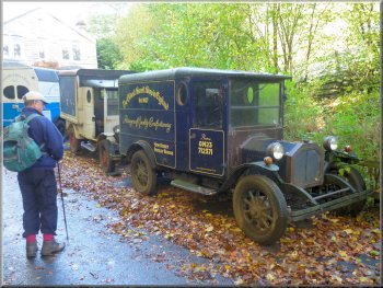
Vintage style delivery vans by the road side
Tempting path into the woods - But the wrong one!
|
Tempting path into the woods from the crown of the bend - But the wrong
one! |
|
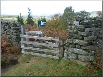
Gate to the right path about 100m further on
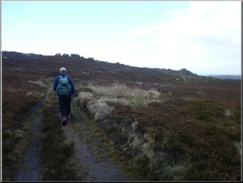
Climbing up the hillside towards Ravens Nest farm
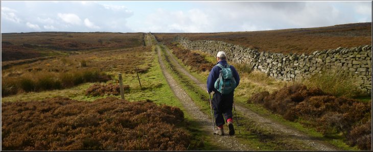
After about 250m we came to a wall near the top of the slope. The
stile through this wall is about 30m along the wall from the corner
of the field. We continued along the edge of the fields to an access
track at map ref. SE150638.
|
We continued up the hill for another 100m and where the road began
to bend left again we turned left off the road through a gate at map
ref. SE151642. At once the path climbed up a steep grassy bank under
the trees in some rough pasture next to a wood.
Climbing up the hillside towards Ravens Nest farm

Stile in the wall at the top of the climb
|
Looking back over Nidderdale from the road |
|
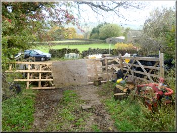
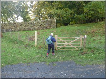
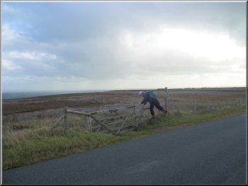
Temporary gate at Ravens Nest farm
Track onto the moors from Ravens Nest farm
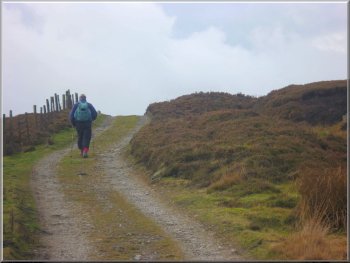
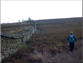
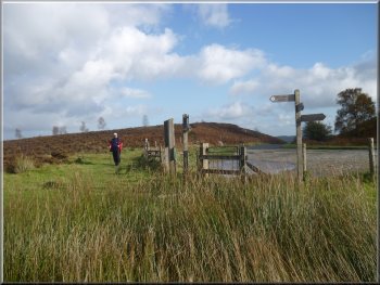
We went through this gate onto a grassy track which we followed for
about 350m to a gate across the track. We walked through the gate and
followed the track over the open moor for another 200m to a path on
our left. There was a post with a footpath arrow to mark the turn.
|
At the track we turned left to follow the track for about 20m towards
Ravens Nest farm that was being renovated. At this point on our right
there was a makeshift gate (a large sheet of plywood).
The track away from Ravens Nest farm
Track onto the moors from Ravens Nest farm
|
About to turn off the track onto the path to Ravens Gill |
|
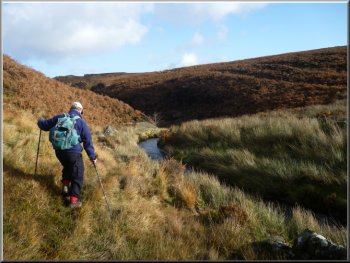
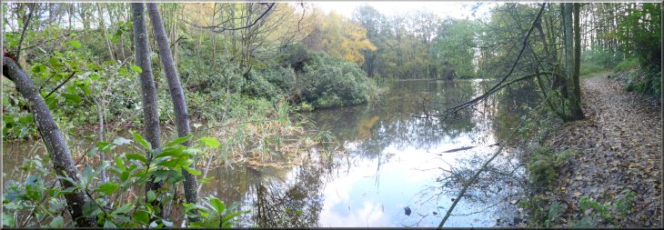
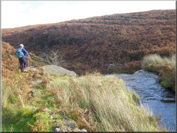
Arriving at Ravens Gill
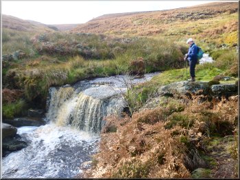
The waterfall on Ravens Gill
We stopped there for our lunch break. It was a very pretty spot and
we sat on a large rock at the top of the falls watching the brown peaty
water tumble over as we ate our sandwiches.
|
We followed this path down the hillside to a large stream called Ravens
Gill. There was a lot of water in the stream after recent wet weather
and we turned left to walk downstream along the bank of the stream for
about 100m to a waterfall.
Top of the waterfall on Ravens Gill
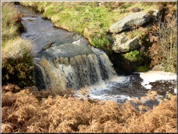
The waterfall on Ravens Gill
|
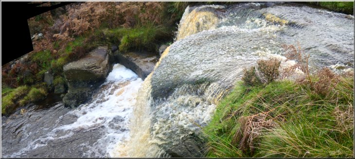
The waterfall on Ravens Gill |
|
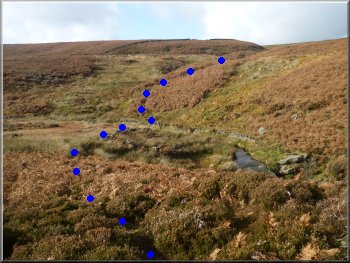
The path across Ravens Gill shown by the blue dots
Path up from Ravens Gill
Following the boundary wall to the road near Yorke's Folly
After about 100m the path became more evident as we climbed up the
hillside looking down on the waterfall where we had had our lunch. We
continued along the path past some rocky outcrops to a boundary wall
where we turned right to follow the wall out towards Yorke's Folly.
We could see the two columns of the folly ahead of us on the horizon
and after following the wall for about 300m we came to a road at map
ref. SE156635.
|
After our break we walked back upstream to the point where we had first
met the stream. The path goes straight across the stream but the crossing
is a bit awkward. The water is quite deep and fast flowing and today
the few stones that provide a crossing place were just submerged. However
we crossed carefully using our trusty walking sticks to balance and
continued around the edge of an area of coarse grass on marshy ground.
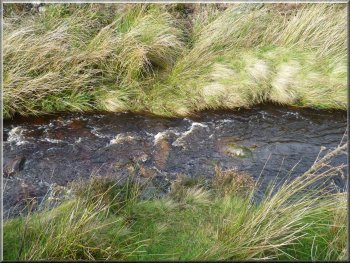
Crossing point on Ravens Gill with the stones just submerged
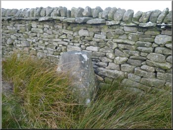
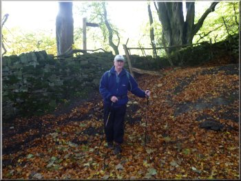
Boundary stone by our path
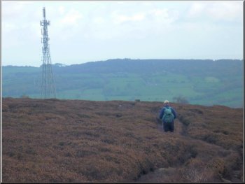
Heading Southeast along the road for about 1km
|
|
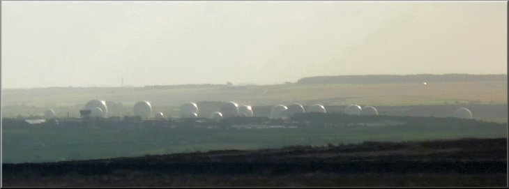
Menwith Hill base - quite picturesque from a distance in the autumn
sunshine
|
|
Turning off the road to head for Guise Cliff
The track towards Guise Cliff
The path led us through a rocky outcrop with a trig point on top and
after about a kilometer we came to the enclosure around the mast.
|
At the road we turned right and walked along the road still climbing
for a little over a kilometer, over the brow of the hill to map ref.
SE161625. Here we turned left off the road to follow a track across
the moor towards the radio mast on Guise Cliff.
The track towards Guise Cliff
Heading for the radio mast on Guise Cliff
|
|
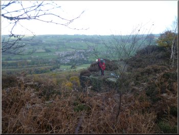
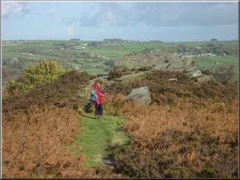
Path along the top of Guise Cliff
Path along the top of Guise Cliff
Approaching Yorke's Folly from Guise Cliff
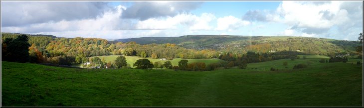
There were some lovely views over Nidderdale, across to Glasshouses
and up the valley to Gouthwaite Reservoir and all the while the sheer
cliff to our right as we progressed along the wooded edge for about
a kilometer to Yorke's Folly.
|
At the corner of the enclosure we turned left onto a narrow path around
the wire mesh fencing that took us past the mast and onto a path around
the edge of Guise Cliff.
The edge of Guise Cliff
Path along the top of Guise Cliff
Looking across Nidderdale from the end of Guise Cliff
|
|
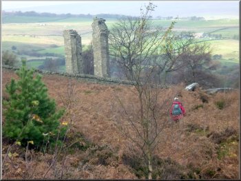
Arriving at Yorke's Folly
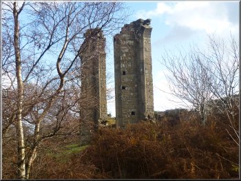
Looking back to Yorke's Folly
From there we continued out to the road at map ref. SE155637.
|
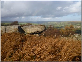
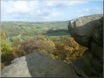
There was a seat here to rest and admire the view looking out between
to columns of the folly, across Nidderdale.
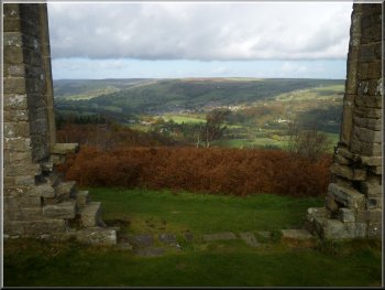
The view from Yorke's Folly
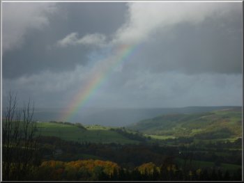
Rainbow over Nidderdale
|
|
Heading for the road from Yorke's Folly
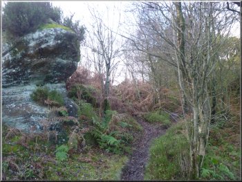
Crocodile Rock
This path took us to the so called "Crocodile Rock" at map ref. SE158637.
We looked all round it but could not find any likeness to a crocodile,
but the view across the valley was lovely.
|
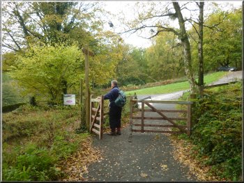
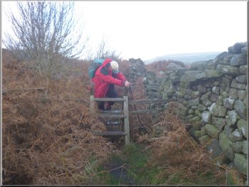
We crossed the road and went through the pedestrian gate opposite.
Once through the gate we turned immediately right to follow a well walked
path parallel to the road below.
Start of the path to Crocodile Rock
View from Crocodile Rock
|
Admiring the view from Crocodile Rock |
|
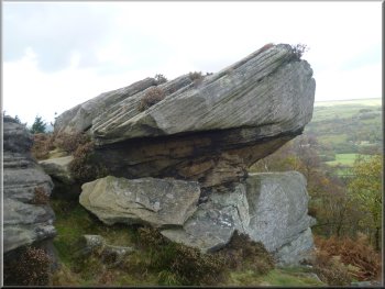
No, it still doesn't look like a crocodile
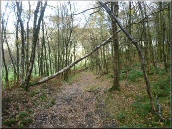
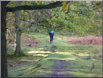
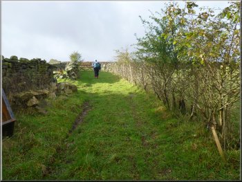
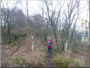
The Nidderdale Way through Strikes Wood
Here we turned right and followed the Nidderdale Way path through a
gate in a wall into Strikes Wood. We followed the path down through
the woods and a steep grassy field to the road at map ref. SE156643.
|
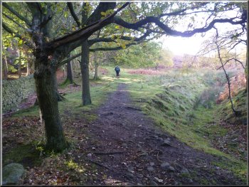
The path took us Northwest around the edge of a wood for about 300m
from the rock until we met the Nidderdale
Way path at map ref. SE155639.
Gate into Strikes Wood at the Nidderdale Way
Looking back to Strikes Wood along the Nidderdale Way
|
Autumn colours in Fishpond Wood seen from the Nidderdale Way below Strikes
Wood |
|
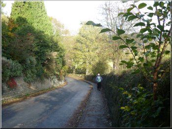
The road into Bewerley
As you can see from the photos, the weather had been mostly bright
sunshine, but there were dark shower clouds about and we had a couple
of short sharp showers. Next to the car park in Pateley Bridge there
is a nice tea shop by the river where we had our usual toasted tea cake
and coffee before heading for home.
|
At the road we turned left and walked along the road into Bewerley
village. From the village we retraced our steps back to the car park
in Pateley Bridge. The whole walk had been 11km and it had taken us
about four and a half hours to walk including our stops. The first 4km
of the walk is almost all steeply up hill. The rest is roughly half
fairly flat and half steep downhill.
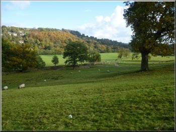
Autumn sunshine on the fields at Bewerley
|
Returning through Bewerley near the end of our walk
|
Background Notes:
This walk is an 11km circuit from Pateley Bridge in Nidderdale. There's a long stay car park on the riverside in the town centre and from there we cross the road bridge over the River Nidd. Just across the river we turn left to follow the road to Bewerley. On the edge of the village we take a path across the fields climbing up the hillside to the top edge of Fishponds Wood.
There's a lovely view back across Nidderdale to Pateley Bridge in the valley bottom. We follow the path down through Fishponds Wood past the large fishpond that was built by the monks of Bewerley Grange in the late 1100's. Monastic settlements usually had a fish pond because a good supply of fish was needed for the religeous observance of meatless days on Fridays.
From the wood we follow a road called Peat Lane up a hill called Middle Tongue between the valleys of two becks, Ravens Gill and Sand Gill. At the top of the short climb we turn on to a path through the fields alongside a wood to the edge of Flat Moor. Here we follow a track across the open moor for only about 150m before we turn right to drop down the moorland hillside to Ravens Gill Beck.
Just downstream of the point where the path crosses the beck there is an attractive waterfall with a good flow of water in the beck and a drop of about 2m over a rock shelf. It has the two alternative names of Cat Loup Dub or Wash Dub. It make a pleasant spot to sit for a drink before climbing up the other side of the valley and following the path across the moor to the road about 1km south of Bewerley.
We follow the road away from the village for another kilometer before turning left to follow a track through a rocky outcrop called High Crag to the radio mast on the edge of Guise Cliff. There's a good path around the edge of the cliff with a great view across Nidderdale over the village of Glasshouses.
At the Northwestern end of Guise Cliff we come to Yorke's Folly. In the mid 1670's the manor of Bewerley, including the land here was acquired by the Yorke family, and remained in their ownership until the1920's. In the late 1800's the Yorke family had three columns built to look like a ruined church on the skyline. This was known locally as the Three Stoups; stoup is an old dialect word for a substantial stone gate post. In a great storm in 1893 one of the columns was blown down so that now there are just the Two Stoups. The work was undertaken as a 'make-work' project to help aleviate the poverty caused by a ressesion at that time.
From Yorke's Folly we follow a path down the hillside past a rocky outcrop called Crocodile Rock but I couldn't see any resemblance to a crocodile. The path leads down a steep hillside back to the village of Bewerley. After the Norman Conquest the land here was given to Roger de Mowbray and in 1175 he sold Bewerley and its lands to Fountains Abbey. The abbey set up a Grange at Bewerley and we enter the village past the Grange chapel. The chapel was built right at the end of the 1490's by Marmaduke Huby who was the Abbot of Fountains Abbey in the period from then to just before the dissolution of the monasteries. His initials are on the walls of the chapel. We continue through the village and back into Pateley Bridge and the end of our walk for this week.
top of page
|