| 2001 walks | 2002
walks | 2003 walks | 2004
walks |
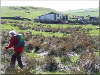
| 2005 walks | 2006
walks | 2007 walks | 2008
walks |
| 2009 walks | 2010
walks | 2011 walks | 2012 walks |
| 2013 walks | 2014 walks | 2015 walks | 2016 walks |
| 2017 walks | 2018 walks | 2019 walks |2020 walks |
| 2021 walks | 1993-2000 library | Find a Route Index |
| A few Routes to print out | Request a Route... |
Route No. 403 - Thursday 7th April 2011
Washfold, Kexwith, How Gate, Helwith - 11km
Swaledale,
Yorkshire Dales . . .
Route map from Ordnance Survey
Open Space service.
Map: OS Explorer OL30 Yorkshire dales Northern & Central areas
Another fine route from Ray Brown this time in the upper
catchment area of Marske Beck starting from Washfold about 4km NNE of Reeth
- Thanks again Ray!
Skegdale Beck flows under a little bridge |
|
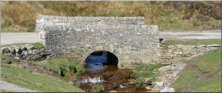
The bridge where Goats Road crosses Padley Beck
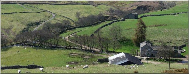
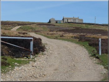
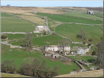
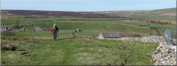
Passing a large barn towards a gate (NZ060042)
Immediately after passing to the left of the farmhouse we used a steel
gate on our right to enter the pasture and turned left along a stone
wall. We continued past a large barn on our left to a gate (NZ060042)
with "veer right" waymark sign leading to moorland. After maybe 50 metres
we branched left, so returning to the wall on our left where we passed
through a steel gate (NZ060044) and again found ourselves with a stone
wall on our left. After following this on a clear path for about 600
metres we branched right in order to pass to the left of a ruined building.
|
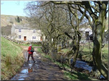
With the weather experts forecasting a fine day we set off for this
area between Swaledale and the River Greta and parked by the bridge
where Goats Road crosses Padley Beck in the hamlet of Washfold at NZ054027.
Using the metalled Goats Road we walked initially East, keeping left
at the fork at the top of the hill and ignoring other tracks on the
right. The metalled road ended near a sharp right bend where Skegdale
Beck flows under a little bridge. After the bend we declined to follow
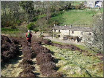
a bridleway sign on the left, preferring instead to use the track, a
few metres further on, that leads to the farm called Schoolmaster Pasture.
Track leading to Schoolmaster Pasture
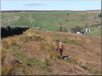
Again found ourselves with a stone wall on our left
|
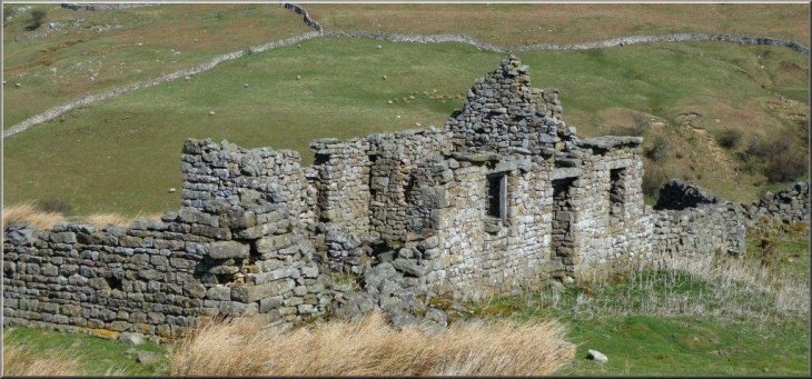
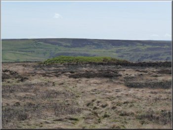
Ruin before the descent to Kexwith |
|
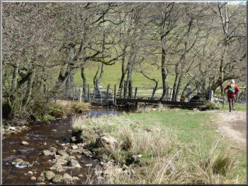
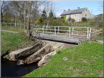
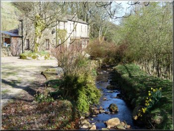
Kexwith footbridge
Kexwith Beck
Beyond the footbridge it merges with Kexwith Beck to become Holgate
Beck. We crossed both minor becks to reach Kexwith Farm where we were
greeted by a couple of porkers.
|
The path led through rough pasture to a gate on the left and thence
to a farm track which ran downhill to a ford and footbridge over Moresdale
Beck.
Kexwith
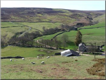
Leaving Kexwith
|
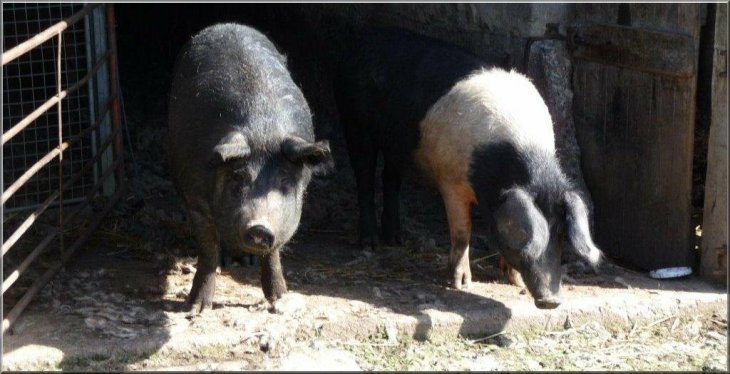
Greeted by a couple of porkers |
|
The signpost pointed towards a distant clump of trees
We stepped over an electric fence
At this point we walked right along the road for 50 metres before
turning left on to more moorland to head South. As on the previous stretch
of moorland a GPS device loaded in advance with waypoints (in this case
NZ077042 and NZ077038) was helpful and in mist would be invaluable.
Now however there were signs of a used path which passed to the left
of a grassy mound. After stepping over an electric fence we soon found
ourselves on a definite grassy path which returned us at NZ076034 to
the Newsham-Helwith road. Turning left we proceeded down to Helwith
where the farm buildings make a pleasant backdrop for a picture of the
ford and footbridge.
|
We left the farm by its service track which headed initially steeply
uphill and then ran East across moorland for about 1.5km to meet the
Newsham-Helwith minor road at How Gate. Here we turned right for about
50 metres before following a right of way footpath signpost on the left
which pointed towards a clump of trees some 2 km distant. The next kilometre
of our route lay across occasionally boggy heather moorland with no
clear path. The best route (aiming towards NZ076047) curved to the right
of the direct line to the clump of trees and it emerged at NZ078046
on a minor metalled road opposite the track leading to Kersey Green
farm.
The path passed to the left of a grassy mound
Helwith
|
|
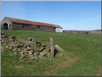
Leaving Helwith
The right of way runs through a farmyard where the thick mud (I use
the term euphemistically) was everywhere and in places 20cm deep. After
finally ploughing through this we reached the farm's service track and
mused that on future occasions we shall use one of the two alternative
routes which begin on the North side of the Shaw Beck. We used the farm
track for almost 900 metres until, after climbing steeply to a cattle
grid, it turned sharply left.
|
The map shows three alternative rights of way from Helwith to Washfold;
we chose that which took us across the Shaw Beck and steeply up a clear
grassy track. When the path levelled we followed a stone wall high above,
but alongside, Shaw Beck and were able to view the ruins of the old
Prys lead workings below. When Prys House farm appeared we left the
wall and made directly for the farm through rough pasture.
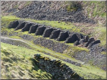
Ruins of the old Prys lead workings
|
Approach to Prys House farm |
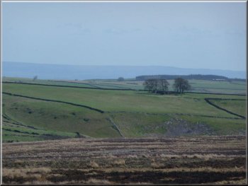
Holgate How |
Joining the path down to Washfold |
|
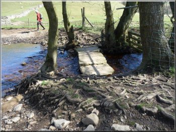
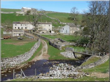
Entering Washfold at the end of our walk
On our right we had fine views of the gentle summit of Holgate How
which our walk had circumnavigated. On reaching Washfold and crossing
the footbridge over Padley Beck, we turned left and followed the track
back to the car - Ray Brown
|
Here we continued straight ahead for 40 metres along a wall on the
right before turning right to join a distinct path running downhill
towards Washfold.
Crossing Padley Beck
|