| 2001 walks | 2002
walks | 2003 walks | 2004
walks |
| 2005 walks | 2006
walks | 2007 walks | 2008
walks |
| 2009 walks | 2010
walks | 2011 walks | 2012 walks |
| 2013 walks | 2014 walks | 2015 walks | 2016 walks |
| 2017 walks | 2018 walks | 2019 walks |2020 walks |
| 2021 walks | 1993-2000 library | Find a Route Index |
| A few Routes to print out | Request a Route... |
Route No. 556 - Tuesday 1 July 2014
Bolton Abbey along the River Wharfe to
Ilkley via the Dales Way route - 11km
(linear route) - Wharfedale . . .
Route map from Ordnance Survey
Open Space service.
Map: OS Explorer 297 Lower Wharfedale & Washburn Valley
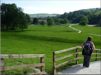
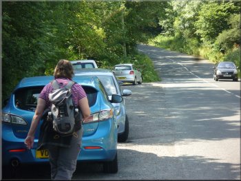
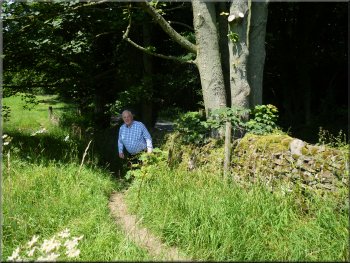
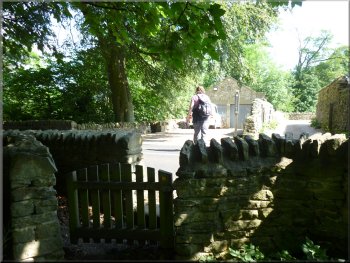
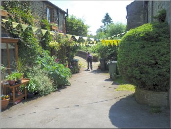
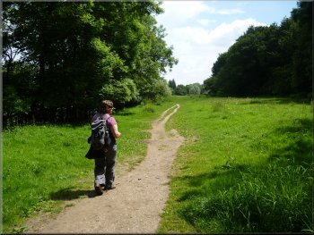
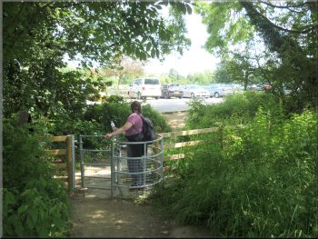
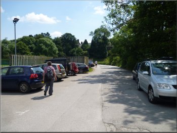
Near the entrance to the Bolton Abbey car park at the start of our walk
|
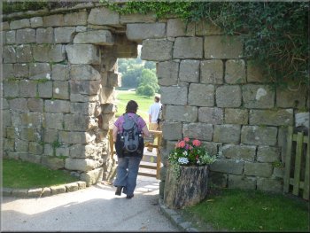
Gateway through the wall to Bolton Abbey & the River Wharfe
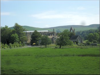
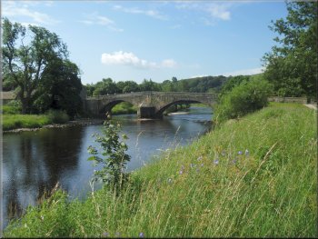
Bolton Abbey away to our left
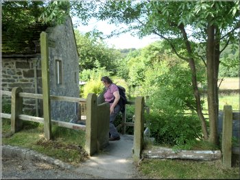
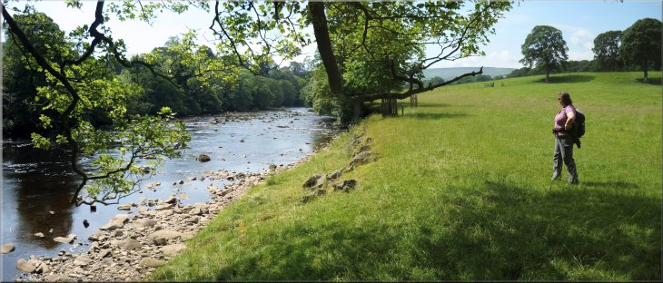
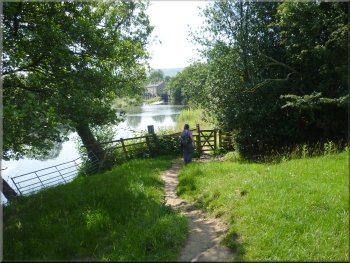
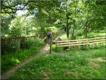
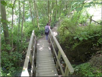
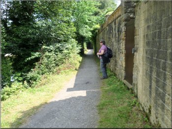
We went through the gateway to a gravel path heading down to the stepping stone &
footbridge over the River Wharfe below Bolton Abbey. There was a good view of Bolton Abbey (strictly it's Bolton Priory)
away to our left and above it is Bolton Hall. |
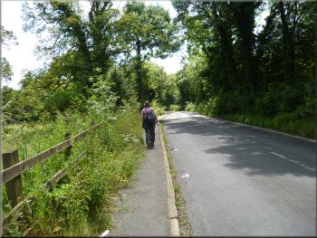
My wife & I had stayed with my son's family in Ilkley last night and this morning after the grandchildren had gone to school, my daughter-in-law drove
us to the car park entrance at Bolton Abbey, map ref. SE069538. From the car park we walked along the road for about 150m to a gateway through
the high stone wall on the right hand side of the road.
Start of the path down to the River Wharfe
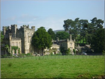
Bolton Hall next to the abbey
|
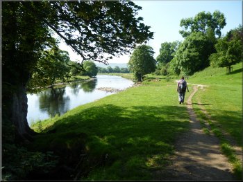
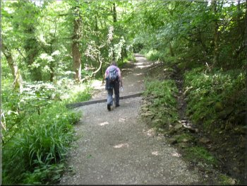
Dales Way riverside path heading downstream
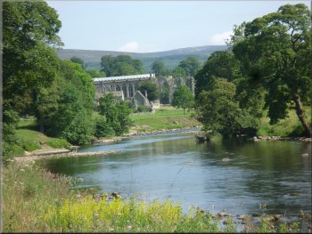
Looking back up-river to Bolton Abbey
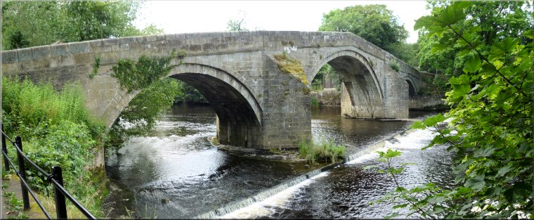
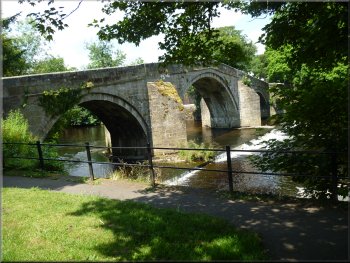
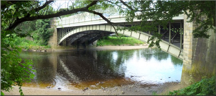
Bolton Bridge over the River Wharfe
(The Dales Way starts in Ilkley and follows Wharfedale and then over the watershed into the Lake District to finish at
Bowness-on-Windermere.) We walked downstream alongside the river for about 1km to the road at Bolton Bridge. |
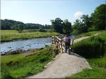
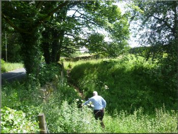
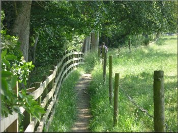
Before reaching the stepping stones across the River Wharfe we turned right to follow the path downstream along the western bank of the river. This
path is part of the Dales Way.
Dales Way riverside path heading downstream
Dales Way path heading for Bolton Bridge
Approaching the road at Bolton Bridge
|
Across the road we continued on the Dales Way

Path under the A59
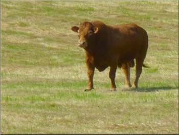
Limosin bull in a field on the roadside
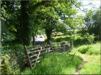
At the road we turned left to walk along the road for about 200m to an informal lay-by on the left just before a left hand bend in the road |
We crossed the road and continued along the Dales Way route on a footpath under the A59 and up to the B6160 at map ref. SE071527.
Dales Way path nearing the A59
Footbridge approaching the B6160
Informal lay-by on the B6160
|
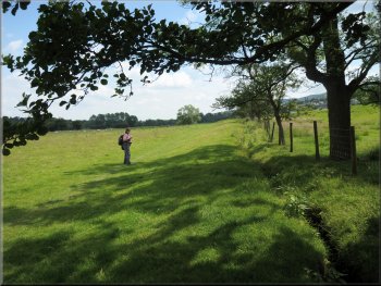
Turning off the road onto the field path
Continuing along the field path with the road on the left
The path continues parallel to the road along the field edge. It was a relief to be separated from the traffic on this path along the edge of the fields. |
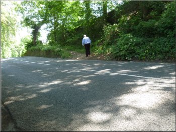
We continued along the road round the bend and up hill with a wood on the right of the road. At the top of the hill on the right hand side of the road is a path leading off the road.
The field path with the traffic safely on the other side of the wall
The field path heading for the entrance to Farfield Farm
|
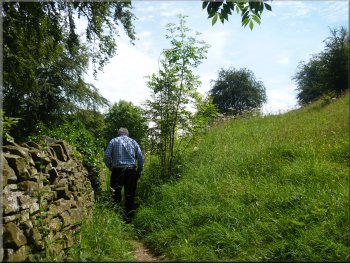
Looking along the path by the field edge next to the road
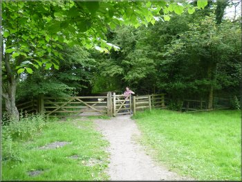
Stile to the track by the Friends' Meeting House
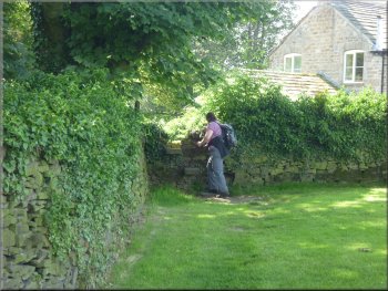
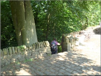
On
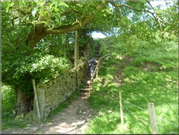
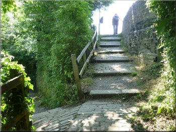
the left here there is an old Quaker meeting house called Farfield Friends' Meeting House. The path goes round the back of this meeting house and
out to the road. The route continues across the road and down some steps to the path along the river bank once more. |
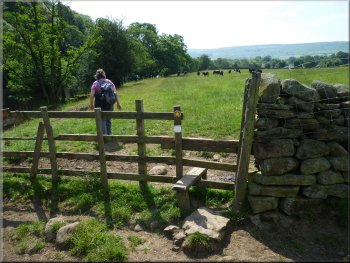
After about 550m the path passes through a stile to the road edge again at the entrance to Farfield Farm. The Dales Way route goes along the farm
drive for about 100m and then turns left to cross a stile. This leads on to an access track where the route turns left to head back towards the road.
Stile on to the roadside at Farfield Farm entrance
Dales Way crossing the B6160
|
Dales Way path beside the River Wharfe heading downstream to Addingham
|
Start of the riverside path after crossing the B6160
Dales Way heading downstream to Addingham
The River Wharfe at Addingham
As the path approaches this point
there is a path on the right that goes across the River Wharfe on a pedestrian suspension bridge. The Dales Way route goes straight ahead up a cobbled ramp to the road. |
The Dales Way route follows the river bank for a little over 2km to a road in Addingham at map ref. SE083499.
Dales Way heading downstream to Addingham
Short detour away from the riverbank
Cobbled ramp up to the road in Addingham
|
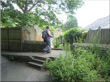
Lane heading for the church in Addingham
Path leaving the church yard
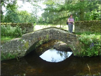
Footbridge on the path to Low Mill Lane
In the church yard the path turns sharp right to leave the church yard via an iron gate leading down to a pretty little stone footbridge
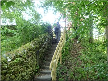
over a stream. The path led us up to Low Mill Lane at map ref. SE085495 where we turned left to follow the lane. |
At the road we turned left to walk along the road for about 150m to a lane on the left. We turned on to this
lane to follow a public footpath for about 150m to St. Peter's Church, Addingham. The path goes through the church yard and we sat on a bench there
for a short break.
Lane heading for the church in Addingham
Footbridge on the path to Low Mill Lane
Steps up to Low Mill Lane
|
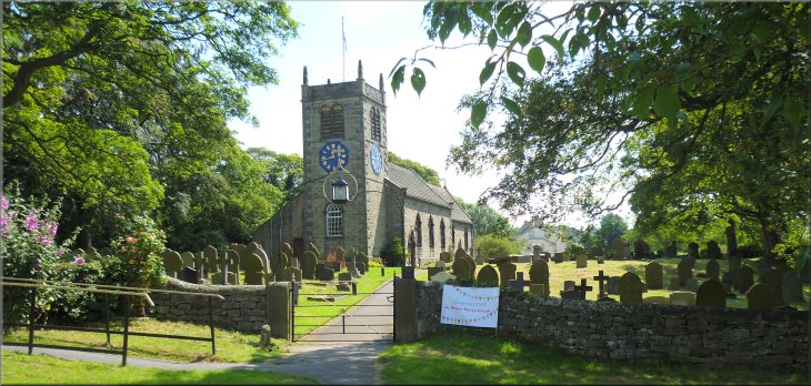
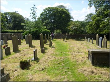
Dales Way path through St. Peter's church yard in Addingham
|

Low Mill Lane leaving Addingham
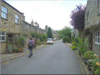
Low Mill Village
Walking along Ilkley Road from Addingham
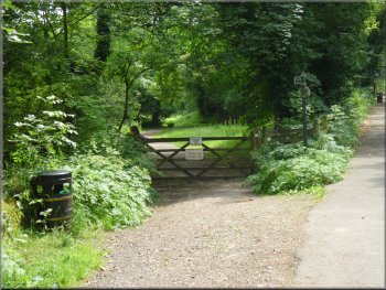
We walked along Old Lane for about 500m to its junction with Ilkley Road
where we turned left to walk along Ilkley Road. After about 600m we came to a gate on the left hand side of the road where we turned off the road to
follow the Dales Way route along a public footpath across the fields by the river. |
After about 500m we came to Low Mill Village and after passing through the buildings we returned to the riverside on a road called Old Lane with a
view back up river through a gate to an ornamental weir across the river.
Entering Low Mill Village from Low Mill Lane
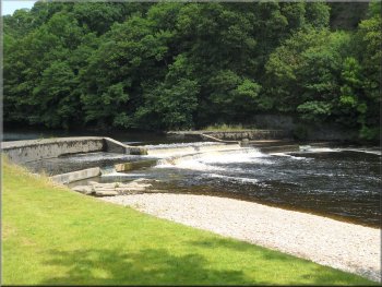
Ornamental weir on the edge of Low Mill Village
Dales Way turning off Ilkley Road
|
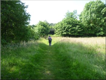
Dales Way path heading downstream to Ilkley
Dales Way path heading downstream to Ilkley
Dales Way path turning away from the river
It emerged onto the access road to Ilkley Tennis Club where there is a friendly sign inviting walkers to use the refreshment facilities at the clubhouse. |
After about 700m the path turned away from the river and continued across the fields for another 700m.
Dales Way path heading downstream to Ilkley
Dales Way path heading downstream to Ilkley
Dales Way reaching the Ilkley Tennis Club access drive
|
The Ilkley Tennis Club access drive
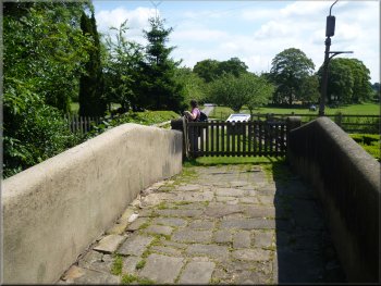
Ilkley Bridge - official start of the Dales Way
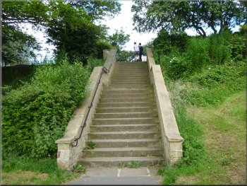
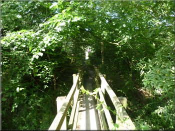
Steps from the riverside park to New Brook Street
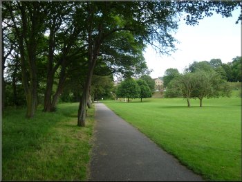
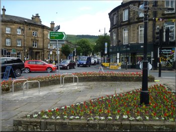
The old stone arch bridge is called Ilkley Bridge and this is the official end/start of the Dales Way. We continued along the riverside path through a large park to the road bridge over the river at New Brook Street. We climbed up the steps to the road and turned right to walk into the town centre and the end of our walk for today. |
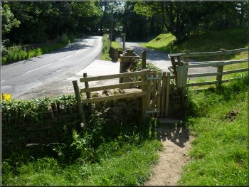
We walked along the access road for about 250m to a sharp right hand bend in the road. At the bend the Dales Way route continued straight ahead
along a footpath by the riverside. We followed this path for about 200m to a lovely old stone arch bridge across the river.
Riverside path entering Ilkley
The large riverside park in Ilkley
Ilkley town centre at the A65
|
Road bridge over the River Wharfe at New Brook Street in Ilkley
|